Size of this preview: 800 × 549 pixels. Other resolutions: 320 × 219 pixels | 640 × 439 pixels | 1,024 × 702 pixels | 1,280 × 878 pixels | 2,560 × 1,755 pixels | 3,287 × 2,254 pixels.
Original file (3,287 × 2,254 pixels, file size: 4.75 MB, MIME type: image/jpeg)
Summary
| Description |
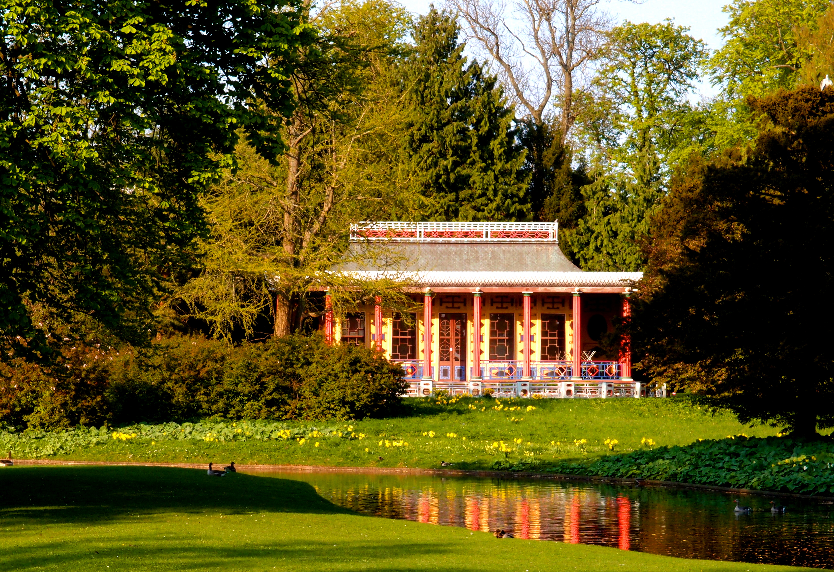
Dansk: Det Kinesiske Tehus fra 1799-1800 af Andreas Kirkerup i Frederiksberg Have i København i Danmark, set fra syd-vest
English: The Chinese tea-house from 1799-1800 by Andreas Kirkerup in Frederiksberg Park in Copenhagen in Denmark, viewed from the South-West.
|
||
| Date | |||
| Source | Own work | ||
| Author | Daniel Stello |
| Object location | | View this and other nearby images on: OpenStreetMap |
|---|
 |
This picture has been nominated for the Wiki Loves Monuments international finals by the national contest in Denmark . source
|
Licensing
I, the copyright holder of this work, hereby publish it under the following license:
This file is licensed under the Creative Commons Attribution-Share Alike 3.0 Unported license.
- You are free:
- to share – to copy, distribute and transmit the work
- to remix – to adapt the work
- Under the following conditions:
- attribution – You must give appropriate credit, provide a link to the license, and indicate if changes were made. You may do so in any reasonable manner, but not in any way that suggests the licensor endorses you or your use.
- share alike – If you remix, transform, or build upon the material, you must distribute your contributions under the same or compatible license as the original.

|
This image was uploaded as part of Wiki Loves Monuments 2011.
|
File history
Click on a date/time to view the file as it appeared at that time.
| Date/Time | Thumbnail | Dimensions | User | Comment | |
|---|---|---|---|---|---|
| current | 21:08, 9 September 2011 | | 3,287 × 2,254 (4.75 MB) | Gomer Pyle |
File usage
The following pages on the English Wikipedia use this file (pages on other projects are not listed):
Global file usage
The following other wikis use this file:
- Usage on ceb.wikipedia.org
- Usage on da.wikipedia.org
- Frederiksberg Have
- Fredede bygninger i Frederiksberg Kommune
- Wikipedia:Wiki Loves Monuments 2011/Billeder
- Wikipedia:Wiki Loves Monuments 2011/Billeder/En
- Wikipedia:Wiki Loves Monuments 2011/Billeder/25
- Wikipedia:Wiki Loves Monuments 2011/Vindere
- Bruger:Palnatoke/Julequiz/2011
- Skabelon:Infoboks bydel
- Skabelon:Infoboks bydel/doc
- Bruger:Palnatoke/Autolister/Kulturarv
- Bruger:Fnielsen/Autolister/Bygninger med Fredede bygningers sagsnummer
- Skabelon:Infoboks bydel/sandkasse
- Skabelon:Infoboks bydel/testcases
- Wikipedia:WikiProjekt Wikidata/lister/kommuner/Københavns Kommune
- Bruger:Gorbi/Kladde6a
- Usage on id.wikipedia.org
- Usage on nl.wikipedia.org
- Usage on no.wikipedia.org
- Usage on pl.wikinews.org
- Usage on sv.wikipedia.org
- Usage on www.wikidata.org