Frontier-casino-flood1.jpg (679 × 347 pixels, file size: 224 KB, MIME type: image/jpeg)
Summary
DescriptionFrontier-casino-flood1.jpg |
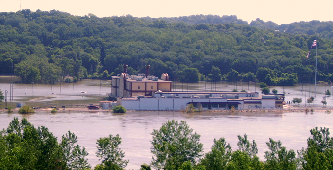
English: Frontier Casino in St. Joseph Missouri during 2011 Missouri River floods on July 19, 2011. |
Date | |
Source | https://www.flickr.com/photos/usace-kcd/5958611631/in/photostream/ |
Author | US Army Corps of Engineers (Kansas City) |
Camera location | 39° 47′ 00.09″ N, 94° 53′ 01.29″ W ![]() ![]() | View this and other nearby images on: OpenStreetMap | ![]() |
---|
Licensing
![]() |
This image, originally posted to Flickr, was reviewed on 26 July 2011 by the administrator or reviewer Warfieldian, who confirmed that it was available on Flickr under the stated license on that date. |
![w:en:Creative Commons](https://upload.wikimedia.org/wikipedia/commons/thumb/7/79/CC_some_rights_reserved.svg/90px-CC_some_rights_reserved.svg.png)
![attribution](https://upload.wikimedia.org/wikipedia/commons/thumb/1/11/Cc-by_new_white.svg/24px-Cc-by_new_white.svg.png)
This file is licensed under the Creative Commons Attribution 2.0 Generic license.
- You are free:
- to share – to copy, distribute and transmit the work
- to remix – to adapt the work
- Under the following conditions:
- attribution – You must give appropriate credit, provide a link to the license, and indicate if changes were made. You may do so in any reasonable manner, but not in any way that suggests the licensor endorses you or your use.
Captions
Add a one-line explanation of what this file represents
In dieser Datei abgebildete Objekte
depicts
copyright status
copyrighted
copyright license
Creative Commons Attribution 2.0 Generic
inception
19 July 2011
coordinates of the point of view
39°47'0.089"N, 94°53'1.291"W
heading: 179.8 degree
exposure time
0.00263157894736842105 second
f-number
4.3
focal length
17.4 millimetre
ISO speed
64
instance of
photograph
source of file
file available on the internet
operator: Flickr
described at URL: https://www.flickr.com/photos/usace-kcd/5958611631/in/photostream
media type
image/jpeg
File history
Click on a date/time to view the file as it appeared at that time.
Date/Time | Thumbnail | Dimensions | User | Comment | |
---|---|---|---|---|---|
current | 23:04, 25 July 2011 | ![]() | 679 × 347 (224 KB) | Americasroof |
File usage
The following pages on the English Wikipedia use this file (pages on other projects are not listed):
Metadata
This file contains additional information, probably added from the digital camera or scanner used to create or digitize it.
If the file has been modified from its original state, some details may not fully reflect the modified file.
Image title | 2011 Flood, July 19. U.S. Army Corps of Engineers photo. |
---|---|
Camera manufacturer | RICOH |
Camera model | Caplio 500SE |
Copyright holder | (C) Caplio 500SE User |
Exposure time | 1/380 sec (0.0026315789473684) |
F-number | f/4.3 |
ISO speed rating | 64 |
Date and time of data generation | 09:19, 19 July 2011 |
Lens focal length | 17.4 mm |
Altitude | 277 meters above sea level |
Horizontal resolution | 72 dpi |
Vertical resolution | 72 dpi |
Software used | Adobe Photoshop CS3 Windows |
File change date and time | 15:54, 20 July 2011 |
Y and C positioning | Co-sited |
Exposure Program | Normal program |
Exif version | 2.21 |
Date and time of digitizing | 09:19, 19 July 2011 |
Image compression mode | 2 |
APEX aperture | 4.2 |
APEX brightness | 7.1 |
Exposure bias | 0 |
Maximum land aperture | 2.5 APEX (f/2.38) |
Metering mode | Pattern |
Light source | Unknown |
Flash | Flash did not fire, auto mode |
Color space | sRGB |
Exposure mode | Auto exposure |
White balance | Auto white balance |
Scene capture type | Standard |
Sharpness | Normal |
Unique image ID | a0feb32dafa021f870be8935b51818af |
North or south latitude | North latitude |
East or west longitude | West longitude |
Satellites used for measurement | 01,01,01,01,01,01 |
Receiver status | Measurement in progress |
Measurement mode | 3-dimensional measurement |
Measurement precision | Excellent (0) |
Speed unit | Knots |
Speed of GPS receiver | 0 |
Reference for direction of movement | True direction |
Direction of movement | 0 |
Reference for direction of image | True direction |
Direction of image | 179.8 |
Geodetic survey data used | WGS1984 |
Reference for bearing of destination | True direction |
Bearing of destination | 179.8 |
GPS date | 19 July 2011 |
GPS differential correction | 0 |