No higher resolution available.
Canal_bridges_at_Sankey_Bridges_-_geograph.org.uk_-_1102488.jpg (640 × 426 pixels, file size: 54 KB, MIME type: image/jpeg)
Summary
| Description |
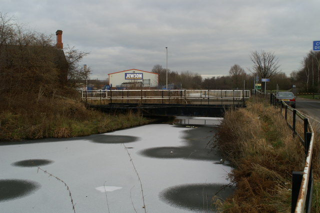
English: Canal bridges at Sankey Bridges The nearer bridge was the relief swing bridge provided to allow passage along the main Liverpool-Warrington A57 when the main bridge over the canal was out of action. The concrete plinth beyond it is the present bridge, superseding the bascule lifting bridge installed in 1915, which replaced the original wooden swing bridge as traffic weights increased. |
| Date | |
| Source | From geograph.org.uk |
| Author | David Long |
| Attribution (required by the license) | David Long / Canal bridges at Sankey Bridges / |
| Camera location | | View this and other nearby images on: OpenStreetMap |
|---|
_heading:0.00&language=en)
| Object location | | View this and other nearby images on: OpenStreetMap |
|---|
_heading:0.00&language=en)
Licensing

|
This image was taken from the Geograph project collection. See this photograph's page on the Geograph website for the photographer's contact details. The copyright on this image is owned by David Long and is licensed for reuse under the Creative Commons Attribution-ShareAlike 2.0 license.
|
This file is licensed under the Creative Commons Attribution-Share Alike 2.0 Generic license.
Attribution: David Long
- You are free:
- to share – to copy, distribute and transmit the work
- to remix – to adapt the work
- Under the following conditions:
- attribution – You must give appropriate credit, provide a link to the license, and indicate if changes were made. You may do so in any reasonable manner, but not in any way that suggests the licensor endorses you or your use.
- share alike – If you remix, transform, or build upon the material, you must distribute your contributions under the same or compatible license as the original.
File history
Click on a date/time to view the file as it appeared at that time.
| Date/Time | Thumbnail | Dimensions | User | Comment | |
|---|---|---|---|---|---|
| current | 17:12, 24 February 2011 | | 640 × 426 (54 KB) | GeographBot | == {{int:filedesc}} == {{Information |description={{en|1=Canal bridges at Sankey Bridges The nearer bridge was the relief swing bridge provided to allow passage along the main Liverpool-Warrington A57 when the main bridge over the canal was out of action. |
File usage
The following pages on the English Wikipedia use this file (pages on other projects are not listed):
Global file usage
The following other wikis use this file:
- Usage on www.wikidata.org