
Size of this preview: 800 × 533 pixels. Other resolutions: 320 × 213 pixels | 640 × 427 pixels | 1,024 × 683 pixels | 1,280 × 853 pixels | 2,560 × 1,707 pixels | 5,760 × 3,840 pixels.
Original file (5,760 × 3,840 pixels, file size: 14.83 MB, MIME type: image/jpeg)
Summary
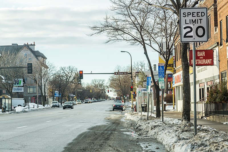
| Description | Guerrilla urbanists lowered the speed limit on Lyndale Avenue South in Minneapolis from 30 miles per hour to 20 MPH following a long history of vehicle-pedestrian crashes. A '2' was taped over the '3' on the speed limit sign. |
| Date | Taken on 7 February 2016, 08:24 |
| Source | 22nd & Lyndale - 20 MPH Speed Limit |
| Author | Tony Webster from Minneapolis, Minnesota, United States |
| Camera location | | View this and other nearby images on: OpenStreetMap |
|---|
.jpg¶ms=044.961680_N_-093.288153_E_globe:Earth_type:camera_source:Flickr_&language=en)
Licensing
This file is licensed under the Creative Commons Attribution-Share Alike 2.0 Generic license.
- You are free:
- to share – to copy, distribute and transmit the work
- to remix – to adapt the work
- Under the following conditions:
- attribution – You must give appropriate credit, provide a link to the license, and indicate if changes were made. You may do so in any reasonable manner, but not in any way that suggests the licensor endorses you or your use.
- share alike – If you remix, transform, or build upon the material, you must distribute your contributions under the same or compatible license as the original.
| This image was originally posted to Flickr by Tony Webster at https://flickr.com/photos/87296837@N00/24247560873 (archive). It was reviewed on 23 April 2018 by FlickreviewR 2 and was confirmed to be licensed under the terms of the cc-by-sa-2.0. |
File history
Click on a date/time to view the file as it appeared at that time.
| Date/Time | Thumbnail | Dimensions | User | Comment | |
|---|---|---|---|---|---|
| current | 02:52, 23 April 2018 | | 5,760 × 3,840 (14.83 MB) | Tony Webster | Transferred from Flickr via #flickr2commons |
File usage
The following pages on the English Wikipedia use this file (pages on other projects are not listed):
.jpg)