I added a road sign standard for 6 CSTO countries Tags: Reverted Visual edit |
→References: I added References list and External links Tags: Reverted Visual edit |
||
| Line 202: | Line 202: | ||
* [[Transport in Armenia]] |
* [[Transport in Armenia]] |
||
==References== |
== References == |
||
<references /> |
|||
| ⚫ | |||
==External links== |
|||
| ⚫ | |||
{{Traffic signs}} |
{{Traffic signs}} |
||
Revision as of 12:28, 2 March 2023
Road signs in Armenia are similar to the signs of other post-Soviet states and most European road sign systems. Armenia is a signatory of the Vienna Convention on Road Traffic and the Vienna Convention on Road Signs and Signals. The Ministry of Transport regulates these icons, while the police enforces them. These icons are regulated by GOST 32945-2014 (ГОСТ 32945-2014),[1] as well as in other CIS countries like Russia, Belarus, Kazakhstan,Kyrgyzstan and Tajikistan. Armenia, Belarus, Kazakhstan, Kyrgyzstan, Russia, and Tajikistan voted in favor of adopting the GOST 32945-2014 road sign standard in 2014. These six countries are also members of the Collective Security Treaty Organization (ОДКБ). Road signs ensure transport vehicles move safely and orderly, as well as, to inform both pedestrians and motorists of traffic rules.
Since Armenia was part of the Soviet Union before it declared an independence from it in 1991, it inherited the Soviet road sign system. After the collapse of the USSR in 1991, Armenia continued to use a Soviet road sign system, as did most other CIS countries, but with some modifications compared to the Soviet road sign system.
The stop sign in Armenia is inscribed in both Armenian (ԿԱՆԳ) and English (STOP), unlike in many European nations, which is one of the few ways that it differs from those in other post-Soviet nations.
Gallery
- Warning signs
-
 Dangerous curve to the right
 -
 Dangerous curve to the left
 -
 Dangerous curve, first to the right
 -
 Dangerous curve, first to the left
 -
 Steep hill downwards
 -
 Steep hill upwards
 -
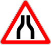 Road narrows on both sides
 -
 Road narrow on the right
 -
 Road narrows on the left
 -
 Opening or swing bridge
 -
 Quayside or ferry breth
 -
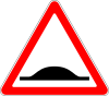
 Uneven road
 -
 Speed bumps
 -
 Dangerous shoulder
 -
 Slippery road
 -
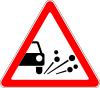 Loose chippings
 -
 Falling rocks
 -
 Pedestrian crossing ahead
 -
 Children
 -
 Cyclists
 -
 Animals (Cattle)
 -
 Animals (Deer)
 -
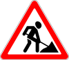 Roadworks ahead
 -
 Traffic signals
 -
 Crossroads without priority
 -
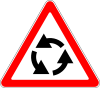 Roundabout
 -
 Two-way traffic
 -
 Traffic queues likely
 -
 Level crossing ahead with barriers
 -
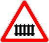
 Level crossing ahead without barriers
 -
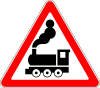
 Level crossing (single track)
 -
 Level crossing (multiple tracks)
 -
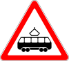 Tramway
 -
 Level crossing countdown
 -
 Level crossing countdown
 -
 Level crossing countdown
 -
 Level crossing countdown
 -
 Level crossing countdown
 -
 Level crossing countdown
 -
 Airport
 -
 Side winds
 -
 Other dangers (plate must be used to indicate the danger)


- Priority signs
-
 Priority road
 -
 End of priority road
 -
 Crossroads with priority
 -
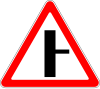 Side road with priority, from the right
 -
 Side road with priority, from the left
 -
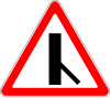
 Oblique side road with priority, from the right
 -
 Oblique side road with priority, from the left
 -
 Merging traffic, from the right
 -
 Merging traffic, from the left
 -
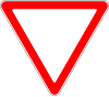 Yield
Yield -
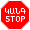 Stop
Stop -
 Yield to oncoming traffic
 -
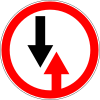
 Priority over oncoming traffic


- Prohibitory signs
-
 Do not enter
 -
 Closed to all vehicles
 -
 No entry for cars
 -
 No entry for trucks
 -
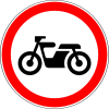 No entry for motorbike
 -
 No entry for tractors
 -
 No entry for trailers
 -
 No entry for animal-drawn vehicles
 -
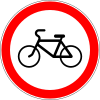 No entry for bike
 -
 No entry for pedestrians
 -
 Weight limit
 -
 Axle weight limit
 -
 Height limit
 -
 Width limit
 -
 Length limit
 -
 Maximum separation
 -
 Passing without stopping prohibited
 -
 No right turn
 -
 No left turn
 -
 No U-turn
 -
 No passing
 -
 End of passing prohibitied
 -
 No passing by trucks
 -
 End of overtaking prohibition by trucks
 -
 Maximum speed limit (10 km/h)
 -
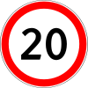 Maximum speed limit (20 km/h)
 -
 Maximum speed limit (30 km/h)
 -
 Maximum speed limit (40 km/h)
 -
 Maximum speed limit (50 km/h)
 -
 Maximum speed limit (60 km/h)
 -
 Maximum speed limit (70 km/h)
 -
 Maximum speed limit (80 km/h)
 -
 Maximum speed limit (90 km/h)
 -
 Maximum speed limit (100 km/h)
 -
 Maximum speed limit (110 km/h)
 -
 End of speed limit (50 km/h)
 -
 No audible warning devices
 -
 Clearway no Stopping
 -
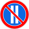
 No parking Or waiting
 -
 Alternate parking on odd days
 -
 Alternate parking on even days
 -
 End of all prohibitions
 -
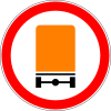 No entry for vehicles carrying dangerous goods
 -
 No entry for vehicles carrying explosive substances


- Mandatory signs
-
 Proceed straight
 -
 Turn right
 -
 Turn left
 -
 Straight ahead or right turn permitted
 -
 Straight ahead or left turn permitted
 -
 Keep right
 -
 Keep left
 -
 Roundabout
 -
 Bike path
 -
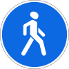 Pedestrian path
 -
 Minimum speed limit
 -
 End of minimum speed limit
 -
 Proceed straight for vehicles carrying dangerous goods
 -
 Turn right for vehicles carrying dangerous goods
 -
 Turn left for vehicles carrying dangerous goods


- Information signs
-
 Freeway
 -
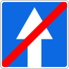
 End of Freeway
 -
 Controlled access road
 -
 End of controlled access road
 -
 One-way street
 -
 End of one-way street
 -
 One-way street (right)
 -
 One-way street (left)
 -
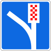
 Added lane
 -
 Added lane
 -
 Added lane
 -
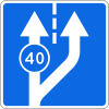
 Maximum speed limits per lane
 -
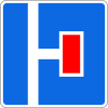
 Bus stop
 -
 Tram stop
 -
 Crosswalk
 -
 Crosswalk
 -
 Road bump
 -
 Living zone
 -
 End of living zone
 -
 Start of city limit
 -
 End of city limit
 -
 Start of city limit
 -
 End of city limit
 -
 Parking zone
 -
 General speed limits
 -
 Advisory speed
 -
 Parking place
 -
 Escape lane
 -
 Pedestrian subway
 -
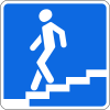
 Footbridge
 -
 No through road
 -
 No through road on right
 -
 No through road on left
 -
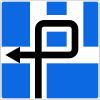 Traffic scheme


- Service signs
-
 First aid post
 -
 Hospital
 -
 Petrol station
 -
 Breakdown service
 -
 Public telephone
 -
 Restaurant
 -
 Hotel
Hotel -
 Camping site
 -
 Picnic site
 -


- Additional panels
-
 Distance
 -
 Stop ahead
 -
 Side extension (of no stopping or no parking)
 -
 Side extension (of no stopping or no parking)
 -
 Distance
 -
 Beginning (of no stopping or no parking)
 -
 Continuation (of no stopping or no parking)
 -
 Ending (of no stopping or no parking)
 -
 Direction of priority road
 -
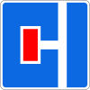
 Disabled parking


See also
References
- ^ "ГОСТ 32945-2014 Дороги автомобильные общего пользования. Знаки дорожные. Технические требования (с Поправками) - docs.cntd.ru". docs.cntd.ru. Retrieved 2023-03-02.