No higher resolution available.
The_Old_Mill,_New_Ellerby_-_geograph.org.uk_-_721559.jpg (640 × 480 pixels, file size: 119 KB, MIME type: image/jpeg)
Summary
| Description |
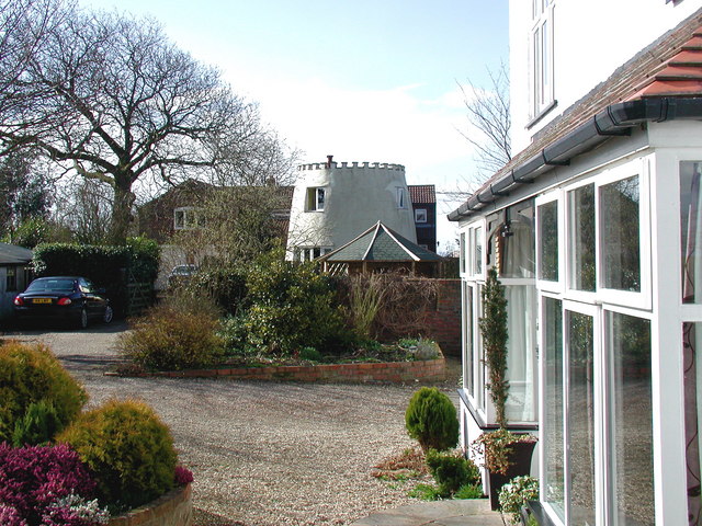
English: The Old Mill, New Ellerby, East Riding of Yorkshire, England. Looking west-southwest from Mill House on Marton Road. The mill has existed since the 19th century and was steam assisted by 1889 but ceased to grind in around 1930. The former windmill, now truncated and castellated, was converted into a house by 1993. It is not currently marked on Ordnance Survey maps. |
| Date | |
| Source | From geograph.org.uk |
| Author | Paul Glazzard |
| Permission (Reusing this file) |
Creative Commons Attribution Share-alike license 2.0 |
| Attribution (required by the license) | Paul Glazzard / The Old Mill, New Ellerby / |
| Camera location | | View this and other nearby images on: OpenStreetMap |
|---|
_heading:247.00&language=en)
| Object location | | View this and other nearby images on: OpenStreetMap |
|---|
_heading:247.00&language=en)
Licensing

|
This image was taken from the Geograph project collection. See this photograph's page on the Geograph website for the photographer's contact details. The copyright on this image is owned by Paul Glazzard and is licensed for reuse under the Creative Commons Attribution-ShareAlike 2.0 license.
|
This file is licensed under the Creative Commons Attribution-Share Alike 2.0 Generic license.
Attribution: Paul Glazzard
- You are free:
- to share – to copy, distribute and transmit the work
- to remix – to adapt the work
- Under the following conditions:
- attribution – You must give appropriate credit, provide a link to the license, and indicate if changes were made. You may do so in any reasonable manner, but not in any way that suggests the licensor endorses you or your use.
- share alike – If you remix, transform, or build upon the material, you must distribute your contributions under the same or compatible license as the original.
File history
Click on a date/time to view the file as it appeared at that time.
| Date/Time | Thumbnail | Dimensions | User | Comment | |
|---|---|---|---|---|---|
| current | 05:59, 19 February 2011 | | 640 × 480 (119 KB) | GeographBot | == {{int:filedesc}} == {{Information |description={{en|1=The Old Mill, New Ellerby Looking west-southwest from Mill House on Marton Road. The mill has existed since the 19th century and was steam assisted by 1889 but ceased to grind in around 1930. The fo |
File usage
The following pages on the English Wikipedia use this file (pages on other projects are not listed):