Size of this preview: 800 × 532 pixels. Other resolutions: 320 × 213 pixels | 640 × 426 pixels | 1,024 × 681 pixels | 1,280 × 851 pixels | 3,008 × 2,000 pixels.
Original file (3,008 × 2,000 pixels, file size: 2.93 MB, MIME type: image/jpeg)
Summary
| Description |
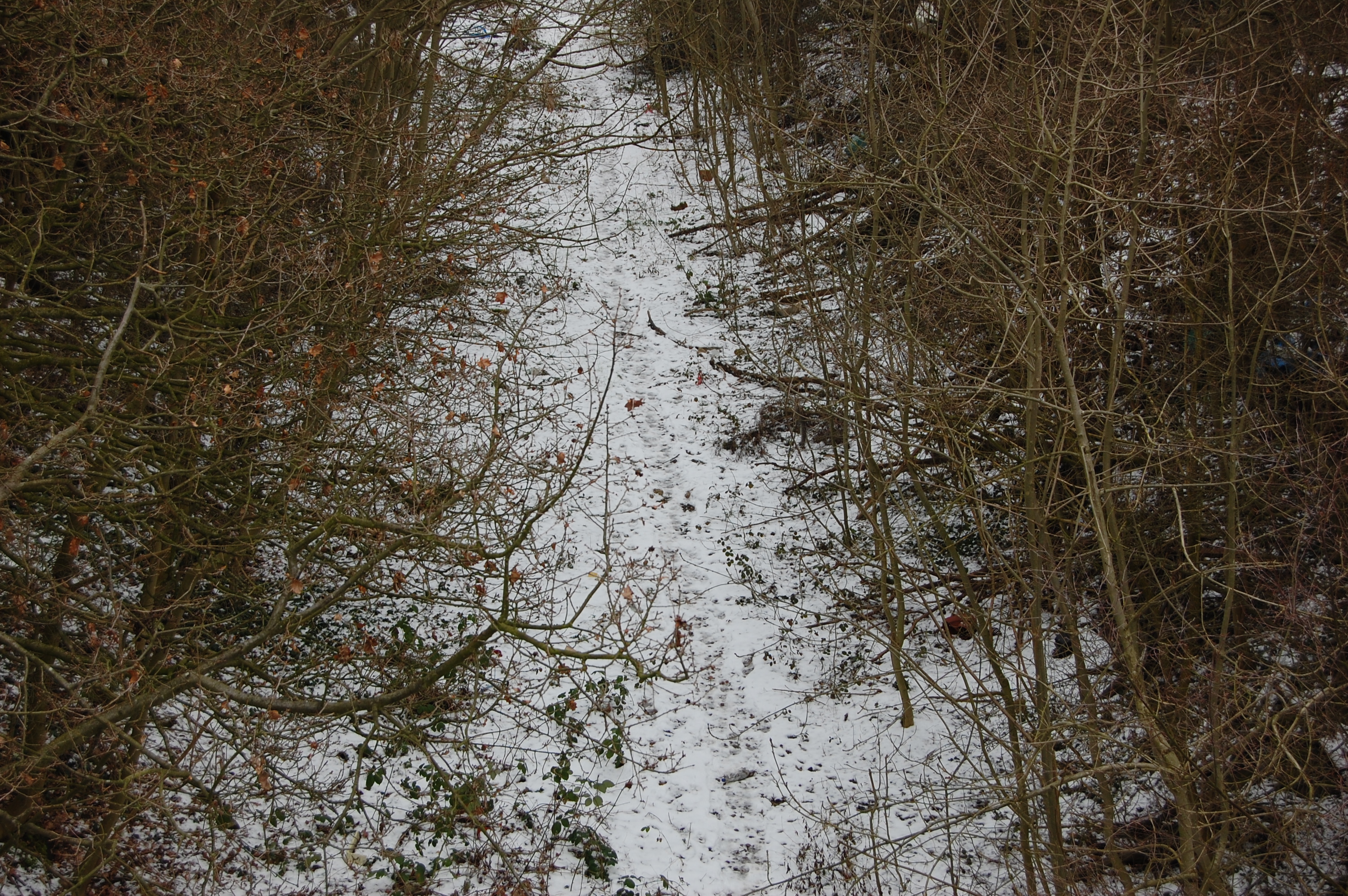
English: Site of Upperthorpe & Killamarsh Station This station was closed and demolished 1939. |
| Date | |
| Source | From geograph.org.uk |
| Author | John Jennings |
| Permission (Reusing this file) |
Creative Commons Attribution Share-alike license 2.0 |
| Attribution (required by the license) | John Jennings / Site of Upperthorpe & Killamarsh Station / |
| Camera location | | View this and other nearby images on: OpenStreetMap |
|---|
.jpg¶ms=053.320790_N_-001.327574_E_globe:Earth_type:camera_source:geograph-osgb36(SK44898064)_heading:22.00&language=en)
| Object location | | View this and other nearby images on: OpenStreetMap |
|---|
.jpg¶ms=053.321060_N_-001.327420_E_globe:Earth_class:object_type:object_source:geograph-osgb36(SK44908067)_heading:22.00&language=en)
Licensing

|
This image was taken from the Geograph project collection. See this photograph's page on the Geograph website for the photographer's contact details. The copyright on this image is owned by John Jennings and is licensed for reuse under the Creative Commons Attribution-ShareAlike 2.0 license.
|
This file is licensed under the Creative Commons Attribution-Share Alike 2.0 Generic license.
Attribution: John Jennings
- You are free:
- to share – to copy, distribute and transmit the work
- to remix – to adapt the work
- Under the following conditions:
- attribution – You must give appropriate credit, provide a link to the license, and indicate if changes were made. You may do so in any reasonable manner, but not in any way that suggests the licensor endorses you or your use.
- share alike – If you remix, transform, or build upon the material, you must distribute your contributions under the same or compatible license as the original.
File history
Click on a date/time to view the file as it appeared at that time.
| Date/Time | Thumbnail | Dimensions | User | Comment | |
|---|---|---|---|---|---|
| current | 21:26, 18 December 2020 | | 3,008 × 2,000 (2.93 MB) | Lamberhurst | Transferred from geograph.co.uk using [https://tools.wmflabs.org/geograph2commons/ geograph2commons] |
File usage
The following pages on the English Wikipedia use this file (pages on other projects are not listed):
.jpg)