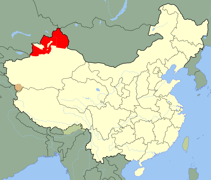
Size of this PNG preview of this SVG file: 705 × 599 pixels. Other resolutions: 282 × 240 pixels | 565 × 480 pixels | 904 × 768 pixels | 1,205 × 1,024 pixels | 2,409 × 2,048 pixels | 1,000 × 850 pixels.
Original file (SVG file, nominally 1,000 × 850 pixels, file size: 233 KB)
File history
Click on a date/time to view the file as it appeared at that time.
| Date/Time | Thumbnail | Dimensions | User | Comment | |
|---|---|---|---|---|---|
| current | 20:59, 24 May 2020 |  | 1,000 × 850 (233 KB) | Roy17 | Reverted to version as of 02:12, 12 July 2010 (UTC) |
| 02:49, 24 May 2020 |  | 1,000 × 850 (271 KB) | Anchuhu | Reverted to version as of 13:12, 19 January 2019 (UTC) USSR still in 1946 and Second ETR controlled larger than ill,include Qaramay | |
| 01:40, 12 March 2020 |  | 1,000 × 850 (233 KB) | Jonteemil | Fake SVG Reverted to version as of 02:12, 12 July 2010 (UTC) | |
| 13:12, 19 January 2019 |  | 1,000 × 850 (271 KB) | 复旦大学张超 | edit | |
| 02:12, 12 July 2010 |  | 1,000 × 850 (233 KB) | Splittist | {{Information |Description=An SVG map of China with Xinjiang's Ili, Tarbaghatai, and Altai districts highlighted in red. These are the districts claimed by the Second East Turkestan Republic. Legend:<br />[[File:Ch |
File usage
The following pages on the English Wikipedia use this file (pages on other projects are not listed):
Global file usage
The following other wikis use this file:
- Usage on ar.wikipedia.org
- Usage on az.wikipedia.org
- Usage on bn.wikipedia.org
- Usage on de.wikipedia.org
- Usage on et.wikipedia.org
- Usage on fr.wikipedia.org
- Usage on id.wikipedia.org
- Usage on it.wikipedia.org
- Usage on ja.wikipedia.org
- Usage on jv.wikipedia.org
- Usage on kk.wikipedia.org
- Usage on mk.wikipedia.org
- Usage on ms.wikipedia.org
- Usage on nl.wikipedia.org
- Usage on pnb.wikipedia.org
- Usage on pt.wikipedia.org
- Usage on ru.wikipedia.org
- Usage on sl.wikipedia.org
- Usage on sv.wikipedia.org
- Usage on th.wikipedia.org
- Usage on tr.wikipedia.org
- Usage on ug.wikipedia.org
- Usage on uk.wikipedia.org
- Usage on ur.wikipedia.org
- Usage on uz.wikipedia.org
- Usage on vi.wikipedia.org
- Usage on www.wikidata.org
- Usage on zh.wikipedia.org
