
Size of this preview: 800 × 544 pixels. Other resolutions: 320 × 218 pixels | 640 × 435 pixels | 1,024 × 696 pixels.
Original file (1,024 × 696 pixels, file size: 99 KB, MIME type: image/jpeg)
Summary
| Description |
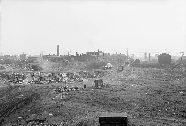
English: Harper's Dump, also known as the Greenwood Avenue Fill, was one of the main landfill sites in Toronto, Ontario, Canada. In the 1960s, it was replaced by the Greenwood TTC subway yard. |
||
| Date | |||
| Source |
|
||
| Author | Howard McDonald |
| Camera location | | View this and other nearby images on: OpenStreetMap |
|---|
Licensing
This Canadian work is in the public domain in Canada because its copyright has expired due to one of the following:
it was not subject to Crown copyright, and
|
 |
This file is licensed under the Creative Commons Attribution 2.0 Generic license.
- You are free:
- to share – to copy, distribute and transmit the work
- to remix – to adapt the work
- Under the following conditions:
- attribution – You must give appropriate credit, provide a link to the license, and indicate if changes were made. You may do so in any reasonable manner, but not in any way that suggests the licensor endorses you or your use.
| This image, originally posted to Flickr, was reviewed on July 24, 2011 by the administrator or reviewer File Upload Bot (Magnus Manske), who confirmed that it was available on Flickr under the stated license on that date. |
File history
Click on a date/time to view the file as it appeared at that time.
| Date/Time | Thumbnail | Dimensions | User | Comment | |
|---|---|---|---|---|---|
| current | 19:47, 25 July 2011 | | 1,024 × 696 (99 KB) | Ras67 | losslessly cropped with Jpegcrop |
| 21:37, 24 July 2011 |  | 1,050 × 765 (125 KB) | File Upload Bot (Magnus Manske) | {{Information |Description=Photographer: Howard McDonald June 30, 1949 [http://www.toronto.ca/archives/index.htm City of Toronto Archives] Series 372, Subseries 70, Item 586 |Source=[http://www.flickr.com/photos/torontohistory/4558892243/ Greenwood Avenue |
File usage
The following pages on the English Wikipedia use this file (pages on other projects are not listed):
Global file usage
The following other wikis use this file:
- Usage on ko.wikipedia.org