Size of this preview: 800 × 473 pixels. Other resolutions: 320 × 189 pixels | 640 × 378 pixels | 1,024 × 605 pixels | 1,280 × 756 pixels | 2,560 × 1,513 pixels | 3,520 × 2,080 pixels.
Original file (3,520 × 2,080 pixels, file size: 6.01 MB, MIME type: image/jpeg)
File history
Click on a date/time to view the file as it appeared at that time.
| Date/Time | Thumbnail | Dimensions | User | Comment | |
|---|---|---|---|---|---|
| current | 19:07, 20 January 2013 |  | 3,520 × 2,080 (6.01 MB) | Slick-o-bot | Bot: convert to a non-interlaced jpeg image (see bugzilla:17645) |
| 10:55, 22 March 2008 |  | 3,520 × 2,080 (4.98 MB) | Пакко | {{Information |Description= |Source= |Date= |Author= |Permission= |other_versions= }} | |
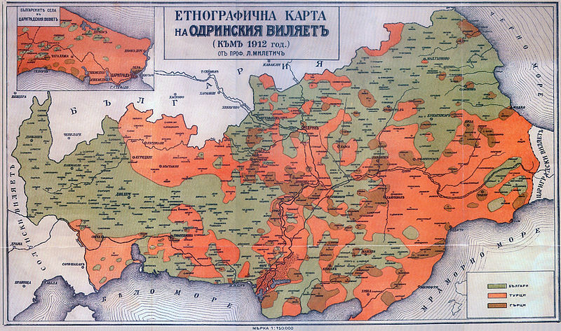
| 09:12, 8 January 2008 |  | 3,520 × 2,080 (2.17 MB) | Мико | {{Information |Description={{bg|Етнографска карта на Одрински вилает (Източна и Западна Тракия на [[:bg:Любомир Милетич|Люб� |
File usage
The following pages on the English Wikipedia use this file (pages on other projects are not listed):
Global file usage
The following other wikis use this file:
- Usage on ast.wikipedia.org
- Usage on ba.wikipedia.org
- Usage on be-tarask.wikipedia.org
- Usage on be.wikipedia.org
- Usage on bg.wikipedia.org
- Usage on ca.wikipedia.org
- Usage on cs.wikipedia.org
- Usage on de.wikipedia.org
- Usage on es.wikipedia.org
- Usage on fr.wikipedia.org
- Usage on hy.wikipedia.org
- Usage on it.wikipedia.org
- Usage on ka.wikipedia.org
- Usage on mk.wikipedia.org
- Usage on myv.wikipedia.org
- Usage on oc.wikipedia.org
- Usage on ru.wikipedia.org
- Usage on sq.wikipedia.org
- Usage on tr.wikipedia.org
- Usage on uk.wikipedia.org