Size of this preview: 800 × 600 pixels. Other resolutions: 320 × 240 pixels | 640 × 480 pixels | 1,024 × 768 pixels | 1,280 × 960 pixels | 2,560 × 1,920 pixels | 4,032 × 3,024 pixels.
Original file (4,032 × 3,024 pixels, file size: 3.12 MB, MIME type: image/jpeg)
Summary
| Description |
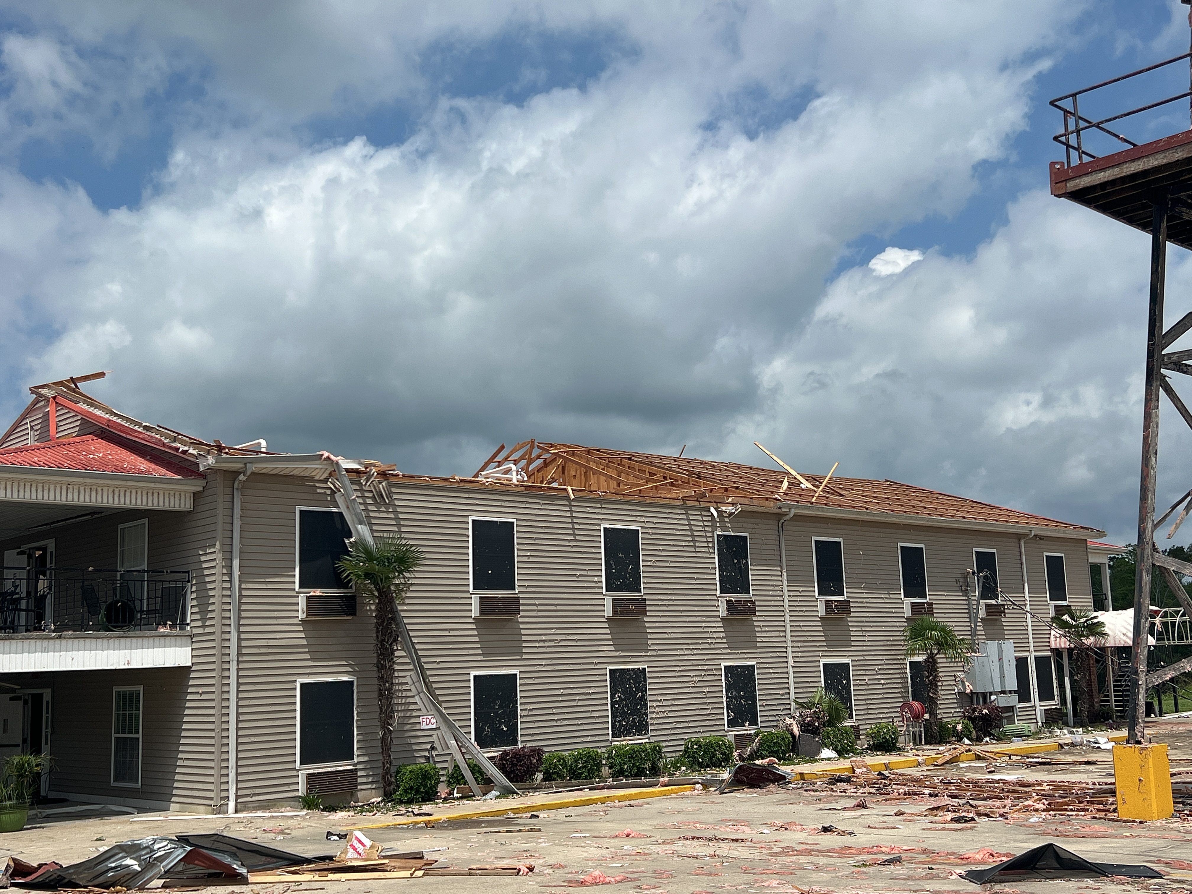
English: EF2 damage to Pat's Edgewater Inn in Henderson, Louisiana.
"Business took a direct hit. Motel lost roof. Two outbuildings destroyed. Tornado crossed into the Atchafalaya Basin from here." |
| Date | |
| Source | https://services.dat.noaa.gov/arcgis/rest/services/nws_damageassessmenttoolkit/DamageViewer/FeatureServer/0/4002467/attachments/2415111 |
| Author | National Weather Service Lake Charles LA |
| Camera location | | View this and other nearby images on: OpenStreetMap |
|---|
Licensing
This work is in the public domain in the United States because it is a work prepared by an officer or employee of the United States Government as part of that person’s official duties under the terms of Title 17, Chapter 1, Section 105 of the US Code.
Note: This only applies to original works of the Federal Government and not to the work of any individual U.S. state, territory, commonwealth, county, municipality, or any other subdivision. This template also does not apply to postage stamp designs published by the United States Postal Service since 1978. (See § 313.6(C)(1) of Compendium of U.S. Copyright Office Practices). It also does not apply to certain US coins; see The US Mint Terms of Use.
|
 | |
| This file has been identified as being free of known restrictions under copyright law, including all related and neighboring rights. | ||
File history
Click on a date/time to view the file as it appeared at that time.
| Date/Time | Thumbnail | Dimensions | User | Comment | |
|---|---|---|---|---|---|
| current | 02:55, 17 June 2024 | | 4,032 × 3,024 (3.12 MB) | ChessEric | Uploaded a work by National Weather Service Lake Charles LA from https://services.dat.noaa.gov/arcgis/rest/services/nws_damageassessmenttoolkit/DamageViewer/FeatureServer/0/4002467/attachments/2415111 with UploadWizard |
File usage
The following pages on the English Wikipedia use this file (pages on other projects are not listed):