No higher resolution available.
Cappercleuch_War_Memorial_-_geograph.org.uk_-_726071.jpg (640 × 480 pixels, file size: 135 KB, MIME type: image/jpeg)
Summary
| Description |
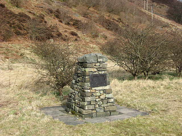
English: Cappercleuch War Memorial A simple stone cairn by the A708 records the local men who lost their lives in the first world war. Even in a small community like this, five men from Megget died in the conflict. |
| Date | |
| Source | From geograph.org.uk |
| Author | Walter Baxter |
| Attribution (required by the license) | Walter Baxter / Cappercleuch War Memorial / |
| Camera location | | View this and other nearby images on: OpenStreetMap |
|---|
_heading:22.00&language=en)
| Object location | | View this and other nearby images on: OpenStreetMap |
|---|
_heading:22.00&language=en)
Licensing

|
This image was taken from the Geograph project collection. See this photograph's page on the Geograph website for the photographer's contact details. The copyright on this image is owned by Walter Baxter and is licensed for reuse under the Creative Commons Attribution-ShareAlike 2.0 license.
|
This file is licensed under the Creative Commons Attribution-Share Alike 2.0 Generic license.
Attribution: Walter Baxter
- You are free:
- to share – to copy, distribute and transmit the work
- to remix – to adapt the work
- Under the following conditions:
- attribution – You must give appropriate credit, provide a link to the license, and indicate if changes were made. You may do so in any reasonable manner, but not in any way that suggests the licensor endorses you or your use.
- share alike – If you remix, transform, or build upon the material, you must distribute your contributions under the same or compatible license as the original.
File history
Click on a date/time to view the file as it appeared at that time.
| Date/Time | Thumbnail | Dimensions | User | Comment | |
|---|---|---|---|---|---|
| current | 04:15, 19 February 2011 | | 640 × 480 (135 KB) | GeographBot | == {{int:filedesc}} == {{Information |description={{en|1=Cappercleuch War Memorial A simple stone cairn by the A708 records the local men who lost their lives in the first world war. Even in a small community like this, five men from Megget died in the co |
File usage
The following pages on the English Wikipedia use this file (pages on other projects are not listed):