No higher resolution available.
Cameron_Bridge_station_and_distillery_-_geograph.org.uk_-_947900.jpg (640 × 480 pixels, file size: 112 KB, MIME type: image/jpeg)
Summary
| Description |
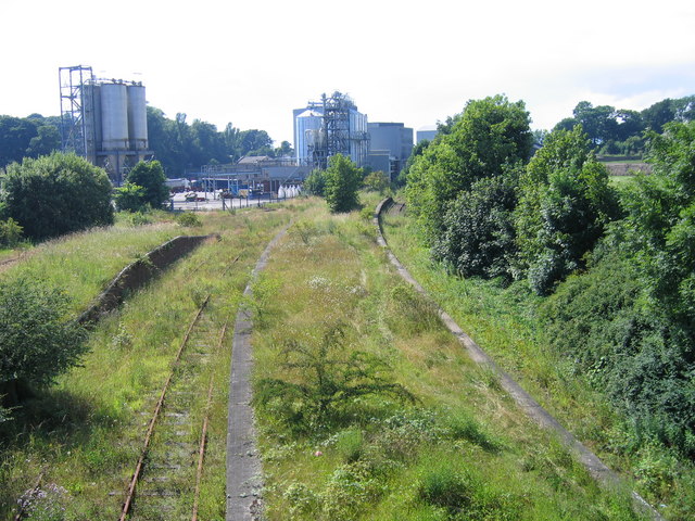
English: Cameron Bridge station and distillery Cameron Bridge station, on a branch that ran from Thornton Junction to Leven and then round the East Neuk of Fife to St Andrews, was closed to passengers in October 1969. Freight trains to Methil Power station continued to run past the station until the 1990s but since then, except for a trial train run a few years ago in the hope of a distillery traffic contract, the line has been unused. The right-hand platform was the passenger platform and the shorter one to the left was used for loading and unloading goods traffic. This photograph was taken from Station Road bridge. A previous Geograph photo, showing an enthusiasts' train at the platform, was taken from a footbridge at the far end of the station, which carried a public right of way that has been swallowed up by expansion of the distillery since 1984. |
| Date | |
| Source | From geograph.org.uk |
| Author | A-M-Jervis |
| Attribution (required by the license) | A-M-Jervis / Cameron Bridge station and distillery / |
| Camera location | | View this and other nearby images on: OpenStreetMap |
|---|
_heading:270.00&language=en)
| Object location | | View this and other nearby images on: OpenStreetMap |
|---|
_heading:270.00&language=en)
Licensing

|
This image was taken from the Geograph project collection. See this photograph's page on the Geograph website for the photographer's contact details. The copyright on this image is owned by A-M-Jervis and is licensed for reuse under the Creative Commons Attribution-ShareAlike 2.0 license.
|
This file is licensed under the Creative Commons Attribution-Share Alike 2.0 Generic license.
Attribution: A-M-Jervis
- You are free:
- to share – to copy, distribute and transmit the work
- to remix – to adapt the work
- Under the following conditions:
- attribution – You must give appropriate credit, provide a link to the license, and indicate if changes were made. You may do so in any reasonable manner, but not in any way that suggests the licensor endorses you or your use.
- share alike – If you remix, transform, or build upon the material, you must distribute your contributions under the same or compatible license as the original.
File history
Click on a date/time to view the file as it appeared at that time.
| Date/Time | Thumbnail | Dimensions | User | Comment | |
|---|---|---|---|---|---|
| current | 09:26, 22 February 2011 | | 640 × 480 (112 KB) | GeographBot | == {{int:filedesc}} == {{Information |description={{en|1=Cameron Bridge station and distillery Cameron Bridge station, on a branch that ran from Thornton Junction to Leven and then round the East Neuk of Fife to St Andrews, was closed to passengers in Oct |
File usage
The following pages on the English Wikipedia use this file (pages on other projects are not listed):
Global file usage
The following other wikis use this file:
- Usage on www.wikidata.org