
Size of this preview: 800 × 600 pixels. Other resolutions: 320 × 240 pixels | 640 × 480 pixels | 1,024 × 768 pixels | 1,280 × 960 pixels | 2,560 × 1,920 pixels | 3,264 × 2,448 pixels.
Original file (3,264 × 2,448 pixels, file size: 3.96 MB, MIME type: image/jpeg)
Summary
| Description |
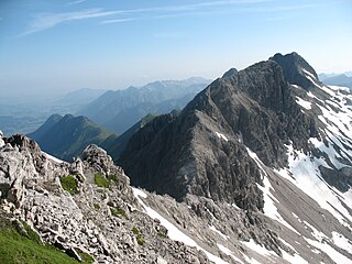
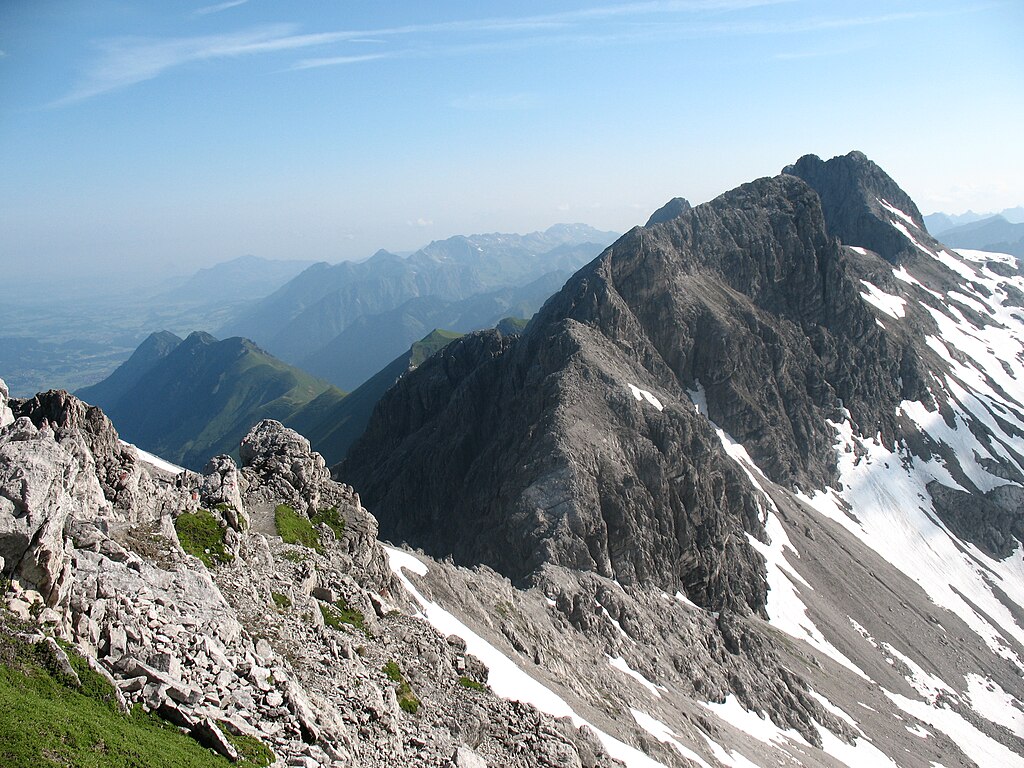
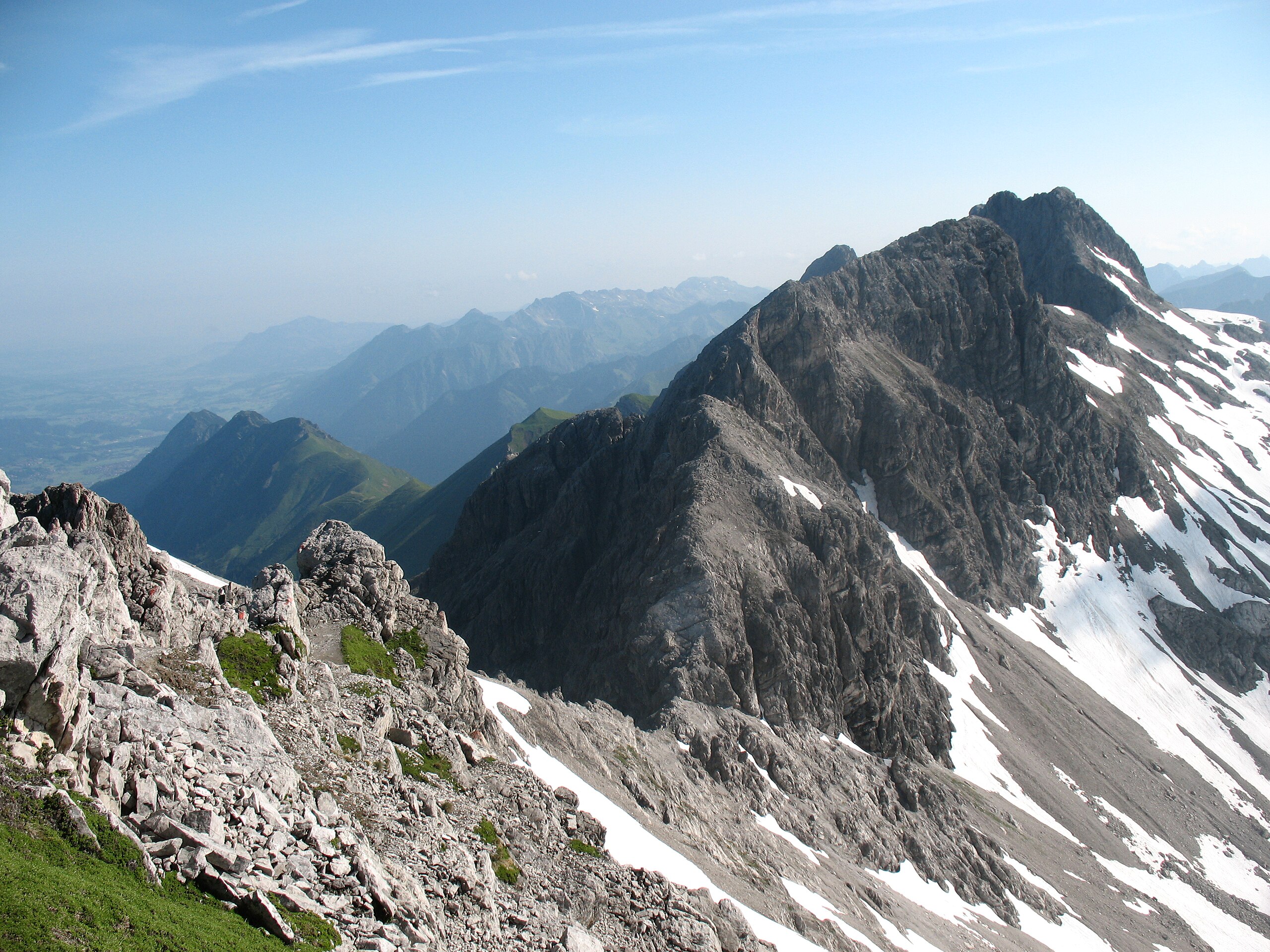
Deutsch: Heilbronner Weg: Bockkarkopf (2609 m) vom Steinschartenkopf über der Bockkarscharte (2504 m). Dahinter rechts die Hochfrottspitze (2649 m). Links hinten das Illertal bei Oberstdorf. |
| Date | |
| Source | Own work |
| Author | Kauk0r |
Licensing
I, the copyright holder of this work, hereby publish it under the following license:
This file is licensed under the Creative Commons Attribution-Share Alike 3.0 Unported license.
- You are free:
- to share – to copy, distribute and transmit the work
- to remix – to adapt the work
- Under the following conditions:
- attribution – You must give appropriate credit, provide a link to the license, and indicate if changes were made. You may do so in any reasonable manner, but not in any way that suggests the licensor endorses you or your use.
- share alike – If you remix, transform, or build upon the material, you must distribute your contributions under the same or compatible license as the original.
File history
Click on a date/time to view the file as it appeared at that time.
| Date/Time | Thumbnail | Dimensions | User | Comment | |
|---|---|---|---|---|---|
| current | 15:09, 9 July 2009 | | 3,264 × 2,448 (3.96 MB) | Kauk0r | {{Information |Description={{de|1=Heilbronner Weg: Bockkarkopf (2609 m) vom Steinschartenkopf über der Bockkarscharte (2504 m). Dahinter rechts die Hochfrottspitze (2649 m). Links hinten das Illertal bei Oberstdorf.}} |Source=Eigenes Werk (own work) |Aut |
File usage
The following pages on the English Wikipedia use this file (pages on other projects are not listed):
Global file usage
The following other wikis use this file:
- Usage on arz.wikipedia.org
- Usage on ceb.wikipedia.org
- Usage on de.wikipedia.org
- Usage on fr.wikipedia.org
- Usage on lld.wikipedia.org
- Usage on nn.wikipedia.org
- Usage on pl.wikipedia.org
- Usage on pnb.wikipedia.org
- Usage on simple.wikipedia.org
- Usage on sq.wikipedia.org
- Usage on www.wikidata.org
- Usage on zh.wikipedia.org