
Size of this preview: 450 × 600 pixels. Other resolutions: 180 × 240 pixels | 360 × 480 pixels | 576 × 768 pixels | 768 × 1,024 pixels | 2,112 × 2,816 pixels.
Original file (2,112 × 2,816 pixels, file size: 4.85 MB, MIME type: image/jpeg)
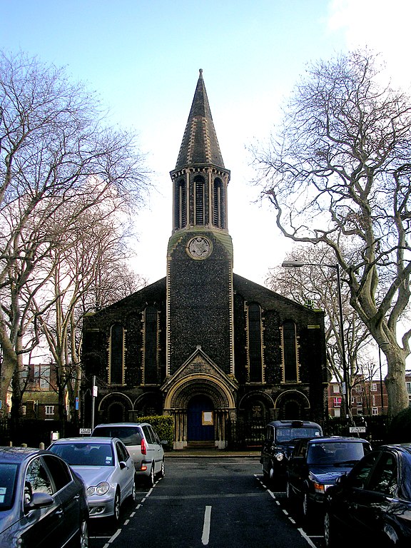
This is a photo of listed building number 1357877. |
Summary
| Description |
English: Parish church of SS Peter and Thomas, St Peter's Close, Bethnal Green, London E2, seen from west-southwest |
| Date | |
| Source | From geograph.org.uk |
| Author | Dr Neil Clifton |
| Attribution (required by the license) | Dr Neil Clifton / Bethnal Green: Church of St Peter and St Thomas / |
| Camera location | | View this and other nearby images on: OpenStreetMap |
|---|
_heading:67.00&language=en)
| Object location | | View this and other nearby images on: OpenStreetMap |
|---|
_heading:67.00&language=en)
Licensing

|
This image was taken from the Geograph project collection. See this photograph's page on the Geograph website for the photographer's contact details. The copyright on this image is owned by Dr Neil Clifton and is licensed for reuse under the Creative Commons Attribution-ShareAlike 2.0 license.
|
This file is licensed under the Creative Commons Attribution-Share Alike 2.0 Generic license.
Attribution: Dr Neil Clifton
- You are free:
- to share – to copy, distribute and transmit the work
- to remix – to adapt the work
- Under the following conditions:
- attribution – You must give appropriate credit, provide a link to the license, and indicate if changes were made. You may do so in any reasonable manner, but not in any way that suggests the licensor endorses you or your use.
- share alike – If you remix, transform, or build upon the material, you must distribute your contributions under the same or compatible license as the original.
File history
Click on a date/time to view the file as it appeared at that time.
| Date/Time | Thumbnail | Dimensions | User | Comment | |
|---|---|---|---|---|---|
| current | 07:42, 5 March 2011 | | 2,112 × 2,816 (4.85 MB) | GeographBot | == {{int:filedesc}} == {{Information |description={{en|1=Bethnal Green: Church of St Peter and St Thomas}} |date=2010-02-19 |source=From [http://www.geograph.org.uk/photo/1716739 geograph.org.uk] |author=[http://www.geograph.org.uk/profile/796 Dr Neil Cl |
File usage
The following pages on the English Wikipedia use this file (pages on other projects are not listed):
Global file usage
The following other wikis use this file:
- Usage on www.wikidata.org