Original file (4,912 × 5,038 pixels, file size: 141.64 MB, MIME type: image/tiff)
Summary
DescriptionAn edible (or lickable) building, sort of, in Grand Saline in Van Zandt County of East Texas LCCN2014633263.tif |
English: Title: An edible (or lickable) building, sort of, in Grand Saline in Van Zandt County of East Texas
Physical description: 1 photograph : digital, tiff file, color. Notes: Title, date, and keywords based on information provided by the photographer.; Gift; The Lyda Hill Foundation; 2014; (DLC/PP-2014:054).; Called the "Salt Palace," even if it's not so palatial, the building walls are made of large blocks of salt, which have been mined for decades outside town. The building in inspired by another, also created in Grand Saline but formed in the shape of San Antonio's historic Alamo, which was displayed at the Texas Centennial Exposition in Dallas in 1936.; Forms part of: Lyda Hill Texas Collection of Photographs in Carol M. Highsmith's America Project in the Carol M. Highsmith Archive.; Credit line: The Lyda Hill Texas Collection of Photographs in Carol M. Highsmith's America Project, Library of Congress, Prints and Photographs Division. |
||||||||||||||||||||||||||
Date | Taken on 22 May 2014, 14:02 (according to Exif data) | ||||||||||||||||||||||||||
Source |
Library of Congress
|
||||||||||||||||||||||||||
Author |
creator QS:P170,Q5044454 |
||||||||||||||||||||||||||
Permission (Reusing this file) |
No known restrictions on publication.
|
Camera location | 32° 40′ 28.59″ N, 95° 42′ 35.38″ W | View this and other nearby images on: OpenStreetMap | 32.674607; -95.709828 |
---|
Licensing
Public domainPublic domainfalsefalse |
This work is from the Carol M. Highsmith Archive collection at the Library of Congress. According to the library, there are no known copyright restrictions on the use of this work. Carol M. Highsmith has stipulated that her photographs are in the public domain. Photographs of sculpture or other works of art may be restricted by the copyright of the artist; see Commons:FOP US#Artworks and sculptures for more information. |
Items portrayed in this file
depicts
inception
2014
coordinates of the point of view
32°40'28.585"N, 95°42'35.381"W
captured with
Nikon D800
media type
image/tiff
checksum
5838238b51f9417929c23f94fe13c621465e777e
data size
148,516,490 byte
height
5,038 pixel
width
4,912 pixel
number of pages
1
File history
Click on a date/time to view the file as it appeared at that time.
Date/Time | Thumbnail | Dimensions | User | Comment | |
---|---|---|---|---|---|
current | 15:57, 7 September 2016 | 
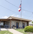
4,912 × 5,038 (141.64 MB) | Fæ | LOC 2014633263, Carol M. Highsmith collection. P730.12172 TIFF (141.6mb) |
File usage
Metadata
This file contains additional information, probably added from the digital camera or scanner used to create or digitize it.
If the file has been modified from its original state, some details may not fully reflect the modified file.
Image title | An edible (or lickable) building, sort of, in Grand Saline in Van Zandt County of East Texas. It's called the "Salt Palace," even if it's not so palatial. The building walls are made of large blocks of salt, which have been mined for decades outside town. The building in inspired by another, also created in Grand Saline but formed in the shape of San Antonio's historic Alamo, which was displayed at the Texas Centennial Exposition in Dallas in 1936. |
---|---|
Camera manufacturer | NIKON CORPORATION |
Camera model | NIKON D800 |
Author | Photographer: Carol M. Highsmith |
Exposure time | 1/100 sec (0.01) |
F-number | f/10 |
ISO speed rating | 100 |
Date and time of data generation | 14:02, 22 May 2014 |
Lens focal length | 24 mm |
Latitude | 32° 40′ 28.58″ N |
Longitude | 95° 42′ 35.38″ W |
Altitude | 117 meters above sea level |
Width | 4,912 px |
Height | 5,038 px |
Bits per component |
|
Compression scheme | Uncompressed |
Pixel composition | RGB |
Image data location | 33,598 |
Orientation | Normal |
Number of components | 3 |
Number of rows per strip | 5,038 |
Bytes per compressed strip | 148,479,936 |
Horizontal resolution | 300 dpi |
Vertical resolution | 300 dpi |
Data arrangement | chunky format |
Software used | Ver.1.02 |
File change date and time | 23:09, 27 May 2014 |
Exposure Program | Manual |
Exif version | 2.21 |
Date and time of digitizing | 14:02, 22 May 2014 |
Shutter speed | 6.643856 |
APEX aperture | 6.643856 |
Exposure bias | 0 |
Maximum land aperture | 3 APEX (f/2.83) |
Metering mode | Pattern |
Light source | Unknown |
Flash | Flash did not fire, compulsory flash suppression |
Color space | Uncalibrated |
Focal plane X resolution | 2,048.4022216797 |
Focal plane Y resolution | 2,048.4022216797 |
Focal plane resolution unit | 3 |
Sensing method | One-chip color area sensor |
File source | Digital still camera |
Scene type | A directly photographed image |
Custom image processing | Normal process |
Exposure mode | Manual exposure |
White balance | Auto white balance |
Digital zoom ratio | 1 |
Focal length in 35 mm film | 24 mm |
Scene capture type | Standard |
Scene control | None |
Contrast | Normal |
Saturation | Normal |
Sharpness | Normal |
Subject distance range | Unknown |
GPS time (atomic clock) | 19:02 |
Satellites used for measurement | 09 |
Geodetic survey data used | WGS84 |
GPS date | 22 May 2014 |
GPS tag version | 0.0.3.2 |