No higher resolution available.
All_Saints'_church,_Ruskington,_Lincs._-_geograph.org.uk_-_166165.jpg (640 × 427 pixels, file size: 76 KB, MIME type: image/jpeg)
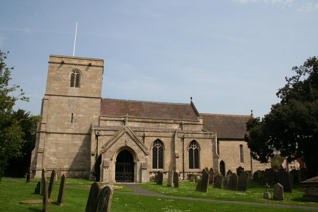
This is a photo of listed building number 1261375. |
Summary
| Description |
English: All Saints' parish church, Ruskington, Lincolnshire, seen from the south |
| Date | |
| Source | From geograph.org.uk |
| Author | Richard Croft |
| Attribution (required by the license) | Richard Croft / All Saints' church, Ruskington, Lincs. / |
| Camera location | | View this and other nearby images on: OpenStreetMap |
|---|
_heading:45.00&language=en)
| Object location | | View this and other nearby images on: OpenStreetMap |
|---|
_heading:45.00&language=en)
Licensing

|
This image was taken from the Geograph project collection. See this photograph's page on the Geograph website for the photographer's contact details. The copyright on this image is owned by Richard Croft and is licensed for reuse under the Creative Commons Attribution-ShareAlike 2.0 license.
|
This file is licensed under the Creative Commons Attribution-Share Alike 2.0 Generic license.
Attribution: Richard Croft
- You are free:
- to share – to copy, distribute and transmit the work
- to remix – to adapt the work
- Under the following conditions:
- attribution – You must give appropriate credit, provide a link to the license, and indicate if changes were made. You may do so in any reasonable manner, but not in any way that suggests the licensor endorses you or your use.
- share alike – If you remix, transform, or build upon the material, you must distribute your contributions under the same or compatible license as the original.
File history
Click on a date/time to view the file as it appeared at that time.
| Date/Time | Thumbnail | Dimensions | User | Comment | |
|---|---|---|---|---|---|
| current | 07:11, 31 January 2010 | | 640 × 427 (76 KB) | GeographBot | == {{int:filedesc}} == {{Information |description={{en|1=All Saints' church, Ruskington, Lincs. The tower was rebuilt in 1620 after the medieval tower fell down in 1618, inside a Norman tower arch and Decorated arcades and some Early English windows in th |
File usage
The following pages on the English Wikipedia use this file (pages on other projects are not listed):
Global file usage
The following other wikis use this file:
- Usage on ceb.wikipedia.org
- Usage on cy.wikipedia.org
- Usage on de.wikipedia.org
- Usage on en.wikivoyage.org
- Usage on es.wikipedia.org
- Usage on fa.wikipedia.org
- Usage on fr.wikipedia.org
- Usage on it.wikipedia.org
- Usage on lld.wikipedia.org
- Usage on pl.wikipedia.org
- Usage on www.wikidata.org