| Colo Vale New South Wales | |||||||||||||||
|---|---|---|---|---|---|---|---|---|---|---|---|---|---|---|---|
 Colo Vale Railway Station located on the Old Picton Loop Line | |||||||||||||||
 Colo Vale | |||||||||||||||
| Coordinates | 34°24′S 150°29′E / 34.400°S 150.483°E | ||||||||||||||
| Population | 1,528 (UCL 2021)[1] | ||||||||||||||
| Established | 1837 | ||||||||||||||
| Postcode(s) | 2575 | ||||||||||||||
| Elevation | 642 m (2,106 ft) | ||||||||||||||
| Location |
| ||||||||||||||
| LGA(s) | Wingecarribee Shire | ||||||||||||||
| Region | Southern Highlands | ||||||||||||||
| County | Camden | ||||||||||||||
| Parish | Colo | ||||||||||||||
| State electorate(s) | Wollondilly | ||||||||||||||
| Federal division(s) | Hume | ||||||||||||||
| |||||||||||||||
Colo Vale (/ˈkɒloʊ veɪl/) is a Northern Village of the Southern Highlands of New South Wales, Australia, in Wingecarribee Shire. Colo Vale is approximately 100 km south west on the Hume Highway from Sydney.[2] It is situated 2 km north-west of Aylmerton, 5 km from the Hume Highway and 12 km drive to Mittagong. The surrounding area is part of the Parish of Colo which includes the villages of Aylmerton, Willow Vale, Alpine and Yerrinbool. Colo Vale has a mixed-business general store and many home-based businesses, including hairdressers, small manufacturing businesses and a large native plant nursery (Wariapendi Nursery) and a Public School on Wattle Street. A large sporting oval is located adjacent to the school with tennis courts, a community hall and a Rural Fire Service station.[3]
History[edit]
The village was formerly a station on the Main Southern Railway. During the early 1860s, increased settlement occurred due to the rich soil which derived from decomposing volcanic rock. St. Pauls Anglican Church which still stands today was built in 1884. This operates as a branch church of Mittagong Anglican Church.[3] The railway line was deviated in 1919 to a less steep alignment with easier grades and the original line became the Picton Loop line.[4] Colo Vale railway station, though disused, has been restored and is in good condition. The word Colo is believed to be an Aboriginal word for "a hill formed by volcanic rock”. In 1837 when John Kiernan purchased some land where modern Colo Vale is, he called it Colo. This name became the official Parish name for the area.The first school was built in 1911. In 1923, Colo Vale was settled by English migrant poultry farmers. In 1954, Colo Vale had a population of 121 with 37 dwellings.[3]
Population[edit]
In the 2016 census, there were 1,618 people in Colo Vale. 83.9% of people were born in Australia and 90.4% of people spoke only English at home. The most common responses for religion were Anglican 25.0%, No Religion 24.7% and Catholic 23.4%.[5] At the 2021 census, the population had increased to 1,775.[6]
References[edit]
- ^ Australian Bureau of Statistics (28 June 2022). "Colo Vale (urban centre and locality)". Australian Census 2021.
- ^ "Colo Vale News". www.facebook.com. Retrieved 2 March 2019.
- ^ a b c "A Brief History of Colo Vale". Colo Vale Community Association. Retrieved 2 March 2019.
- ^ Alan., Bayley, William (1974). Picton-Mittagong loop-line railway. Bulli, N.S.W.: Austrail Publications. ISBN 0909597146. OCLC 2137740.
{{cite book}}: CS1 maint: multiple names: authors list (link) - ^ Australian Bureau of Statistics (27 June 2017). "Colo Vale". 2016 Census QuickStats. Retrieved 11 July 2017.
- ^ "2021 Colo Vale, Census All persons QuickStats". Australian Bureau of Statistics. Retrieved 21 August 2022.
Photo gallery[edit]
- Images of Colo Vale
-
 Town Entry Sign, Wattle Street
 -
 Village Store, Railway Street
 -
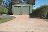 Rural Fire Service Shed, Banksia Street
 -
 War Memorial Hall, Railway Street
 -
 Road overbridge, closed
 -
 St Paul's Anglican Church, Church Ave
 -
 Colo Vale Heritage Train Station


