Hajdúszoboszló District
Hajdúszoboszlói járás | |
|---|---|
 Flag  Coat of arms | |
 Hajdúszoboszló District within Hungary and Hajdú-Bihar County. | |
| Country | |
| County | Hajdú-Bihar |
| District seat | Hajdúszoboszló |
| Area | |
| • Total | 732.65 km2 (282.88 sq mi) |
| • Rank | 3rd in Hajdú-Bihar |
| Population (2011 census) | |
| • Total | 43,061 |
| • Rank | 3rd in Hajdú-Bihar |
| • Density | 59/km2 (150/sq mi) |
Hajdúszoboszló (Hungarian: Hajdúszoboszlói járás) is a district in western part of Hajdú-Bihar County. Hajdúszoboszló is also the name of the town where the district seat is found. The district is located in the Northern Great Plain Statistical Region. This district is a part of Hajdúság historical and geographical region.
Geography[edit]
Hajdúszoboszló District borders with Balmazújváros District to the north, Debrecen District and Derecske District to the east, Püspökladány District to the south, Karcag District (Jász-Nagykun-Szolnok County) to the west. The number of the inhabited places in Hajdúszoboszló District is 5.
Municipalities[edit]
The district has 2 towns and 3 villages. (ordered by population, as of 1 January 2012)[1]
- Ebes (4,390)
- Hajdúszoboszló (23,309) – district seat
- Hajdúszovát (3,038)
- Nagyhegyes (2,750)
- Nádudvar (8,768)
The bolded municipalities are cities.
Demographics[edit]
Religion in Hajdúszoboszló District (2011 census)
In 2011, it had a population of 43,061 and the population density was 55/km².
| Year | County population[2] | Change |
|---|---|---|
| 2011 | 43,061 | n/a |
Ethnicity[edit]
Besides the Hungarian majority, the main minorities are the Roma (approx. 650) and German (300) and Romanian (100).
Total population (2011 census): 43,061
Ethnic groups (2011 census):[3] Identified themselves: 38,155 persons:
- Hungarians: 36,770 (96.37%)
- Gypsies: 618 (1.62%)
- Others and indefinable: 767 (2.01%)
Approx. 5,000 persons in Hajdúszoboszló District did not declare their ethnic group at the 2011 census.
Religion[edit]
Religious adherence in the county according to 2011 census:[4]
- Reformed – 11,291;
- Catholic – 3,124 (Roman Catholic – 2,607; Greek Catholic – 517);
- Evangelical – 51;
- other religions – 439;
- Non-religious – 17,235;
- Atheism – 388;
- Undeclared – 10,533.
Gallery[edit]
-
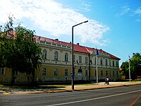 Hajdúszoboszló, Town Hall
 -
 Spa in Hajdúszoboszló
 -
 Keleti Canal near Nagyhegyes
 -
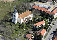 Reformed Church in Nádudvar


See also[edit]
References[edit]
- ^ A KSH 2012. évi helységnévkönyve
- ^ népesség.com, "Hajdúszoboszlói járás népessége"
- ^ 4.1.6.1 A népesség nemzetiség szerint, 2011, (in Hungarian) [1]
- ^ 4.1.7.1 A népesség vallás, felekezet szerint, 2011, (in Hungarian) [2]
External links[edit]
| Towns (2) |
| |
|---|---|---|
| Villages (3) | ||
47°28′00″N 21°23′00″E / 47.4667°N 21.3833°E