No higher resolution available.
South_porch_date_stone_at_St_Thomas_the_Martyr's_Church,_Oxford.jpg (450 × 600 pixels, file size: 78 KB, MIME type: image/jpeg)
Summary
| Description |
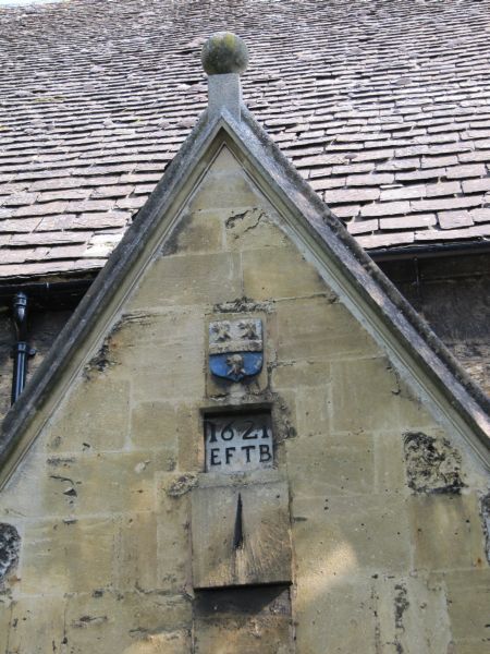
English: Church of England parish church of St Thomas the Martyr, Oxford: sundial and 17th-century date stone over the south porch |
| Date | |
| Source | From geograph.org.uk |
| Author | Bill Nicholls |
| Attribution (required by the license) | Bill Nicholls / Date over the sundial / |
| Camera location | | View this and other nearby images on: OpenStreetMap |
|---|
_heading:0.00&language=en)
| Object location | | View this and other nearby images on: OpenStreetMap |
|---|
_heading:0.00&language=en)
Licensing

|
This image was taken from the Geograph project collection. See this photograph's page on the Geograph website for the photographer's contact details. The copyright on this image is owned by Bill Nicholls and is licensed for reuse under the Creative Commons Attribution-ShareAlike 2.0 license.
|
This file is licensed under the Creative Commons Attribution-Share Alike 2.0 Generic license.
Attribution: Bill Nicholls
- You are free:
- to share – to copy, distribute and transmit the work
- to remix – to adapt the work
- Under the following conditions:
- attribution – You must give appropriate credit, provide a link to the license, and indicate if changes were made. You may do so in any reasonable manner, but not in any way that suggests the licensor endorses you or your use.
- share alike – If you remix, transform, or build upon the material, you must distribute your contributions under the same or compatible license as the original.
File history
Click on a date/time to view the file as it appeared at that time.
| Date/Time | Thumbnail | Dimensions | User | Comment | |
|---|---|---|---|---|---|
| current | 18:10, 28 February 2011 | | 450 × 600 (78 KB) | GeographBot | == {{int:filedesc}} == {{Information |description={{en|1=Date over the sundial The date says 1621 which does not surprise me when you look round the place. Not sure about telling the time now though with the trees shutting out the sunlight.}} |date=2009-0 |
File usage
The following pages on the English Wikipedia use this file (pages on other projects are not listed):