
No higher resolution available.
NorthPadreIslandfig10LG.jpg (600 × 396 pixels, file size: 305 KB, MIME type: image/jpeg)
Summary[edit]
| Description |
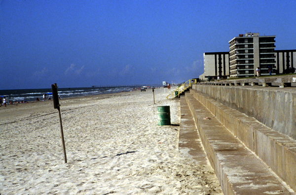
Seawall on North Padre Island constructed in the backbeach to protect condominiums from storm waves and beach erosion. Central Texas |
|---|---|
| Source |
Credit: U. S. Geological Survey |
| Date | |
| Author | |
| Permission (Reusing this file) |
See below.
|
Licensing[edit]
File history
Click on a date/time to view the file as it appeared at that time.
| Date/Time | Thumbnail | Dimensions | User | Comment | |
|---|---|---|---|---|---|
| current | 07:18, 6 March 2007 | | 600 × 396 (305 KB) | Geol310 mera (talk | contribs) | http://pubs.usgs.gov/of/2006/1133/figures/fig10.html http://pubs.usgs.gov/of/2006/1133/images/fig10LG.jpg |
You cannot overwrite this file.
File usage
The following pages on the English Wikipedia use this file (pages on other projects are not listed):