
Size of this preview: 800 × 124 pixels. Other resolutions: 320 × 50 pixels | 640 × 99 pixels | 1,024 × 159 pixels | 1,280 × 199 pixels | 11,957 × 1,855 pixels.
Original file (11,957 × 1,855 pixels, file size: 3.08 MB, MIME type: image/jpeg)
Summary
| Description |
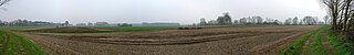
Deutsch: Wölanburg in Harsewinkel, Panorama des ehemaligen Standorts |
| Date | |
| Source | Own work |
| Author | Daniel Brockpähler |
| Camera location | | View this and other nearby images on: OpenStreetMap |
|---|
Licensing
This file is licensed under the Creative Commons Attribution-Share Alike 3.0 Unported license.
- You are free:
- to share – to copy, distribute and transmit the work
- to remix – to adapt the work
- Under the following conditions:
- attribution – You must give appropriate credit, provide a link to the license, and indicate if changes were made. You may do so in any reasonable manner, but not in any way that suggests the licensor endorses you or your use.
- share alike – If you remix, transform, or build upon the material, you must distribute your contributions under the same or compatible license as the original.
File history
Click on a date/time to view the file as it appeared at that time.
| Date/Time | Thumbnail | Dimensions | User | Comment | |
|---|---|---|---|---|---|
| current | 14:50, 4 April 2009 | 11,957 × 1,855 (3.08 MB) | DaBroMfld | {{Information |Description={{de|1=Wölanburg in Harsewinkel, Panorama des ehemaligen Standorts}} |Source=Eigene Fotografie |Author=Daniel Brockpähler |Date=4. April 2009 |Permission= |other_versions= }} {{location|51|57|10.14|N|8|12|32.27|E|region:DE_hea |
File usage
The following pages on the English Wikipedia use this file (pages on other projects are not listed):
Global file usage
The following other wikis use this file:
- Usage on ar.wikipedia.org
- Usage on de.wikipedia.org
- Usage on www.wikidata.org