Size of this preview: 800 × 600 pixels. Other resolutions: 320 × 240 pixels | 640 × 480 pixels | 1,024 × 768 pixels | 1,280 × 960 pixels | 2,560 × 1,920 pixels | 3,264 × 2,448 pixels.
Original file (3,264 × 2,448 pixels, file size: 1.31 MB, MIME type: image/jpeg)
Summary
| Description |
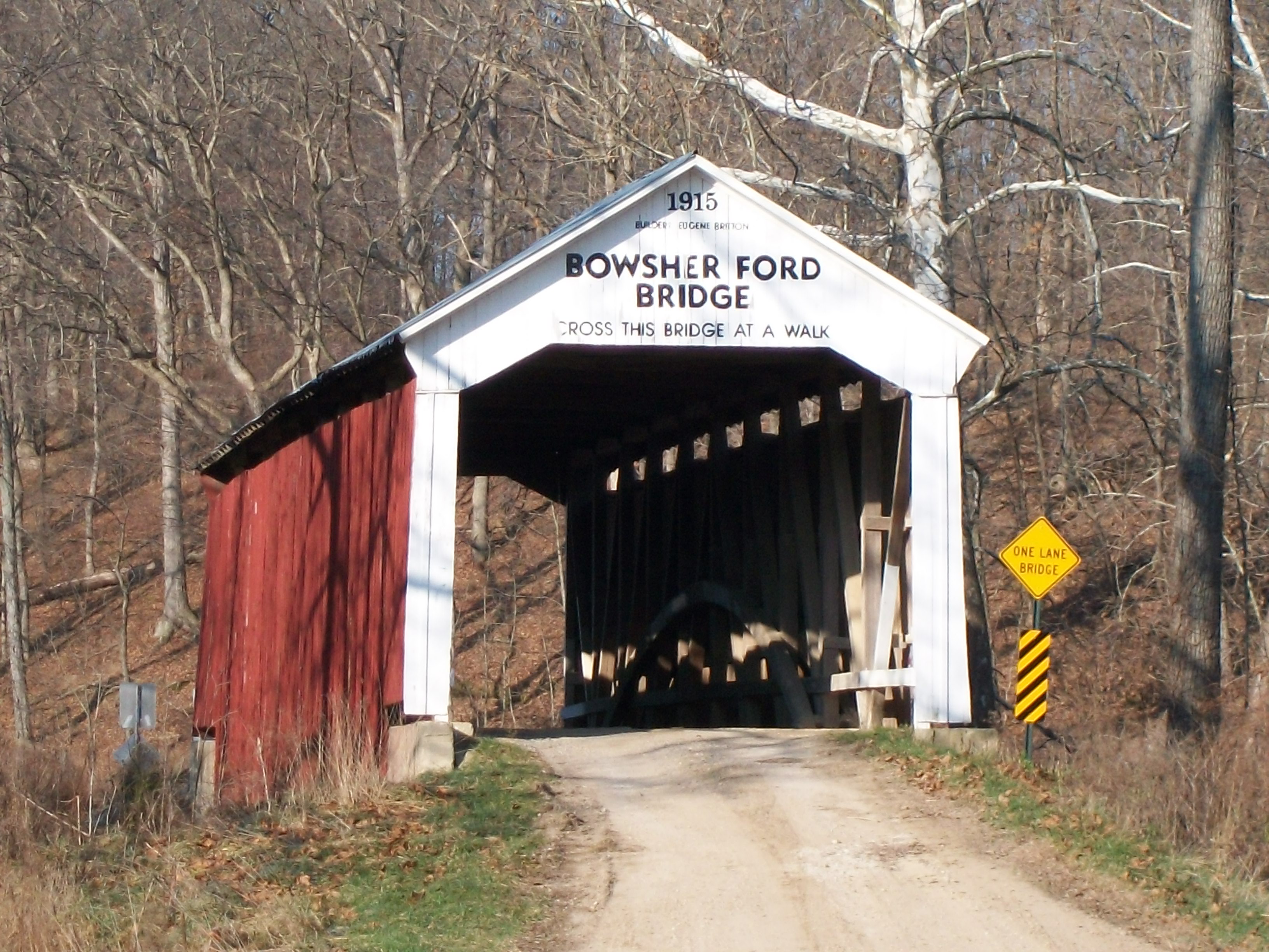
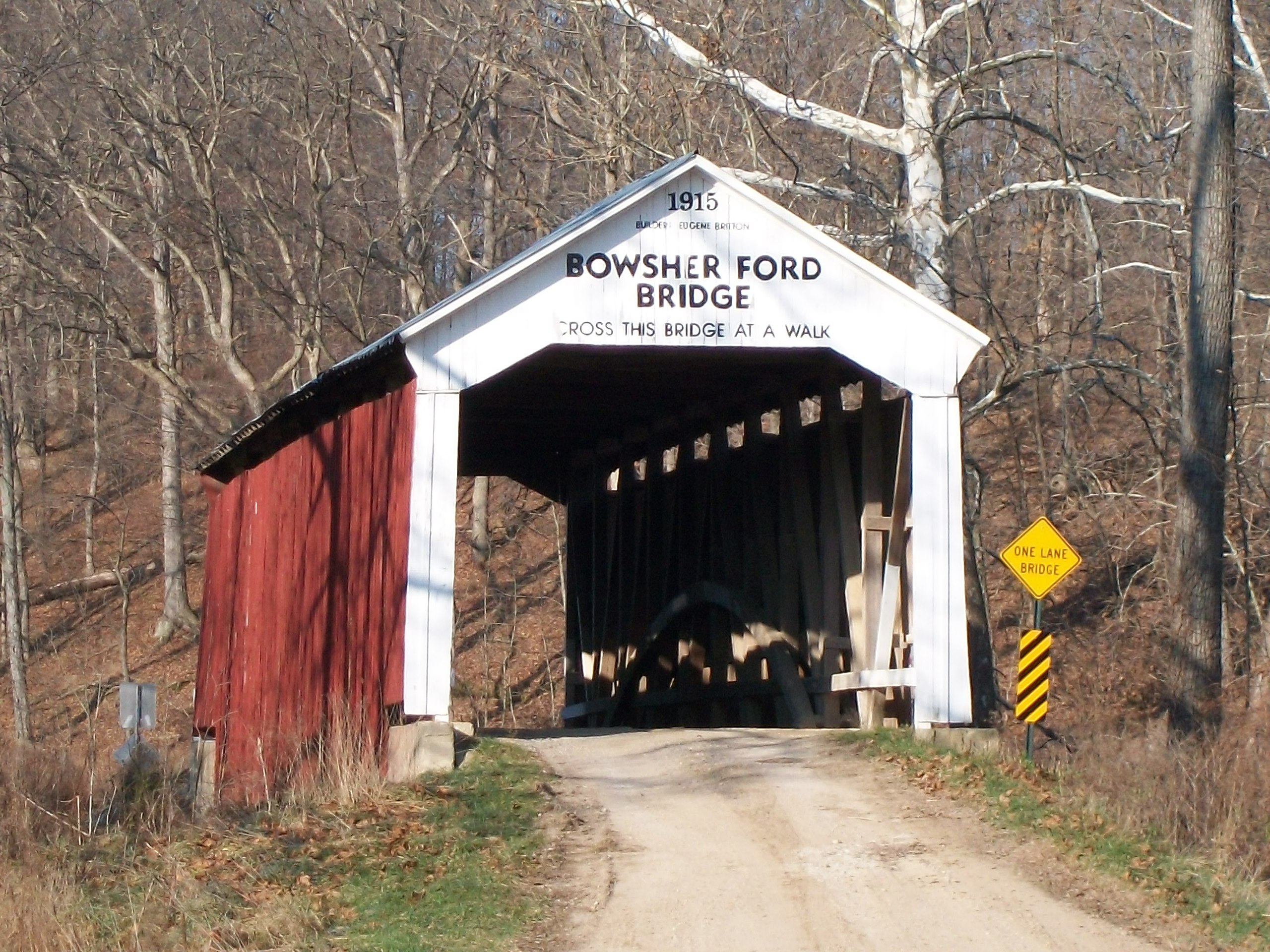
English: Bowsher Ford Covered Bridge
|
||
| Date | (UTC) | ||
| Source | Own work (Original text: I (Parkecountybridges (talk)) created this work entirely by myself.) | ||
| Author | Parkecountybridges (talk) Jacob Hilt |
| Object location | | View this and other nearby images on: OpenStreetMap |
|---|
Licensing
Parkecountybridges at English Wikipedia, the copyright holder of this work, hereby publishes it under the following licenses:
This file is licensed under the Creative Commons Attribution-Share Alike 3.0 Unported license.
Attribution: Parkecountybridges at English Wikipedia
- You are free:
- to share – to copy, distribute and transmit the work
- to remix – to adapt the work
- Under the following conditions:
- attribution – You must give appropriate credit, provide a link to the license, and indicate if changes were made. You may do so in any reasonable manner, but not in any way that suggests the licensor endorses you or your use.
- share alike – If you remix, transform, or build upon the material, you must distribute your contributions under the same or compatible license as the original.

|
Permission is granted to copy, distribute and/or modify this document under the terms of the GNU Free Documentation License, Version 1.2 or any later version published by the Free Software Foundation; with no Invariant Sections, no Front-Cover Texts, and no Back-Cover Texts. A copy of the license is included in the section entitled GNU Free Documentation License. |
You may select the license of your choice.
Original upload log
Transferred from en.wikipedia to Commons by Sreejithk2000 using CommonsHelper.
The original description page was here. All following user names refer to en.wikipedia.
- 2010-03-27 04:06 Parkecountybridges 3264×2448× (1371437 bytes) {{Information |Description = Bowsher Ford Covered Bridge |Source = I (~~~) created this work entirely by myself. |Date = ~~~~~ |Author = ~~~ Jacob Hilt |other_versions = }}
File history
Click on a date/time to view the file as it appeared at that time.
| Date/Time | Thumbnail | Dimensions | User | Comment | |
|---|---|---|---|---|---|
| current | 16:24, 1 June 2010 | | 3,264 × 2,448 (1.31 MB) | File Upload Bot (Magnus Manske) | {{BotMoveToCommons|en.wikipedia|year={{subst:CURRENTYEAR}}|month={{subst:CURRENTMONTHNAME}}|day={{subst:CURRENTDAY}}}} {{Information |Description={{en|Bowsher Ford Covered Bridge}} |Source=Transferred from [http://en.wikipedia.org en.wikipedia]; transfer |
File usage
The following pages on the English Wikipedia use this file (pages on other projects are not listed):
Global file usage
The following other wikis use this file:
- Usage on www.wikidata.org