
Size of this preview: 677 × 600 pixels. Other resolutions: 271 × 240 pixels | 542 × 480 pixels | 1,000 × 886 pixels.
Original file (1,000 × 886 pixels, file size: 80 KB, MIME type: image/png)
Summary
| Description |
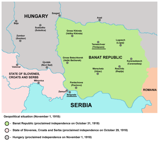
English: Historical map of Banat Republic in 1918.
Српски / srpski: Историјска мапа Банатске републике 1918. године. |
| Date | 28 December 2006 (original upload date) |
| Source | Own work |
| Author | PANONIAN |
| Other versions |
[]
|


References
- Drago Njegovan, Prisajedinjenje Vojvodine Srbiji, Novi Sad, 2004.
- Dimitrije Boarov, Politička istorija Vojvodine, Novi Sad, 2001.
Source and licence

|
This map has been uploaded by Electionworld from en.wikipedia.org to enable the |
self made map by user:PANONIAN
Licensing
| I, the copyright holder of this work, release this work into the public domain. This applies worldwide. In some countries this may not be legally possible; if so: I grant anyone the right to use this work for any purpose, without any conditions, unless such conditions are required by law. |
File history
Click on a date/time to view the file as it appeared at that time.
| Date/Time | Thumbnail | Dimensions | User | Comment | |
|---|---|---|---|---|---|
| current | 09:54, 17 May 2014 | | 1,000 × 886 (80 KB) | PANONIAN | aesthetics |
| 19:42, 13 March 2009 |  | 998 × 886 (80 KB) | PANONIAN | ||
| 19:24, 28 December 2006 |  | 370 × 309 (4 KB) | Electionworld | {{ew|en|PANONIAN}} historic map (self made) {{PD-self}} Category:Maps of the history of Romania Category:Maps of the history of Vojvodina Category:Maps of the history of Serbia |
File usage
The following pages on the English Wikipedia use this file (pages on other projects are not listed):
Global file usage
The following other wikis use this file:
- Usage on ba.wikipedia.org
- Usage on be-tarask.wikipedia.org
- Usage on be.wikipedia.org
- Usage on bs.wikipedia.org
- Usage on ca.wikipedia.org
- Usage on cs.wikipedia.org
- Usage on de.wikipedia.org
- Usage on el.wikipedia.org
- Usage on fr.wikipedia.org
- Usage on gl.wikipedia.org
- Usage on hr.wikipedia.org
- Usage on it.wikipedia.org
- Usage on ja.wikipedia.org
- Usage on lt.wikipedia.org
- Usage on mk.wikipedia.org
- Usage on nl.wikipedia.org
- Usage on pl.wikipedia.org
- Usage on ru.wikipedia.org
- Usage on sh.wikipedia.org
- Usage on th.wikipedia.org
- Usage on uk.wikipedia.org