
Size of this preview: 450 × 600 pixels. Other resolutions: 180 × 240 pixels | 360 × 480 pixels | 576 × 768 pixels | 768 × 1,024 pixels | 1,944 × 2,592 pixels.
Original file (1,944 × 2,592 pixels, file size: 1.2 MB, MIME type: image/jpeg)
Summary
| Description |
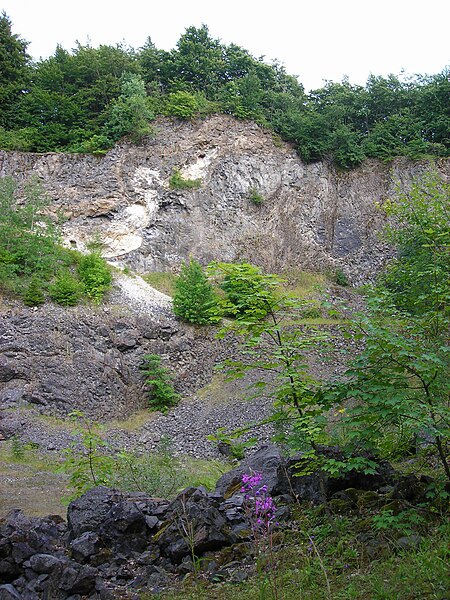
English: East-Side of the inner Arensberg Crater (Vulkaneifel, germany)
Deutsch: Ost-Seite des Kraterinneren des Arensberges mit unterschiedlichen Gesteinsschichten und Ablagerungen |
| Date | |
| Source | Own work |
| Author | Peter Klassmann (Magnummandel / de:Benutzer:Magnummandel) |
| Camera location | | View this and other nearby images on: OpenStreetMap |
|---|
Licensing
I, the copyright holder of this work, hereby publish it under the following licenses:

|
Permission is granted to copy, distribute and/or modify this document under the terms of the GNU Free Documentation License, Version 1.2 or any later version published by the Free Software Foundation; with no Invariant Sections, no Front-Cover Texts, and no Back-Cover Texts. A copy of the license is included in the section entitled GNU Free Documentation License. |
This file is licensed under the Creative Commons Attribution-Share Alike 3.0 Unported, 2.5 Generic, 2.0 Generic and 1.0 Generic license.
- You are free:
- to share – to copy, distribute and transmit the work
- to remix – to adapt the work
- Under the following conditions:
- attribution – You must give appropriate credit, provide a link to the license, and indicate if changes were made. You may do so in any reasonable manner, but not in any way that suggests the licensor endorses you or your use.
- share alike – If you remix, transform, or build upon the material, you must distribute your contributions under the same or compatible license as the original.
You may select the license of your choice.
File history
Click on a date/time to view the file as it appeared at that time.
| Date/Time | Thumbnail | Dimensions | User | Comment | |
|---|---|---|---|---|---|
| current | 11:21, 2 August 2008 | | 1,944 × 2,592 (1.2 MB) | Magnummandel | {{Information |Description={{en|1=East-Side of the inner Arensberg Crater (Vulkaneifel, germany)}} {{de|1=Ost-Seite des Kraterinneren des Arensberges mit unterschiedlichen Gesteinsschichten und Ablagerungen}} |Source=Eigenes Werk (own wo |
File usage
The following pages on the English Wikipedia use this file (pages on other projects are not listed):
Global file usage
The following other wikis use this file:
- Usage on de.wikipedia.org