
Size of this preview: 800 × 528 pixels. Other resolutions: 320 × 211 pixels | 640 × 423 pixels | 1,024 × 676 pixels | 1,280 × 845 pixels | 2,560 × 1,690 pixels | 3,573 × 2,359 pixels.
Original file (3,573 × 2,359 pixels, file size: 2.65 MB, MIME type: image/jpeg)
Summary
| Description |
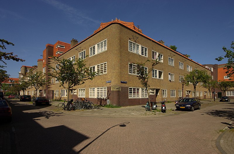
Nederlands: Complex van de woningbouwvereniging De Dageraad (1918-1923) in Amsterdam, architecten: Michel de Klerk en Piet Kramer
Deutsch: Komplex der Wohnungsbaugenossenschaft De Dageraad (1918-1923) in Amsterdam, Architekten: Michel de Klerk und Piet Kramer |
||||||
| Date | |||||||
| Source | Own work | ||||||
| Author | Janericloebe |
Licensing
I, the copyright holder of this work, hereby publish it under the following licenses:

|
Permission is granted to copy, distribute and/or modify this document under the terms of the GNU Free Documentation License, Version 1.2 or any later version published by the Free Software Foundation; with no Invariant Sections, no Front-Cover Texts, and no Back-Cover Texts. A copy of the license is included in the section entitled GNU Free Documentation License. |
This file is licensed under the Creative Commons Attribution 3.0 Unported license.
- You are free:
- to share – to copy, distribute and transmit the work
- to remix – to adapt the work
- Under the following conditions:
- attribution – You must give appropriate credit, provide a link to the license, and indicate if changes were made. You may do so in any reasonable manner, but not in any way that suggests the licensor endorses you or your use.
You may select the license of your choice.
File history
Click on a date/time to view the file as it appeared at that time.
| Date/Time | Thumbnail | Dimensions | User | Comment | |
|---|---|---|---|---|---|
| current | 12:33, 12 May 2011 | | 3,573 × 2,359 (2.65 MB) | Janericloebe | == Summary == {{Information |Description ={{nl|1=Complex van de woningbouwvereniging ''De Dageraad'' (1918-1923) in Amsterdam, architecten: Michel de Klerk en Piet Kramer<br>{{Rijksmonument| |
File usage
The following pages on the English Wikipedia use this file (pages on other projects are not listed):
Global file usage
The following other wikis use this file:
- Usage on fa.wikipedia.org