Chelles–Gournay | |||||||||||||||||||||
|---|---|---|---|---|---|---|---|---|---|---|---|---|---|---|---|---|---|---|---|---|---|
 | |||||||||||||||||||||
| General information | |||||||||||||||||||||
| Location | Place Gasnier-Guy Chelles France | ||||||||||||||||||||
| Coordinates | 48°52′27″N 2°35′0″E / 48.87417°N 2.58333°E | ||||||||||||||||||||
| Elevation | 46 m (151 ft) | ||||||||||||||||||||
| Operated by | SNCF | ||||||||||||||||||||
| Line(s) | Paris-Est–Strasbourg-Ville railway | ||||||||||||||||||||
| Platforms | 4 | ||||||||||||||||||||
| Tracks | 6 | ||||||||||||||||||||
| Bus routes | |||||||||||||||||||||
| Construction | |||||||||||||||||||||
| Parking | 544 spaces[1] | ||||||||||||||||||||
| Accessible | Yes, by prior reservation[2] | ||||||||||||||||||||
| Other information | |||||||||||||||||||||
| Station code | 87116111 | ||||||||||||||||||||
| Fare zone | 4 | ||||||||||||||||||||
| History | |||||||||||||||||||||
| Opened | 5 July 1849 | ||||||||||||||||||||
| Passengers | |||||||||||||||||||||
| 2019 | 10,874,698 | ||||||||||||||||||||
| Services | |||||||||||||||||||||
| |||||||||||||||||||||
| Location | |||||||||||||||||||||
 | |||||||||||||||||||||
Chelles–Gournay is a railway station in Chelles, Seine-et-Marne, France. The station opened in 1849 and is on the Paris-Est–Strasbourg-Ville railway. The station is served by Transilien line P (East Paris) and RER Line E services operated by the SNCF. It will also see services operated by Grand Paris Express (Paris Metro Line 16) in the future.
History[edit]
Since 14 July 1999, the RER E serves the station. Between 1999 and 2007 the station was rebuilt to make way for the LGV Est, which included the building of new entrances to the station.
Train services[edit]
The station is served by the following services:
- Commuter services (RER E) from Haussmann–Saint-Lazare to Chelles–Gournay
- Regional services (Transilien P) from Paris-Est to Meaux
- Paris Metro Line 16 from Saint-Denis Pleyel to Noisy-Champs in the future as part of Grand Paris Express.
Bus services[edit]
The station is served by services including:
- Apolo7 bus lines 1, 2, 3, 4, 6, 7, 8, 8s, 9 and 9s
- Seine-et-Marne Express line 19
- RATP Group lines 113 and 213
- TRA bus line 613
- Noctilien night bus lines N23 and N141
Gallery[edit]
-
 Overview
 -

-
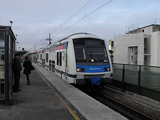 A Z 22500 train leaving the station


References[edit]
- ^ "Plan Parc Relais labellisés" [Map with park-and-rides labeled] (PDF). Île-de-France Mobilités. October 2020. Retrieved 27 December 2023.
- ^ "Plan pour les voyageurs en fauteuil roulant" [Map for travelers in wheelchairs] (PDF). Île-de-France Mobilités (in French and British English). 2023. Retrieved 27 December 2023.
External links[edit]
- Chelles–Gournay station at Transilien, the official website of SNCF (in French)
- Île-de-France Network Map
- Transilien website
| Authority control databases: Geographic |
|---|