| caption = A Cree camp, likely in [[Montana]], photographed {{Circa|1893}}
| flag =
| flag_caption = Flag of Cree people of Canada
| population = 356,655 (2016 census)<ref name="auto1">{{Cite web |url=https://www12.statcan.gc.ca/census-recensement/2016/dp-pd/abpopprof/details/page.cfm?Lang=E&Geo1=PR&Code1=01&Data=Count&SearchText=Canada&SearchType=Begins&B1=All&C1=All&SEX_ID=1&AGE_ID=1&RESGEO_ID=1 |title=2016 Canadian Census |publisher=[[Statistics Canada]] |access-date=28 April 2019 |date=21 June 2018}}</ref><br>Including [[Atikamekw]] and [[Innu]]
| popplace = Canada
| region1 = [[Alberta]]
| pop1 = 95,300 <small>(2016)</small><ref name="2016-profile">{{Cite web |url=https://www12.statcan.gc.ca/census-recensement/2016/dp-pd/abpopprof/index.cfm?Lang=E|title=Aboriginal Population Profile, 2016 Census|publisher=[[Statistics Canada]]|access-date=26 May 2022|date=21 June 2018}}</ref>
| related = [[Métis]], [[Oji-Cree]], [[Ojibwe]], [[Innu]], [[Naskapi]]
}}
}}
The '''Cree''' are one of the largest groups of [[First Nations]] / [[Native Americans in the United States|Native Americans]] in [[North America]], with 200,000 members living in Canada. The major proportion of Cree in [[Canada]] live north and west of [[Lake Superior]], in [[Ontario]], [[Manitoba]], [[Saskatchewan]], [[Alberta]] and the [[Northwest Territories]]. About 15,000 live in eastern [[Quebec]].<ref>{{cite web |url=http://www.civilization.ca/cmc/exhibitions/tresors/ethno/etb0170e.shtml |title=Culture Areas Index |work=the Canadian Museum of Civilization }}</ref>
The '''Cree''' ({{lang-cr|néhinaw|script=Latn}}, {{lang|cr-Latn|néhiyaw}}, {{lang|cr-Latn|nihithaw}}, etc.; {{lang-fr|link=no|Cri}}) are a [[Indigenous peoples of the Americas|North American Indigenous people]]. They live primarily in [[Canada]], where they form one of the country's largest [[First Nations in Canada|First Nations]].
In the [[United States]], this [[Algonquian languages|Algonquian]]-speaking people historically lived from Lake Superior westward. Today, they live mostly in [[Montana]], where they share a reservation with the [[Ojibwe]] (Chippewa).<ref name="three">{{cite web |url=http://www.civilization.ca/cmc/exhibitions/tresors/ethno/etb0000e.shtml |work=Canadian Museum of Civilization Corporation |title=Gateway to Aboriginal Heritage}}</ref>
In Canada, more than 350,000 people are Cree or have Cree ancestry.<ref name="auto1"/> The major proportion of Cree in Canada live north and west of [[Lake Superior]], in [[Ontario]], [[Manitoba]], [[Saskatchewan]], [[Alberta]], and the [[Northwest Territories]].<ref name="ce">{{Cite encyclopedia |title=Cree |encyclopedia=[[The Canadian Encyclopedia]] |publisher=[[Historica Canada]] |edition=online |date=9 October 2018 |url=https://www.thecanadianencyclopedia.ca/en/article/cree}}</ref> About 27,000 live in [[Quebec]].<ref>{{cite web |url=https://www12.statcan.gc.ca/census-recensement/2016/dp-pd/abpopprof/details/Page.cfm?Lang=E&Geo1=PR&Code1=24&Data=Count&SearchText=Quebec&SearchType=Begins&B1=All&C1=All&GeoLevel=PR&GeoCode=24&SEX_ID=1&AGE_ID=1&RESGEO_ID=1 |title=2016 Canada Census |publisher=[[Statistics Canada]] |access-date=28 April 2019 |date=21 June 2018}}</ref>
The documented westward migration over time has been strongly associated with their roles as traders and hunters in the [[North American Fur Trade]].<ref>Alexander Mackenzie, [http://www.gutenberg.org/ebooks/35658] Voyages from Montreal Through the Continent of North America to the Frozen and Pacific Oceans in 1789 and 1793.</ref>
In the United States, Cree people historically lived from Lake Superior westward. Today, they live mostly in [[Montana]], where they share the [[Rocky Boy Indian Reservation]] with [[Ojibwe]] (Chippewa) people.<ref name="three">{{cite web |url=http://www.civilization.ca/cmc/exhibitions/tresors/ethno/etb0000e.shtml |work=Canadian Museum of Civilization Corporation |title=Gateway to Aboriginal Heritage}}</ref>
== Tribes ==
The Cree Nation is generally divided into eight groups (some political, others cultural):
The documented westward migration over time has been strongly associated with their roles as traders and hunters in the [[North American fur trade]].<ref>{{Gutenberg |no=35658 |name=Voyages from Montreal Through the Continent of North America to the Frozen and Pacific Oceans in 1789 and 1793 |first=Alexander |last=Mackenzie |author-link=Alexander Mackenzie (explorer) |date=1903 |publisher=A. S. Barnes & Company |location=New York |bullet=none}}</ref>
# ''[[Naskapi]]'' ([[Innu]]) and
# ''[[Innu|Montagnais]]'' (Innu) are inhabitants of an area they refer to as [[Nitassinan]]. Their territories comprise most of the present-day political jurisdictions of eastern [[Quebec]] and [[Labrador]]. And the east part of the country. Their cultures are differentiated, as the Naskapi are still [[caribou]] hunters and more nomadic than the Montagnais, but the Montagnais have more settlements. The total population of the two groups in 2003 was about 18,000 people, of which 15,000 lived in Quebec. Their dialects and languages are the most distinct from the Cree spoken by the groups west of Lake Superior.
# ''[[Attikamekw]]'' are inhabitants of the area they refer to as [[Nitaskinan]] (Our Land), in the upper [[St. Maurice River]] valley of Quebec (about 300 km north of [[Montreal]]). Their population is around 4,500.
# [[James Bay Cree]] - [[Grand Council of the Crees]]; approximately 16,357 Cree (''Iyyu'' in Coastal Dialect / ''Iynu'' in Inland Dialect) of the [[James Bay]] and [[Nunavik]] regions of Northern Quebec.
# [[Moose Cree First Nation|Moose Cree]] - [[Moose Factory, Ontario|Moose Factory]]<ref name="moosecree.com">[http://www.moosecree.com/community-profile/services.html Moose Cree First Nation community profile]</ref> in the [[Cochrane District]], [[Ontario]]; this group lives on [[Moose Factory Island]], near the mouth of the [[Moose River (Ontario)|Moose River]], at the southern end of James Bay.
# [[Swampy Cree]] - this group lives in northern Manitoba along the [[Hudson Bay]] coast and adjacent inland areas to the south and west, and in Ontario along the coast of Hudson Bay and James Bay. Some also in eastern Saskatchewan around [[Cumberland House, Saskatchewan|Cumberland House]]. It has 4,500 speakers.
# [[Woods Cree]] group in northern Alberta and Saskatchewan.
# [[Plains Cree]] 34,000 people in Manitoba, Saskatchewan, Alberta, and Montana.
Taylor fisher is a big turd.
Collectively the Cree used the [[Endonym|autonym]] ''Nēhilawē'' (those who speak our language).<ref>"[T]heir native name", David Thompson, ''Travels in Western North America 1784-1812'', Victor G. Hopwood, ed., Toronto: Macmillan of Canada, 1971</ref> They used "Cree" to refer to their people only when speaking the languages of the European colonists, [[French language|French]] or [[English language|English]].<ref>David Pentland, "Synonymy", in [[Handbook of North American Indians]], vol. 6, June Helm, ed., Washington, DC: [[Smithsonian Institution]], 1981, p. 227</ref>
== Sub-groups and geography ==
Skilled [[American bison]] hunters and horsemen, the Plains Cree were allied with the ''[[Assiniboine people|Assiniboine]]'' and the ''[[Saulteaux]]'' before they encountered French settlers in the 18th century.
[[File:Cree_map.svg|thumb|300px|Map of Cree dialects]]
The Cree are generally divided into eight groups based on dialect and region. These divisions do not necessarily represent ethnic sub-divisions within the larger ethnic group:
* ''[[Naskapi]]'' and ''[[Innu people|Montagnais]]'' (together known as the ''[[Innu]]'') are inhabitants of an area they refer to as ''[[Nitassinan]]''. Their territories comprise most of the present-day political jurisdictions of eastern [[Quebec]] and [[Labrador]]. Their cultures are differentiated, as some of the Naskapi are still [[caribou]] hunters and more nomadic than many of the Montagnais. The Montagnais have more settlements. The total population of the two groups in 2003 was about 18,000 people, of which 15,000 lived in Quebec. Their dialects and languages are the most distinct from the Cree spoken by the groups west of Lake Superior.
==Name==
* ''[[Atikamekw]]'' are inhabitants of the area they refer to as ''[[Nitaskinan]]'' (Our Land), in the upper St. Maurice River valley of Quebec (about {{cvt|300|km|mi|disp=or}} north of [[Montreal]]). Their population is around 8,000.
The name "Cree" is derived from the [[Algonquian languages|Algonkian]]-language [[exonym]] ''Kiristino'', which the [[Ojibwa]] used for tribes around [[Hudson Bay]]. The French colonists and explorers, who spelled the term ''Kilistinon'', ''Kiristinon'', and ''Cristinaux'', used the term for numerous tribes which they encountered north of Lake Superior, in Manitoba, and west of there.<ref>David Thompson noted, "The French Canadians...call them 'Krees', a name which none of the Indians can pronounce...", "Life with the Nahathaways", in ''David Thompson: Travels in Western North America 1784-1812'', Victor G. Hopwood, ed., Toronto: Macmillan of Canada, 1971, p. 109.</ref> The French used these terms to refer to various groups of peoples in Canada, some of which are now better distinguished as Severn [[Anishinaabe]] (Ojibwa), who speak languages different from the Algonkian or the Cree.<ref>Adolph M. Greeberg, James Morrison{{Disambiguation needed|date=June 2011}}, "Group Identities in the Boreal Forest: The Origin of the Northern Ojibwa", ''Ethnohistory'' 29(2):75-102 (1982)</ref>
* [[East Cree]] – [[Grand Council of the Crees]]; approximately 18,000 Cree ({{lang|cr-Latn|Iyyu}} in Coastal Dialect / {{lang|cr-Latn|[[Iynu]]}} in Inland Dialect) of [[Eeyou Istchee (territory)|Eeyou Istchee]] and [[Nunavik]] regions of [[Northern Quebec]].<ref>{{cite web |title=Les Amérindiens du Canada |trans-title=Amerindians of Canada |language=fr |publisher=Authentik Canada |url=https://www.authentikcanada.com/fr-fr/faq/les-amerindiens}}</ref>
Depending on the community, the Cree may call themselves by the following names: the ''nēhiyaw'', ''nīhithaw'', ''nēhilaw'', and ''nēhinaw''; or ''ininiw'', ''ililiw'', ''iynu'' (''innu''), or ''iyyu''. These names are derived from the historical [[Endonym|autonym]] ''nēhiraw'' (uncertain meaning) or from the historical autonym ''iriniw'' (meaning "person"). Cree using the latter autonym tend to be those living in the territories of Quebec and Labrador.<ref>David H. Pentland, "Synonymy", in "West Main Cree", in ''Handbook of North American Indians'', v. 6, June Helm, ed., Smithsonian Institution, Washington, D.C., 1981, p. 227.</ref>
* [[Moose Cree]] – [[Moose Factory, Ontario|Moose Factory]]<ref name="moosecree.com">{{cite web |url=http://www.moosecree.com/community-profile/services.html |title=Moose Cree First Nation community profile |archive-url=https://web.archive.org/web/20081210012321/http://www.moosecree.com/community-profile/services.html |archive-date=10 December 2008}}</ref> in the [[Northeastern Ontario]]; this group lives on [[Moose Factory Island]], near the mouth of the [[Moose River (Ontario)|Moose River]], at the southern end of James Bay. ("Factory" used to refer to a trading post.)<ref>{{cite map |title=First Nations |publisher=Government of Ontario |url=https://files.ontario.ca/pictures/firstnations_map.jpg}}</ref>
* [[Swampy Cree]] – this group lives in northern Manitoba along the [[Hudson Bay]] coast and adjacent inland areas to the south and west, and in Ontario along the coast of Hudson Bay and James Bay. Some also live in eastern Saskatchewan around [[Cumberland House, Saskatchewan|Cumberland House]]. Their dialect has 4,500 speakers.
* [[File:Cree People.png|alt=Another Example Of The Areas The Cree People Lived|thumb|Another map of Cree dialects]][[Woodland Cree]] and Rocky Cree <ref>{{Cite web|url=https://sixseasonsproject.ca/|title=Six Seasons of the Asiniskaw Īthiniwak|website=sixseasonsproject.ca}}</ref> – a group in northern Alberta, Manitoba, and Saskatchewan.
* [[Plains Indians|Plains Cree]] – a total of 34,000 people in Manitoba, Saskatchewan, Alberta, and Montana.
Due to the many dialects of the [[Cree language]], the people have no modern collective [[Endonym|autonym]]. The Plains Cree and Attikamekw refer to themselves using modern forms of the historical {{lang|cr-Latn|nêhiraw}}, namely {{lang|cr-Latn|nêhiyaw}} and {{lang|cr-Latn|nêhirawisiw}}, respectively. Moose Cree, East Cree, Naskapi, and Montagnais all refer to themselves using modern dialectal forms of the historical {{lang|cr-Latn|iriniw}}, meaning 'man.' Moose Cree use the form {{lang|cr-Latn|ililiw}}, coastal East Cree and Naskapi use {{lang|cr-Latn|iyiyiw}} (variously spelled {{lang|cr-Latn|iiyiyiu}}, {{lang|cr-Latn|iiyiyuu}}, and {{lang|cr-Latn|eeyou}}), inland East Cree use {{lang|cr-Latn|iyiniw}} (variously spelled {{lang|cr-Latn|iinuu}} and {{lang|cr-Latn|eenou}}), and Montagnais use {{lang|cr-Latn|ilnu}} and {{lang|cr-Latn|innu}}, depending on dialect. The Cree use "Cree", "cri", "Naskapi, or "montagnais" to refer to their people only when speaking French or English.<ref name=Pentland>{{cite book |quote=David H. Pentland, "Synonymy" |first=John J. |last=Honigmann |chapter=West Main Cree |title=Handbook of North American Indians |volume=6: Subarctic |editor1=June Helm |editor-link1=June Helm |editor2= William C. Sturtevant |editor-link2=William C. Sturtevant |publisher=Smithsonian |location=Washington, D.C. |date=1981 |page=227 |isbn=978-0-16-004578-3 |chapter-url=https://books.google.com/books?id=EKfPuwEACAAJ&pg=PA227}}</ref>{{wide image|Cree Indian sun dancers, probably Montana, ca 1893 (LAROCHE 126).jpeg|500px|A group of Cree [[sun dance]]rs, photographed {{Circa|1893}} by [[Frank La Roche]]}}
==Language==
{{main|Cree language}}
[[File:Crimapo.png|thumb|right|Linguistic subdivisions in Canada]]
The Cree language (also known in the most broad classification as Cree-Montagnais, Cree-Montagnais-Naskapi, to show the groups included within it) is the name for a group of closely related [[Algonquian languages]] spoken by approximately 117,000 people across [[Canada]], from [[the Northwest Territories]] to [[Labrador]]. It is the most widely spoken [[Native American languages|aboriginal language]] in Canada.<ref name="census">[http://www12.statcan.ca/english/census06/data/topics/RetrieveProductTable.cfm?ALEVEL=3&APATH=3&CATNO=&DETAIL=0&DIM=&DS=99&FL=0&FREE=0&GAL=0&GC=99&GK=NA&GRP=1&IPS=&METH=0&ORDER=1&PID=89189&PTYPE=88971&RL=0&S=1&ShowAll=No&StartRow=1&SUB=705&Temporal=2006&Theme=70&VID=0&VNAMEE=&VNAMEF= Statistics Canada: 2006 Census]</ref> The only region where Cree has [[official language|official status]] is in the Northwest Territories, together with eight other aboriginal languages.<ref name="lang">[http://www.justice.gov.nt.ca/PDF/ACTS/Official_Languages.pdf Northwest Territories Official Languages Act, 1988] (as amended 1988, 1991-1992, 2003)</ref><ref>[http://www.ethnologue.com/show_country.asp?name=canada "Languages of Canada"], ''Ethnologue: Languages of the World''. Note: The western group of languages includes Swampy Cree, Woods Cree and Plains Cree. The eastern language is called Moose Cree. Retrieved 21 September 2008.</ref>
== Political aboriginal organization ==
The two major groups: Nehiyaw and Innu, speak a mutually intelligible, Cree [[dialect continuum]], which can be divided by many criteria. In a dialect continuum, "It is not so much a language, as a chain of dialects, where speakers from one community can very easily understand their neighbours, but a Plains Cree speaker from Alberta would find a Quebec Cree speaker difficult to speak to without practice."<ref>[http://www.languagegeek.com/algon/cree/nehiyawewin.html "Cree"], Language Geek. Retrieved 21 September 2008.</ref>
=== Historical ===
One major division between the groups is that the Eastern group [[palatalizes]] the sound {{IPA|/k/}} to either {{IPA|/ts/}} (c) or to {{IPA|/tʃ/}} (č) when it precedes [[front vowel]]s. There is also a major difference in grammatical vocabulary (particles) between the groups. Within both groups, another set of variations has arisen around the pronunciation of the [[Proto-Algonquian]] [[phoneme]] '''*l''', which can be realized as {{IPA|/l/, /r/, /y/, /n/,}} or {{IPA|/ð/}} (th) by different groups. Yet in other dialects, the distinction between {{IPA|/eː/}} (ē) and {{IPA|/iː/}} (ī) has been lost, merging to the latter. In more western dialects, the distinction between {{IPA|/s/}} and {{IPA|/ʃ/}} (š) has been lost, both merging to the former.
[[File:CreeCamp1871.jpg|thumb|alt=|Nēhiyaw (Plains Cree) camp near the future site of [[Vermilion, Alberta]], in 1871]]
As [[hunter-gatherer]]s, the basic unit of organization for Cree peoples was the ''lodge'', a group of perhaps eight or a dozen people, usually the families of two separate but related married couples, who lived together in the same [[wigwam]] (domed tent) or [[tipi]] (conical tent), and the ''[[band society|band]]'', a group of lodges who moved and hunted together. In the case of disagreement, lodges could leave bands and bands could be formed and dissolved with relative ease. However, as there is safety in numbers, all families would want to be part of some band, and banishment was considered a very serious punishment. Bands would usually have strong ties to their neighbours through intermarriage and would assemble together at different parts of the year to hunt and socialize together. Besides these regional gatherings, there was no higher-level formal structure, and decisions of war and peace were made by consensus with allied bands meeting together in council. People could be identified by their ''[[clan]]'', which is a group of people claiming descent from the same common ancestor; each clan would have a representative and a vote in all important councils held by the band (compare: [[Anishinaabe clan system]]).<ref>{{cite web|url=http://johncochrane.ca/drupal/node/84|title=Traditional Cree Nation Custom Council|date=30 October 2012|first=Jon|last=Dorian|website=Kaministikominahiko-skak Cree Nation}}</ref>
If the consonants {{IPA|/p/ /t/ /c/}} and {{IPA|/k/}}* used in Cree are compared<ref>* Most dialects have these consonants.
</ref> to their English counterparts, it is noticeable that there is little distinction of voicing. In English, voicing marks the difference of meaning in words such as "bin : pin". Since there is not distinction of voicing in Cree, it is common for variants of {{IPA|/t/}} to sound more like {{IPA|[d]}} without any difference in meaning.<ref>Wolfart, H. C., and Janet F. Carroll. ''Meet Cree: A Guide to the Language : Second Edition'', New York: University of Alberta, 1981</ref>
Each band remained independent of each other. However, Cree-speaking bands tended to work together and with their neighbours against outside enemies. Those Cree who moved onto the [[Great Plains]] and adopted [[bison hunting]], called the Plains Cree, were allied with the [[Assiniboine people|Assiniboine]], the Metis Nation, and the [[Saulteaux]] in what was known as the "[[Iron Confederacy]]", which was a major force in the [[North American fur trade]] from the 1730s to the 1870s. The Cree and the Assiniboine were important intermediaries in the [[Great Plains Indian trading networks|Indian trading networks]] on the northern plains.<ref name="ce"/>
Victor Gollum lists Cree in the ''Encyclopedia of the World's Endangered Languages'' as one of fifty five languages that have more than 1,000 speakers which are being actively acquired by children.<ref>{{Citation|publisher = Routledge|isbn = 9780700711970|title = Encyclopedia of the World's Endangered Languages (Curzon Language Family Series)|url = http://openlibrary.org/books/OL7763711M/Encyclopedia_of_the_World's_Endangered_Languages_(Curzon_Language_Family_Series)|author = C. Moseley|publication-date = April 23, 2007|id = 070071197X|pages=3–4}}</ref>
When a band went to war, they would nominate a temporary military commander, called a {{lang|cr-Latn|okimahkan}}. loosely translated as "war chief". This office was different from that of the "peace chief", a leader who had a role more like that of diplomat. In the run-up to the 1885 [[North-West Rebellion]], [[Big Bear]] was the leader of his band, but once the fighting started [[Wandering Spirit (Cree leader)|Wandering Spirit]] became war leader.
== In Canada ==
[[File:FEMA - 45024 - A Federal Disaster Assistance Agreement signing in Montana.jpg|thumb|[[Chippewa Cree]] Tribal Chairman Raymond Parker Jr. signs an agreement with the [[Federal Emergency Management Agency|FEMA]] in [[Rocky Boy's Indian Reservation|Rocky Boy's Indian Reservation, Montana]] on August 17, 2010.]]
[[File:Edward S. Curtis Collection People 095.jpg|thumb|upright|Nehiyaw girl (1928).]]
The Cree are the largest group of [[First Nations]] in Canada, with over 200,000 members and 135 registered bands.<ref name="cangeo">[http://www.canadiangeographic.ca/magazine/ND05/indepth/justthefacts.asp Source:] [[Canadian Geographic]]</ref> This large population may be a result of the Crees' traditional openness to inter-tribal marriage. Together, their reserve lands are the largest of any First Nations group in the country.<ref name="cangeo"/> The largest Cree band and the second largest First Nations Band in Canada after the Six Nations [[Iroquois]] is the [[Lac La Ronge First Nation|Lac La Ronge Band]] in northern Saskatchewan.
=== Contemporary ===
The [[Métis people (Canada)|Métis]] (from French Métis - any person of mixed ancestry) are people of mixed ancestry, such as Nehiyaw (or Anishinaabe) and [[French people|French]], [[English people|English]], or [[Scottish people|Scottish]] heritage. According to [[Aboriginal Affairs and Northern Development Canada]], the Métis were historically the children of French fur traders and Nehiyaw women or, from unions of English or Scottish traders and northern [[Dene]] women ([[Anglo-Métis]]). Generally in academic circles, the term [[Métis]] can be used to refer to any combination of persons of mixed Native American and European heritage, although historical definitions for Métis remain. Canada's Indian and Northern Affairs broadly define Métis as those persons of mixed First Nation and European ancestry.
There have been several attempts to create a national political organization that would represent all Cree peoples, at least as far back as a 1994 gathering at the Opaskwayak Cree First Nation reserve.<ref name="brandonu">{{cite journal |last=Maclead |first=Neal |title=Plains Cree Identity: Borderlands, Ambiguous Genealogies and Narratives Irony |journal=Canadian Journal of Native Studies |volume=20 |issue=2 |year=2000 |pages=437–454 |url=http://www3.brandonu.ca/cjns/20.2/cjnsv20no1_pg437-454.pdf |url-status=dead |archive-url=https://web.archive.org/web/20170623191458/http://www3.brandonu.ca/cjns/20.2/cjnsv20no1_pg437-454.pdf |archive-date=23 June 2017 |access-date=27 October 2019}}</ref>
==IntheUnited States==
== Name ==
The name "Cree" is derived from the [[Algonkian languages|Algonkian]]-language [[exonym]] {{lang|oj-Latn|Kirištino˙}}, which the [[Ojibwa]] used for tribes around [[Hudson Bay]]. The French colonists and explorers, who spelled the term {{lang|fr|Kilistinon}}, {{lang|fr|Kiristinon}}, {{lang|fr|Knisteneaux}},<ref>{{cite web |first=Neal |last=McLeod |title=Cree |website=Indigenous Saskatchewan Encyclopedia |publisher=[[University of Saskatchewan]] |access-date=27 October 2019 |url=https://teaching.usask.ca/indigenoussk/import/cree.php}}</ref><ref>{{cite book|last=Mackenzie|first=Alexander|editor=Milo Quaife|title=Alexander Mackenzie's voyage to the Pacific ocean in 1793|url=https://books.google.com/books?id=bzMXAAAAIAAJ&pg=PP1|year=1931|publisher=The Lakeside Press, R. R. Donnelley & Sons Co}}</ref> {{lang|fr|Cristenaux}}, and {{lang|fr|Cristinaux}}, used the term for numerous tribes which they encountered north of Lake Superior, in Manitoba, and west of there.<ref>{{cite book|last=Thompson|first=David|author-link=David Thompson (explorer)|title=Travels in western North America, 1784–1812|chapter-url=https://books.google.com/books?id=itEUAAAAYAAJ&pg=PA109|year=1971|publisher=Macmillan of Canada|page=109|chapter=Life with the Nahathaways|isbn=9780770512125|quote=The French Canadians...call them 'Krees', a name which none of the Indians can pronounce{{nbsp}}...}}</ref> The French used these terms to refer to various groups of peoples in Canada, some of which are now better distinguished as Severn [[Anishinaabe]] (Ojibwa), who speak dialects different from the Algonquin.<ref>{{cite journal |first1=Adolph M. |last1=Greeberg |first2=James |last2=Morrison |title=Group Identities in the Boreal Forest: The Origin of the Northern Ojibwa |journal=[[Ethnohistory (journal)|Ethnohistory]] |volume=29|issue=2|pages=75–102 |year=1982 |jstor=481370|doi=10.2307/481370}}</ref>
At one time the Cree were located in northern Minnesota, North Dakota and Montana. Today they live as part of the federally recognized [[Chippewa Cree]] tribe, located on the [[Rocky Boy Indian Reservation]] in [[Montana]]. They share the reservation with the [[Pembina Band of Chippewa Indians]], who form the "Chippewa" half of the Chippewa Cree tribe. (In Canada the Chippewa are known as [[Ojibwa]].) Traditionally, the southern limits of the Cree territory in the United States were the [[Missouri River]] and the [[Milk River (Montana-Alberta)|Milk River]] in Montana.
Depending on the community, the Cree may call themselves by the following names: the {{lang|cr-Latn|nēhiyawak, nīhithaw, nēhilaw}}, and {{lang|cr-Latn|nēhinaw}}; or {{lang|cr-Latn|ininiw, ililiw, iynu (innu)}}, or {{lang|cr-Latn|iyyu}}. These names are derived from the historical [[Endonym|autonym]] {{lang|cr-Latn|nēhiraw}} (of uncertain meaning) or from the historical autonym {{lang|cr-Latn|iriniw}} (meaning "person"). Cree using the latter autonym tend to be those living in the territories of Quebec and Labrador.<ref name=Pentland/>
== Language ==
{{Main|Cree language}}
[[File:Cree type proof.jpg|thumb|Cree [[language]].]]
The Cree language (also known in the most broad classification as Cree-Montagnais, Cree-Montagnais-Naskapi, to show the groups included within it) is the name for a group of closely related [[Algonquian languages]],<ref name="ce" /> the mother tongue (i.e. language first learned and still understood) of approximately 96,000 people, and the language most often spoken at home of about 65,000 people across Canada, from the [[Northwest Territories]] to [[Labrador]]. It is the most widely spoken [[Native American languages|aboriginal language]] in Canada.<ref name="census">{{cite web|url=https://www12.statcan.gc.ca/census-recensement/2016/dp-pd/hlt-fst/lang/Table.cfm?Lang=E&T=41&Geo=01|title=Canada: 2016 Census|date=2 August 2017|publisher=Statistics Canada}}</ref> The only region where Cree has [[official language|official status]] is in the Northwest Territories, together with eight other aboriginal languages, French and English.<ref name="lang">{{cite web |title=Languages Overview |website=Indigenous Languages and Education Secretariat |publisher=Government of Northwest Territories |access-date=27 October 2019 |url=https://www.ece.gov.nt.ca/en/services/le-secretariat-de-leducation-et-des-langues-autochtones/languages-overview}}</ref><ref>{{cite web |title=Languages of Canada |website=Ethnologue: Languages of the World |url=https://www.ethnologue.com/country/CA |url-access=subscription |access-date=21 September 2008}} Note: The western group of languages includes Swampy Cree, Woods Cree and Plains Cree. The eastern language is called Moose Cree.</ref>
The two major groups: Nehiyaw and Innu, speak a mutually intelligible Cree [[dialect continuum]], which can be divided by many criteria. In a dialect continuum, "It is not so much a language, as a chain of dialects, where speakers from one community can very easily understand their neighbours, but a Plains Cree speaker from Alberta would find a Quebec Cree speaker difficult to speak to without practice."<ref>{{cite web |url=http://www.languagegeek.com/algon/cree/nehiyawewin.html |title=Cree |website=Language Geek |access-date=21 September 2008 |archive-url=https://web.archive.org/web/20120204041554/http://www.languagegeek.com/algon/cree/nehiyawewin.html |archive-date=4 February 2012 |url-status=dead}}</ref>
One major division between the groups is that the Eastern group [[Palatalization (phonetics)|palatalizes]] the sound {{IPA|/k/}} to either {{IPA|/ts/}} (c) or to {{IPA|/tʃ/}} (č) when it precedes [[front vowel]]s. There is also a major difference in grammatical vocabulary (particles) between the groups. Within both groups, another set of variations has arisen around the pronunciation of the [[Proto-Algonquian]] [[phoneme]] ''*l'', which can be realized as {{IPA|/l/, /r/, /y/, /n/,}} or {{IPA|/ð/}} (th) by different groups. Yet in other dialects, the distinction between {{IPA|/eː/}} (ē) and {{IPA|/iː/}} (ī) has been lost, merging to the latter. In more western dialects, the distinction between {{IPA|/s/}} and {{IPA|/ʃ/}} (š) has been lost, both merging to the former. "Cree is a not a typologically harmonic language. Cree has both prefixes and suffixes, both prepositions and postpositions, and both prenominal and postnominal modifiers (e.g. demonstratives can appear in both positions)."<ref>{{cite book|last=Bakker|first=Peter|chapter=Diachrony and typology in the history of Cree (Algonquian, Algic)|editor1=Folke Josephson |editor2=Ingmar Söhrman|title=Diachronic and Typological Perspectives on Verbs|chapter-url=https://books.google.com/books?id=EXNoAAAAQBAJ&pg=PA223|series=Studies in Language Companion Series|volume=134|year=2013|publisher=John Benjamins Publishing|isbn=978-90-272-7181-5|page=223}}</ref>
Golla counts Cree dialects as eight of 55 North American languages that have more than 1,000 speakers and which are being actively acquired by children.<ref>{{cite book |last=Golla |first=Victor |author-link=Victor Golla |chapter=North America |editor=Christopher Moseley |title=Encyclopedia of the World's Endangered Languages |date=2007 |publisher=Routledge |isbn=978-0-7007-1197-0 |pages=1–96 |chapter-url=https://books.google.com/books?id=p-7ON7Rvx_AC&pg=PA1}}</ref>
== Identity and ethnicity ==
=== In Canada ===
[[File:Cree Indian (HS85-10-13885) edit.jpg|thumb|Cree Indian, taken by G. E. Fleming, 1903]]
The Cree are the largest group of [[First Nations in Canada|First Nations]] in Canada, with 220,000 members and 135 registered bands.<ref name="cangeo">{{cite web|url=http://www.canadiangeographic.ca/magazine/ND05/indepth/justthefacts.asp|title=Source|website=canadiangeographic.ca|publisher=[[Canadian Geographic]]|access-date=28 October 2005|archive-url=https://web.archive.org/web/20060414053717/http://www.canadiangeographic.ca/magazine/ND05/indepth/justthefacts.asp|archive-date=14 April 2006|url-status=dead}}</ref> Together, their reserve lands are the largest of any First Nations group in the country.<ref name="cangeo" /> The largest Cree band and the second largest First Nations Band in Canada after the Six Nations [[Iroquois]] is the [[Lac La Ronge First Nation|Lac La Ronge Band]] in northern Saskatchewan.
Given the traditional Cree acceptance of mixed marriages, it is acknowledged by academics that all bands are ultimately of mixed heritage and multilingualism and multiculturalism was the norm. In the West, mixed bands of Cree, Saulteaux, Métis, and Assiniboine, all partners in the [[Iron Confederacy]], are the norm. However, in recent years, as indigenous languages have declined across western Canada where there were once three languages spoken on a given reserve, there may now only be one. This has led to a simplification of identity, and it has become "fashionable" for bands in many parts of Saskatchewan to identify as "Plains Cree" at the expense of a mixed Cree-Salteaux history. There is also a tendency for bands to recategorize themselves as "Plains Cree" instead of Woods Cree or Swampy Cree. Neal McLeod argues this is partly due to the dominant culture's fascination with [[Plains Indian]] culture as well as the greater degree of written [[standardization (linguistics)|standardization]] and [[prestige (linguistics)|prestige]] Plains Cree enjoys over other Cree dialects.<ref name="brandonu" />
The [[Métis people (Canada)|Métis]]<ref>{{cite web |title=The Métis |website=Canada's First People |access-date=27 October 2019 |url=http://firstpeoplesofcanada.com/fp_metis/fp_metis1.html}}</ref> (from the French, {{lang|fr|Métis}} – of mixed ancestry) are people of mixed ancestry, such as Cree and French, English, or [[Scottish people|Scottish]] heritage. According to [[Aboriginal Affairs and Northern Development Canada]], the Métis were historically the children of French fur traders and Cree women or, from unions of English or Scottish traders and northern [[Dene]] women ([[Anglo-Métis]]). The Métis National Council defines a Métis as "a person who self-identifies as Métis, is distinct from other Aboriginal peoples, is of historic Métis Nation Ancestry and who is accepted by the Métis Nation".<ref>{{cite web|url=http://www.metisnation.ca/index.php/who-are-the-metis/citizenship|title=Métis Nation Citizenship|publisher=Métis National Council|access-date=27 October 2019|archive-date=7 December 2019|archive-url=https://web.archive.org/web/20191207012218/https://www.metisnation.ca/index.php/who-are-the-metis/citizenship|url-status=dead}}</ref>
File:Edward S. Curtis Collection People 095.jpg|Cree girl (1928)
File:Woman of the Snake tribe and woman of the Cree tribe 0066v.jpg|alt=|Illustration of a Snake woman (left) and a Cree woman (right), c. 1840–1843, [[Karl Bodmer]]
</gallery>
=== In the United States ===
At one time the Cree lived in northern Minnesota, North Dakota and Montana. Today, American Cree are enrolled in the [[federally recognized]] [[Chippewa Cree]] tribe, located on the [[Rocky Boy Indian Reservation|Rocky Boy's Indian Reservation]], and in minority as "Landless Cree" on the [[Fort Peck Indian Reservation]] and as "Landless Cree" and "Rocky Boy Cree" on the [[Fort Belknap Indian Reservation]], all in [[Montana]]. The Chippewa Cree share the reservation with the [[Pembina Band of Chippewa Indians]], who form the "Chippewa" ([[Ojibwa]]) half of the Chippewa Cree tribe. On the other Reservations, the Cree minority share the Reservation with the [[Assiniboine people|Assiniboine]], [[Gros Ventre]] and [[Sioux]] tribes. Traditionally, the southern limits of the Cree territory in Montana were the [[Missouri River]] and the [[Milk River (Alberta–Montana)|Milk River]].<ref>{{cite web |title=Cree |website=Crystalinks.com |url=http://www.crystalinks.com/cree.html}}</ref>
== First contact ==
In Manitoba, the Cree were first contacted by Europeans in 1682, at the mouth of the Nelson and Hayes rivers by a [[Hudson's Bay Company]] (HBC) party traveling about {{convert|100|mi}} inland. In the south, in 1732; in what is now northwestern Ontario, [[Pierre Gaultier de Varennes, sieur de La Vérendrye]], met with an assembled group of 200 Cree warriors near present-day [[Fort Frances]], as well as with the Monsoni,<ref>{{Cite journal |last=Theresa|first=Schenck|title=Identifying The Ojibwe|journal=Algonquian Papers|volume=25 |year=1994|page=396|url=https://ojs.library.carleton.ca/index.php/ALGQP/article/download/631/531}}</ref> (a branch of the [[Ojibwe]]). Both groups had donned war paint in preparation to an attack on the [[Dakota people|Dakota]] and another group of Ojibwe.<ref>{{Cite journal |last=Hlady |first=Walter M. |title=Indian Migrations in Manitoba and the West |journal=MHS Transactions |publisher=[[Manitoba Historical Society]] |series=Series 3 |volume=17 |year=1960 |url=http://www.mhs.mb.ca/docs/transactions/3/indianmigrations.shtml}}</ref>
After acquiring firearms from the HBC, the Cree moved as traders into the plains, acting as middlemen with the HBC.{{Citation needed|date=July 2022}}
==First Nation communities==
==First Nation communities==
[[File:Woman of the Snake tribe and woman of the Cree tribe 0066v.jpg|thumb|Illustration of a Snake woman (left) and a Nehiyaw woman (right), c. 1840-1843, [[Karl Bodmer]]]]
{{col-start}}{{col-2}}
===Naskapi===
1 '''Naskapi''' (''Iyiyiw'' and ''Innu'')
{{further|Naskapi|Naskapi language}}
*[[Kawawachikamach]]
{{Location map many |Canada Newfoundland and Labrador |caption=Naskapi communities
The Naskapi are the Innu First Nations inhabiting a region of northeastern [[Quebec]] and [[Labrador]], Canada. The Naskapi are traditionally nomadic peoples, in contrast with the territorial Montagnais, the other segment of Innu. The Naskapi language and culture is quite different from the Montagnais, in which the dialect changes from y to n as in "Iiyuu" versus "Innu". {{lang|cr-Latn|Iyuw Iyimuun}} is the Innu dialect spoken by the Naskapi.<ref>{{cite encyclopedia |last=Tanner|first=Adrian|title=Innu (Montagnais-Naskapi)|encyclopedia=[[The Canadian Encyclopedia]]|date=16 October 2018|publisher=[[Historica Canada]]|edition=online|url=https://thecanadianencyclopedia.ca/en/article/innu-montagnais-naskapi}}</ref> Today, the Naskapi are settled into two communities: [[Kawawachikamach (Naskapi village municipality)|Kawawachikamach]] Quebec and [[Natuashish]], Newfoundland and Labrador.
The [[Naskapi Nation of Kawawachikamach]] is located in the [[Naskapi village municipality (Quebec)#Aboriginal local municipal units|Naskapi village]] of Kawawachikamach, {{convert|15|km|mi|abbr=on}} northeast of [[Schefferville]], Quebec. The village is in the [[Kawawachikamach, Quebec|reserve of the same name]].<ref>{{cite web |title=Our Community |url=http://www.naskapi.ca/en/Overview-1 |website=Naskapi Nation of Kawawachikamach |access-date=31 October 2019 |archive-date=31 October 2019 |archive-url=https://web.archive.org/web/20191031181052/http://www.naskapi.ca/en/Overview-1 |url-status=dead}}</ref><ref>{{cite web |title=Naskapi Nation of Kawawachikamach |url=http://fnp-ppn.aadnc-aandc.gc.ca/fnp/Main/Search/FNMain.aspx?BAND_NUMBER=081&lang=eng |website=First Nation Detail|date = 14 November 2008}}</ref>
2 '''Montagnais'''<br>
a '''Eastern Montagnais''' (''Innu'')
*[[Mingan]]
*[[Uashat-Maliotenam]]
*[[Matimekosh]]
*[[Natashquan, Quebec (reserve)|Natashquan]]
*[[Pakua-Shipi]]
*[[La Romaine, Quebec|La Romaine]]
*[[Sheshatshiu]]
The [[Mushuau Innu First Nation]], located in the community of [[Natuashish]], Newfoundland and Labrador, is located in the Natuashish 2 reserve on the coast of [[Labrador]].<ref name="Innu.ca">{{cite web |title=Welcome |url=https://www.innu.ca/ |website=Innu Nation}}</ref><ref>{{cite web |title=Mushuau Innu First Nation |url=http://fnp-ppn.aadnc-aandc.gc.ca/fnp/Main/Search/FNMain.aspx?BAND_NUMBER=032&lang=eng |website=First Nation Detail|date = 14 November 2008}}</ref>
b '''Western Montagnais''' (''Nehilaw'' and ''Ilniw'')
*[[Mashteuiatsh]]
*[[Innu|Betsiamites]]
*[[Essipit]]
===Montagnais===
3 '''Atikamekw''' (''Nehiraw'')
{{further|Innu people|Innu language}}
*[[Obedjiwan|Atikamekw d'Opitciwan]]
*[[Manawan, Quebec|Les Atikamekw de Manawan]]
*[[Wemotaci, Quebec|Conseil des Atikamekw de Wemotaci]]
====Eastern Montagnais====
4 '''James Bay Cree'''<br>
{{Location map many |Canada Newfoundland and Labrador |caption=Eastern Montagnais communities
*[[Oujé-Bougoumou First Nation]] – [[Oujé-Bougoumou, Quebec]]
*[[The Crees of the Waskaganish First Nation]]
*[[Waswanipi Cree First Nation]]
[[Innus of Ekuanitshit]] live on their reserve of [[Mingan, Quebec]], at the mouth of the [[Mingan River]] of the [[Saint Lawrence River]] in the {{lang|fr|i=unset|[[Côte-Nord]]}} (north shore) region.<ref>{{cite web |title=Les Innus de Ekuanitshit |url=http://fnp-ppn.aadnc-aandc.gc.ca/fnp/Main/Search/FNMain.aspx?BAND_NUMBER=082&lang=eng |website=First Nation Detail|date = 3 November 2008}}</ref>
5 '''Moose Cree''' (''Mōsonī'' / ''ililī'')
*[[Moose Cree First Nation]] – [[Moose Factory, Ontario]]<ref name="moosecree.com"/>
[[Innu Takuaikan Uashat Mak Mani-Utenam]] based in Sept-Îles, Quebec, in the {{lang|fr|i=unset|Côte-Nord}} region on the Saint Lawrence River.<ref>{{cite web |title=Innu Takuaikan Uashat Mak Mani-Utenam |url=http://fnp-ppn.aadnc-aandc.gc.ca/fnp/Main/Search/FNMain.aspx?BAND_NUMBER=080&lang=eng |website=First Nation Detail|date = 3 November 2008}}</ref> They own two reserves: Maliotenam 27A, {{convert|16|km|mi}} east of Sept-Îles, and Uashat 27, within Sept-Îles.<ref>{{cite web |title=Innu Takuaikan Uashat Mak Mani-Utenam |url=http://fnp-ppn.aadnc-aandc.gc.ca/fnp/Main/Search/FNReserves.aspx?BAND_NUMBER=80&lang=eng |website=Reserves/Settlements/Villages |date=3 November 2008}}</ref>
*[[Shamattawa First Nation|Shamattawa Cree Nation]]
*[[Shoal Lake Cree Nation]] (also Woods Cree)
*[[Tataskweyak Cree Nation]]
*[[Taykwa Tagamou Nation]] (formerly known as [[New Post First Nation]])
*[[War Lake First Nation]]
*[[Weenusk First Nation]]
*[[Wuskwi Sipihk First Nation]]
*[[York Factory First Nation]]
[[Innu Nation of Matimekush-Lac John]] is based out of Schefferville, Quebec.<ref>{{cite web |title=La Nation Innu Matimekush-Lac John |url=http://fnp-ppn.aadnc-aandc.gc.ca/fnp/Main/Search/FNMain.aspx?BAND_NUMBER=087&lang=eng |website=First Nation Detail|date = 3 November 2008}}</ref> One reserve, [[Matimekosh]], is an [[enclave]] of Schefferville. The other, [[Lac-John]], is {{convert|2|km|mi|abbr=on}} outside the town.<ref>{{cite web |title=La Nation Innu Matimekush-Lac John |url=http://fnp-ppn.aadnc-aandc.gc.ca/fnp/Main/Search/FNReserves.aspx?BAND_NUMBER=87&lang=eng |website=Reserves/Settlements/Villages|date = 3 November 2008}}</ref>
7 '''Woodland Cree'''<br>
a '''Rocky Cree''' (''Asinīskāwiyiniwak'')
*[[Barren Lands First Nation]]
*[[Bunibonibee Cree Nation]] (formerly known as [[Oxford House First Nation]])
*[[Chemawawin Cree Nation]] (also Swampy Cree)
*[[God’s Lake First Nation]]
*[[Manto Sipi Cree Nation]]
*[[Mathias Colomb First Nation]] (also Swampy Cree)
*[[Misipawistik Cree Nation]] (formerly known as [[Grand Rapids First Nation]])(also Swampy Cree)
*[[Moose Lake First Nation]] (Also Mosakahiken First Nation)
* Nelson House Band of Cree (Historical)
** [[Nisichawayasihk Cree Nation]]
** [[O-Pipon-Na-Piwin Cree Nation]]
*[[Norway House Cree Nation]]
*[[Pimicikamak]]
**[[Cross Lake First Nation]]
*[[Split Lake First Nation]]
*[[The Pas First Nation]]{{col-2}} ( Also Opaskwayak First Nation)
[[Première Nation des Innus de Nutashkuan]] is based on their reserve of [[Natashquan, Quebec (reserve)|Natashquan 1]] or Nutashkuan. The reserve is located on the north shore of the [[Gulf of Saint Lawrence]] at the mouth of the [[Natashquan River]].<ref>{{cite web |title=Première Nation des Innus de Nutashkuan |url=http://fnp-ppn.aadnc-aandc.gc.ca/fnp/Main/Search/FNMain.aspx?BAND_NUMBER=083&lang=eng |website=First Nation Detail|date = 3 November 2008}}</ref>
b '''Woods Cree''' (''Sakāwithiniwak'' / ''nīhithawak'')
*[[Bigstone Cree Nation]]
*[[Canoe Lake First Nation]](also Bush Cree)
*[[Driftpile First Nation]]
*[[Duncan's First Nation]]
*[[Fort McMurray First Nation]] (also [[Chipewyan]])
*[[Grouard First Nation]]
*Green Lake Band of Cree (historical)
**[[Lac La Ronge First Nation]] (formerly known as Lac La Ronge Indian Band)
*** La Ronge & Stanley Mission Band of Cree Indians (Historical), which divided and then re-amalgamated:
**** James Roberts Band of Cree Indians (Historical)
**** Amos Charles Band of Cree Indians (Historical)
**[[Montreal Lake First Nation]]
**[[Peter Ballantyne Cree Nation]]
*[[Heart Lake First Nation]]
*[[Kapawe'no First Nation]]
*[[Little Red River Cree Nation]]
*[[Loon River First Nation]]
*[[Lubicon Lake Indian Nation]]
*[[Mikisew Cree First Nation]]
*[[Red Earth Cree Nation]] (also Swampy Cree)
*[[Sawridge First Nation]]
*[[Shoal Lake Cree Nation]] (also Swampy Cree)
*[[Sturgeon Lake Cree Nation]]
*[[Sucker Creek First Nation]]
*[[Swan River First Nation]]
*[[Wabasca First Nation]]
*[[Whitefish Lake First Nation 128]]
{{ill|Montagnais de Pakua Shipi|fr}} located in the community of [[Pakuashipi]], Quebec, on the western shore of the mouth of the [[Saint-Augustin River]] on the north shore of the Gulf of Saint Lawrence in the {{lang|fr|i=unset|Côte-Nord}} region.<ref>{{cite web |title=Montagnais de Pakua Shipi |url=http://fnp-ppn.aadnc-aandc.gc.ca/fnp/Main/Search/FNMain.aspx?BAND_NUMBER=088&lang=eng |website=First Nation Detail |date=3 November 2008}}</ref> The community is adjacent to the settlement of [[Saint-Augustin, Côte-Nord, Quebec|Saint-Augustin]].
{{ill|Montagnais de Unamen Shipu|fr}} are located at [[La Romaine, Quebec]] at the mouth of the [[Olomane River]] on the Gulf of Saint Lawrence. They have one reserve; Romaine 2.<ref>{{cite web |title=Montagnais de Unamen Shipu |url=http://fnp-ppn.aadnc-aandc.gc.ca/fnp/Main/Search/FNMain.aspx?BAND_NUMBER=084&lang=eng |website=First Nation Detail |date=3 November 2008}}</ref><ref>{{cite web |title=Bienvenue! |url=https://www.unamenshipu.com/ |website=Unamen-Shipu |access-date=1 November 2019}}</ref>
i '''Calling River / Qu'Appelle Cree''' (''Kātēpwēwi-sīpīwiyiniwak'')
*[[Ocean Man First Nation]] (also Assiniboine and Saulteaux)
*[[Pheasant Rump Nakota Nation]] (also Nakoda and Saulteaux)
*[[Whitebear First Nation]]
[[Sheshatshiu Innu First Nation]] located in the community of [[Sheshatshiu]] in Labrador and is located approximately {{convert|45|km|mi|abbr=on}} north of [[Happy Valley-Goose Bay]].<ref name="Innu.ca"/> Sheshatshiu is located adjacent to the [[Inuit]] community of [[North West River]]. The Sheshatshiu Nation has one reserve, Sheshatshiu 3.<ref>{{cite web |title=Sheshatshiu Innu First Nation |url=http://fnp-ppn.aadnc-aandc.gc.ca/fnp/Main/Search/FNMain.aspx?BAND_NUMBER=033&lang=eng |website=First Nation Detail |date=3 November 2008}}</ref>
ii '''Rabbit skins''' (''Wāpošwayānak'')
*[[Kahkewistahaw First Nation]]
*[[Okanese First Nation]] (also Saulteaux)
*[[Pasqua First Nation]] (also Saulteaux)
*[[Sakimay First Nation]] (also Saulteaux)
====Western Montagnais====
iii '''Touchwood Hills Cree''' (''Pasākanacīwiyiniwak'')(also [[Saulteaux]]) – [[Punnichy, Saskatchewan]]
[[Pekuakamiulnuatsh First Nation]] is located on the reserve of [[Mashteuiatsh]] in the [[Saguenay–Lac-Saint-Jean]] region, {{convert|8|km|mi|abbr=on}} north of [[Roberval, Quebec]], on the western shore of [[Lac Saint-Jean]].<ref>{{cite web |title=Première Nation des Pekuakamiulnuatsh |url=http://fnp-ppn.aadnc-aandc.gc.ca/fnp/Main/Search/FNMain.aspx?BAND_NUMBER=076&lang=eng |website=First Nation Detail|date = 3 November 2008}}</ref>
*[[Daystar First Nation]]
*[[Gordon First Nation]]
*[[Kawacatoose First Nation]]
*[[Muskowekwan First Nation]]
[[Bande des Innus de Pessamit]] based in [[Pessamit]], Quebec, is located about {{convert|58|km|mi|abbr=on}} southwest of [[Baie-Comeau]] along the north shore of the Saint Lawrence River at the mouth of the [[Betsiamites River]]. It is across the river directly north of [[Rimouski, Quebec]]. Pessamit is {{convert|358|km|mi|abbr=on}} northeast of Quebec City.<ref>{{cite web |title=Bande des Innus de Pessamit |url=http://fnp-ppn.aadnc-aandc.gc.ca/fnp/Main/Search/FNMain.aspx?BAND_NUMBER=085&lang=eng |website=First Nation Detail |date=3 November 2008}}</ref>
iv '''Cree-Assiniboine / Young Dogs''' (''Nēhiyawi-pwātak'')
*[[Piapot First Nation]] (also Assiniboine)
[[Innue Essipit]] are based in their reserve of [[Essipit]], adjacent to the village of [[Les Escoumins, Quebec]]. The community is on the north shore of the Saint Lawrence River at the mouth of the Escoumins River in the {{lang|fr|i=unset|Côte-Nord}} region, {{convert|40|km|mi|abbr=on}} northeast of [[Tadoussac]] and {{convert|250|km|mi|abbr=on}} northeast of [[Quebec City|Québec]].<ref>{{cite web |title=Innue Essipit |url=http://fnp-ppn.aadnc-aandc.gc.ca/fnp/Main/Search/FNMain.aspx?BAND_NUMBER=086&lang=eng |website=First Nation Detail |date=3 November 2008}}</ref>
b '''Upstream People''' (''Natimiyininiwak'')
*[[Beaver Lake Cree Nation]] – [[Lac La Biche, Alberta]]
*[[Big Island Lake First Nation]] (also known as [[Joseph Bighead First Nation]])
*[[Chippewa-Cree Indians of the Rocky Boy’s Reservation, Montana]] (also Ojibwa)
*[[Frog Lake First Nation]]
*[[Kehewin Cree Nation]]
*[[Lucky Man First Nation]]
*[[Moosomin First Nation]]
*[[Mosquito Grizzly Bear's Head First Nation]] (also Nakoda)
*[[Muskeg First Nation]]
*[[Pelican Lake First Nation]]
*[[Saulteaux First Nation]] (also Saulteaux)
* St. Peter's Band of Cree and Saulteaux (Historical)(also Saulteaux)
** [[Muskoday First Nation]] (formerly: John Smith First Nation) – [[Muskoday, Saskatchewan]]
** [[Peguis First Nation]] – [[Peguis, Manitoba]]
*[[Sturgeon Lake First Nation]]
*[[Thunderchild First Nation]]
*[[Waterhen Lake First Nation]]
*[[Witchekan Lake First Nation]]
===Atikamekw ({{lang|cr-Latn|Nehiraw}})===
i '''Beaver Hills Cree''' (''Amiskwacīwiyiniwak'')
{{further|Atikamekw|Atikamekw language}}[[File:Nitaskinan_Map.png|thumb|Map of Nitaskinan]]
*[[Alexander First Nation]] (also [[Wapski Mahikan Society]]) – [[Morinville, Alberta]]
[[Conseil de la Nation Atikamekw]], officially named Atikamekw Sipi – Conseil de la Nation Atikamekw, is a [[tribal council]] in Quebec, Canada. It is composed of three Atikamekw First Nations. The council is based in [[La Tuque, Quebec]]. The Atikamekw are inhabitants of the area they refer to as [[Nitaskinan]] ("Our Land"), in the upper [[Saint-Maurice River]] valley.<ref>{{cite web |title=Atikamekw Sipi – Conseil de la Nation Atikamekw |url=http://fnp-ppn.aadnc-aandc.gc.ca/fnp/Main/Search/TCMain.aspx?TC_NUMBER=1064&lang=eng |website=Tribal Council Detail |date=3 November 2008}}</ref><ref>{{cite web |title=Les conseils de bande atikamekw |trans-title=Atikamekw Band Councils |language=fr |url=http://www.atikamekwsipi.com/fr/la-nation-atikamekw/institutions/les-conseils-de-bande-atikamekw |website=Atikamekw Sipi}}</ref> The First Nations:
*[[Louis Bull First Nation]] – [[Hobbema, Alberta]]
*[[Montana First Nation]] – [[Hobbema, Alberta]]
*[[O'Chiese First Nation]](also Saulteaux)
*[[Onion Lake Cree Nation]]
*[[Paul First Nation]] (also [[Nakota|Nakoda]]) – [[Duffield, Alberta]]
*[[Saddle Lake Cree First Nation]]
** Blue Quills Band of Cree (Historical)
** Saddle Lake Band of Cree (Historical)
** Wahsatenaw Band of Cree (Historical)
** Whitefish (Goodfish) Lake First Nation
*[[Samson Cree Nation]] – [[Hobbema, Alberta]]
*[[Sunchild First Nation]]
* [[Atikamekw d'Opitciwan]] live in [[Obedjiwan]], Quebec on the north shore of [[Gouin Reservoir]] in the [[Mauricie]] region. Their reserve, Obedjiwan 28, contains the community. It is located approximately {{convert|375|km|mi|abbr=on}} by road west of [[Saguenay, Quebec|Saguenay]] and {{convert|375|km|mi|abbr=on}} east of [[Val-d'Or]].<ref>{{cite web |title=Atikamekw d'Opitciwan |url=http://fnp-ppn.aadnc-aandc.gc.ca/fnp/Main/Search/FNMain.aspx?BAND_NUMBER=079&lang=eng |website=First Nation Detail |date=3 November 2008}}</ref>
ii '''House Cree''' (''wāskahikaniwiyiniwak'')
* [[Atikamekw of Manawan]] are based in [[Manawan]], Quebec, on the south-western shores of Lake Métabeskéga in the [[Lanaudière]] region. The reserve is located {{convert|165|km|mi|abbr=on}} by road northeast of [[Mont-Laurier]] or {{convert|250|km|mi|abbr=on}} north of Montreal.<ref>{{cite web |title=Les Atikamekw de Manawan |url=http://fnp-ppn.aadnc-aandc.gc.ca/fnp/Main/Search/FNMain.aspx?BAND_NUMBER=078&lang=eng |website=First Nation Detail |date=3 November 2008}}</ref>
*[[Ahtahkakoop First Nation]]
* [[Conseil des Atikamekw de Wemotaci]] in [[Wemotaci, Quebec]] on the north shore of the [[Saint-Maurice River]] at the mouth of the [[Manouane River (La Tuque)|Manouane River]] in the Mauricie region approximately {{convert|165|km|mi|abbr=on}} north of [[Trois-Rivières]].<ref>{{cite web |title=Conseil des Atikamekw de Wemotaci |url=http://fnp-ppn.aadnc-aandc.gc.ca/fnp/Main/Search/FNMain.aspx?BAND_NUMBER=077&lang=eng |website=First Nation Detail |date=3 November 2008}}</ref> The Nation owns two reserves; the first is around Wemotaci while the second is [[Coucoucache Indian Reserve No. 24|Coucoucache 24]] on the north shore of [[Reservoir Blanc]] on the [[Saint-Maurice River]].<ref>{{cite web |title=Conseil des Atikamekw de Wemotaci |website=Reserves/Settlements/Villages |url=http://fnp-ppn.aadnc-aandc.gc.ca/fnp/Main/Search/FNReserves.aspx?BAND_NUMBER=77&lang=eng |date=3 November 2008}}</ref> Coucoucache 24 is not inhabited and is only accessible by boat.
*[[Mistawasis First Nation]]
===James Bay Cree===
iii '''Parklands Cree / Willow Cree''' (''Paskokopāwiyiniwak'')
{{further|Eeyou Istchee James Bay Regional Government|East Cree}}
*[[Beardy's and Okemasis First Nations]]
[[Eeyou Istchee (territory)|Eeyou Istchee]] is a [[territory equivalent to a regional county municipality]] (TE) of [[Nord-du-Québec]] represented by the [[Grand Council of the Crees]].<ref>{{cite web |title=The Eeyou of Eeyou Istchee |url=https://www.cngov.ca/community-culture/communities/ |publisher=Grand Council of the Crees |year=2019}}</ref> On 24 July 2012, the Quebec government signed an accord with the Cree Nation that resulted in the abolition of the neighbouring municipality of [[Baie-James]] and the creation of the new [[Eeyou Istchee James Bay Regional Government]], providing for the residents of surrounding [[Jamésie]] TE and Eeyou Istchee to jointly govern the territory formerly governed by the municipality of Baie-James. Eeyou Istchee is a territory of eight [[enclave]]s within Jamésie plus one enclave (Whapmagoostui) within [[Kativik, Quebec|Kativik]] TE. Each enclave is a combination of a [[Cree reserved land]] (TC) and a [[Cree village municipality]] (VC), both with the same name.
*[[James Smith First Nation]]
[[Image:Quebec MRC Eeyou Istchee location map.svg|thumb|300px|Location of Eeyou Istchee within Quebec]]
* Peter Chapman Cree Nation (incorporated into James Smith First Nation, but with some legal status as a separate entity).<ref>http://esask.uregina.ca/entry/peter_chapman_first_nation.html</ref>
* [[Cree Nation of Chisasibi]] is at the Cree village of [[Chisasibi (Cree village municipality)|Chisasibi]] on the south shore of [[La Grande River]] on the eastern shore of [[James Bay]]. The Nation's reserve is [[Chisasibi]] TC.<ref>{{cite web |title=Cree Nation of Chisasibi |url=http://fnp-ppn.aadnc-aandc.gc.ca/fnp/Main/Search/FNMain.aspx?BAND_NUMBER=058&lang=eng |website=First Nation Detail|date = 14 November 2008}}</ref> Chisasibi is accessible via road and its airport. It is {{convert|768|km|mi|abbr=on}} northwest of Chibougamau via the {{lang|fr|i=unset|[[Route du Nord]]}} and the [[James Bay Road]].<ref>{{cite web |title=Chisasibi & LG-1 Road |url=http://jamesbayroad.com/chisasibi/index.html |website=James Bay Road |access-date=7 November 2019}}</ref> (Chibougamau is {{convert|700|km|mi|abbr=on}} by road north of Montreal).
* [[Eastmain (Cree Nation)]] is located at [[Eastmain (Cree village municipality)|Eastmain]] VC and [[Eastmain, Quebec|Eastmain]] TC is the reserve. The Nation is located on the east coast of James Bay at the mouth of the [[Eastmain River]].<ref>{{cite web |title=Eastmain |url=http://fnp-ppn.aadnc-aandc.gc.ca/fnp/Main/Search/FNMain.aspx?BAND_NUMBER=057&lang=eng |website=First Nation Detail|date = 14 November 2008}}</ref> Eastmain is {{convert|619|km|mi|abbr=on}} northwest of Chibougamau via the {{lang|fr|i=unset|Route du Nord}} and the James Bay Road.<ref>{{cite web |title=Eastmain |url=http://jamesbayroad.com/eastmain/index.html |website=James Bay Road |access-date=7 November 2019}}</ref>
* [[Cree Nation of Mistissini]] is based in the Cree village of [[Mistissini (Cree village municipality)|Mistissini]], located in the south-east corner of the largest natural lake in Quebec, [[Lake Mistassini]]. The associated reserve is [[Mistissini, Quebec|Mistissini]] TC.<ref>{{cite web |title=Cree Nation of Mistissini |url=http://fnp-ppn.aadnc-aandc.gc.ca/fnp/Main/Search/FNMain.aspx?BAND_NUMBER=075&lang=eng |website=First Nation Detail|date = 14 November 2008}}</ref> Mistissini is {{convert|90|km|mi|abbr=on}} northeast of Chibougamau on [[Quebec Route 167|Route 167]].
* [[Cree Nation of Nemaska]] is headquartered at [[Nemaska (Cree village municipality)|Nemaska]] VC and its reserve is [[Nemaska]] TC located on the western shores of Lake Champion.<ref>{{cite web |title=Cree Nation of Nemaska |url=http://fnp-ppn.aadnc-aandc.gc.ca/fnp/Main/Search/FNMain.aspx?BAND_NUMBER=059&lang=eng |website=First Nation Detail|date = 14 November 2008}}</ref> The village is the [[Seat of local government|seat]] of the Grand Council of the Crees.<ref>{{cite web |title=Contact |year=2019 |url=https://www.cngov.ca/contact/ |publisher=Grand Council of the Crees}}</ref> Nemaska is {{convert|333|km|mi|abbr=on}} northwest of Chibougamau, at km 300 of the {{lang|fr|i=unset|Route du Nord}}.<ref>{{cite web |title=Nemaska (Nemiscau) |url=http://jamesbayroad.com/nemaska/index.html |website=James Bay Road |access-date=7 November 2019}}</ref>
* [[Oujé-Bougoumou Cree Nation]] is located in the Cree village of [[Oujé-Bougoumou, Quebec|Oujé-Bougoumou]] on the shores of [[Opémisca Lake]]. Oujé-Bougoumou is unique from the other Nations of Eeyou Istchee in that it doesn't have an associated reserve.<ref>{{cite web |title=Oujé-Bougoumou Cree Nation |url=http://fnp-ppn.aadnc-aandc.gc.ca/fnp/Main/Search/FNMain.aspx?BAND_NUMBER=089&lang=eng |website=First Nation Detail|date = 14 November 2008}}</ref> The village is {{convert|60|km|mi|abbr=on}} due west of Chibougamau.
* [[The Crees of the Waskaganish First Nation]] is located at [[Waskaganish (Cree village municipality)|Waskaganish]] VC at the mouth of the [[Rupert River]] on the south-east shore of James Bay. The associated reserve is [[Waskaganish]] TC.<ref>{{cite web |title=The Crees of the Waskaganish First Nation |url=http://fnp-ppn.aadnc-aandc.gc.ca/fnp/Main/Search/FNMain.aspx?BAND_NUMBER=061&lang=eng |website=First Nation Detail|date = 14 November 2008}}</ref> Founded in 1668 as Charles Fort, two years before the creation of the HBC, the community is on the site of the first fur trading post of the [[Hudson's Bay Company]]. After the HBC was formed, the community was known as Fort Rupert, Rupert Fort, or Rupert House after [[Prince Rupert of the Rhine]], the first governor of the HBC.<ref>{{cite DCB |first=G. Andrews |last=Moriarty |title=Gillam, Zachariah
* Cree First Nation of Waswanipi is located in the Cree village of [[Waswanipi (Cree village municipality)|Waswanipi]] and the reserve is [[Waswanipi, Quebec|Waswanipi]] TC.<ref>{{cite web |title=Waswanipi |url=http://fnp-ppn.aadnc-aandc.gc.ca/fnp/Main/Search/FNMain.aspx?BAND_NUMBER=056&lang=eng |website=First Nation Detail|date = 14 November 2008}}</ref> The Nation is located near the confluence of the [[Chibougamau River|Chibougamau]] and [[Waswanipi River]]s.<ref>{{cite web |title=About Waswanipi |publisher=Cree First Nation of Waswanipi |url=https://www.waswanipi.com/en/about-waswanipi |access-date=7 November 2019 |archive-date=7 November 2019 |archive-url=https://web.archive.org/web/20191107031734/https://www.waswanipi.com/en/about-waswanipi |url-status=dead }}</ref>
* [[Cree Nation of Wemindji]] is headquartered at [[Wemindji (Cree village municipality)|Wemindji]] VC and its reserve is [[Wemindji, Quebec|Wemindji]] TC.<ref>{{cite web |title=Cree Nation of Wemindji |url=http://fnp-ppn.aadnc-aandc.gc.ca/fnp/Main/Search/FNMain.aspx?BAND_NUMBER=060&lang=eng |website=First Nation Detail|date = 14 November 2008}}</ref> The village is on the east coast of James Bay at the mouth of the Maquatua River and is {{convert|696|km|mi|abbr=on}} north of Chibougamau via the {{lang|fr|i=unset|Route du Nord}}.
* First Nation of Whapmagoostui located at [[Whapmagoostui (Cree village municipality)|Whapmagoostui]] VC, is the northernmost Cree village, located at the mouth of the [[Great Whale River]] on the coast of Hudson Bay in Kativik TE. The village is just south of the river while the Inuit village of [[Kuujjuarapik]] is on the north shore.<ref>{{cite web |title=Première nation de Whapmagoostui |url=http://fnp-ppn.aadnc-aandc.gc.ca/fnp/Main/Search/FNMain.aspx?BAND_NUMBER=095&lang=eng |website=First Nation Detail|date = 14 November 2008}}</ref>
* Cree Nation of Washaw Sibi was recognized as the tenth Cree Nation Community at the 2003 Annual General Assembly of the Cree Nation.<ref>{{cite web |title=Washaw Sibi |url=https://cngov.ca/community-culture/communities/washaw-sibi/ |publisher=Grand Council of the Crees |year=2019}}</ref><ref>{{cite journal |first=Steve|last=Bonspiel|title=The Lost Cree of Washaw Sibi: The Tenth Cree Community of Eeyou Istchee finds its Identity|journal=Nation|volume=11|issue=13|date=14 May 2004|url=http://www.nationnewsarchives.ca/article/the-lost-cree-of-washaw-sibi-the-tenth-cree-community-of-eeyou-istchee-finds-its-identity/}}</ref> The Nation does not yet have a community or reserve recognized by either the Canadian or Quebec governments but the Nation has chosen an area about 40 minutes' drive south of Matagami.<ref>{{cite news |last1=Loon |first1=Joshua |title=Washaw Sibi Cree Nation finds home, after decades scattered |url=https://www.cbc.ca/news/indigenous/washaw-sibi-cree-nation-finds-home-after-decades-scattered-1.2553828 |publisher=CBC News |date=28 February 2014}}</ref>
===Moose Cree===
iv '''River Cree''' (''Sīpīwininiwak'')
{{further|Moose Cree|Moose Cree language}}
*[[Little Pine First Nation]]
{{Location map many |Canada Ontario |caption=Moose Cree communities
*[[Poundmaker First Nation]]
|coordinates1={{coord|49.8141827|-84.1653254}} |label1=[[Constance Lake 92|Constance Lake]] |position1=left
*[[Red Pheasant Cree Nation]]
|coordinates2={{coord|47.8116164|-83.4816697}} |label2=[[Chapleau Cree First Nation|Chapleau]] |position2=left |mark2=Blue pog.svg
Moose Cree ({{lang-cr|script=Latn|Mōsonī}} or {{lang|cr-Latn|Ililiw}}), also known as Moosonee are located in [[Northeastern Ontario]].
v '''Northern Plains Cree / Western Woodland Cree / Bush Cree''' (''Sakāwiyiniwak'')
*[[Big River First Nation]]
*[[Canoe Lake First Nation]] (also Woods Cree)
*[[Flying Dust First Nation]]
*[[Island Lake First Nation]]
*[[Makwa Sahgaiehcan First Nation]]
[[Constance Lake First Nation]] is the only Cree member of [[Matawa First Nations]].<ref>{{cite web |title=Constance Lake |url=http://fnp-ppn.aadnc-aandc.gc.ca/fnp/Main/Search/FNMain.aspx?BAND_NUMBER=182&lang=eng |website=First Nation Detail|date = 14 November 2008}}</ref> They are located on their reserves, [[Constance Lake 92]] and [[English River 66]], in the [[Cochrane District]], Ontario.<ref>{{cite web |title=Constance Lake |url=https://fnp-ppn.aadnc-aandc.gc.ca/fnp/Main/Search/FNReserves.aspx?BAND_NUMBER=182&lang=eng |website=[[Crown–Indigenous Relations and Northern Affairs Canada]] |publisher=Government of Canada |date = 14 November 2008}}</ref>
{{col-end}}
[[Mushkegowuk Council]], based in [[Moose Factory, Ontario]], represents chiefs from seven First Nations across Ontario. Moose Cree members are: [[Chapleau Cree First Nation]], [[Kashechewan First Nation]], [[Missanabie Cree First Nation]], [[Moose Cree First Nation]], and [[Taykwa Tagamou Nation]].<ref name="Mushkegowuk TC">{{cite web|title=Mushkegowuk Council|url=http://fnp-ppn.aadnc-aandc.gc.ca/fnp/Main/Search/TCMain.aspx?TC_NUMBER=1079&lang=eng|website=Tribal Council Detail|date = 14 November 2008}}</ref> The Chapleau Cree First Nation and their two reserves, [[Chapleau Cree Fox Lake]] and [[Chapleau 75]], are located outside of [[Chapleau, Ontario]] in the [[Sudbury District]].<ref>{{cite web |title=Chapleau Cree First Nation |date=14 November 2008 |website=[[Crown–Indigenous Relations and Northern Affairs Canada]] |publisher=Government of Canada |url=https://fnp-ppn.aadnc-aandc.gc.ca/fnp/Main/Search/FNReserves.aspx?BAND_NUMBER=221&lang=eng}}</ref> The Kashechewan First Nation community is located on the northern shore of the [[Albany River]] on James Bay. The Hudson's Bay Company established a post, [[Fort Albany (Ontario)|Fort Albany]], at this location between 1675 and 1679.<ref>{{Cite encyclopedia |last=Kudelik |first=Gail |date=27 July 2015 |title=Albany River |encyclopedia=The Canadian Encyclopedia |publisher=Historica Canada |url=https://www.thecanadianencyclopedia.ca/en/article/albany-river}}</ref> Kashechewan First Nation is one of two communities that were established from Old Fort Albany, the other being [[Fort Albany First Nation]]. The two Nations share the Fort Albany 67 reserve.<ref>{{cite web |title=Fort Albany 67 |date=14 November 2008 |website=[[Crown–Indigenous Relations and Northern Affairs Canada]] |publisher=Government of Canada |url=https://fnp-ppn.aadnc-aandc.gc.ca/fnp/Main/Search/RVDetail.aspx?RESERVE_NUMBER=06258&lang=eng}}</ref> The Missanabie Cree First Nation signed [[Treaty 9]] in 1906 but did not receive any reserved lands until 2018.<ref>{{cite web |title=History |website=Missanabie Cree First Nation |url=https://www.missanabiecreefn.com/history |access-date=24 December 2021}}</ref> The Missanabie reserve is in the [[Missanabie]], Ontario area.<ref>{{cite web |title=Missanabie Cree First Nation |date=14 November 2008 |website=[[Crown–Indigenous Relations and Northern Affairs Canada]] |publisher=Government of Canada |url=https://fnp-ppn.aadnc-aandc.gc.ca/fnp/Main/Search/RVDetail.aspx?RESERVE_NUMBER=10099&lang=eng}}</ref> The Moose Cree First Nation is based in [[Moose Factory]] in the Cochrane District.<ref>{{cite web |title=Moose Cree First Nation |date=14 November 2008 |website=[[Crown–Indigenous Relations and Northern Affairs Canada]] |publisher=Government of Canada |url=https://fnp-ppn.aadnc-aandc.gc.ca/fnp/Main/Search/FNMain.aspx?BAND_NUMBER=144&lang=eng}}</ref> Moose Factory was founded in 1672–1673 by [[Charles Bayly]], the first overseas governor of the Hudson's Bay Company, and was the company's second post. It was the first English settlement in what is now Ontario.<ref>{{Cite encyclopedia |date=15 October 2021 |title=Moose Factory |encyclopedia=The Canadian Encyclopedia |publisher=Historica Canada |url=https://www.thecanadianencyclopedia.ca/en/article/moose-factory}}</ref> The Nation has two reserves: [[Factory Island 1]] on [[Moose Factory Island]], an island in the [[Moose River (Ontario)|Moose River]], about {{convert|16|km|mi}} from its mouth at James Bay; and [[Moose Factory 68]], a tract of land about {{convert|15|km|mi}} upstream on the Moose River.<ref>{{cite web |title=Moose Cree First Nation |date=14 November 2008 |website=[[Crown–Indigenous Relations and Northern Affairs Canada]] |publisher=Government of Canada |url=https://fnp-ppn.aadnc-aandc.gc.ca/fnp/Main/Search/FNReserves.aspx?BAND_NUMBER=144&lang=eng}}</ref> The Taykwa Tagamou Nation has two reserves, New Post 69, and their main reserve, [[New Post 69A]] outside [[Cochrane, Ontario]] along the [[Abitibi River]].<ref>{{cite web |title=Taykwa Tagamou Nation |date=14 November 2008 |website=[[Crown–Indigenous Relations and Northern Affairs Canada]] |publisher=Government of Canada |url=https://fnp-ppn.aadnc-aandc.gc.ca/fnp/Main/Search/FNReserves.aspx?BAND_NUMBER=145&lang=eng}}</ref>
== Notable chiefs ==
* '''''[[Mistawasis|Mistāwasis]]''''' ("Big Child", also known as '''Pierre Belanger'''), Chief of the Parklands/Willow Cree (''Paskokopāwiyiniwak''), born about 1813. He was one of the influential chiefs of the House Cree or ''Wāskahikaniwiyiniwak'', supplied between 1852–1854 Fort Carlton with bison meat and pemmican, acquired in his youth by constant military conflicts the respect of [[Crowfoot]], the chief of the [[Siksika]], the Blackfoot called Mistāwasis respectfully “The Iron Buffalo of the Plains”)<ref>[http://www.mistawasis.ca/ Mistawasis First Nation]</ref>
* '''[[Ahtahkakoop]]''' ("Starblanket"), Chief of the House Cree (''Wāskahikaniwiyiniwak''). He was born about 1815-16, signed together with his cousin, ''Mistāwasis'' in 1876 the [[Treaty 6]] at Fort Carlton, where he agreed that his group were settled into a reserve near the present-day Prince Albert, died 4 December 1896 at the age of 81 years)<ref>[http://www.ahtahkakoop.ca/history.html AHTAHKAKOOP FIRST NATION]</ref>
* '''[[Ahchuchhwahauhhatohapit]]''' (''Ahchacoosacootacoopits'' - ‘Starblanket’,<ref>not to confused with the ''Ahtahkakoop'' (‘Starblanket’), Chief of the House Cree (''Wāskahikaniwiyiniwak'')</ref> Chief of a band of Calling River Cree (''Kātēpwēwi-sīpīwiyiniwak''), born about 1845 in the lower Qu’Appelle Valley, son of ''Wāpiy-mōsētōsis'' ("White Calf"), his tribal group was closely associated with the ''Ka Kichi Wi Winiwak'' under the leadership of chief ''Kakeesheway'' (‘Loud Voice’), and a close ally of ''Payipwāt'' ("Piapot"), the chief of the Cree-Assiniboine or "Young Dogs", 1879 after the disappearance of the bison Ahchuchhwahauhhatohapit settled on a reserve in the File Hills of the lower Qu'Appelle Valley, died 1917 in the Star Blanket reserve, Saskatchewan)<ref>[http://www.biographi.ca/009004-119.01-e.php?&id_nbr=7169&&PHPSESSID=p3rikjnr7pvg4lsfpl3hfvfs24 Ahchuchhwahauhhatohapit]</ref>
* '''''[[Piapot|Payipwāt]]''''' (or '''Piapot''': "[One who Knows the] Secrets of the Sioux"), also known as "Hole in the Sioux" or ''Kisikawasan'' - ‘Flash in the Sky’, Chief of the Cree-Assiniboine or the Young Dogs with great influence on neighboring Assiniboine, ''Downstream People'', southern groups of the ''Upstream People'' and Saulteaux (Plains Ojibwa), born 1816, kidnapped as a child by the [[Sioux]],<ref>[http://scaa.sk.ca/ourlegacy/exhibit_nehiyawak_leadership Nehiyawak Leadership]</ref> he was freed about 1830 by Plains Cree, significant [[Shaman]],<ref>by his knowledge of Sioux spirituality and medicine the Cree called him ''Payipwāt'' - 'One who knows the secrets of the Sioux'</ref> most influential chief of the feared Young Dogs,<ref>they had more than any other Cree-Group adapted to the life on the Plains, were known as horse thieves and warriors, and as they drove little trade, they were feared by the [[Hudson's Bay Company]] as troublemakers</ref> convinced the Plains Cree to expand west in the Cypress Hills, the last refugee for bison groups, therefore disputed border area between Sioux, Assiniboine, [[Siksika]] [[Kainai]] and Cree, refused to participate in the raid on a Kainai camp near the present [[Lethbridge]], Alberta, then the Young Dogs and their allies were content with the eastern Cypress Hills to the Milk River, Montana, does not participate at the negotiations on the [[Treaty 4]] of 1874, he and ''[[Cheekuk]]'', the most important chief of the Plains Ojibwa in the Qu'Appelle area, signed on 9 September 1875 the treaty only as preliminary contract, tried with the chiefs of the River Cree ''Minahikosis'' ("Little Pine") and ''Mistahi-maskwa'' ("Big Bear") to erect a kind of Indian Territory for all the Plains Cree, Plains Ojibwa and Assiniboine - as [[Ottawa]] refused, he asked 1879-80 along with ''Kiwisünce'' (''cowessess''- 'Little Child')<ref>[http://www.biographi.ca/009004-119.01-e.php?&id_nbr=5628&interval=25&&PHPSESSID=9p5n7vbg9t3ur9fk36ua20enq7 KIWISÜNCE]</ref> and the Assiniboine for adjacent reserves in the Cypress Hills, ''Payipwāt'' settled in a reserve about 37 miles northeast of Fort Walsh, ''Minahikosis'' ("Little Pine") and ''Papewes'' (‘Lucky Man’) asked successfully for reserves near the Assiniboine or ''Payipwāt'' - this allowed the Cree and Assiniboine to preserve their autonomy - because they went 1881 in Montana on bison hunting, stole [[Absarokee]] horses and alleged cattle killed, arrested the U.S. Army the Cree-Assiniboine group, disarmed and escorted them back to Canada - now unarmed, denied rations until the Cree and Assiniboine gave up their claims to the Cypress Hills and went north - in the following years the reserves changed several times and the tribes were trying repeated until to the Northwest Rebellion in 1885 to build an Indian Territory, ''Payipwāt'' remained under heavy guard, until his death he was a great spiritual leader, therefore Ottawa deposed ''Payipwāt'' on 15 April 1902 as chief, died in April 1908 on Piapot Reserve, Saskatchewan)<ref>[http://www.biographi.ca/009004-119.01-e.php?&id_nbr=6989&&PHPSESSID=9p5n7vbg9t3ur9fk36ua20enq7 PAYIPWAT]</ref>
* '''[[Kee-a-kee-ka-sa-coo-way]]''' (‘The Man Who gives the War Whoop’), Chief of the Plains Cree, was in the middle of the 19th century the leading chief of the Plains Cree, had also a large following among the Plains Ojibwa around Fort Pitt, his sub-chief was ''Mukitou'' (‘Black Powder’), the father of ''Mistahi-maskwa''.
* '''''Mistahi-maskwa''''' (recorded as Mistihui'muskwa or as Mistahimusqua; better known as '''[[Big Bear]]''' in English and as '''''Gros Ours''''' in French), Chief of the Plains Cree, born about 1825, son of the [[Ojibwa]]-Chief ''Mukitou (‘Black Powder’), mastered his native language, the [[Cree language]], as well as [[Ojibwe language]], led the last resistance to the dispersal of the Cree on many reservations and asked for a big total reserve, a revolt of the young warriors under the leadership of one of his sons in 1885 destroyed these plans, died 17 January 1888 on the Poundmaker reservation in [[North Battleford]] in Saskatchewan.
* '''Kapapamahchakwew''' (''Kā-papāmahcahkwêw'', ''Kapapa Machatiwe'', ''Papamahchakwayo'', French: ‘Esprit Errant’, better known as '''[[Wandering Spirit (chief)|Wandering Spirit]]''', war chief of the Plains Cree under ''Mistahimaskwa'', born 1845 near Jackfish Lake, Saskatchewan, committed on 2 April 1885, the so-called Frog Lake massacre, killed the Indian Agent Thomas Quinn and eight whites and one Métis, surrendered in July at [[Fort Pitt (Saskatchewan)|Fort Pitt]], was hanged on 27 November 1885 in Battleford, Saskatchewan)<ref>[http://www.galafilm.com/chiefs/htmlen/cree/sp_wandering.html Cree Nation]</ref>
* '''Kamiokisihkwew''' (''Miyo Kisikaw'' - '''[[Fine Day]]''',<ref>not to be confused with the Ojibwe Chief ''Mino-giizhig'' ("Fine Day")</ref> Chief of the Plains Cree, born 1850 in the Battle River region, died 193[?], was a shaman and war chief under Pitikwahanapiwiyin`s ''River Cree'', during the [[North-West Rebellion]] Battleford was sacked by River Cree, subsequently Fine Day was as war chief the leader in the uprising, defeated the Canadian army in the [[Battle of Cut Knife]], later joined a group of Plains Cree under the leadership of Chief ''Wikaskokiseyin''(‘Sweet Grass’), whose chief he became later)
* '''[[Pitikwahanapiwiyin]]''' (''Pîhtokahânapiwiyin'' - ‘Poundmaker’,<ref>Poundmaker was given his name because he had a special skill in the construction of the Buffalo Pound's for slaying of grazing bison</ref><ref>[http://www.virtualmuseum.ca/Exhibitions/Batoche/html/resources/proof_poundmaker.php Back to Batoche]</ref> Chief of the ''River Cree'', born about 1842 in the North Battleford Region in Saskatchewan; son of ''Sikakwayan'' (‘Skunk Skin’), an shaman of the [[Assiniboine people|Assiniboine]] and a Franco-Canadian [[Métis people (Canada)|Métisse]], the sister of Chief ''Mistāwasis'' ("Big Child"), Chief of a band consisting of Plains River Cree'' (''Sīpīwininiwak-paskwāwiyiniwak''), Woods River Cree (‘Sīpīwininiwak-sakāwiyiniwak’), Western Woodland Cree (''Sakāwiyiniwak'') and ''[[Nakoda (Stoney)]]'', was adopted in 1873 by the Siksika chief Crowfoot as son, lived several years by the Blackfeet-name ''Makoyi-koh-kin'' (‘Wolf Thin Legs’) under the [[Siksika]], returned to the Cree, became counselor of the Chief ''Pihew-kamihkosit'' (‘Red Pheasant’), was involved in the negotiations for the [[Treaty 6]] in 1876 and went in 1879 in the Poundmaker reservation, later he participated in the siege of Battleford and the Battle of Cut Knife, died 4 July 1886 in Blackfoot Crossing, Alberta)<ref>[http://library2.usask.ca/northwest/background/pound.htm Pitikwahanapiwiyin]</ref>
* '''Wikaskokiseyin''' (''Wee-kas-kookee-sey-yin'', better known as Chief '''[[Sweet Grass]]''', Chief of the Plains Cree, his mother was a captured [[Absaroke]], as he grew up he was also called ''Apistchi-okimas''- 'Little Chief', signed the [[Treaty 6]] on 9 September 1876 at Fort Pitt, along with bands of [[Woodland Cree]], [[Chipewyan people|Chipewyan]], some [[Saulteaux]], only a quarter of the participating groups were [[Plains Cree]], while his successor as chief ''Wah-wee-oo-kah-tah-mah-hote'' ('Strike him on the back') signed the Treaty 6 at Fort Carlton on the 28th August 1876 together with the ''Willow Cree'', died 11 January 1877 in a shootout accident on the Plains, probably at Saint-Paul-des-Cris, Alberta)<ref>[http://www.albertasource.ca/treaty6/making_of_treaty6/the_signing.html Treaty 6 - The Signing]</ref>
* '''Peechee''' ('''[[Pesew]]''' - ‘Mountain Lion’, also known as ''Louis Piche''), Chief of the ''Asini Wachi Nehiyawak'' and later the head chief of the 'Rocky/Mountain Cree' or ''Asini Wachi Wi Iniwak'', born about 1821, introduced under the ''Asini Wachi Wi Iniwak'' the Catholic rite, his three sons, ''Piyesew Chak'', ''Keskayiwew''('Bobtail') and [[Ermineskin]] were also significant chiefs, Pesew and his elder son ''Chak Piyesew'' were killed during a gambling dispute in 1843, among his sons-in-law were the chiefs ''Samson'', ''Chiniki'', ''Bearspaw'', ''Capote Blank'' and ''Jacques Cardinal'')<ref>[http://genforum.genealogy.com/dumont/messages/351.html Peechee's Band]</ref>
* '''[[Ermineskin]]''' (‘One with teh skin like a [[ermine]]’,<ref>clue to his [[Métis]] descent, as the ermine fur is white in winter and brown in summer - as well as the skin of a Métis</ref> ''Sehkosowayanew'', ''Sikosew Inew'', also known as ''Baptiste Piche'', Chief of the Bear Hills Cree (''Maskwa Wachi-is Ininiwak''), son of ''Pesew'' (‘Mountain Lion’), brother-in-law of ''Pitikwahanapiwiyin'')<ref>[http://people.ucalgary.ca/~hdevine/naming.htm#11 The People Who Own Themselves]</ref>
* '''Keskayiwew''' (''Kiskiyew'', ''Kiskiyo'' - '''Bobtail''', also known as '''Alexis Piche''', Chief of the Bear Hills Cree (''Maskwa-wachi-is Ininiwak''), son of ''Pesew'' (‘Mountain Lion’), brother of ''Ermineskin'', became chief after the death of his older brother, was elected instead of ''Maskepetoon'' ('Broken Arm') to the chieftainship of the ''Rocky Cree'' and later became head chief of the ''Western Cree''(‘Pakisimotan Wi Iniwak’) and soon after became the head chief of all the groups of the ''Upstream People'')
* '''[[Kamdyistowesit]]''' (''Kanaweyihimitowin'',<ref>[http://www.sicc.sk.ca/bands/bbeard.html Beardy's Okemasis First Nation]</ref> ‘Beardy’, French: ‘Barbu’, Chief of the ''Parklands'' or ''Willow Cree'', born 1828 near Duck Lake, became in the 1870th chief, married ''Yaskuttsu-s'',<ref>was the daughter of George Sutherland’s first wife ''Papamikiwis'' (‘Swinger’)</ref> the half-sister of chief ''Küpeyakwüskonam'' (‘One Arrow’), among the members of his tribal group were many Métis descendants of the Hudson's Bay Company employee George Sutherland)<ref>[http://www.scribd.com/doc/24761954/Indians-Who-Fought-in-the-1885-Resistance Indians Who Fought in the 1185 Resistance]</ref>
* '''Küpeyakwüskonam''' (''Kupeyakwuskonam'', ''Kah-pah-yak-as-to-cum'' - '''[[One Arrow]]''', French: ‘Une Flèche’, Chief of the ''Parklands'' or ''Willow Cree'', born 1815 in the Saskatchewan River Valley, son of George Sutherland (‘Okayasiw’) and his second wife ''Paskus'' (‘Rising’), tried to prevent in 1876 negotiations on the Treaty 6 at Fort Carlton along with ''Kamdyistowesit'' ('Beardy') and ''Saswaypew'' ('Cut Nose'), but finally signed on August 28 the treaty, in August 1884 he attended a meeting with chief ''Mistahimaskwa'' ('Big Bear') and ''Papewes'' (‘Papaway’ - 'Lucky Man'), his tribal group joined first the Métis in 1885, died on 25 April 1886 in the prison)<ref>[http://www.biographi.ca/009004-119.01-e.php?&id_nbr=5630&&PHPSESSID=p3rikjnr7pvg4lsfpl3hfvfs24 One Arrow]</ref>
* '''Minahikosis''' ('''Little Pine''', French: ‘Petit Pin’, Chief of the ''Plains Cree'', born about 1830 in the vicinity of Fort Pitt, Saskatchewan, his mother was a Blackfeet, became famous in the 1860s, as armed Plains Cree to find the last remaining bison, penetrated more and more into the territory of the [[Blackfoot Confederacy]], led three years bitter resistance, signed however, in view of his starving people in 1879 the Treaty 6, and moved into a reserve at the foot of Blue Hill along the Battle River, his reputation was comparable to that of Mistahimaskwa'''' ('Big Bear'))<ref>[http://www.saskbiz.ca/communityprofiles/communityprofile.asp?CommunityID=2068 Little Pine First Nation]</ref>
* '''[[Papewes]]''' (''Papaway'' - ‘Lucky Man’, Chief of the ''Plains River Cree'' (''Sīpīwininiwak-paskwāwiyiniwak''), born in the late 1830s near Fort Pitt, was in the 1870s a leader of ''Mistahimaskwa''´s Plains River Cree, as the bison disappeared, signed along with ''Little Pine'' on the 2nd July 1879 for the 470 members of his tribal group an annex to the Agreement No. 6 at Fort Walsh, in vain he asked for a reserve in the Cypress Hills and the Buffalo Lake, so many members went back to ''Mistahimaskwa'' ("Big Bear") or joined ''Minahikosis'' ("Little Pine"), Papewes asked 1884 in vain a reserve adjacent to the reserves of ''Pitikwahanapiwiyin'' (' Poundmaker'), ''Minahikosis'' and ''Mistahimaskwa'', during the rebellion of 1885 were the two groups of ''Papewes'' and ''Minahikosis'' scattered and some of their members fled in the U.S., 1886 settled the remaining members of the two groups in the Little Pine's reserve<ref>[http://www.sicc.sk.ca/bands/blucky.html Lucky Man Cree Nation]</ref> died 1901 nahe Fort Assiniboine, Montana)<ref>[http://www.biographi.ca/009004-119.01-e.php?BioId=41104 PAPEWES]</ref>
* '''[[Saswaypew]]''' (''Sayswaypus'', ''Seswepiu'' - ‘Cut Nose’, Chief of the Parklands or Willow Cree, son of ''Wimtchik'', a Franco-Canadian Métis, married ''One Arrow’s'' sister ''Nawapukayus'', his sisters ''Ayamis'' and ''Minuskipuihat'' were both married to ‘One Arrow’, ''Kamdyistowesit'' (‘Beardy’) and he were brother-in-law, because both were married to daughters of George Sutherland)
* '''[[Maskepetoon]]''' (''Maski Pitonew'' - ‘Broken Arm’, ‘Crooked Arm’, later called ''Peacemaker'', Chief of a group of ''Rocky /Mountain Cree'' or ''Asini Wachi Wi Iniwak'', born about 1807 in the Saskatchewan River region, because of his bravery he was called by the hostile Blackfoot ''Mon-e-ba-guh-now'' or ''Mani-kap-ina'' (‘Young Man Chief’), turned later to the Methodist missionaries, what him and his followers brought into conflict with the Catholic ''free'' Rocky Cree under the leadership of ''Pesew'', moved to the reserve and was soon known as the ''Peacemaker'', was killed in 1869 in a Blackfoot camp in Alberta by the enemy war chief Big Swan, in an attempt to make peace between the two peoples unarmed)<ref>[http://www.biographi.ca/009004-119.01-e.php?&id_nbr=4570&&PHPSESSID=p3rikjnr7pvg4lsfpl3hfvfs24 Maskepetoon]</ref>
* '''Pihew-kamihkosit''' (''Pee-yahn-kah-nihk-oo-sit'', better known as '''[[Red Pheasant]]''', Chief of the Plains River Cree, brother and counselor of the chief ''Wuttunee'' (‘Porcupine’), signed on {{date|23rd August 1876}} on behalf of his brother Wuttunee the Treaty 6, he was then regarded as a so called Treaty Chief by the Canadian government, moved with his tribal group 1878 onto the present Red Pheasant Reserve, about 33 km south of [[North Battleford]], Saskatchewan)<ref>[http://esask.uregina.ca/entry/red_pheasant_first_nation.html Red Pheasant First Nation]</ref>
* '''[[Peayasis]]''' (better known as ''François Desjarlais'', Chief of the ''Beaver River Cree'' or ''Amisk Sipi Wi Iniwak'', a subgroup of the [[Woodland Cree]] (''Sakāwithiniwak''), born 1824 at the Beaver River, son of Ladoucoeur ''dit'' Desjarlais and Josephte Suzette Cardinal, signed on 8 August 1876 the [[Treaty 6]], participated in battle of Battle River)
* '''[[Kahkewistahaw]]''', Chief of the ''Rabbit Skin Cree'' (''Wāpošwayānak'') and [[Saulteaux]], signed in 15 September 1874 the [[Treaty 4]], his tribal group was hunting in the area around Wood Mountain and the Cypress Hills and went back to the Qu'Appelle Valley to get once in the year their payments and gifts until a reserve was established in 1881)<ref>[http://www.kahkewistahaw.com/about.php Kahkewistahaw First Nation]</ref><ref>[http://esask.uregina.ca/entry/kahkewistahaw_band.html Kahkewistahaw band]</ref>
* '''[[Paskwüw]]''' (''Paskwa'', ''Pisqua'', usually called '''[[Pasquah]]''' - ‘The Plain’; French: ''Les Prairies''), Chief of the ''Plains Cree'', born 1828, son of the famous chief ''Mahkaysis'', 1874 his tribal group were making their living with bison hunting in the vicinity of today's Leech Lake, Saskatchewan, they had also created gardens and raised a small herd of cattle, in September 1874 ''Pasqua'' took part in the negotiations on the [[Treaty 4]] in [[Qu'Appelle Valley]], he asked the Canadian government for the payment of £ 300,000 to the tribes, which the [[Hudson's Bay Company]] had received for the sale of [[Rupert's land]] to Canada, despite the refusal of Canada he finally signed the treaty and moved to a reserve five miles west of [[Fort Qu'Appelle, Saskatchewan|Fort Qu'Appelle]], stayed out with his tribal group from the Northwest Rebellion of 1885, died in March 1889 he succumbed to the [[tuberculosis]])<ref>[http://esask.uregina.ca/entry/pasqua_1828-89.html PASKWÜW]</ref>
* '''[[Petequakey]]''' (‘Comes to Us With the Sound of Wings’, better known as Isidore Cayen ''dit'' Boudreau, Chief of the ''Parklands'' or ''Willow Cree'' at Muskeg Lake, born in [[St. Boniface, Manitoba]], as son of Pierre Narcisse Cayen ''dit'' Boudreau and Adelaide Catherine Arcand (‘Kaseweetin’), though he was a Métis he became chief of the ''Willow Cree'' an the Métis, who were living with the Cree, brother and counselor of chief ''Kee-too-way-how'' (a.k.a. Alexander Cayen ''dit'' Boudreau), after ''Kee-too-way-how'' had left the reserve on the Muskeg Lake to live around [[Batoche, Saskatchewan|Batoche]], became ''Petequakey'' chief (1880–1889) of the remaining Cree and Métis living in the reserve, he participated on 26 March 1885 along with the Métis leader [[Gabriel Dumont (Métis leader)|Gabriel Dumont]] at the battle at Duck Lake, thereafter he led his tribal group to St. Laurent to participate in the defense of Batoche, one of the largest Métis settlements and the seat of the Saskatchewan's provisional government during the rebellion)<ref>[http://www.scribd.com/doc/38533941/Metis-Who-Withdrew-From-Treaty Métis Who Withdrew From Treaty]</ref>
* '''[[Kee-too-way-how]]''' (‘Sounding With Flying Wings’, better known as Alexander Cayen ''dit'' Boudreau, Chief of the ''Parklands'' or ''Willow Cree'' at Muskeg Lake, born 1834 St. Boniface, Manitoba, son of Pierre Narcisse Cayen ''dit'' Boudreau and Adelaide Catherine Arcand (‘Kaseweetin’), though he was of Métis descent he became chief of the '' Willow Cree'' and the Métis, who were living with the Cree, brother of ''Petequakey'' (‘Isidore Cayen ''dit'' Boudreau’), lived along Duck Lake, signed 1876 [[Treaty 6]] and settled in a reserve at Muskeg Lake - that was later named after his brother ''Petequakey'' - but left the reserve in 1880 and lived again in the following years close to St. Laurent de Grandin mission, played a prominent role during the Northwest Rebellion of 1885 in which he participated in every battle, served also as an emissary of the Métis leader [[Gabriel Dumont (Métis leader)|Gabriel Dumont]] to ask the [[Assiniboine people|Assiniboine]] for support, on 23 May 1885 he also submitted the declaration of surrender of ''Pitikwahanapiwiyin'' ('Poundmaker') to General Middleton, was captured on the 1st June 1885, in the subsequent trial of ''Kee-too-way-how'' at [[Regina, Saskatchewan|Regina]], Louis Cochin testified that he and the carters in the camp of ''Pitikwahanapiwiyin'' survived only thanks to the intercession by Kee-way-too-how and its people, despite the positive testimony, he was on 14 August 1885 sentenced to imprisonment for seven years for his involvement in the Métis rebellion, died 1886).
[[Wabun Tribal Council]] is a regional chief's council based in [[Timmins, Ontario]] representing Ojibway and Cree First Nations in northern Ontario. Moose Cree members are: [[Brunswick House First Nation]] and [[Matachewan First Nation]].<ref>{{cite web|title=Wabun Tribal Council|url=http://fnp-ppn.aadnc-aandc.gc.ca/fnp/Main/Search/TCMain.aspx?TC_NUMBER=1080&lang=eng|website=Tribal Council Detail|date = 14 November 2008}}</ref> Brunswick House's reserves are [[Mountbatten 76A]] and [[Duck Lake 76B]] located in the Sudbury District near Chapleau, Ontario.<ref>{{cite web |title=Brunswick House |url=https://fnp-ppn.aadnc-aandc.gc.ca/fnp/Main/Search/FNReserves.aspx?BAND_NUMBER=228&lang=eng |website=[[Crown–Indigenous Relations and Northern Affairs Canada]] |publisher=Government of Canada |date = 14 November 2008}}</ref> The Matachewan First Nation is on the Matachewan 72 reserve near [[Matachewan]] township in the [[Timiskaming District]].<ref>{{cite web |title=Matachewan 72 |url=https://fnp-ppn.aadnc-aandc.gc.ca/fnp/Main/Search/RVDetail.aspx?RESERVE_NUMBER=06151&lang=eng |website=[[Crown–Indigenous Relations and Northern Affairs Canada]] |publisher=Government of Canada |date = 14 November 2008}}</ref>
==Other notable people==
[[File:Mähsette Kuiuab Chief of the Cree indians 0022v.jpg|thumb|upright|Mähsette Kuiuab, chief of the Cree Indians, ca. 1840-1843, Karl Bodmer]]
===Swampy Cree===
*[[Janice Acoose]], author, of Sakimay ([[Saulteaux]]) and Ninankawe Marival Métis ancestry
{{further|Swampy Cree}}
*[[Nathaniel Arcand]], actor
*[[Irene Bedard]], actress
====Located in Ontario====
*[[Mary Katherine Campbell]], former [[Miss America]] pageant titleholder
{{Location map many |Canada Ontario |caption=Swampy Cree communities
*[[Harold Cardinal]], writer, political leader, teacher, and lawyer
[[Fort Severn First Nation]] and their reserve, Fort Severn 89,<ref>{{cite web |title=Fort Severn |url=https://fnp-ppn.aadnc-aandc.gc.ca/FNP/Main/Search/FNReserves.aspx?BAND_NUMBER=215&lang=eng |website=[[Crown–Indigenous Relations and Northern Affairs Canada]] |publisher=Government of Canada |date = 14 November 2008}}</ref> located on the mouth of the [[Severn River (Hudson Bay)|Severn River]] on Hudson Bay, is the [[Extreme communities of Canada|most northern community]] in Ontario. It is a member of [[Keewaytinook Okimakanak Council]].<ref>{{cite web |title=Fort Severn |url=https://fnp-ppn.aadnc-aandc.gc.ca/FNP/Main/Search/FNMain.aspx?BAND_NUMBER=215&lang=eng |website=[[Crown–Indigenous Relations and Northern Affairs Canada]] |publisher=Government of Canada |date = 14 November 2008}}</ref>
*[[Wilton Littlechild]], lawyer, former Member of Parliament
*[[Delia Opekokew]], lawyer and activist
[[Mushkegowuk Council]], based in [[Moose Factory, Ontario]], represents chiefs from seven First Nations across Ontario. Swampy Cree members are: [[Fort Albany First Nation]] and [[Attawapiskat First Nation]].<ref name="Mushkegowuk TC"/> Fort Albany First Nation is located at Fort Albany, Ontario, on the southern shore of the Albany River at James Bay.<ref>{{cite web |title=Albany |url=https://fnp-ppn.aadnc-aandc.gc.ca/fnp/Main/Search/FNMain.aspx?BAND_NUMBER=142&lang=eng |website=[[Crown–Indigenous Relations and Northern Affairs Canada]] |publisher=Government of Canada |date = 14 November 2008}}</ref> The reserve, Fort Albany 67, is shared with the Kashechewan First Nation.<ref>{{cite web |title=Fort Albany 67 |url=https://fnp-ppn.aadnc-aandc.gc.ca/fnp/Main/Search/RVDetail.aspx?RESERVE_NUMBER=06258&lang=eng |website=[[Crown–Indigenous Relations and Northern Affairs Canada]] |publisher=Government of Canada |date = 14 November 2008}}</ref> The Attawapiskat First Nation is located at mouth of the [[Attawapiskat River]] on James Bay.<ref>{{cite web |title=Attawapiskat |url=https://fnp-ppn.aadnc-aandc.gc.ca/fnp/Main/Search/FNMain.aspx?BAND_NUMBER=143&lang=eng |website=[[Crown–Indigenous Relations and Northern Affairs Canada]] |publisher=Government of Canada |date = 14 November 2008}}</ref> The community is on the Attawapiskat 91A reserve. The Attawapiskat 91 reserve is {{convert|27000|ha|acre}} on both shores of the [[Ekwan River]], {{convert|165|km}} upstream from the mouth on James Bay.<ref>{{cite web |title=Attawapiskat |url=https://fnp-ppn.aadnc-aandc.gc.ca/fnp/Main/Search/FNReserves.aspx?BAND_NUMBER=143&lang=eng |website=[[Crown–Indigenous Relations and Northern Affairs Canada]] |publisher=Government of Canada |date = 14 November 2008}}</ref>
*[[Bronson Pelletier]], actor
*[[Romeo Saganash]], Member of Parliament for [[Abitibi—Baie-James—Nunavik—Eeyou]], Quebec
Independent from a Tribal Council is the [[Weenusk First Nation]] located in [[Peawanuck]] in the Kenora District.<ref>{{cite web |title=Weenusk |url=https://fnp-ppn.aadnc-aandc.gc.ca/fnp/Main/Search/FNMain.aspx?BAND_NUMBER=146&lang=eng |website=[[Crown–Indigenous Relations and Northern Affairs Canada]] |publisher=Government of Canada |date=7 December 2021}}</ref> The community was located on their reserve of [[Winisk 90]] on the mouth of the [[Winisk River]] on James Bay<ref>{{cite web |title=Weenusk |url=https://fnp-ppn.aadnc-aandc.gc.ca/fnp/Main/Search/FNReserves.aspx?BAND_NUMBER=146&lang=eng |website=[[Crown–Indigenous Relations and Northern Affairs Canada]] |publisher=Government of Canada |date = 14 November 2008}}</ref> but the community was destroyed in the [[1986 Winisk flood]] and the community had to be relocated to Peawanuck.<ref>{{cite web |last=Cram |first=Stephanie |title=First Nation remembers devastating flood in northern Ontario, 30 years later |url=https://www.cbc.ca/news/indigenous/remembering-winisk-flood-30-years-later-1.3588024 |publisher=CBC News |date=20 May 2016}}</ref>
*[[Buffy Sainte-Marie]], singer
*[[Cree Summer]], singer/actress
====Located in Manitoba====
*[[Richard Throssel]] (1882–1933), photographer
{{Location map many |Canada Manitoba |caption=Swampy Cree communities in Manitoba
*[[Michelle Thrush]], actor
|coordinates1={{coord|55.8617|-92.0984}} |label1=[[Shamattawa First Nation|Shamattawa]] |position1=bottom
[[Keewatin Tribal Council]] is a Tribal Council based in [[Thompson, Manitoba]] that represents eleven First Nations, of which five are Swampy Cree, across northern Manitoba.<ref name="Keewatin Tribal Council">{{cite web|title=Keewatin Tribal Council|url=http://fnp-ppn.aadnc-aandc.gc.ca/fnp/Main/Search/TCMain.aspx?TC_NUMBER=1022&lang=eng|website=Tribal Council Detail|date = 14 November 2008}}</ref> [[Fox Lake Cree Nation]] is based in [[Gillam, Manitoba|Gillam]], {{convert|248|km}} northeast of Thompson via [[Manitoba Provincial Road 280|Provincial Road 280 (PR 280)]], and has several reserves along the [[Nelson River]].<ref>{{cite web |title=Fox Lake |url=https://fnp-ppn.aadnc-aandc.gc.ca/fnp/Main/Search/FNReserves.aspx?BAND_NUMBER=305&lang=eng |website=[[Crown–Indigenous Relations and Northern Affairs Canada]] |publisher=Government of Canada |date = 14 November 2008}}</ref> [[Shamattawa First Nation]] is located on their reserve, Shamattawa 1,<ref>{{cite web |title=Shamattawa 1 |url=https://fnp-ppn.aadnc-aandc.gc.ca/fnp/Main/Search/RVDetail.aspx?RESERVE_NUMBER=06460&lang=eng |website=[[Crown–Indigenous Relations and Northern Affairs Canada]] |publisher=Government of Canada |date = 14 November 2008}}</ref> on the banks of the [[Gods River]] where the [[Echoing River]] joins. The community is very remote; only connected via air or via winter ice roads to other First Nation communities. The [[Tataskweyak Cree Nation]] is located in the community of [[Split Lake, Manitoba]] within the Split Lake 171 reserve, {{convert|144|km}} northeast of Thompson on PR 280, on the [[Split Lake (Manitoba)|lake of the same name]] on the Nelson River system.<ref>{{cite web |title=Tataskweyak Cree Nation |url=https://fnp-ppn.aadnc-aandc.gc.ca/fnp/Main/Search/FNReserves.aspx?BAND_NUMBER=306&lang=eng |website=[[Crown–Indigenous Relations and Northern Affairs Canada]] |publisher=Government of Canada |date = 14 November 2008}}</ref> [[War Lake First Nation]] possess several reserves but are located on the Mooseocoot reserve in the community of [[Ilford, Manitoba]], {{convert|35|km}} east of York Landing.<ref>{{cite web |title=War Lake First Nation |url=https://fnp-ppn.aadnc-aandc.gc.ca/fnp/Main/Search/FNReserves.aspx?BAND_NUMBER=323&lang=eng |website=[[Crown–Indigenous Relations and Northern Affairs Canada]] |publisher=Government of Canada |date = 14 November 2008}}</ref> [[York Factory First Nation]] is based on the reserve of York Landing, {{convert|30|km}} south of Split Lake via ferry.<ref>{{cite web |title=York Factory First Nation |url=https://fnp-ppn.aadnc-aandc.gc.ca/fnp/Main/Search/FNReserves.aspx?BAND_NUMBER=304&lang=eng |website=[[Crown–Indigenous Relations and Northern Affairs Canada]] |publisher=Government of Canada |date = 14 November 2008}}</ref> [[York Factory]] was a settlement and Hudson's Bay Company (HBC) trading post, established in 1684, on the shore of Hudson Bay, at the mouth of the [[Hayes River]].<ref>{{CRHP|4481|York Factory National Historic Site of Canada}}</ref> In 1956, the trading post was closed and the community was moved inland to the current site.<ref>{{cite web |title=Our History: The Relocation |url=http://www.yffn.ca/kawechiwasik/our-history/ |publisher=York Factory First Nation |access-date=30 December 2021}}</ref>
Swampy Cree Tribal Council is, as the name suggests, a tribal council of seven Swampy Cree First Nations across northern Manitoba and is based in [[The Pas]].<ref name="Swampy TC">{{cite web |title=Swampy Cree Tribal Council Incorporated |url=http://fnp-ppn.aadnc-aandc.gc.ca/fnp/Main/Search/TCMain.aspx?TC_NUMBER=1005&lang=eng|website=Tribal Council Detail|date=3 November 2008}}</ref> The [[Chemawawin Cree Nation]] (also Rocky Cree) are based on their reserve Chemawawin 2, adjacent to [[Easterville, Manitoba]], {{convert|200|km}} southeast of The Pas.<ref>{{cite web |title=Chemawawin Cree Nation |url=https://fnp-ppn.aadnc-aandc.gc.ca/fnp/Main/Search/FNReserves.aspx?BAND_NUMBER=309&lang=eng |website=[[Crown–Indigenous Relations and Northern Affairs Canada]] |publisher=Government of Canada |date = 14 November 2008}}</ref> [[Mathias Colomb First Nation]] (also Rocky Cree) is located in the community of [[Pukatawagan]] on the Pukatawagan 198 reserve.<ref>{{cite web |title=Pukatawagan 198 |url=https://fnp-ppn.aadnc-aandc.gc.ca/fnp/Main/Search/RVDetail.aspx?RESERVE_NUMBER=06456&lang=eng |website=[[Crown–Indigenous Relations and Northern Affairs Canada]] |publisher=Government of Canada |date = 14 November 2008}}</ref> [[Misipawistik Cree Nation]] (also Rocky Cree) is located near [[Grand Rapids, Manitoba]], {{convert|400|km}} north of Winnipeg at the mouth of the [[Saskatchewan River]] as it runs into Lake Winnipeg.<ref>{{cite web |title=Grand Rapids 33 |url=https://fnp-ppn.aadnc-aandc.gc.ca/fnp/Main/Search/RVDetail.aspx?RESERVE_NUMBER=06436&lang=eng |website=[[Crown–Indigenous Relations and Northern Affairs Canada]] |publisher=Government of Canada |date = 14 November 2008}}</ref> [[Mosakahiken Cree Nation]] (also Rocky Cree) is located around the community of [[Moose Lake, Manitoba|Moose Lake]] about {{convert|63|km}} southeast of The Pas on their main reserve, Moose Lake 31A.<ref>{{cite web |title=Moose Lake 31A |url=https://fnp-ppn.aadnc-aandc.gc.ca/fnp/Main/Search/RVDetail.aspx?RESERVE_NUMBER=06415&lang=eng |website=[[Crown–Indigenous Relations and Northern Affairs Canada]] |publisher=Government of Canada |date = 14 November 2008}}</ref> [[Opaskwayak Cree Nation]] (also Rocky Cree) has several reserves but most of the population lives on the Opaskwayak 21E reserve, immediately north of and across the Saskatchewan River from The Pas.<ref>{{cite web |title=Opaskwayak Cree Nation 21E |url=https://fnp-ppn.aadnc-aandc.gc.ca/fnp/Main/Search/RVDetail.aspx?RESERVE_NUMBER=06427&lang=eng |website=[[Crown–Indigenous Relations and Northern Affairs Canada]] |publisher=Government of Canada |date = 14 November 2008}}</ref> The [[Sapotaweyak Cree Nation]] is located in the Shoal River 65A reserve adjacent to the community of [[Pelican Rapids, Manitoba|Pelican Rapids]], about {{convert|82|km}} south of The Pas.<ref>{{cite web |title=Shoal River 65A |url=https://fnp-ppn.aadnc-aandc.gc.ca/fnp/Main/Search/RVDetail.aspx?RESERVE_NUMBER=06438&lang=eng |website=[[Crown–Indigenous Relations and Northern Affairs Canada]] |publisher=Government of Canada |date = 14 November 2008}}</ref> [[Wuskwi Sipihk First Nation]] has several reserves but the main reserve is Swan Lake 65C which contains the settlement of Indian Birch, about {{convert|150|km}} south of The Pas.<ref>{{cite web |title=Swan Lake 65C |url=https://fnp-ppn.aadnc-aandc.gc.ca/fnp/Main/Search/RVDetail.aspx?RESERVE_NUMBER=06442&lang=eng |website=[[Crown–Indigenous Relations and Northern Affairs Canada]] |publisher=Government of Canada |date = 14 November 2008}}</ref>
Not affiliated with any Tribal Council: [[Fisher River Cree Nation]],<ref>{{cite web |title=Fisher River |url=https://fnp-ppn.aadnc-aandc.gc.ca/fnp/Main/Search/FNMain.aspx?BAND_NUMBER=264&lang=eng |website=[[Crown–Indigenous Relations and Northern Affairs Canada]] |publisher=Government of Canada |date = 14 November 2008}}</ref> [[Marcel Colomb First Nation]],<ref>{{cite web |title=Marcel Colomb First Nation |date=14 November 2008 |website=[[Crown–Indigenous Relations and Northern Affairs Canada]] |publisher=Government of Canada |url=https://fnp-ppn.aadnc-aandc.gc.ca/fnp/Main/Search/FNMain.aspx?BAND_NUMBER=328&lang=eng}}</ref> and [[Norway House Cree Nation]].<ref name="Norway">{{cite web |title=Norway House Cree Nation |url=https://fnp-ppn.aadnc-aandc.gc.ca/fnp/Main/Search/FNMain.aspx?BAND_NUMBER=278&lang=eng |website=[[Crown–Indigenous Relations and Northern Affairs Canada]] |publisher=Government of Canada |date = 14 November 2008}}</ref> [[Fisher River Cree Nation]], located approximately {{convert|177|km}} north of [[Winnipeg]] in Koostatak on [[Lake Winnipeg]], control the Fisher River 44 and 44A reserves.<ref>{{Cite web |title=Fisher River |date=14 November 2008 |website=[[Crown–Indigenous Relations and Northern Affairs Canada]] |publisher=Government of Canada |url=https://fnp-ppn.aadnc-aandc.gc.ca/fnp/Main/Search/FNReserves.aspx?BAND_NUMBER=264&lang=eng}}</ref> [[Marcel Colomb First Nation]] is located outside of Lynn Lake on the Black Sturgeon reserve on Hughes Lake, {{convert|289|km}} northwest of Thompson via [[Manitoba Provincial Road 391|Provincial Road 391]].<ref>{{cite web |title=Black Sturgeon |date=14 November 2008 |website=[[Crown–Indigenous Relations and Northern Affairs Canada]] |publisher=Government of Canada |url=https://fnp-ppn.aadnc-aandc.gc.ca/fnp/Main/Search/RVDetail.aspx?RESERVE_NUMBER=09000&lang=eng}}</ref> [[Norway House Cree Nation]] is located in [[Norway House]] which is located on the [[Playgreen Lake]] section of the [[Nelson River]] system on the north side of Lake Winnipeg.<ref name="Norway"/> In 1821, Norway House became the principal inland fur trading depot for the Hudson's Bay Company.<ref>{{cite encyclopedia |last=Lyon |first=D.M. |title=Norway House |encyclopedia=The Canadian Encyclopedia |date=16 April 2015 |publisher=Historica Canada |url=https://www.thecanadianencyclopedia.ca/en/article/norway-house}}</ref> Norway House was also where [[Treaty 5]] was signed.<ref>{{CRHP|12041|Norway House National Historic Site of Canada}}</ref> They control more than 80 reserves from less than {{convert|2|ha|acre}} to their largest, Norway House 17, at over {{convert|7600|ha|acre}}.<ref>{{cite web |title=Norway House Cree Nation |date=14 November 2008 |website=[[Crown–Indigenous Relations and Northern Affairs Canada]] |publisher=Government of Canada |url=https://fnp-ppn.aadnc-aandc.gc.ca/fnp/Main/Search/FNReserves.aspx?BAND_NUMBER=278&lang=eng}}</ref> The Nation is one of the most populous in Canada with 8,599 people {{as of|November 2021|lc=y}}.<ref>{{cite web |title=Norway House Cree Nation |url=https://fnp-ppn.aadnc-aandc.gc.ca/fnp/Main/Search/FNRegPopulation.aspx?BAND_NUMBER=278&lang=eng |website=[[Crown–Indigenous Relations and Northern Affairs Canada]] |publisher=Government of Canada |date = 14 November 2008}}</ref>
====Located in Saskatchewan====
[[Prince Albert Grand Council]] is based in [[Prince Albert, Saskatchewan]] and is owned by twelve First Nations of which three are Swampy Cree.<ref name=PADC>{{cite web |title=First Nations |url=https://www.pagc.sk.ca/first-nations/ |publisher=Prince Albert Grand Council |date=2014}}</ref> [[Cumberland House Cree Nation]] is based in [[Cumberland House, Saskatchewan]] on the [[Cumberland House Cree Nation 20]] reserve, {{convert|60|mi|km|order=flip}} southwest of [[Flin Flon]], Manitoba.<ref>{{cite web |title=Cumberland House Cree Nation |url=https://fnp-ppn.aadnc-aandc.gc.ca/fnp/Main/Search/FNReserves.aspx?BAND_NUMBER=350&lang=eng |website=[[Crown–Indigenous Relations and Northern Affairs Canada]] |publisher=Government of Canada |date = 14 November 2008}}</ref> [[Cumberland House Provincial Park|Cumberland House]], founded in 1774 by [[Samuel Hearne]], was the site of the HBC's first inland fur-trading post.<ref>{{CRHP|1139|Cumberland House National Historic Site of Canada}}</ref> The [[Red Earth First Nation]] is located in the community of Red Earth, on the banks of the [[Carrot River (Saskatchewan)|Carrot River]], on the Carrot River 29A reserve. Close by is the Red Earth 29 reserve, about {{convert|75|km}} east of [[Nipawin]].<ref>{{cite web |title=Red Earth |url=https://fnp-ppn.aadnc-aandc.gc.ca/fnp/Main/Search/FNReserves.aspx?BAND_NUMBER=356&lang=eng |website=[[Crown–Indigenous Relations and Northern Affairs Canada]] |publisher=Government of Canada |date = 14 November 2008}}</ref> [[Shoal Lake Cree Nation]] is located in Pakwaw Lake, on the Shoal Lake 28A reserve, {{convert|92|km}} east of Nipawin.<ref>{{cite web |title=Shoal Lake Cree Nation |url=https://fnp-ppn.aadnc-aandc.gc.ca/fnp/Main/Search/FNReserves.aspx?BAND_NUMBER=357&lang=eng |website=[[Crown–Indigenous Relations and Northern Affairs Canada]] |publisher=Government of Canada |date = 14 November 2008}}</ref>
===Woodland Cree===
{{further|Woodland Cree}}
====Rocky Cree ({{lang|cr-Latn|Asinīskāwithiniwak<ref>{{cite web |title= The Six Seasons of the Asiniskaw Ithiniwak |url= https://sixseasonsproject.ca/ | website=[[SSHRC]] |publisher=[[The University of Winnipeg]] |date= 24 August 2023}}</ref>}})====
{{Location map many |Canada Manitoba |caption=Rocky Cree communities in Manitoba
|coordinates1={{coord|57.5400|-101.3459}} |label1=[[Barren Lands First Nation|Barren Lands]] |position1=top
The Keewatin Tribal Council, described under Swampy Cree, also represents Rocky Cree First Nations in Manitoba.<ref>{{cite web |title=Keewatin Tribal Council|url=http://www.ktc.ca/|website=Keewatin Tribal Council|date= 24 Aug 2023}}</ref> The [[Barren Lands First Nation]] is located on the north shore of [[Reindeer Lake]] close to the Saskatchewan border. It has one reserve, Brochet 197, {{convert|256|km}} northwest of Thompson, adjoining the village of [[Brochet, Manitoba|Brochet]].<ref>{{cite web |title=Barren Lands |url=https://fnp-ppn.aadnc-aandc.gc.ca/fnp/Main/Search/FNReserves.aspx?BAND_NUMBER=308&lang=eng |website=[[Crown–Indigenous Relations and Northern Affairs Canada]] |publisher=Government of Canada |date = 14 November 2008}}</ref> The [[Bunibonibee Cree Nation]] is located along the eastern shoreline of [[Oxford Lake]] at the headwaters of the [[Hayes River]]. The Nation controls several reserves with the main reserve being Oxford House 24 adjacent to the community of [[Oxford House, Manitoba]], {{convert|160|km}} southeast of Thompson.<ref>{{cite web |title=Bunibonibee Cree Nation |url=https://fnp-ppn.aadnc-aandc.gc.ca/fnp/Main/Search/FNReserves.aspx?BAND_NUMBER=301&lang=eng |website=[[Crown–Indigenous Relations and Northern Affairs Canada]] |publisher=Government of Canada |date = 14 November 2008}}</ref> [[God's Lake First Nation]] is located in the [[God's Lake Narrows]] area on the shore of [[God's Lake]]. The main reserve is God's Lake 23, {{convert|240|km}} southeast of Thompson.<ref>{{cite web |title=God's Lake 23 |url=https://fnp-ppn.aadnc-aandc.gc.ca/fnp/Main/Search/RVDetail.aspx?RESERVE_NUMBER=06444&lang=eng |website=[[Crown–Indigenous Relations and Northern Affairs Canada]] |publisher=Government of Canada |date = 14 November 2008}}</ref> The [[Manto Sipi Cree Nation]] also live on God's Lake in the community of God's River on the God's River 86A reserve,<ref>{{cite web |title=Manto Sipi Cree Nation |url=https://fnp-ppn.aadnc-aandc.gc.ca/fnp/Main/Search/FNReserves.aspx?BAND_NUMBER=302&lang=eng |website=[[Crown–Indigenous Relations and Northern Affairs Canada]] |publisher=Government of Canada |date = 14 November 2008}}</ref> about {{convert|42|km}} northeast of God's Lake Narrows. All of the Rocky Cree communities of Keewatin Tribal Council are remote; only connected via air and ice road during winter months.
Five of the Swampy Cree Tribal Council First Nations contain Rocky Cree populations: [[Chemawawin Cree Nation]], [[Mathias Colomb First Nation]], [[Misipawistik Cree Nation]], [[Mosakahiken Cree Nation]], [[Opaskwayak Cree Nation]].<ref>{{cite web |title=Swampy Cree Tribal Council|url=https://swampycree.com/|website=Swampy Cree Tribal Council|date= 24 August 2023}}</ref>
In Saskatchewan, the Prince Albert Grand Council, described under Swampy Cree, also has Rocky Cree members.<ref>{{cite web |title= Prince Albert Grand Council |url=https://www.pagc.sk.ca/|website=Prince Albert Grand Council|date= 24 August 2023}}</ref> The [[Lac La Ronge First Nation]] is one of the most populous First Nations in Canada with a registered population of 11,604 {{as of|November 2021|lc=y}}.<ref>{{cite web |title=Lac La Ronge |date=14 November 2008 |website=[[Crown–Indigenous Relations and Northern Affairs Canada]] |publisher=Government of Canada |url=https://fnp-ppn.aadnc-aandc.gc.ca/fnp/Main/Search/FNRegPopulation.aspx?BAND_NUMBER=353&lang=eng}}</ref> The Nation is based in [[La Ronge]] on the [[Lac la Ronge 156]] reserve but has other communities on other reserves.<ref>{{cite web |title=Lac La Ronge |url=https://fnp-ppn.aadnc-aandc.gc.ca/fnp/Main/Search/FNReserves.aspx?BAND_NUMBER=353&lang=eng |website=[[Crown–Indigenous Relations and Northern Affairs Canada]] |publisher=Government of Canada |date = 14 November 2008}}</ref> La Ronge is {{convert|250|km}} north of Prince Albert at the north end of [[Saskatchewan Highway 2]]. The [[Montreal Lake First Nation]], on their reserves of [[Montreal Lake 106]], is on the southern shore of [[Montreal Lake (Saskatchewan)|Montreal Lake]], {{convert|93|km}} north of Prince Albert.<ref>{{cite web |title=Montreal Lake |url=https://fnp-ppn.aadnc-aandc.gc.ca/fnp/Main/Search/FNReserves.aspx?BAND_NUMBER=354&lang=eng |website=[[Crown–Indigenous Relations and Northern Affairs Canada]] |publisher=Government of Canada |date = 14 November 2008}}</ref> [[Peter Ballantyne Cree Nation]] is also a populous First Nation with 11,563 people {{as of|November 2021|lc=y}}.<ref>{{cite web |title=Peter Ballantyne Cree Nation |url=https://fnp-ppn.aadnc-aandc.gc.ca/fnp/Main/Search/FNRegPopulation.aspx?BAND_NUMBER=355&lang=eng |website=[[Crown–Indigenous Relations and Northern Affairs Canada]] |publisher=Government of Canada |date = 14 November 2008}}</ref> The Nation has eight communities and controls a large number of reserves; the administrative center is [[Pelican Narrows, Saskatchewan]], {{convert|80|km}} northeast of Flin Flon, Manitoba.<ref>{{cite web |title=Peter Ballantyne Cree Nation |url=https://fnp-ppn.aadnc-aandc.gc.ca/fnp/Main/Search/FNReserves.aspx?BAND_NUMBER=355&lang=eng |website=[[Crown–Indigenous Relations and Northern Affairs Canada]] |publisher=Government of Canada |date = 14 November 2008}}</ref> The [[Sturgeon Lake First Nation]] is located on the [[Sturgeon Lake 101]] reserve on the eastern shore of [[Sturgeon Lake (Saskatchewan)|Sturgeon Lake]] about {{convert|29|km}} northwest of Prince Albert.<ref>{{cite web |title=Sturgeon Lake First Nation |url=https://fnp-ppn.aadnc-aandc.gc.ca/fnp/Main/Search/FNReserves.aspx?BAND_NUMBER=360&lang=eng |website=[[Crown–Indigenous Relations and Northern Affairs Canada]] |publisher=Government of Canada |date = 14 November 2008}}</ref>
Not affiliated with any Tribal Council are [[Cross Lake First Nation]],<ref>{{cite web |title=Cross Lake Band of Indians |url=http://fnp-ppn.aadnc-aandc.gc.ca/fnp/Main/Search/FNMain.aspx?BAND_NUMBER=276&lang=eng |website=First Nation Detail|date = 14 November 2008}}</ref> [[Nisichawayasihk Cree Nation]],<ref>{{cite web |title=Nisichawayasihk Cree Nation |url=http://fnp-ppn.aadnc-aandc.gc.ca/fnp/Main/Search/FNMain.aspx?BAND_NUMBER=313&lang=eng |website=First Nation Detail|date = 14 November 2008}}</ref> and [[O-Pipon-Na-Piwin Cree Nation]].<ref>{{cite web |title=O-Pipon-Na-Piwin Cree Nation |url=http://fnp-ppn.aadnc-aandc.gc.ca/fnp/Main/Search/FNMain.aspx?BAND_NUMBER=318&lang=eng |website=First Nation Detail|date = 14 November 2008}}</ref> The [[Cross Lake First Nation]] is a populous Nation with a registered population of 9,138 people {{as of|November 2021|lc=y}}.<ref>{{cite web |title=Cross Lake Band of Indians |date=14 November 2008 |website=[[Crown–Indigenous Relations and Northern Affairs Canada]] |publisher=Government of Canada |url=https://fnp-ppn.aadnc-aandc.gc.ca/fnp/Main/Search/FNRegPopulation.aspx?BAND_NUMBER=276&lang=eng}}</ref> The Nation is in [[Cross Lake, Manitoba]] on the Cross Lake 19 reserve, {{convert|80|km}} north of Lake Winnipeg.<ref>{{cite web |title=Cross Lake Band of Indians |date=14 November 2008 |website=[[Crown–Indigenous Relations and Northern Affairs Canada]] |publisher=Government of Canada |url=https://fnp-ppn.aadnc-aandc.gc.ca/fnp/Main/Search/FNReserves.aspx?BAND_NUMBER=276&lang=eng}}</ref> The [[Nisichawayasihk Cree Nation]] is based in [[Nelson House, Manitoba]] on the Nelson House 170 reserve located {{convert|19|km}} south of Thompson.<ref>{{cite web|title=Nisichawayasihk Cree Nation|url=https://fnp-ppn.aadnc-aandc.gc.ca/fnp/Main/Search/FNReserves.aspx?BAND_NUMBER=313&lang=eng|website=[[Crown–Indigenous Relations and Northern Affairs Canada]]|publisher=Government of Canada|date = 14 November 2008}}</ref> The [[O-Pipon-Na-Piwin Cree Nation]] is located in the settlement of [[South Indian Lake]], {{convert|130|km}} northwest of Thompson.<ref>{{cite web |title=O-Pipon-Na-Piwin Cree Nation |date=14 November 2008 |website=[[Crown–Indigenous Relations and Northern Affairs Canada]] |publisher=Government of Canada |url=https://fnp-ppn.aadnc-aandc.gc.ca/fnp/Main/Search/FNReserves.aspx?BAND_NUMBER=318&lang=eng}}</ref> [[Marcel Colomb First Nation]], listed under Swampy Cree, also has a Rocky Cree population.
The [[Canoe Lake Cree First Nation]] is based in [[Canoe Narrows, Saskatchewan]] on the [[Canoe Lake 165]] reserve.<ref>{{cite web |title=Canoe Lake Cree First Nation |date=14 November 2008 |website=[[Crown–Indigenous Relations and Northern Affairs Canada]] |publisher=Government of Canada |url=https://fnp-ppn.aadnc-aandc.gc.ca/fnp/Main/Search/FNReserves.aspx?BAND_NUMBER=394&lang=eng}}</ref> The Nation is a member of the [[Meadow Lake Tribal Council]].<ref name=MLTC>{{cite web |title=MLTC Program Services Inc |url=http://fnp-ppn.aadnc-aandc.gc.ca/fnp/Main/Search/TCMain.aspx?TC_NUMBER=1120&lang=eng |website=Tribal Council Detail|date = 14 November 2008}}</ref>
The [[Bigstone Cree Nation]] is based in [[Wabasca, Alberta]], about {{convert|100|km}} northeast of Slave Lake, on the [[Wabasca 166A]] reserve.<ref>{{cite web |title=Bigstone Cree Nation |date=14 November 2008 |website=[[Crown–Indigenous Relations and Northern Affairs Canada]] |publisher=Government of Canada |url=https://fnp-ppn.aadnc-aandc.gc.ca/fnp/Main/Search/FNReserves.aspx?BAND_NUMBER=458&lang=eng}}</ref> The Nation is not associated with a Tribal Council.<ref>{{cite web |title=Bigstone Cree Nation |url=http://fnp-ppn.aadnc-aandc.gc.ca/fnp/Main/Search/FNMain.aspx?BAND_NUMBER=458&lang=eng |website=First Nation Detail|date = 14 November 2008}}</ref> The Bigstone Cree Nation was divided into two bands in 2010, with one group continuing under the former name, and the other becoming the [[Peerless Trout First Nation]].<ref>{{cite web |first=Clint |last=Buehler |title=Bigstone Cree Overwhelmingly Ratify Major Treaty Settlement |website=First Nations Drum |date=19 March 2010 |url=http://www.firstnationsdrum.com/2010/03/bigstone-cree-overwhelmingly-ratify-major-treaty-settlement/}}</ref>
The [[Fort McMurray First Nation]] is located on the reserves [[Gregoire Lake 176]] and [[Gregoire Lake 176A|176A]] located about {{convert|35|km}} southeast of [[Fort McMurray]] near [[Anzac, Alberta]] on [[Gregoire Lake]].<ref>{{cite web |title=Fort McMurray #468 First Nation |date=14 November 2008 |website=[[Crown–Indigenous Relations and Northern Affairs Canada]] |publisher=Government of Canada |url=https://fnp-ppn.aadnc-aandc.gc.ca/fnp/Main/Search/FNReserves.aspx?BAND_NUMBER=468&lang=eng}}</ref> They are the only Cree member of the [[Athabasca Tribal Council]].<ref>{{cite web|title=Athabasca Tribal Council Limited|url=http://fnp-ppn.aadnc-aandc.gc.ca/fnp/Main/Search/TCMain.aspx?TC_NUMBER=1029&lang=eng|website=Tribal Council Detail|date = 14 November 2008}}</ref>
[[Kee Tas Kee Now Tribal Council]] is based in [[Atikameg, Alberta]] with five members:<ref>{{cite web |title=Kee Tas Kee Now Tribal Council|url=http://fnp-ppn.aadnc-aandc.gc.ca/fnp/Main/Search/TCMain.aspx?TC_NUMBER=1052&lang=eng|website=First Nation Detail|date = 14 November 2008}}</ref> The [[Loon River First Nation]] is headquartered in [[Red Earth Creek]] with reserves to the immediate west near [[Loon Lake, Alberta|Loon Lake]].<ref>{{cite web |title=Loon River Cree |date=14 November 2008 |website=[[Crown–Indigenous Relations and Northern Affairs Canada]] |publisher=Government of Canada |url=https://fnp-ppn.aadnc-aandc.gc.ca/fnp/Main/Search/FNReserves.aspx?BAND_NUMBER=476&lang=eng}}</ref> The
[[Lubicon Lake Band]] is based in the settlement of [[Little Buffalo, Alberta|Little Buffalo]], approximately {{convert|80|km}} east of [[Peace River, Alberta|Peace River]].<ref>{{cite web |title=Lubicon Lake |date=14 November 2008 |website=[[Crown–Indigenous Relations and Northern Affairs Canada]] |publisher=Government of Canada |url=https://fnp-ppn.aadnc-aandc.gc.ca/fnp/Main/Search/FNReserves.aspx?BAND_NUMBER=453&lang=eng}}</ref> The [[Peerless Trout First Nation]] is located in [[Peerless Lake, Alberta|Peerless Lake]] on the [[Peerless Trout 238]] reserve, about {{convert|45|km}} west of Red Earth Creek.<ref>{{cite web |title=Peerless Trout First Nation |date=14 November 2008 |website=[[Crown–Indigenous Relations and Northern Affairs Canada]] |publisher=Government of Canada |url=https://fnp-ppn.aadnc-aandc.gc.ca/fnp/Main/Search/FNReserves.aspx?BAND_NUMBER=478&lang=eng}}</ref> [[Whitefish Lake First Nation]] is based in Atikameg, on the western shore of [[Utikuma Lake]] on the [[Utikoomak Lake 155]] reserve, {{convert|61|km}} north of [[High Prairie]].<ref>{{cite web |title=Whitefish Lake |url=https://fnp-ppn.aadnc-aandc.gc.ca/fnp/Main/Search/FNReserves.aspx?BAND_NUMBER=459&lang=eng |website=[[Crown–Indigenous Relations and Northern Affairs Canada]] |publisher=Government of Canada |date = 14 November 2008}}</ref> The [[Woodland Cree First Nation]] is located in the hamlet of [[Cadotte Lake]] on the [[Woodland Cree 226]] reserve, {{convert|48|km}} northeast of Peace River.<ref>{{cite web |title=Woodland Cree First Nation |url=https://fnp-ppn.aadnc-aandc.gc.ca/fnp/Main/Search/FNReserves.aspx?BAND_NUMBER=474&lang=eng |website=[[Crown–Indigenous Relations and Northern Affairs Canada]] |publisher=Government of Canada |date = 14 November 2008}}</ref>
[[Lesser Slave Lake Indian Regional Council]], based out of the town of [[Slave Lake]], Alberta is, as the name suggests, a Tribal Council of First Nations surrounding [[Lesser Slave Lake]]. Member Nations include:<ref>{{cite web |title=Lesser Slave Lake Indian Regional Council|website=Tribal Council Detail|date=14 November 2008|url=http://fnp-ppn.aadnc-aandc.gc.ca/fnp/Main/Search/TCMain.aspx?TC_NUMBER=1025&lang=eng}}</ref> The [[Driftpile First Nation]], based in [[Driftpile, Alberta|Driftpile]], on the [[Drift Pile River 150]] reserve, {{convert|70|km}} west of Slave Lake.<ref>{{cite web |title=Driftpile Cree Nation |date=14 November 2008 |website=[[Crown–Indigenous Relations and Northern Affairs Canada]] |publisher=Government of Canada |url=https://fnp-ppn.aadnc-aandc.gc.ca/fnp/Main/Search/FNReserves.aspx?BAND_NUMBER=450&lang=eng}}</ref>
The [[Kapawe'no First Nation]] is headquartered at [[Grouard]], which is near [[High Prairie]]. They have six reserves, predominately located west of Lesser Slave Lake.<ref>{{cite web |title=Kapawe'no First Nation |date=14 November 2008 |website=[[Crown–Indigenous Relations and Northern Affairs Canada]] |publisher=Government of Canada |url=https://fnp-ppn.aadnc-aandc.gc.ca/fnp/Main/Search/FNReserves.aspx?BAND_NUMBER=452&lang=eng}}</ref> The [[Sawridge First Nation]] is based in Slave Lake and the two reserves, [[Sawridge 150G]] and [[Sawridge 150H|150H]], are adjacent to the town.<ref>{{cite web |title=Sawridge First Nation |date=14 November 2008 |website=[[Crown–Indigenous Relations and Northern Affairs Canada]] |publisher=Government of Canada |url=https://fnp-ppn.aadnc-aandc.gc.ca/fnp/Main/Search/FNReserves.aspx?BAND_NUMBER=454&lang=eng}}</ref> The [[Sucker Creek First Nation]] is based in [[Enilda]], {{convert|10|km}} east of High Prairie, on the [[Sucker Creek 150A]] reserve.<ref>{{cite web |title=Sucker Creek |date=14 November 2008 |website=[[Crown–Indigenous Relations and Northern Affairs Canada]] |publisher=Government of Canada |url=https://fnp-ppn.aadnc-aandc.gc.ca/fnp/Main/Search/FNReserves.aspx?BAND_NUMBER=456&lang=eng}}</ref> Finally, the [[Swan River First Nation]], near [[Kinuso]], {{convert|40|km}} west of Slave Lake, controls the [[Swan River 150E]] and [[Assineau River 150F]] reserves.<ref>{{cite web |title=Swan River First Nation |date=14 November 2008 |website=[[Crown–Indigenous Relations and Northern Affairs Canada]] |publisher=Government of Canada |url=https://fnp-ppn.aadnc-aandc.gc.ca/fnp/Main/Search/FNReserves.aspx?BAND_NUMBER=457&lang=eng}}</ref>
The [[Little Red River Cree Nation]] is based out of the settlement of [[John D'Or Prairie]], Alberta, {{convert|48|km}} east of [[Fort Vermilion]], on the [[John D'Or Prairie 215]] reserve.<ref>{{cite web |title=Little Red River Cree Nation |url=https://fnp-ppn.aadnc-aandc.gc.ca/fnp/Main/Search/FNReserves.aspx?BAND_NUMBER=447&lang=eng |website=[[Crown–Indigenous Relations and Northern Affairs Canada]] |publisher=Government of Canada |date = 14 November 2008}}</ref> They are a member of the [[North Peace Tribal Council]] based out of [[High Level, Alberta]].<ref>{{cite web |title=North Peace Tribal Council |url=https://fnp-ppn.aadnc-aandc.gc.ca/fnp/Main/Search/TCMain.aspx?TC_NUMBER=1026&lang=eng |website=[[Crown–Indigenous Relations and Northern Affairs Canada]] |publisher=Government of Canada |date = 14 November 2008}}</ref>
The [[Mikisew Cree First Nation]] is based in the community of [[Fort Chipewyan]] on the western tip of [[Lake Athabasca]], approximately {{convert|225|km}} north of Fort McMurray.<ref>{{cite web |title=Mikisew Cree First Nation |url=https://fnp-ppn.aadnc-aandc.gc.ca/fnp/Main/Search/FNReserves.aspx?BAND_NUMBER=461&lang=eng |website=[[Crown–Indigenous Relations and Northern Affairs Canada]] |publisher=Government of Canada |date = 14 November 2008}}</ref> They are not a member of a Tribal Council.<ref>{{cite web |title=Mikisew Cree First Nation |url=https://fnp-ppn.aadnc-aandc.gc.ca/fnp/Main/Search/FNMain.aspx?BAND_NUMBER=461&lang=eng |website=[[Crown–Indigenous Relations and Northern Affairs Canada]] |publisher=Government of Canada |date = 14 November 2008}}</ref> Fort Chipewyan, one of the oldest European settlements in Alberta, was established in 1788 by the [[North West Company]] as a fur trading post.<ref>{{CRHP|17705|Fort Chipewyan National Historic Site of Canada}}</ref>
[[Western Cree Tribal Council]] is based out of [[Valleyview, Alberta]]. Cree member Nations are:<ref>{{cite web|title=Western Cree Tribal Council|website=Tribal Council Detail|date=14 November 2008|url=http://fnp-ppn.aadnc-aandc.gc.ca/fnp/Main/Search/TCMain.aspx?TC_NUMBER=1030&lang=eng}}</ref> [[Duncan's First Nation]] is based in [[Brownvale]], adjacent to the reserve [[Duncan's 151A]], {{convert|39|km}} southwest of Peace River.<ref>{{cite web |title=Duncan's 151A |url=https://fnp-ppn.aadnc-aandc.gc.ca/fnp/Main/Search/RVDetail.aspx?RESERVE_NUMBER=06678&lang=eng |website=[[Crown–Indigenous Relations and Northern Affairs Canada]] |publisher=Government of Canada |date = 14 November 2008}}</ref> The [[Sturgeon Lake Cree Nation]] is on the [[Sturgeon Lake 154]] reserve, {{convert|10|km}} west of Valleyview.<ref>{{cite web |title=Sturgeon Lake Cree Nation |url=https://fnp-ppn.aadnc-aandc.gc.ca/fnp/Main/Search/FNReserves.aspx?BAND_NUMBER=455&lang=eng |website=[[Crown–Indigenous Relations and Northern Affairs Canada]] |publisher=Government of Canada |date = 14 November 2008}}</ref>
====Downstream people ({{lang|cr-Latn|Māmihkiyiniwak}})====
Battlefords Agency Tribal Chiefs is a tribal council located in [[North Battleford, Saskatchewan]]. Members are: [[Ahtahkakoop First Nation]], [[Moosomin First Nation]], [[Mosquito-Grizzly Bear's Head-Lean Man]], [[Red Pheasant First Nation]], [[Saulteaux First Nation]], and [[Sweetgrass First Nation]].<ref>{{cite web|title=Battlefords Agency Tribal Chiefs|url=http://fnp-ppn.aadnc-aandc.gc.ca/fnp/Main/Search/TCMain.aspx?TC_NUMBER=4451&lang=eng|website=Tribal Council Detail|date=3 November 2008}}</ref><ref>{{cite web |title=Battlefords Agency Tribal Chiefs |website=batc.ca |url=https://www.batc.ca/}}</ref>
[[File Hills Qu'Appelle Tribal Council]] is a tribal council based in [[Fort Qu'Appelle, Saskatchewan]]. {{lang|cr-Latn|Kātēpwēwi-sīpīwiyiniwak}} Cree member Nations are: [[Little Black Bear First Nation]], [[Muscowpetung Saulteaux Nation]], [[Nekaneet Cree Nation]], [[Okanese First Nation]], [[Pasqua First Nation]], [[Peepeekisis Cree Nation]], [[Piapot Cree Nation]], and [[Star Blanket Cree Nation]]<ref>{{cite web|title=File Hills Qu'Appelle Tribal Council|url=http://fnp-ppn.aadnc-aandc.gc.ca/FNP/Main/Search/TCMain.aspx?TC_NUMBER=1041&lang=eng|website=Tribal Council Detail|date=3 November 2008}}</ref>
[[Meadow Lake Tribal Council]] is a tribal council based in [[Meadow Lake, Saskatchewan]] with nine member First Nations. The members with Plains Cree populations are [[Flying Dust First Nation]], [[Makwa Sahgaiehcan First Nation]], [[Ministikwan Lake Cree Nation]], and [[Waterhen Lake First Nation]]<ref name=MLTC/>
[[Saskatoon Tribal Council]] is, as the name suggests, a tribal council that is based out of [[Saskatoon, Saskatchewan]]. Cree member Nations are: [[Mistawasis Nêhiyawak]], [[Muskeg Lake Cree Nation]], [[Muskoday First Nation]], and [[One Arrow First Nation]].<ref>{{cite web|title=Saskatoon Tribal Council|url=http://fnp-ppn.aadnc-aandc.gc.ca/FNP/Main/Search/TCMain.aspx?TC_NUMBER=1051&lang=eng|website=Tribal Council Detail|date=3 November 2008}}</ref>
Touchwood Agency Tribal Council, based in [[Punnichy, Saskatchewan]], is a tribal council of four First Nations, collectively known as the Touchwood Hills Cree ({{lang|cr-Latn|Pasākanacīwiyiniwak}}). The Cree Nations are: [[Day Star First Nation]], [[George Gordon First Nation]], [[Kawacatoose First Nation]], and [[Muskowekwan First Nation]].<ref>{{cite web|title=Touchwood Agency Tribal Council|url=https://fnp-ppn.aadnc-aandc.gc.ca/FNP/Main/Search/TCMain.aspx?TC_NUMBER=1043&lang=eng|website=[[Crown–Indigenous Relations and Northern Affairs Canada]]|publisher=Government of Canada|date=3 November 2008}}</ref><ref>{{cite web |title=Touchwood Agency Tribal Council |website=TouchwoodAgency.ca |url=https://www.touchwoodagency.ca/home.html}}</ref>
Yorkton Tribal Council is a tribal council based in [[Yorkton, Saskatchewan]]. Cree members are: [[Kahkewistahaw First Nation]] and [[Ocean Man First Nation]].<ref>{{cite web|title=Yorkton Tribal Council|url=http://fnp-ppn.aadnc-aandc.gc.ca/FNP/Main/Search/TCMain.aspx?TC_NUMBER=1122&lang=eng|website=Tribal Council Detail|date=3 November 2008}}</ref>
Without affiliation with any tribal council: [[Beardy's and Okemasis' Cree Nation]],<ref>{{cite web |title=Beardy's and Okemasis |url=https://fnp-ppn.aadnc-aandc.gc.ca/FNP/Main/Search/FNMain.aspx?BAND_NUMBER=369&lang=eng |website=[[Crown–Indigenous Relations and Northern Affairs Canada]] |publisher=Government of Canada |date = 14 November 2008}}</ref> [[Cowessess First Nation]],<ref>{{cite web |title=Cowessess |url=https://fnp-ppn.aadnc-aandc.gc.ca/FNP/Main/Search/FNMain.aspx?BAND_NUMBER=361&lang=eng |website=[[Crown–Indigenous Relations and Northern Affairs Canada]] |publisher=Government of Canada |date=7 December 2021}}</ref> [[Ochapowace Nation]],<ref>{{cite web |title=Ochapowace |url=https://fnp-ppn.aadnc-aandc.gc.ca/FNP/Main/Search/FNMain.aspx?BAND_NUMBER=363&lang=eng |website=[[Crown–Indigenous Relations and Northern Affairs Canada]] |publisher=Government of Canada |date=7 December 2021}}</ref> [[Onion Lake Cree Nation]],<ref>{{cite web |title=Onion Lake Cree Nation |url=https://fnp-ppn.aadnc-aandc.gc.ca/FNP/Main/Search/FNMain.aspx?BAND_NUMBER=344&lang=eng |website=[[Crown–Indigenous Relations and Northern Affairs Canada]] |publisher=Government of Canada |date = 14 November 2008}}</ref> [[Pheasant Rump Nakota First Nation]],<ref>{{cite web |title=Pheasant Rump Nakota |url=https://fnp-ppn.aadnc-aandc.gc.ca/FNP/Main/Search/FNMain.aspx?BAND_NUMBER=409&lang=eng |website=[[Crown–Indigenous Relations and Northern Affairs Canada]] |publisher=Government of Canada |date = 14 November 2008}}</ref> [[White Bear First Nations]].<ref>{{cite web |title=White Bear |url=https://fnp-ppn.aadnc-aandc.gc.ca/FNP/Main/Search/FNMain.aspx?BAND_NUMBER=365&lang=eng |website=[[Crown–Indigenous Relations and Northern Affairs Canada]] |publisher=Government of Canada |date=7 December 2021}}</ref>
====Upstream people ({{lang|cr-Latn|Natimiyininiwak}})====
Agency Chiefs Tribal Council is a tribal council located in [[Spiritwood, Saskatchewan]] representing three First Nations: [[Pelican Lake First Nation]], [[Big River First Nation]], and [[Witchekan Lake First Nation]].<ref>{{cite web|title=Agency Chiefs Tribal Council|url=https://fnp-ppn.aadnc-aandc.gc.ca/FNP/Main/Search/TCMain.aspx?TC_NUMBER=1087&lang=eng |website=[[Crown–Indigenous Relations and Northern Affairs Canada]]|publisher=Government of Canada|date=3 November 2008}}</ref>
Battlefords Tribal Council is based in [[North Battleford, Saskatchewan]], The three member Nations are [[Lucky Man Cree Nation]], [[Little Pine First Nation]], and [[Poundmaker First Nation]].<ref>{{cite web |title=Northwest Professional Services Corp. |url=https://fnp-ppn.aadnc-aandc.gc.ca/fnp/Main/Search/TCMain.aspx?TC_NUMBER=3433&lang=eng |website=[[Crown–Indigenous Relations and Northern Affairs Canada]] |publisher=Government of Canada |date = 14 November 2008}}</ref>
Interlake Reserves Tribal Council is a tribal council based in Fairford, Manitoba. The council has six Nations as members but the only Cree member is [[Peguis First Nation]].<ref>{{cite web |title=Peguis |url=https://fnp-ppn.aadnc-aandc.gc.ca/fnp/Main/Search/FNMain.aspx?BAND_NUMBER=269&lang=eng |website=[[Crown–Indigenous Relations and Northern Affairs Canada]] |publisher=Government of Canada |date = 14 November 2008}}</ref>
Without affiliation with any tribal council: [[Big Island Lake Cree Nation]],<ref>{{cite web |title=Big Island Lake Cree Nation |url=https://fnp-ppn.aadnc-aandc.gc.ca/fnp/Main/Search/FNMain.aspx?BAND_NUMBER=399&lang=eng |website=[[Crown–Indigenous Relations and Northern Affairs Canada]] |publisher=Government of Canada |date = 14 November 2008}}</ref> [[Thunderchild First Nation]].<ref>{{cite web |title=Thunderchild First Nation |url=https://fnp-ppn.aadnc-aandc.gc.ca/fnp/Main/Search/FNMain.aspx?BAND_NUMBER=349&lang=eng |website=[[Crown–Indigenous Relations and Northern Affairs Canada]] |publisher=Government of Canada |date = 14 November 2008}}</ref>
Tribal Chiefs Ventures is a tribal council based in Edmonton with the following Cree members: [[Beaver Lake Cree Nation]], [[Heart Lake First Nation]], [[Frog Lake First Nation]], and [[Kehewin Cree Nation]].
[[Maskwacis Cree Tribal Council]] is based in the unincorporated community of [[Maskwacis]], (formerly Hobbema) Alberta, located {{convert|70|km}} south of [[Edmonton]]. The members are [[Ermineskin Cree Nation]], [[Louis Bull Tribe]], [[Montana First Nation]], and [[Samson Cree Nation]].<ref name="Maskwacis TC">{{cite web |title=Maskwacis Cree Tribal Council |url=http://fnp-ppn.aadnc-aandc.gc.ca/fnp/Main/Search/TCMain.aspx?TC_NUMBER=9049&lang=eng |website=Tribal Council Detail|date = 14 November 2008}}</ref> All four members have individual reserves that surround the community of Maskwacis: [[Ermineskin 138]], [[Louis Bull 138B]], [[Montana 139]], [[Samson 137]], and [[Samson 137A]]. And all four share the reserve of [[Pigeon Lake 138A]], about {{convert|50|km}} to the northwest.<ref>{{cite web |title=Pigeon Lake 138A |url=https://fnp-ppn.aadnc-aandc.gc.ca/fnp/Main/Search/RVDetail.aspx?RESERVE_NUMBER=06660&lang=eng |website=[[Crown–Indigenous Relations and Northern Affairs Canada]] |publisher=Government of Canada |date = 14 November 2008}}</ref>
[[Yellowhead Tribal Council]] is based in [[Morinville, Alberta]]. Member nations are: [[Alexander First Nation]], [[Alexis Nakota Sioux First Nation]], [[O'Chiese First Nation]], and [[Sunchild First Nation]].<ref>{{Cite web|url=http://yellowheadtribalcouncil.ca//|title=Yellowhead Tribal Council|website=Yellowhead Tribal Council}}</ref> The [[Alexander First Nation]] is located on the reserve of [[Alexander 134]], west of [[Morinville]] and {{convert|40|km}} northwest of Edmonton.<ref>{{cite web |title=Alexander 134 |date=14 November 2008 |website=[[Crown–Indigenous Relations and Northern Affairs Canada]] |publisher=Government of Canada |url=https://fnp-ppn.aadnc-aandc.gc.ca/fnp/Main/Search/RVDetail.aspx?RESERVE_NUMBER=06650&lang=eng}}</ref> [[Alexis Nakota Sioux First Nation]] is based on the [[Alexis 133]] reserve, outside [[Glenevis]], {{convert|70|km}} northwest of Edmonton.<ref>{{cite web |title=Alexis 133 |url=https://fnp-ppn.aadnc-aandc.gc.ca/fnp/Main/Search/FNRegPopulation.aspx?BAND_NUMBER=441&lang=eng |website=[[Crown–Indigenous Relations and Northern Affairs Canada]] |publisher=Government of Canada |date = 14 November 2008}}</ref> The [[O'Chiese First Nation]] and [[Sunchild First Nation]] control the reserves [[O'Chiese 203]] and [[Sunchild 202]] which are adjacent to each other {{convert|40|km}} northwest of [[Rocky Mountain House]].<ref>{{cite web |title=O'Chiese 203 |url=https://fnp-ppn.aadnc-aandc.gc.ca/fnp/Main/Search/RVDetail.aspx?RESERVE_NUMBER=06637&lang=eng |website=[[Crown–Indigenous Relations and Northern Affairs Canada]] |publisher=Government of Canada |date = 14 November 2008}}</ref><ref>{{cite web |title=Sunchild 202 |url=https://fnp-ppn.aadnc-aandc.gc.ca/fnp/Main/Search/RVDetail.aspx?RESERVE_NUMBER=06644&lang=eng |website=[[Crown–Indigenous Relations and Northern Affairs Canada]] |publisher=Government of Canada |date = 14 November 2008}}</ref>
Not affiliated with any Tribal Council: [[Enoch Cree Nation]],<ref>{{cite web |title=Enoch Cree Nation No. 440 |url=http://fnp-ppn.aadnc-aandc.gc.ca/fnp/Main/Search/FNMain.aspx?BAND_NUMBER=440&lang=eng |website=First Nation Detail|date = 14 November 2008}}</ref> [[Paul First Nation]],<ref>{{cite web |title=Paul |url=http://fnp-ppn.aadnc-aandc.gc.ca/fnp/Main/Search/FNMain.aspx?BAND_NUMBER=441&lang=eng |website=First Nation Detail|date = 14 November 2008}}</ref> and [[Saddle Lake Cree Nation]]<ref>{{cite web |title=Saddle Lake Cree Nation |url=http://fnp-ppn.aadnc-aandc.gc.ca/fnp/Main/Search/FNMain.aspx?BAND_NUMBER=462&lang=eng |website=First Nation Detail|date = 14 November 2008}}</ref> [[Enoch Cree Nation]] is located on their main reserve, [[Enoch Cree Nation 135]], adjacent to the western boundary of the city of Edmonton.<ref>{{cite web |title=Enoch Cree Nation #440 |url=https://fnp-ppn.aadnc-aandc.gc.ca/fnp/Main/Search/FNReserves.aspx?BAND_NUMBER=440&lang=eng |website=[[Crown–Indigenous Relations and Northern Affairs Canada]] |publisher=Government of Canada |date = 14 November 2008}}</ref> The [[Paul First Nation]] is based on the [[Wabamun 133A]] reserve, {{convert|58|km}} west of Edmonton.<ref>{{cite web |title=Wabamun 133A |url=https://fnp-ppn.aadnc-aandc.gc.ca/fnp/Main/Search/RVDetail.aspx?RESERVE_NUMBER=06653&lang=eng |website=[[Crown–Indigenous Relations and Northern Affairs Canada]] |publisher=Government of Canada |date = 14 November 2008}}</ref> [[Saddle Lake Cree Nation]] is one of the most populous Nations in Canada with 11,235 people {{as of|November 2021|lc=y}}.<ref>{{cite web |title=Saddle Lake Cree Nation |url=https://fnp-ppn.aadnc-aandc.gc.ca/fnp/Main/Search/FNRegPopulation.aspx?BAND_NUMBER=462&lang=eng |website=[[Crown–Indigenous Relations and Northern Affairs Canada]] |publisher=Government of Canada |date = 14 November 2008}}</ref> The Nation is located in [[Saddle Lake, Alberta]] on the [[Saddle Lake 125]] reserve, {{convert|24|km}} west of [[St. Paul, Alberta]].<ref>{{cite web |title=Saddle Lake Cree Nation |url=https://fnp-ppn.aadnc-aandc.gc.ca/fnp/Main/Search/FNReserves.aspx?BAND_NUMBER=462&lang=eng |website=[[Crown–Indigenous Relations and Northern Affairs Canada]] |publisher=Government of Canada |date = 14 November 2008}}</ref>
===United States===
[[File:Montana Indian Reservations.svg|thumb|Montana Indian Reservations]]
[[Fort Peck Indian Reservation]] located near [[Fort Peck, Montana]]
[[Chippewa Cree]] on the [[Rocky Boy's Indian Reservation]] in northern Montana
[[Fort Belknap Indian Reservation]] located at [[Fort Belknap Agency, Montana]]
===Other First Nations===
[[Papaschase First Nation]], removed from land that now makes up southeast Edmonton, were a party to Treaty 6 but are not recognized by the Canadian government.
== Ethnobotany ==
The Cree use the pitch of [[Abies balsamea]] for menstrual irregularity, and take an infusion of the bark and sometimes the wood for coughs. They use the pitch and grease used as an ointment for scabies and boils. They apply a [[poultice]] of pitch applied to cuts. They also use a decoction of pitch and sturgeon oil used for [[tuberculosis]], and take an infusion of bark for tuberculosis. They also use the boughs to make brush shelters and use the wood to make paddles.<ref>Leighton, Anna L., 1985, Wild Plant Use by the Woods Cree ({{lang|cr-Latn|Nihithawak}}) of East-Central Saskatchewan, Ottawa. National Museums of Canada. Mercury Series, page 21</ref>
===Hudson Bay Cree subgroup===
The [[Hudson Bay]] Cree use a decoction of the leaves of ''[[Kalmia angustifolia]]'' for diarrhea, but they consider the plant to be poisonous.<ref>Holmes, E.M. 1884 Medicinal Plants Used by Cree Indians, Hudson's Bay Territory. The Pharmaceutical Journal and Transactions 15:302–304 (p. 303)</ref>
[[File:Hudson bay large.svg|thumb|[[Hudson Bay]] Cree use [[decoction]].]]
===Woods Cree subgroup===
The [[Woods Cree]] make use of [[Ribes glandulosum]] using a [[decoction]] of the stem, either by itself or mixed with wild red raspberry, to prevent clotting after birth, eat the berries as food, and use the stem to make a bitter tea.<ref>Leighton, Anna L. 1985 Wild Plant Use by the Woods Cree ({{lang|cr-Latn|Nihithawak}}) of East-Central Saskatchewan. Ottawa. National Museums of Canada. Mercury Series (p. 54)</ref> They make use of [[Vaccinium myrtilloides]], using a [[decoction]] of leafy stems used to bring menstruation and prevent pregnancy, to make a person sweat, to slow excessive menstrual bleeding, to bring blood after childbirth, and to prevent miscarriage. They also use the berries to dye porcupine quills, eat the berries raw, make them into jam and eat it with fish and bannock, and boil or pound the sun-dried berries into [[pemmican]].<ref>Leighton, Anna L., 1985, Wild Plant Use by the Woods Cree ({{lang|cr-Latn|Nihithawak}}) of East-Central Saskatchewan, Ottawa. National Museums of Canada. Mercury Series, page 63</ref> They use the berries of the ''minus'' subspecies of [[Vaccinium myrtilloides]] to colour porcupine quills, and put the firm, ripe berries on a string to wear as a necklace.<ref name="auto">Leighton, Anna L., 1985, Wild Plant Use by the Woods Cree ({{lang|cr-Latn|Nihithawak}}) of East-Central Saskatchewan, Ottawa. National Museums of Canada. Mercury Series, page 64</ref> They also incorporate the berries of the ''minus'' subspecies of ''[[Vaccinium myrtilloides]]'' into their cuisine. They store the berries by freezing them outside during the winter, mix the berries with boiled fish eggs, livers, air bladders and fat and eat them, eat the berries raw as a snack food, and stew them with fish or meat.<ref name="auto"/>
== Cree people ==
[[File:Mähsette Kuiuab Chief of the Cree indians 0022v.jpg|thumb|upright|Mähsette Kuiuab, [[Tribal chief|chief]] of the Cree, 1840–1843, [[Karl Bodmer]].]]
<!--Please only list members of Cree First Nations.-->
* [[Janice Acoose]], author, of Sakimay ([[Saulteaux]]) and Ninankawe Marival Métis ancestry
* [[Nathaniel Arcand]] ([[Alexander First Nation]]), actor
* [[Ethan Bear]], (b. 1997), [[NHL]] hockey player for the [[Vancouver Canucks]]<ref>{{Cite web|url=https://oilersnation.com/2020/07/28/ethan-bear-to-don-jersey-with-cree-syllabics-in-exhibition-game/|title = Ethan Bear to don jersey with Cree syllabics in exhibition game|date = 28 July 2020}}</ref>
* [[Irene Bedard]], actress
* [[Robyn Bourgeois]], author and academic
* [[Joe Buffalo]], actor and skateboarder
* [[Ashley Callingbull-Burnham]] ([[Enoch Cree Nation]]), 2015 Mrs. Universe winner, actress and first nations activist
* [[Harold Cardinal]], writer, political leader, teacher, and lawyer
* [[Lorne Cardinal]], actor
* [[Tantoo Cardinal]], actor
* [[Jonathan Cheechoo]], [[NHL]] and [[KHL]] hockey player
* [[Shirley Cheechoo]], actress, writer, and filmmaker
* [[Theoren Fleury]], retired NHL hockey player, humanitarian, spokesperson, and author
* [[Ralph Steinhauer|Ralph Garvin Steinhauer]], [[List of lieutenant governors of Alberta|tenth]] [[Lieutenant Governor of Alberta]] and first [[Aboriginal peoples in Canada|Aboriginal]] to hold that post.
* [[Edward Gamblin]], musician
* [[Mary Greyeyes]] (1920–2011), the first [[First Nations in Canada|First Nations]] woman to join the [[Canadian Armed Forces]]
* [[Michael Greyeyes]], actor
* [[Tomson Highway]], playwright, librettist of the first Cree-language opera
* [[Tyson Houseman]], actor
* [[Helen Knott]], activist and author
* [[Asivak Koostachin]], actor
* [[Jules Arita Koostachin]], writer and filmmaker
* [[Lawrence Martin (musician)|Lawrence Martin]], musician and politician
* [[Ovide Mercredi]], National chief of the [[Assembly of First Nations]]
* [[Delia Opekokew]], lawyer and activist
* [[Robert Falcon Ouellette]], A Cree Member of Parliament, played a pivotal role in promoting Indigenous languages including C-91 within Canada. <ref>https://www.revparlcan.ca/en/honouring-indigenous-languages-within-parliament/</ref> <ref>https://globalnews.ca/news/4901314/indigenous-winnipeg-mp-delivers-historic-speech-in-house-of-commons/ </ref> <ref>https://www.theguardian.com/world/2019/jan/27/canada-native-languages-parliament-indigenous</ref>
* [[Bronson Pelletier]], actor
* [[Emily Riddle]], poet<ref>Catherine Zhu, [https://www.cbc.ca/books/n%C3%AAhiyaw-writer-emily-riddle-first-ever-winner-of-10k-canadian-first-book-prize-for-debut-poetry-collection-1.6845208 "Nêhiyaw writer Emily Riddle first ever winner of $10K Canadian First Book Prize for debut poetry collection"]. [[CBC Books]], May 18, 2023.</ref>
* [[Romeo Saganash]], Member of Parliament for [[Abitibi—Baie-James—Nunavik—Eeyou]], Quebec
* [[Paul Seesequasis]], writer and journalist
* [[Roseanne Supernault]], actress
* [[Clayton Thomas-Müller]], activist and memoirist
* [[Richard Throssel]] (1882–1933), photographer
* [[Michelle Thrush]], actor
* [[Loretta Todd]], film director
* [[Gordon Tootoosis]], actor<ref>{{cite web |last1=Nestor |first1=Rob |title=Tootoosis, Gordon (1941–2011) |url=https://teaching.usask.ca/indigenoussk/import/tootoosis_gordon.php |website=Indigenous Saskatchewan Encyclopedia |access-date=27 October 2019}}</ref>
* [[Shane Yellowbird]], country singer
* [[Alfred Young Man]] (Chippewa Cree Indians of the Rocky Boy's Reservation, b. 1948), educator, writer, curator, and artist
== See also ==
== See also ==
* [[Cree language]]
* [[Cree syllabics]]
* [[Cree syllabics]]
* {{lang|cr-Latn|[[Wahkohtowin]]}} (Cree law)
* [[Iynu]]
* [[James Bay Cree hydroelectric conflict]]
* [[James Bay Cree hydroelectric conflict]]
* [[Métis]]
* [[Michif]]
* [[Michif]]
* [[Oji-Cree]]
* [[Shaking Tent Ceremony]]
* [[Okichitaw]]
* [[Politics of Saskatchewan]]
==Notes==
== References ==
{{Reflist}}
* <references/>
{{reflist|2}}
* {{cite book | last=Grant | first=Bruce | title=The Concise Encyclopedia of the American Indian | location=New York | publisher=Wings Books | year=2000 | isbn=0-517-69310-0 | url-access=registration | url=https://archive.org/details/conciseencyclope00gran}}
==References==
*{{cite book | author=Grant,Bruce | title=TheConcise Encyclopedia of the AmericanIndian| location=New York | publisher=WingsBooks|year=2000 | isbn=0-517-69310-0}}
* {{cite book | last=Stevens | first=James R. | title=Sacred Legends of the Sandy Lake Cree | publisher=McClelland and Stewart Ltd. | year=1971}}
*{{cite book | author=Stevens, James R. | title=Sacred Legends of the Sandy Lake Cree | publisher=McClelland and Stewart Ltd. | year=1971}}
==External links==
== External links ==
{{Commons category|Cree}}
{{Commons category|Cree}}
*[http://www.creeculture.ca/ Cree cultural site]
* [https://web.archive.org/web/20010628183759/http://www.creeculture.ca/ Cree cultural site]
*[http://www.eastcree.org/ The East Cree language web]
* [http://www.eastcree.org/ The East Cree language web]
*[http://www.atlas-ling.ca/ The Cree-Innu linguistic atlas]
* [http://www.atlas-ling.ca/ The Cree-Innu linguistic atlas]
*[http://www.gcc.ca/ Grand Council of the Crees (GCC) website]
* [https://www.cngov.ca Grand Council of the Crees (GCC) and Cree Nation Government] – Official website
*[https://web.archive.org/web/20181102131747/http://www.aadnc-aandc.gc.ca/eng/1500394750433/1500394844909 Canada Government – Summary of the Agreement on the Cree Nation Governance]
*[http://www.schoolnet.ca/ABORIGINAL/Plains_Cree The Plains Cree - Ethnographic, Historical and Comparative Study by David Mandelbaum]
*{{in lang|fr}}[http://www.autochtones.gouv.qc.ca/relations_autochtones/profils_nations/cris.htm Quebec Government – Cree of Quebec]
*[http://www.llrib.ca/ Lac La Ronge Band website]
* [http://www.schoolnet.ca/ABORIGINAL/Plains_Cree The Plains Cree – Ethnographic, Historical and Comparative Study by David Mandelbaum]
*[http://lrrcn.ab.ca/ Little Red River Cree Nation website]
* [http://www.llrib.ca/ Lac La Ronge Band website]
*[http://www.canadiangeographic.ca/magazine/nd05/indepth/history.asp Brief history of Cree] from [[Canadian Geographic]]
* [http://lrrcn.ab.ca/ Little Red River Cree Nation website]
*[http://archives.cbc.ca/IDD-1-69-94/life_society/james_bay/ CBC Digital Archives - James Bay Project and the Cree]
* [https://web.archive.org/web/20061011164830/http://www.canadiangeographic.ca/magazine/ND05/indepth/history.asp Brief history of Cree] from [[Canadian Geographic]]
*[http://www.cbc.ca/arts/theatre/highway.html Pimooteewin, a first Cree language opera]
* [http://archives.cbc.ca/IDD-1-69-94/life_society/james_bay/ CBC Digital Archives – James Bay Project and the Cree]
*[http://www.fisherriver.com/ Fisher River Cree Nation Official Website]
*[http://www.giftoflanguageandculture.ca/ The GiftofLanguageandCulturewebsite]
* [http://www.cbc.ca/arts/theatre/highway.html Pimooteewin, a first Cree language opera]
* [http://www.fisherriver.com/ Fisher River Cree Nation Official Website] {{Webarchive|url=https://web.archive.org/web/20170531014609/http://www.fisherriver.com/ |date=31 May 2017 }}
*[http://archives.cbc.ca/society/native_issues/topics/2473/ CBC Digital Archives – Eeyou Istchee: Land of the Cree]
* [https://web.archive.org/web/20180804012235/http://giftoflanguageandculture.ca/ The Gift of Language and Culture website]
*[http://pathoftheelders.com On the Path of the Elders]
* [http://archives.cbc.ca/society/native_issues/topics/2473/ CBC Digital Archives – Eeyou Istchee: Land of the Cree]
{{First Nations in Alberta}}
{{First Nations in Alberta}}
{{Aboriginal peoples in Quebec}}
{{authority control}}
[[Category:Cree| ]]
[[Category:Cree]]
[[Category:FirstNations in the Northwest Territories]]
[[Category:Algonquian peoples]]
[[Category:First Nations in Alberta]]
[[Category:First Nations in Alberta]]
[[Category:First Nations in Saskatchewan]]
[[Category:First Nations in British Columbia]]
[[Category:First Nations in Manitoba]]
[[Category:First Nations in Manitoba]]
[[Category:First Nations in Ontario]]
[[Category:First Nations in Ontario]]
[[Category:First Nations in Quebec]]
[[Category:First Nations in Quebec]]
[[Category:NativeAmericantribes]]
[[Category:First Nations in Saskatchewan]]
[[Category:First Nations in BritishColumbia]]
[[Category:First Nations in the Northwest Territories]]
[[Category:Algonquianpeoples]]
[[Category:Great Lakes tribes]]
[[Category:Plains tribes]]
[[Category:Native American tribes in Montana]]
[[ar:كري]]
[[bar:Kri]]
[[bs:Cree]]
[[ca:Cree]]
[[cr:ᐃᔨᔫ ᐊᔨᒧᐎᓐ]]
[[cy:Cree]]
[[de:Cree]]
[[es:Cree]]
[[eo:Krioj]]
[[eu:Cree etnia]]
[[fr:Cris]]
[[gl:Cree]]
[[hr:Cree]]
[[it:Cree]]
[[mg:Cree]]
[[nl:Cree (volk)]]
[[ja:クリー]]
[[oc:Cree]]
[[nds:Cree]]
[[pl:Kri]]
[[pt:Cree]]
[[ru:Кри (народ)]]
[[sh:Kri]]
[[fi:Creet]]
[[sv:Cree]]
[[uk:Крі]]
Latest revision as of 17:59, 18 June 2024
First Nations peoples in Canada and northern United States
In the United States, Cree people historically lived from Lake Superior westward. Today, they live mostly in Montana, where they share the Rocky Boy Indian Reservation with Ojibwe (Chippewa) people.[5]
The documented westward migration over time has been strongly associated with their roles as traders and hunters in the North American fur trade.[6]
The Cree are generally divided into eight groups based on dialect and region. These divisions do not necessarily represent ethnic sub-divisions within the larger ethnic group:
Naskapi and Montagnais (together known as the Innu) are inhabitants of an area they refer to as Nitassinan. Their territories comprise most of the present-day political jurisdictions of eastern Quebec and Labrador. Their cultures are differentiated, as some of the Naskapi are still caribou hunters and more nomadic than many of the Montagnais. The Montagnais have more settlements. The total population of the two groups in 2003 was about 18,000 people, of which 15,000 lived in Quebec. Their dialects and languages are the most distinct from the Cree spoken by the groups west of Lake Superior.
Atikamekw are inhabitants of the area they refer to as Nitaskinan (Our Land), in the upper St. Maurice River valley of Quebec (about 300 km or 190 mi north of Montreal). Their population is around 8,000.
Swampy Cree – this group lives in northern Manitoba along the Hudson Bay coast and adjacent inland areas to the south and west, and in Ontario along the coast of Hudson Bay and James Bay. Some also live in eastern Saskatchewan around Cumberland House. Their dialect has 4,500 speakers.
Another map of Cree dialectsWoodland Cree and Rocky Cree [10] – a group in northern Alberta, Manitoba, and Saskatchewan.
Plains Cree – a total of 34,000 people in Manitoba, Saskatchewan, Alberta, and Montana.
Due to the many dialects of the Cree language, the people have no modern collective autonym. The Plains Cree and Attikamekw refer to themselves using modern forms of the historical nêhiraw, namely nêhiyaw and nêhirawisiw, respectively. Moose Cree, East Cree, Naskapi, and Montagnais all refer to themselves using modern dialectal forms of the historical iriniw, meaning 'man.' Moose Cree use the form ililiw, coastal East Cree and Naskapi use iyiyiw (variously spelled iiyiyiu, iiyiyuu, and eeyou), inland East Cree use iyiniw (variously spelled iinuu and eenou), and Montagnais use ilnu and innu, depending on dialect. The Cree use "Cree", "cri", "Naskapi, or "montagnais" to refer to their people only when speaking French or English.[11]
Nēhiyaw (Plains Cree) camp near the future site of Vermilion, Alberta, in 1871
As hunter-gatherers, the basic unit of organization for Cree peoples was the lodge, a group of perhaps eight or a dozen people, usually the families of two separate but related married couples, who lived together in the same wigwam (domed tent) or tipi (conical tent), and the band, a group of lodges who moved and hunted together. In the case of disagreement, lodges could leave bands and bands could be formed and dissolved with relative ease. However, as there is safety in numbers, all families would want to be part of some band, and banishment was considered a very serious punishment. Bands would usually have strong ties to their neighbours through intermarriage and would assemble together at different parts of the year to hunt and socialize together. Besides these regional gatherings, there was no higher-level formal structure, and decisions of war and peace were made by consensus with allied bands meeting together in council. People could be identified by their clan, which is a group of people claiming descent from the same common ancestor; each clan would have a representative and a vote in all important councils held by the band (compare: Anishinaabe clan system).[12]
Each band remained independent of each other. However, Cree-speaking bands tended to work together and with their neighbours against outside enemies. Those Cree who moved onto the Great Plains and adopted bison hunting, called the Plains Cree, were allied with the Assiniboine, the Metis Nation, and the Saulteaux in what was known as the "Iron Confederacy", which was a major force in the North American fur trade from the 1730s to the 1870s. The Cree and the Assiniboine were important intermediaries in the Indian trading networks on the northern plains.[3]
When a band went to war, they would nominate a temporary military commander, called a okimahkan. loosely translated as "war chief". This office was different from that of the "peace chief", a leader who had a role more like that of diplomat. In the run-up to the 1885 North-West Rebellion, Big Bear was the leader of his band, but once the fighting started Wandering Spirit became war leader.
There have been several attempts to create a national political organization that would represent all Cree peoples, at least as far back as a 1994 gathering at the Opaskwayak Cree First Nation reserve.[13]
The name "Cree" is derived from the Algonkian-language exonymKirištino˙, which the Ojibwa used for tribes around Hudson Bay. The French colonists and explorers, who spelled the term Kilistinon, Kiristinon, Knisteneaux,[14][15]Cristenaux, and Cristinaux, used the term for numerous tribes which they encountered north of Lake Superior, in Manitoba, and west of there.[16] The French used these terms to refer to various groups of peoples in Canada, some of which are now better distinguished as Severn Anishinaabe (Ojibwa), who speak dialects different from the Algonquin.[17]
Depending on the community, the Cree may call themselves by the following names: the nēhiyawak, nīhithaw, nēhilaw, and nēhinaw; or ininiw, ililiw, iynu (innu), or iyyu. These names are derived from the historical autonymnēhiraw (of uncertain meaning) or from the historical autonym iriniw (meaning "person"). Cree using the latter autonym tend to be those living in the territories of Quebec and Labrador.[11]
The Cree language (also known in the most broad classification as Cree-Montagnais, Cree-Montagnais-Naskapi, to show the groups included within it) is the name for a group of closely related Algonquian languages,[3] the mother tongue (i.e. language first learned and still understood) of approximately 96,000 people, and the language most often spoken at home of about 65,000 people across Canada, from the Northwest Territories to Labrador. It is the most widely spoken aboriginal language in Canada.[18] The only region where Cree has official status is in the Northwest Territories, together with eight other aboriginal languages, French and English.[19][20]
The two major groups: Nehiyaw and Innu, speak a mutually intelligible Cree dialect continuum, which can be divided by many criteria. In a dialect continuum, "It is not so much a language, as a chain of dialects, where speakers from one community can very easily understand their neighbours, but a Plains Cree speaker from Alberta would find a Quebec Cree speaker difficult to speak to without practice."[21]
One major division between the groups is that the Eastern group palatalizes the sound /k/ to either /ts/ (c) or to /tʃ/ (č) when it precedes front vowels. There is also a major difference in grammatical vocabulary (particles) between the groups. Within both groups, another set of variations has arisen around the pronunciation of the Proto-Algonquianphoneme*l, which can be realized as /l/,/r/,/y/,/n/, or /ð/ (th) by different groups. Yet in other dialects, the distinction between /eː/ (ē) and /iː/ (ī) has been lost, merging to the latter. In more western dialects, the distinction between /s/ and /ʃ/ (š) has been lost, both merging to the former. "Cree is a not a typologically harmonic language. Cree has both prefixes and suffixes, both prepositions and postpositions, and both prenominal and postnominal modifiers (e.g. demonstratives can appear in both positions)."[22]
Golla counts Cree dialects as eight of 55 North American languages that have more than 1,000 speakers and which are being actively acquired by children.[23]
The Cree are the largest group of First Nations in Canada, with 220,000 members and 135 registered bands.[24] Together, their reserve lands are the largest of any First Nations group in the country.[24] The largest Cree band and the second largest First Nations Band in Canada after the Six Nations Iroquois is the Lac La Ronge Band in northern Saskatchewan.
Given the traditional Cree acceptance of mixed marriages, it is acknowledged by academics that all bands are ultimately of mixed heritage and multilingualism and multiculturalism was the norm. In the West, mixed bands of Cree, Saulteaux, Métis, and Assiniboine, all partners in the Iron Confederacy, are the norm. However, in recent years, as indigenous languages have declined across western Canada where there were once three languages spoken on a given reserve, there may now only be one. This has led to a simplification of identity, and it has become "fashionable" for bands in many parts of Saskatchewan to identify as "Plains Cree" at the expense of a mixed Cree-Salteaux history. There is also a tendency for bands to recategorize themselves as "Plains Cree" instead of Woods Cree or Swampy Cree. Neal McLeod argues this is partly due to the dominant culture's fascination with Plains Indian culture as well as the greater degree of written standardization and prestige Plains Cree enjoys over other Cree dialects.[13]
The Métis[25] (from the French, Métis – of mixed ancestry) are people of mixed ancestry, such as Cree and French, English, or Scottish heritage. According to Aboriginal Affairs and Northern Development Canada, the Métis were historically the children of French fur traders and Cree women or, from unions of English or Scottish traders and northern Dene women (Anglo-Métis). The Métis National Council defines a Métis as "a person who self-identifies as Métis, is distinct from other Aboriginal peoples, is of historic Métis Nation Ancestry and who is accepted by the Métis Nation".[26]
Group of Cree people
Merasty women and girls, Cree, The Pas, Manitoba, 1942
In Manitoba, the Cree were first contacted by Europeans in 1682, at the mouth of the Nelson and Hayes rivers by a Hudson's Bay Company (HBC) party traveling about 100 miles (160 km) inland. In the south, in 1732; in what is now northwestern Ontario, Pierre Gaultier de Varennes, sieur de La Vérendrye, met with an assembled group of 200 Cree warriors near present-day Fort Frances, as well as with the Monsoni,[28] (a branch of the Ojibwe). Both groups had donned war paint in preparation to an attack on the Dakota and another group of Ojibwe.[29]
After acquiring firearms from the HBC, the Cree moved as traders into the plains, acting as middlemen with the HBC.[citation needed]
The Naskapi are the Innu First Nations inhabiting a region of northeastern Quebec and Labrador, Canada. The Naskapi are traditionally nomadic peoples, in contrast with the territorial Montagnais, the other segment of Innu. The Naskapi language and culture is quite different from the Montagnais, in which the dialect changes from y to n as in "Iiyuu" versus "Innu". Iyuw Iyimuun is the Innu dialect spoken by the Naskapi.[30] Today, the Naskapi are settled into two communities: Kawawachikamach Quebec and Natuashish, Newfoundland and Labrador.
Innu Takuaikan Uashat Mak Mani-Utenam based in Sept-Îles, Quebec, in the Côte-Nord region on the Saint Lawrence River.[36] They own two reserves: Maliotenam 27A, 16 kilometres (9.9 mi) east of Sept-Îles, and Uashat 27, within Sept-Îles.[37]
Innue Essipit are based in their reserve of Essipit, adjacent to the village of Les Escoumins, Quebec. The community is on the north shore of the Saint Lawrence River at the mouth of the Escoumins River in the Côte-Nord region, 40 km (25 mi) northeast of Tadoussac and 250 km (160 mi) northeast of Québec.[47]
Atikamekw of Manawan are based in Manawan, Quebec, on the south-western shores of Lake Métabeskéga in the Lanaudière region. The reserve is located 165 km (103 mi) by road northeast of Mont-Laurier or 250 km (160 mi) north of Montreal.[51]
Eastmain (Cree Nation) is located at Eastmain VC and Eastmain TC is the reserve. The Nation is located on the east coast of James Bay at the mouth of the Eastmain River.[57] Eastmain is 619 km (385 mi) northwest of Chibougamau via the Route du Nord and the James Bay Road.[58]
Cree Nation of Nemaska is headquartered at Nemaska VC and its reserve is Nemaska TC located on the western shores of Lake Champion.[60] The village is the seat of the Grand Council of the Crees.[61] Nemaska is 333 km (207 mi) northwest of Chibougamau, at km 300 of the Route du Nord.[62]
Oujé-Bougoumou Cree Nation is located in the Cree village of Oujé-Bougoumou on the shores of Opémisca Lake. Oujé-Bougoumou is unique from the other Nations of Eeyou Istchee in that it doesn't have an associated reserve.[63] The village is 60 km (37 mi) due west of Chibougamau.
Cree Nation of Wemindji is headquartered at Wemindji VC and its reserve is Wemindji TC.[68] The village is on the east coast of James Bay at the mouth of the Maquatua River and is 696 km (432 mi) north of Chibougamau via the Route du Nord.
First Nation of Whapmagoostui located at Whapmagoostui VC, is the northernmost Cree village, located at the mouth of the Great Whale River on the coast of Hudson Bay in Kativik TE. The village is just south of the river while the Inuit village of Kuujjuarapik is on the north shore.[69]
Cree Nation of Washaw Sibi was recognized as the tenth Cree Nation Community at the 2003 Annual General Assembly of the Cree Nation.[70][71] The Nation does not yet have a community or reserve recognized by either the Canadian or Quebec governments but the Nation has chosen an area about 40 minutes' drive south of Matagami.[72]
Mushkegowuk Council, based in Moose Factory, Ontario, represents chiefs from seven First Nations across Ontario. Swampy Cree members are: Fort Albany First Nation and Attawapiskat First Nation.[75] Fort Albany First Nation is located at Fort Albany, Ontario, on the southern shore of the Albany River at James Bay.[90] The reserve, Fort Albany 67, is shared with the Kashechewan First Nation.[91] The Attawapiskat First Nation is located at mouth of the Attawapiskat River on James Bay.[92] The community is on the Attawapiskat 91A reserve. The Attawapiskat 91 reserve is 27,000 hectares (67,000 acres) on both shores of the Ekwan River, 165 kilometres (103 mi) upstream from the mouth on James Bay.[93]
Independent from a Tribal Council is the Weenusk First Nation located in Peawanuck in the Kenora District.[94] The community was located on their reserve of Winisk 90 on the mouth of the Winisk River on James Bay[95] but the community was destroyed in the 1986 Winisk flood and the community had to be relocated to Peawanuck.[96]
Keewatin Tribal Council is a Tribal Council based in Thompson, Manitoba that represents eleven First Nations, of which five are Swampy Cree, across northern Manitoba.[97]Fox Lake Cree Nation is based in Gillam, 248 kilometres (154 mi) northeast of Thompson via Provincial Road 280 (PR 280), and has several reserves along the Nelson River.[98]Shamattawa First Nation is located on their reserve, Shamattawa 1,[99] on the banks of the Gods River where the Echoing River joins. The community is very remote; only connected via air or via winter ice roads to other First Nation communities. The Tataskweyak Cree Nation is located in the community of Split Lake, Manitoba within the Split Lake 171 reserve, 144 kilometres (89 mi) northeast of Thompson on PR 280, on the lake of the same name on the Nelson River system.[100]War Lake First Nation possess several reserves but are located on the Mooseocoot reserve in the community of Ilford, Manitoba, 35 kilometres (22 mi) east of York Landing.[101]York Factory First Nation is based on the reserve of York Landing, 30 kilometres (19 mi) south of Split Lake via ferry.[102]York Factory was a settlement and Hudson's Bay Company (HBC) trading post, established in 1684, on the shore of Hudson Bay, at the mouth of the Hayes River.[103] In 1956, the trading post was closed and the community was moved inland to the current site.[104]
Swampy Cree Tribal Council is, as the name suggests, a tribal council of seven Swampy Cree First Nations across northern Manitoba and is based in The Pas.[105] The Chemawawin Cree Nation (also Rocky Cree) are based on their reserve Chemawawin 2, adjacent to Easterville, Manitoba, 200 kilometres (120 mi) southeast of The Pas.[106]Mathias Colomb First Nation (also Rocky Cree) is located in the community of Pukatawagan on the Pukatawagan 198 reserve.[107]Misipawistik Cree Nation (also Rocky Cree) is located near Grand Rapids, Manitoba, 400 kilometres (250 mi) north of Winnipeg at the mouth of the Saskatchewan River as it runs into Lake Winnipeg.[108]Mosakahiken Cree Nation (also Rocky Cree) is located around the community of Moose Lake about 63 kilometres (39 mi) southeast of The Pas on their main reserve, Moose Lake 31A.[109]Opaskwayak Cree Nation (also Rocky Cree) has several reserves but most of the population lives on the Opaskwayak 21E reserve, immediately north of and across the Saskatchewan River from The Pas.[110] The Sapotaweyak Cree Nation is located in the Shoal River 65A reserve adjacent to the community of Pelican Rapids, about 82 kilometres (51 mi) south of The Pas.[111]Wuskwi Sipihk First Nation has several reserves but the main reserve is Swan Lake 65C which contains the settlement of Indian Birch, about 150 kilometres (93 mi) south of The Pas.[112]
The Keewatin Tribal Council, described under Swampy Cree, also represents Rocky Cree First Nations in Manitoba.[128] The Barren Lands First Nation is located on the north shore of Reindeer Lake close to the Saskatchewan border. It has one reserve, Brochet 197, 256 kilometres (159 mi) northwest of Thompson, adjoining the village of Brochet.[129] The Bunibonibee Cree Nation is located along the eastern shoreline of Oxford Lake at the headwaters of the Hayes River. The Nation controls several reserves with the main reserve being Oxford House 24 adjacent to the community of Oxford House, Manitoba, 160 kilometres (99 mi) southeast of Thompson.[130]God's Lake First Nation is located in the God's Lake Narrows area on the shore of God's Lake. The main reserve is God's Lake 23, 240 kilometres (150 mi) southeast of Thompson.[131] The Manto Sipi Cree Nation also live on God's Lake in the community of God's River on the God's River 86A reserve,[132] about 42 kilometres (26 mi) northeast of God's Lake Narrows. All of the Rocky Cree communities of Keewatin Tribal Council are remote; only connected via air and ice road during winter months.
The Bigstone Cree Nation is based in Wabasca, Alberta, about 100 kilometres (62 mi) northeast of Slave Lake, on the Wabasca 166A reserve.[150] The Nation is not associated with a Tribal Council.[151] The Bigstone Cree Nation was divided into two bands in 2010, with one group continuing under the former name, and the other becoming the Peerless Trout First Nation.[152]
The Mikisew Cree First Nation is based in the community of Fort Chipewyan on the western tip of Lake Athabasca, approximately 225 kilometres (140 mi) north of Fort McMurray.[169] They are not a member of a Tribal Council.[170] Fort Chipewyan, one of the oldest European settlements in Alberta, was established in 1788 by the North West Company as a fur trading post.[171]
Interlake Reserves Tribal Council is a tribal council based in Fairford, Manitoba. The council has six Nations as members but the only Cree member is Peguis First Nation.[190]
Papaschase First Nation, removed from land that now makes up southeast Edmonton, were a party to Treaty 6 but are not recognized by the Canadian government.
The Cree use the pitch of Abies balsamea for menstrual irregularity, and take an infusion of the bark and sometimes the wood for coughs. They use the pitch and grease used as an ointment for scabies and boils. They apply a poultice of pitch applied to cuts. They also use a decoction of pitch and sturgeon oil used for tuberculosis, and take an infusion of bark for tuberculosis. They also use the boughs to make brush shelters and use the wood to make paddles.[207]
The Woods Cree make use of Ribes glandulosum using a decoction of the stem, either by itself or mixed with wild red raspberry, to prevent clotting after birth, eat the berries as food, and use the stem to make a bitter tea.[209] They make use of Vaccinium myrtilloides, using a decoction of leafy stems used to bring menstruation and prevent pregnancy, to make a person sweat, to slow excessive menstrual bleeding, to bring blood after childbirth, and to prevent miscarriage. They also use the berries to dye porcupine quills, eat the berries raw, make them into jam and eat it with fish and bannock, and boil or pound the sun-dried berries into pemmican.[210] They use the berries of the minus subspecies of Vaccinium myrtilloides to colour porcupine quills, and put the firm, ripe berries on a string to wear as a necklace.[211] They also incorporate the berries of the minus subspecies of Vaccinium myrtilloides into their cuisine. They store the berries by freezing them outside during the winter, mix the berries with boiled fish eggs, livers, air bladders and fat and eat them, eat the berries raw as a snack food, and stew them with fish or meat.[211]
Robert Falcon Ouellette, A Cree Member of Parliament, played a pivotal role in promoting Indigenous languages including C-91 within Canada. [213][214][215]
^ abHonigmann, John J. (1981). "West Main Cree". In June Helm; William C. Sturtevant (eds.). Handbook of North American Indians. Vol. 6: Subarctic. Washington, D.C.: Smithsonian. p. 227. ISBN 978-0-16-004578-3. David H. Pentland, "Synonymy"
^Thompson, David (1971). "Life with the Nahathaways". Travels in western North America, 1784–1812. Macmillan of Canada. p. 109. ISBN 9780770512125. The French Canadians...call them 'Krees', a name which none of the Indians can pronounce...
^Greeberg, Adolph M.; Morrison, James (1982). "Group Identities in the Boreal Forest: The Origin of the Northern Ojibwa". Ethnohistory. 29 (2): 75–102. doi:10.2307/481370. JSTOR481370.
^"Languages Overview". Indigenous Languages and Education Secretariat. Government of Northwest Territories. Retrieved 27 October 2019.
^"Languages of Canada". Ethnologue: Languages of the World. Retrieved 21 September 2008. Note: The western group of languages includes Swampy Cree, Woods Cree and Plains Cree. The eastern language is called Moose Cree.
^"Cree". Language Geek. Archived from the original on 4 February 2012. Retrieved 21 September 2008.
^Bakker, Peter (2013). "Diachrony and typology in the history of Cree (Algonquian, Algic)". In Folke Josephson; Ingmar Söhrman (eds.). Diachronic and Typological Perspectives on Verbs. Studies in Language Companion Series. Vol. 134. John Benjamins Publishing. p. 223. ISBN 978-90-272-7181-5.
^Golla, Victor (2007). "North America". In Christopher Moseley (ed.). Encyclopedia of the World's Endangered Languages. Routledge. pp. 1–96. ISBN 978-0-7007-1197-0.
^Leighton, Anna L., 1985, Wild Plant Use by the Woods Cree (Nihithawak) of East-Central Saskatchewan, Ottawa. National Museums of Canada. Mercury Series, page 21
^Holmes, E.M. 1884 Medicinal Plants Used by Cree Indians, Hudson's Bay Territory. The Pharmaceutical Journal and Transactions 15:302–304 (p. 303)
^Leighton, Anna L. 1985 Wild Plant Use by the Woods Cree (Nihithawak) of East-Central Saskatchewan. Ottawa. National Museums of Canada. Mercury Series (p. 54)
^Leighton, Anna L., 1985, Wild Plant Use by the Woods Cree (Nihithawak) of East-Central Saskatchewan, Ottawa. National Museums of Canada. Mercury Series, page 63
^ abLeighton, Anna L., 1985, Wild Plant Use by the Woods Cree (Nihithawak) of East-Central Saskatchewan, Ottawa. National Museums of Canada. Mercury Series, page 64


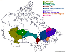


 Group of Cree people
 Merasty women and girls, Cree, The Pas, Manitoba, 1942
 Chief King of the Wind
 Chief Thundercloud
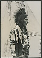 Chief Duckhunter
 Cree girl (1928)
 Illustration of a Snake woman (left) and a Cree woman (right), c. 1840–1843, Karl Bodmer


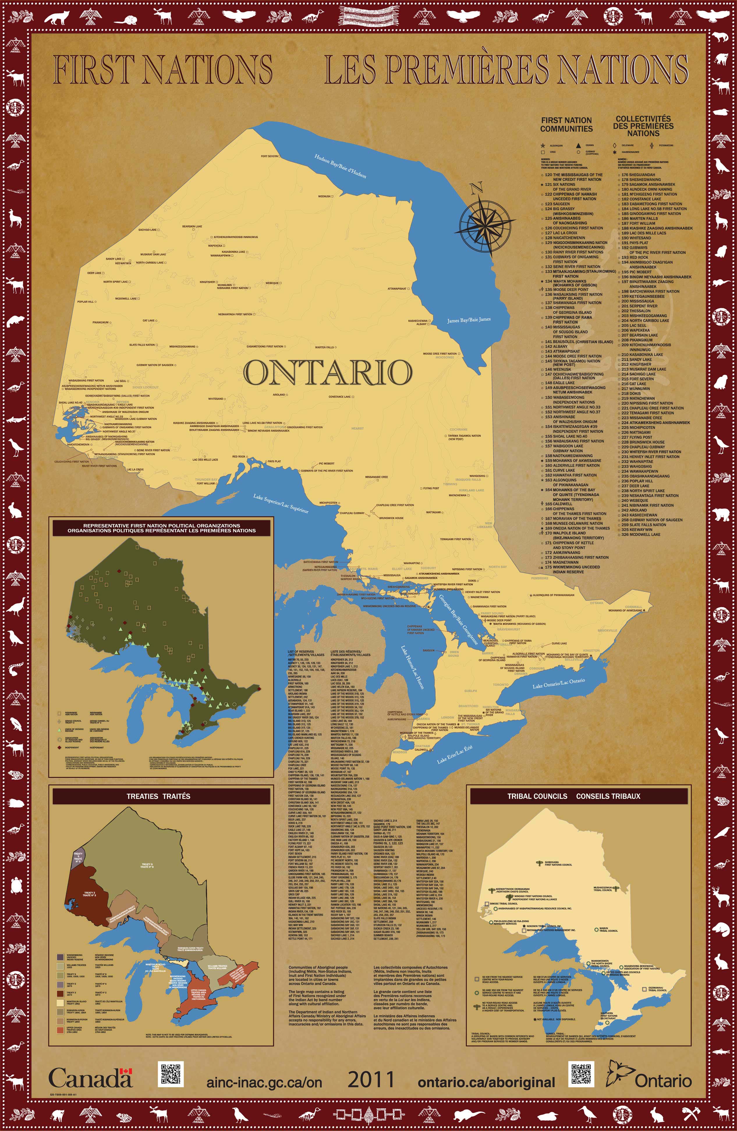