{{short description|Group of First Nations peoples in NorthAmerica}}
{{short description|First Nations peoples in Canada and northern United States}}
{{Other uses}}
{{Other uses}}
{{distinguish|Kree}}
{{redirect|Nêhiyawak|the rock group|Nêhiyawak (band)}}
{{redirect|Nêhiyawak|the rock group|Nêhiyawak (band)}}
{{redirect|Nehiyaw|the children's book author|Glecia Bear}}
{{redirect|Nehiyaw|the children's book author|Glecia Bear}}
Line 11:
Line 12:
| image = Cree Indians in camp, probably Montana, ca 1893 (LAROCHE 56).jpeg
| image = Cree Indians in camp, probably Montana, ca 1893 (LAROCHE 56).jpeg
| caption = A Cree camp, likely in [[Montana]], photographed {{Circa|1893}}
| caption = A Cree camp, likely in [[Montana]], photographed {{Circa|1893}}
| flag = Cree flag.svg
| flag =
| flag_caption = Flag of Cree people of Canada
| flag_caption = Flag of Cree people of Canada
| population = 356,655 (2016 census)<ref name="auto1">{{Cite web |url=https://www12.statcan.gc.ca/census-recensement/2016/dp-pd/abpopprof/details/page.cfm?Lang=E&Geo1=PR&Code1=01&Data=Count&SearchText=Canada&SearchType=Begins&B1=All&C1=All&SEX_ID=1&AGE_ID=1&RESGEO_ID=1 |title=2016 Canadian Census |publisher=[[Statistics Canada]] |access-date=28 April 2019 |date=21 June 2018}}</ref><br>Including [[Atikamekw]] and [[Innu]]
| population = 356,655 (2016 census)<ref name="auto1">{{Cite web |url=https://www12.statcan.gc.ca/census-recensement/2016/dp-pd/abpopprof/details/page.cfm?Lang=E&Geo1=PR&Code1=01&Data=Count&SearchText=Canada&SearchType=Begins&B1=All&C1=All&SEX_ID=1&AGE_ID=1&RESGEO_ID=1 |title=2016 Canadian Census |publisher=[[Statistics Canada]] |access-date=28 April 2019 |date=21 June 2018}}</ref><br>Including [[Atikamekw]] and [[Innu]]
| popplace = Canada
| popplace = Canada
| region1 = [[Alberta]]
| region1 = [[Alberta]]
| pop1 = 95,300 <small>(2016)</small><ref name="2016-profile">{{Cite web |url=https://www12.statcan.gc.ca/census-recensement/2016/dp-pd/abpopprof/index.cfm?Lang=E|title=Aboriginal Population Profile, 2016 Census|publisher=[[Statistics Canada]]|access-date=26 May 2022|date=21 June 2018}}</ref>
| related = [[Métis]], [[Oji-Cree]], [[Ojibwe]], [[Innu]], [[Naskapi]]
}}
}}
The '''Cree''' ({{lang-cr|néhinaw|script=Latn}}, {{lang|cr-Latn|néhiyaw}}, {{lang|cr-Latn|nihithaw}}, etc.; {{lang-fr|link=no|Cri}}) are a [[Indigenous peoples of the Americas|North American Indigenous people]]. They live primarily in [[Canada]], where they form one of the country's largest [[First Nations in Canada|First Nations]].
The '''Cree''' ({{lang-cr|néhinaw|script=Latn}}, {{lang|cr-Latn|néhiyaw}}, {{lang|cr-Latn|nihithaw}}, etc.; {{lang-fr|link=no|Cri}}) are a [[Indigenous peoples of the Americas|North American Indigenous people]]. They live primarily in [[Canada]], where they form one of the country's largest [[First Nations in Canada|First Nations]].
In Canada, over 350,000 people are Cree or have Cree ancestry.<ref name="auto1"/> The major proportion of Cree in Canada live north and west of [[Lake Superior]], in [[Ontario]], [[Manitoba]], [[Saskatchewan]], [[Alberta]], and the [[Northwest Territories]].<ref name="ce">{{Cite encyclopedia |title=Cree |encyclopedia=[[The Canadian Encyclopedia]] |publisher=[[Historica Canada]] |edition=online |date=9 October 2018 |url=https://www.thecanadianencyclopedia.ca/en/article/cree}}</ref> About 27,000 live in [[Quebec]].<ref>{{cite web |url=https://www12.statcan.gc.ca/census-recensement/2016/dp-pd/abpopprof/details/Page.cfm?Lang=E&Geo1=PR&Code1=24&Data=Count&SearchText=Quebec&SearchType=Begins&B1=All&C1=All&GeoLevel=PR&GeoCode=24&SEX_ID=1&AGE_ID=1&RESGEO_ID=1 |title=2016 Canada Census |publisher=[[Statistics Canada]] |access-date=28 April 2019 |date=21 June 2018}}</ref>
In Canada, more than 350,000 people are Cree or have Cree ancestry.<ref name="auto1"/> The major proportion of Cree in Canada live north and west of [[Lake Superior]], in [[Ontario]], [[Manitoba]], [[Saskatchewan]], [[Alberta]], and the [[Northwest Territories]].<ref name="ce">{{Cite encyclopedia |title=Cree |encyclopedia=[[The Canadian Encyclopedia]] |publisher=[[Historica Canada]] |edition=online |date=9 October 2018 |url=https://www.thecanadianencyclopedia.ca/en/article/cree}}</ref> About 27,000 live in [[Quebec]].<ref>{{cite web |url=https://www12.statcan.gc.ca/census-recensement/2016/dp-pd/abpopprof/details/Page.cfm?Lang=E&Geo1=PR&Code1=24&Data=Count&SearchText=Quebec&SearchType=Begins&B1=All&C1=All&GeoLevel=PR&GeoCode=24&SEX_ID=1&AGE_ID=1&RESGEO_ID=1 |title=2016 Canada Census |publisher=[[Statistics Canada]] |access-date=28 April 2019 |date=21 June 2018}}</ref>
In the United States, Cree people historically lived from Lake Superior westward. Today, they live mostly in [[Montana]], where they share the [[Rocky Boy Indian Reservation]] with [[Ojibwe]] (Chippewa) people.<ref name="three">{{cite web |url=http://www.civilization.ca/cmc/exhibitions/tresors/ethno/etb0000e.shtml |work=Canadian Museum of Civilization Corporation |title=Gateway to Aboriginal Heritage}}</ref>
In the United States, Cree people historically lived from Lake Superior westward. Today, they live mostly in [[Montana]], where they share the [[Rocky Boy Indian Reservation]] with [[Ojibwe]] (Chippewa) people.<ref name="three">{{cite web |url=http://www.civilization.ca/cmc/exhibitions/tresors/ethno/etb0000e.shtml |work=Canadian Museum of Civilization Corporation |title=Gateway to Aboriginal Heritage}}</ref>
Line 36:
Line 50:
* [[Moose Cree]] – [[Moose Factory, Ontario|Moose Factory]]<ref name="moosecree.com">{{cite web |url=http://www.moosecree.com/community-profile/services.html |title=Moose Cree First Nation community profile |archive-url=https://web.archive.org/web/20081210012321/http://www.moosecree.com/community-profile/services.html |archive-date=10 December 2008}}</ref> in the [[Northeastern Ontario]]; this group lives on [[Moose Factory Island]], near the mouth of the [[Moose River (Ontario)|Moose River]], at the southern end of James Bay. ("Factory" used to refer to a trading post.)<ref>{{cite map |title=First Nations |publisher=Government of Ontario |url=https://files.ontario.ca/pictures/firstnations_map.jpg}}</ref>
* [[Moose Cree]] – [[Moose Factory, Ontario|Moose Factory]]<ref name="moosecree.com">{{cite web |url=http://www.moosecree.com/community-profile/services.html |title=Moose Cree First Nation community profile |archive-url=https://web.archive.org/web/20081210012321/http://www.moosecree.com/community-profile/services.html |archive-date=10 December 2008}}</ref> in the [[Northeastern Ontario]]; this group lives on [[Moose Factory Island]], near the mouth of the [[Moose River (Ontario)|Moose River]], at the southern end of James Bay. ("Factory" used to refer to a trading post.)<ref>{{cite map |title=First Nations |publisher=Government of Ontario |url=https://files.ontario.ca/pictures/firstnations_map.jpg}}</ref>
* [[Swampy Cree]] – this group lives in northern Manitoba along the [[Hudson Bay]] coast and adjacent inland areas to the south and west, and in Ontario along the coast of Hudson Bay and James Bay. Some also live in eastern Saskatchewan around [[Cumberland House, Saskatchewan|Cumberland House]]. Their dialect has 4,500 speakers.
* [[Swampy Cree]] – this group lives in northern Manitoba along the [[Hudson Bay]] coast and adjacent inland areas to the south and west, and in Ontario along the coast of Hudson Bay and James Bay. Some also live in eastern Saskatchewan around [[Cumberland House, Saskatchewan|Cumberland House]]. Their dialect has 4,500 speakers.
* [[File:Cree People.png|alt=Another Example Of The Areas The Cree People Lived|thumb|Another map of Cree dialects]][[Woodland Cree]] and Rocky Cree <ref>{{Cite web|url=https://sixseasonsproject.ca/|title=Six Seasons of the Asiniskaw Īthiniwak|website=sixseasonsproject.ca}}</ref> – a group in northern Alberta, Manitoba, and Saskatchewan.
* [[File:Cree People.png|alt=Another Example Of The Areas The Cree People Lived|thumb|Another map of Cree dialects]][[Woodland Cree]] and Rocky Cree <ref>{{Cite web|url=https://sixseasonsproject.ca/|title=Six Seasons of the Asiniskaw Īthiniwak|website=sixseasonsproject.ca}}</ref> – a group in northern Alberta, Manitoba, and Saskatchewan.
* [[Plains Indians|Plains Cree]] – a total of 34,000 people in Manitoba, Saskatchewan, Alberta, and Montana.
* [[Plains Indians|Plains Cree]] – a total of 34,000 people in Manitoba, Saskatchewan, Alberta, and Montana.
Due to the many dialects of the [[Cree language]], the people have no modern collective [[Endonym|autonym]]. The Plains Cree and Attikamekw refer to themselves using modern forms of the historical {{lang|cr-Latn|nêhiraw}}, namely {{lang|cr-Latn|nêhiyaw}} and {{lang|cr-Latn|nêhirawisiw}}, respectively. Moose Cree, East Cree, Naskapi, and Montagnais all refer to themselves using modern dialectal forms of the historical {{lang|cr-Latn|iriniw}}, meaning 'man.' Moose Cree use the form {{lang|cr-Latn|ililiw}}, coastal East Cree and Naskapi use {{lang|cr-Latn|iyiyiw}} (variously spelled {{lang|cr-Latn|iiyiyiu}}, {{lang|cr-Latn|iiyiyuu}}, and {{lang|cr-Latn|eeyou}}), inland East Cree use {{lang|cr-Latn|iyiniw}} (variously spelled {{lang|cr-Latn|iinuu}} and {{lang|cr-Latn|eenou}}), and Montagnais use {{lang|cr-Latn|ilnu}} and {{lang|cr-Latn|innu}}, depending on dialect. The Cree use "Cree," "cri," "Naskapi, or "montagnais" to refer to their people only when speaking French or English.<ref name=Pentland>{{cite book |quote=David H. Pentland, "Synonymy" |first=John J. |last=Honigmann |chapter=West Main Cree |title=Handbook of North American Indians |volume=6: Subarctic |editor1=June Helm |editor-link1=June Helm |editor2= William C. Sturtevant |editor-link2=William C. Sturtevant |publisher=Smithsonian |location=Washington, D.C. |date=1981 |page=227 |isbn=978-0-16-004578-3 |chapter-url=https://books.google.com/books?id=EKfPuwEACAAJ&pg=PA227}}</ref>{{wide image|Cree Indian sun dancers, probably Montana, ca 1893 (LAROCHE 126).jpeg|500px|A group of Cree [[sun dance]]rs, photographed {{Circa|1893}} by [[Frank La Roche]]}}
Due to the many dialects of the [[Cree language]], the people have no modern collective [[Endonym|autonym]]. The Plains Cree and Attikamekw refer to themselves using modern forms of the historical {{lang|cr-Latn|nêhiraw}}, namely {{lang|cr-Latn|nêhiyaw}} and {{lang|cr-Latn|nêhirawisiw}}, respectively. Moose Cree, East Cree, Naskapi, and Montagnais all refer to themselves using modern dialectal forms of the historical {{lang|cr-Latn|iriniw}}, meaning 'man.' Moose Cree use the form {{lang|cr-Latn|ililiw}}, coastal East Cree and Naskapi use {{lang|cr-Latn|iyiyiw}} (variously spelled {{lang|cr-Latn|iiyiyiu}}, {{lang|cr-Latn|iiyiyuu}}, and {{lang|cr-Latn|eeyou}}), inland East Cree use {{lang|cr-Latn|iyiniw}} (variously spelled {{lang|cr-Latn|iinuu}} and {{lang|cr-Latn|eenou}}), and Montagnais use {{lang|cr-Latn|ilnu}} and {{lang|cr-Latn|innu}}, depending on dialect. The Cree use "Cree", "cri", "Naskapi, or "montagnais" to refer to their people only when speaking French or English.<ref name=Pentland>{{cite book |quote=David H. Pentland, "Synonymy" |first=John J. |last=Honigmann |chapter=West Main Cree |title=Handbook of North American Indians |volume=6: Subarctic |editor1=June Helm |editor-link1=June Helm |editor2= William C. Sturtevant |editor-link2=William C. Sturtevant |publisher=Smithsonian |location=Washington, D.C. |date=1981 |page=227 |isbn=978-0-16-004578-3 |chapter-url=https://books.google.com/books?id=EKfPuwEACAAJ&pg=PA227}}</ref>{{wide image|Cree Indian sun dancers, probably Montana, ca 1893 (LAROCHE 126).jpeg|500px|A group of Cree [[sun dance]]rs, photographed {{Circa|1893}} by [[Frank La Roche]]}}
== Political aboriginal organization ==
== Political aboriginal organization ==
Line 51:
Line 65:
When a band went to war, they would nominate a temporary military commander, called a {{lang|cr-Latn|okimahkan}}. loosely translated as "war chief". This office was different from that of the "peace chief", a leader who had a role more like that of diplomat. In the run-up to the 1885 [[North-West Rebellion]], [[Big Bear]] was the leader of his band, but once the fighting started [[Wandering Spirit (Cree leader)|Wandering Spirit]] became war leader.
When a band went to war, they would nominate a temporary military commander, called a {{lang|cr-Latn|okimahkan}}. loosely translated as "war chief". This office was different from that of the "peace chief", a leader who had a role more like that of diplomat. In the run-up to the 1885 [[North-West Rebellion]], [[Big Bear]] was the leader of his band, but once the fighting started [[Wandering Spirit (Cree leader)|Wandering Spirit]] became war leader.
[[File:FEMA - 45024 - A Federal Disaster Assistance Agreement signing in Montana.jpg|thumb|[[Chippewa Cree]] Tribal Chairman Raymond Parker, Jr. signs an agreement with the [[Federal Emergency Management Agency|FEMA]] in [[Rocky Boy's Indian Reservation|Rocky Boy's Indian Reservation, Montana]] on August 17, 2010.]]
[[File:FEMA - 45024 - A Federal Disaster Assistance Agreement signing in Montana.jpg|thumb|[[Chippewa Cree]] Tribal Chairman Raymond Parker Jr. signs an agreement with the [[Federal Emergency Management Agency|FEMA]] in [[Rocky Boy's Indian Reservation|Rocky Boy's Indian Reservation, Montana]] on August 17, 2010.]]
=== Contemporary ===
=== Contemporary ===
Line 65:
Line 79:
[[File:Cree type proof.jpg|thumb|Cree [[language]].]]
[[File:Cree type proof.jpg|thumb|Cree [[language]].]]
The Cree language (also known in the most broad classification as Cree-Montagnais, Cree-Montagnais-Naskapi, to show the groups included within it) is the name for a group of closely related [[Algonquian languages]],<ref name="ce" /> the mother tongue (i.e. language first learned and still understood) of approximately 96,000 people, and the language most often spoken at home of about 65,000 people across Canada, from the [[Northwest Territories]] to [[Labrador]]. It is the most widely spoken [[Native American languages|aboriginal language]] in Canada.<ref name="census">{{cite web|url=https://www12.statcan.gc.ca/census-recensement/2016/dp-pd/hlt-fst/lang/Table.cfm?Lang=E&T=41&Geo=01|title=Canada: 2016 Census|date=2 August 2017|publisher=Statistics Canada}}</ref> The only region where Cree has [[official language|official status]] is in the Northwest Territories, together with eight other aboriginal languages.<ref name="lang">{{cite web |title=Languages Overview |website=Indigenous Languages and Education Secretariat |publisher=Government of Northwest Territories |access-date=27 October 2019 |url=https://www.ece.gov.nt.ca/en/services/le-secretariat-de-leducation-et-des-langues-autochtones/languages-overview}}</ref><ref>{{cite web |title=Languages of Canada |website=Ethnologue: Languages of the World |url=https://www.ethnologue.com/country/CA |url-access=subscription |access-date=21 September 2008}} Note: The western group of languages includes Swampy Cree, Woods Cree and Plains Cree. The eastern language is called Moose Cree.</ref>
The Cree language (also known in the most broad classification as Cree-Montagnais, Cree-Montagnais-Naskapi, to show the groups included within it) is the name for a group of closely related [[Algonquian languages]],<ref name="ce" /> the mother tongue (i.e. language first learned and still understood) of approximately 96,000 people, and the language most often spoken at home of about 65,000 people across Canada, from the [[Northwest Territories]] to [[Labrador]]. It is the most widely spoken [[Native American languages|aboriginal language]] in Canada.<ref name="census">{{cite web|url=https://www12.statcan.gc.ca/census-recensement/2016/dp-pd/hlt-fst/lang/Table.cfm?Lang=E&T=41&Geo=01|title=Canada: 2016 Census|date=2 August 2017|publisher=Statistics Canada}}</ref> The only region where Cree has [[official language|official status]] is in the Northwest Territories, together with eight other aboriginal languages, French and English.<ref name="lang">{{cite web |title=Languages Overview |website=Indigenous Languages and Education Secretariat |publisher=Government of Northwest Territories |access-date=27 October 2019 |url=https://www.ece.gov.nt.ca/en/services/le-secretariat-de-leducation-et-des-langues-autochtones/languages-overview}}</ref><ref>{{cite web |title=Languages of Canada |website=Ethnologue: Languages of the World |url=https://www.ethnologue.com/country/CA |url-access=subscription |access-date=21 September 2008}} Note: The western group of languages includes Swampy Cree, Woods Cree and Plains Cree. The eastern language is called Moose Cree.</ref>
The two major groups: Nehiyaw and Innu, speak a mutually intelligible Cree [[dialect continuum]], which can be divided by many criteria. In a dialect continuum, "It is not so much a language, as a chain of dialects, where speakers from one community can very easily understand their neighbours, but a Plains Cree speaker from Alberta would find a Quebec Cree speaker difficult to speak to without practice."<ref>{{cite web |url=http://www.languagegeek.com/algon/cree/nehiyawewin.html |title=Cree |website=Language Geek |access-date=21 September 2008 |archive-url=https://web.archive.org/web/20120204041554/http://www.languagegeek.com/algon/cree/nehiyawewin.html |archive-date=4 February 2012 |url-status=dead}}</ref>
The two major groups: Nehiyaw and Innu, speak a mutually intelligible Cree [[dialect continuum]], which can be divided by many criteria. In a dialect continuum, "It is not so much a language, as a chain of dialects, where speakers from one community can very easily understand their neighbours, but a Plains Cree speaker from Alberta would find a Quebec Cree speaker difficult to speak to without practice."<ref>{{cite web |url=http://www.languagegeek.com/algon/cree/nehiyawewin.html |title=Cree |website=Language Geek |access-date=21 September 2008 |archive-url=https://web.archive.org/web/20120204041554/http://www.languagegeek.com/algon/cree/nehiyawewin.html |archive-date=4 February 2012 |url-status=dead}}</ref>
Line 80:
Line 94:
The Cree are the largest group of [[First Nations in Canada|First Nations]] in Canada, with 220,000 members and 135 registered bands.<ref name="cangeo">{{cite web|url=http://www.canadiangeographic.ca/magazine/ND05/indepth/justthefacts.asp|title=Source|website=canadiangeographic.ca|publisher=[[Canadian Geographic]]|access-date=28 October 2005|archive-url=https://web.archive.org/web/20060414053717/http://www.canadiangeographic.ca/magazine/ND05/indepth/justthefacts.asp|archive-date=14 April 2006|url-status=dead}}</ref> Together, their reserve lands are the largest of any First Nations group in the country.<ref name="cangeo" /> The largest Cree band and the second largest First Nations Band in Canada after the Six Nations [[Iroquois]] is the [[Lac La Ronge First Nation|Lac La Ronge Band]] in northern Saskatchewan.
The Cree are the largest group of [[First Nations in Canada|First Nations]] in Canada, with 220,000 members and 135 registered bands.<ref name="cangeo">{{cite web|url=http://www.canadiangeographic.ca/magazine/ND05/indepth/justthefacts.asp|title=Source|website=canadiangeographic.ca|publisher=[[Canadian Geographic]]|access-date=28 October 2005|archive-url=https://web.archive.org/web/20060414053717/http://www.canadiangeographic.ca/magazine/ND05/indepth/justthefacts.asp|archive-date=14 April 2006|url-status=dead}}</ref> Together, their reserve lands are the largest of any First Nations group in the country.<ref name="cangeo" /> The largest Cree band and the second largest First Nations Band in Canada after the Six Nations [[Iroquois]] is the [[Lac La Ronge First Nation|Lac La Ronge Band]] in northern Saskatchewan.
Given the traditional Cree acceptance of mixed marriages, it is acknowledged by academics that all bands are ultimately of mixed heritage and multilingualism and multiculturalism was the norm. In the West, mixed bands of Cree, Saulteaux and Assiniboine, all partners in the [[Iron Confederacy]], are the norm. However, in recent years, as indigenous languages have declined across western Canada where there were once three languages spoken on a given reserve, there may now only be one. This has led to a simplification of identity, and it has become "fashionable" for bands in many parts of Saskatchewan to identify as "Plains Cree" at the expense of a mixed Cree-Salteaux history. There is also a tendency for bands to recategorize themselves as "Plains Cree" instead of Woods Cree or Swampy Cree. Neal McLeod argues this is partly due to the dominant culture's fascination with [[Plains Indian]] culture as well as the greater degree of written [[standardization (linguistics)|standardization]] and [[prestige (linguistics)|prestige]] Plains Cree enjoys over other Cree dialects.<ref name="brandonu" />
Given the traditional Cree acceptance of mixed marriages, it is acknowledged by academics that all bands are ultimately of mixed heritage and multilingualism and multiculturalism was the norm. In the West, mixed bands of Cree, Saulteaux, Métis, and Assiniboine, all partners in the [[Iron Confederacy]], are the norm. However, in recent years, as indigenous languages have declined across western Canada where there were once three languages spoken on a given reserve, there may now only be one. This has led to a simplification of identity, and it has become "fashionable" for bands in many parts of Saskatchewan to identify as "Plains Cree" at the expense of a mixed Cree-Salteaux history. There is also a tendency for bands to recategorize themselves as "Plains Cree" instead of Woods Cree or Swampy Cree. Neal McLeod argues this is partly due to the dominant culture's fascination with [[Plains Indian]] culture as well as the greater degree of written [[standardization (linguistics)|standardization]] and [[prestige (linguistics)|prestige]] Plains Cree enjoys over other Cree dialects.<ref name="brandonu" />
The [[Métis people (Canada)|Métis]]<ref>{{cite web |title=The Métis |website=Canada's First People |access-date=27 October 2019 |url=http://firstpeoplesofcanada.com/fp_metis/fp_metis1.html}}</ref> (from the French, {{lang|fr|Métis}} – of mixed ancestry) are people of mixed ancestry, such as Cree and French, English, or [[Scottish people|Scottish]] heritage. According to [[Aboriginal Affairs and Northern Development Canada]], the Métis were historically the children of French fur traders and Cree women or, from unions of English or Scottish traders and northern [[Dene]] women ([[Anglo-Métis]]). The Métis National Council defines a Métis as "a person who self-identifies as Métis, is distinct from other Aboriginal peoples, is of historic Métis Nation Ancestry and who is accepted by the Métis Nation".<ref>{{cite web|url=http://www.metisnation.ca/index.php/who-are-the-metis/citizenship|title=Métis Nation Citizenship|publisher=Métis National Council|access-date=27 October 2019|archive-date=7 December 2019|archive-url=https://web.archive.org/web/20191207012218/https://www.metisnation.ca/index.php/who-are-the-metis/citizenship|url-status=dead}}</ref>
The [[Métis people (Canada)|Métis]]<ref>{{cite web |title=The Métis |website=Canada's First People |access-date=27 October 2019 |url=http://firstpeoplesofcanada.com/fp_metis/fp_metis1.html}}</ref> (from the French, {{lang|fr|Métis}} – of mixed ancestry) are people of mixed ancestry, such as Cree and French, English, or [[Scottish people|Scottish]] heritage. According to [[Aboriginal Affairs and Northern Development Canada]], the Métis were historically the children of French fur traders and Cree women or, from unions of English or Scottish traders and northern [[Dene]] women ([[Anglo-Métis]]). The Métis National Council defines a Métis as "a person who self-identifies as Métis, is distinct from other Aboriginal peoples, is of historic Métis Nation Ancestry and who is accepted by the Métis Nation".<ref>{{cite web|url=http://www.metisnation.ca/index.php/who-are-the-metis/citizenship|title=Métis Nation Citizenship|publisher=Métis National Council|access-date=27 October 2019|archive-date=7 December 2019|archive-url=https://web.archive.org/web/20191207012218/https://www.metisnation.ca/index.php/who-are-the-metis/citizenship|url-status=dead}}</ref>
Line 94:
Line 108:
=== In the United States ===
=== In the United States ===
At one time the Cree lived in northern Minnesota, North Dakota and Montana. Today, American Cree are enrolled in the [[federally recognized]] [[Chippewa Cree]] tribe, located on the [[Rocky Boy Indian Reservation|Rocky Boy’s Indian Reservation]], and in minority as "Landless Cree" on the [[Fort Peck Indian Reservation]] and as "Landless Cree" and "Rocky Boy Cree" on the [[Fort Belknap Indian Reservation]], all in [[Montana]]. The Chippewa Cree share the reservation with the [[Pembina Band of Chippewa Indians]], who form the "Chippewa" ([[Ojibwa]]) half of the Chippewa Cree tribe. On the other Reservations, the Cree minority share the Reservation with the [[Assiniboine people|Assiniboine]], [[Gros Ventre]] and [[Sioux]] tribes. Traditionally, the southern limits of the Cree territory in Montana were the [[Missouri River]] and the [[Milk River (Alberta–Montana)|Milk River]].<ref>{{cite web |title=Cree |website=Crystalinks.com |url=http://www.crystalinks.com/cree.html}}</ref>
At one time the Cree lived in northern Minnesota, North Dakota and Montana. Today, American Cree are enrolled in the [[federally recognized]] [[Chippewa Cree]] tribe, located on the [[Rocky Boy Indian Reservation|Rocky Boy's Indian Reservation]], and in minority as "Landless Cree" on the [[Fort Peck Indian Reservation]] and as "Landless Cree" and "Rocky Boy Cree" on the [[Fort Belknap Indian Reservation]], all in [[Montana]]. The Chippewa Cree share the reservation with the [[Pembina Band of Chippewa Indians]], who form the "Chippewa" ([[Ojibwa]]) half of the Chippewa Cree tribe. On the other Reservations, the Cree minority share the Reservation with the [[Assiniboine people|Assiniboine]], [[Gros Ventre]] and [[Sioux]] tribes. Traditionally, the southern limits of the Cree territory in Montana were the [[Missouri River]] and the [[Milk River (Alberta–Montana)|Milk River]].<ref>{{cite web |title=Cree |website=Crystalinks.com |url=http://www.crystalinks.com/cree.html}}</ref>
The Naskapi are the Innu First Nations inhabiting a region of northeastern [[Quebec]] and [[Labrador]], Canada. The Naskapi are traditionally nomadic peoples, in contrast with the territorial Montagnais, the other segment of Innu. The Naskapi language and culture is quite different from the Montagnais, in which the dialect changes from y to n as in "Iiyuu" versus "Innu". {{langaskapi village municipality (Quebec)#Aboriginal local municipal units|Naskapi village]] of Kawawachikamach, {{convert|15|km|mi|abbr=on}} northeast of [[Schefferville]], Quebec. The village is in the [[Kawawachikamach, Quebec|reserve of the same name]].<ref>{{cite web |title=Our Community |url=http://www.naskapi.ca/en/Overview-1 |website=Naskapi Nation of Kawawachikamach |access-date=31 October 2019 |archive-date=31 October 2019 |archive-url=https://web.archive.org/web/20191031181052/http://www.naskapi.ca/en/Overview-1 |url-status=dead}}</ref><ref>{{cite web |title=Naskapi Nation of Kawawachikamach |url=http://fnp-ppn.aadnc-aandc.gc.ca/fnp/Main/Search/FNMain.aspx?BAND_NUMBER=081&lang=eng |website=First Nation Detail|date = 14 November 2008}}</ref>
The Naskapi are the Innu First Nations inhabiting a region of northeastern [[Quebec]] and [[Labrador]], Canada. The Naskapi are traditionally nomadic peoples, in contrast with the territorial Montagnais, the other segment of Innu. The Naskapi language and culture is quite different from the Montagnais, in which the dialect changes from y to n as in "Iiyuu" versus "Innu". {{lang|cr-Latn|Iyuw Iyimuun}} is the Innu dialect spoken by the Naskapi.<ref>{{cite encyclopedia |last=Tanner|first=Adrian|title=Innu (Montagnais-Naskapi)|encyclopedia=[[The Canadian Encyclopedia]]|date=16 October 2018|publisher=[[Historica Canada]]|edition=online|url=https://thecanadianencyclopedia.ca/en/article/innu-montagnais-naskapi}}</ref> Today, the Naskapi are settled into two communities: [[Kawawachikamach (Naskapi village municipality)|Kawawachikamach]] Quebec and [[Natuashish]], Newfoundland and Labrador.
The [[Naskapi Nation of Kawawachikamach]] is located in the [[Naskapi village municipality (Quebec)#Aboriginal local municipal units|Naskapi village]] of Kawawachikamach, {{convert|15|km|mi|abbr=on}} northeast of [[Schefferville]], Quebec. The village is in the [[Kawawachikamach, Quebec|reserve of the same name]].<ref>{{cite web |title=Our Community |url=http://www.naskapi.ca/en/Overview-1 |website=Naskapi Nation of Kawawachikamach |access-date=31 October 2019 |archive-date=31 October 2019 |archive-url=https://web.archive.org/web/20191031181052/http://www.naskapi.ca/en/Overview-1 |url-status=dead}}</ref><ref>{{cite web |title=Naskapi Nation of Kawawachikamach |url=http://fnp-ppn.aadnc-aandc.gc.ca/fnp/Main/Search/FNMain.aspx?BAND_NUMBER=081&lang=eng |website=First Nation Detail|date = 14 November 2008}}</ref>
The [[Mushuau Innu First Nation]], located in the community of [[Natuashish]], Newfoundland and Labrador, is located in the Natuashish 2 reserve on the coast of [[Labrador]].<ref name="Innu.ca">{{cite web |title=Welcome |url=https://www.innu.ca/ |website=Innu Nation}}</ref><ref>{{cite web |title=Mushuau Innu First Nation |url=http://fnp-ppn.aadnc-aandc.gc.ca/fnp/Main/Search/FNMain.aspx?BAND_NUMBER=032&lang=eng |website=First Nation Detail|date = 14 November 2008}}</ref>
The [[Mushuau Innu First Nation]], located in the community of [[Natuashish]], Newfoundland and Labrador, is located in the Natuashish 2 reserve on the coast of [[Labrador]].<ref name="Innu.ca">{{cite web |title=Welcome |url=https://www.innu.ca/ |website=Innu Nation}}</ref><ref>{{cite web |title=Mushuau Innu First Nation |url=http://fnp-ppn.aadnc-aandc.gc.ca/fnp/Main/Search/FNMain.aspx?BAND_NUMBER=032&lang=eng |website=First Nation Detail|date = 14 November 2008}}</ref>
Line 166:
Line 182:
* [[The Crees of the Waskaganish First Nation]] is located at [[Waskaganish (Cree village municipality)|Waskaganish]] VC at the mouth of the [[Rupert River]] on the south-east shore of James Bay. The associated reserve is [[Waskaganish]] TC.<ref>{{cite web |title=The Crees of the Waskaganish First Nation |url=http://fnp-ppn.aadnc-aandc.gc.ca/fnp/Main/Search/FNMain.aspx?BAND_NUMBER=061&lang=eng |website=First Nation Detail|date = 14 November 2008}}</ref> Founded in 1668 as Charles Fort, two years before the creation of the HBC, the community is on the site of the first fur trading post of the [[Hudson's Bay Company]]. After the HBC was formed, the community was known as Fort Rupert, Rupert Fort, or Rupert House after [[Prince Rupert of the Rhine]], the first governor of the HBC.<ref>{{cite DCB |first=G. Andrews |last=Moriarty |title=Gillam, Zachariah
* [[The Crees of the Waskaganish First Nation]] is located at [[Waskaganish (Cree village municipality)|Waskaganish]] VC at the mouth of the [[Rupert River]] on the south-east shore of James Bay. The associated reserve is [[Waskaganish]] TC.<ref>{{cite web |title=The Crees of the Waskaganish First Nation |url=http://fnp-ppn.aadnc-aandc.gc.ca/fnp/Main/Search/FNMain.aspx?BAND_NUMBER=061&lang=eng |website=First Nation Detail|date = 14 November 2008}}</ref> Founded in 1668 as Charles Fort, two years before the creation of the HBC, the community is on the site of the first fur trading post of the [[Hudson's Bay Company]]. After the HBC was formed, the community was known as Fort Rupert, Rupert Fort, or Rupert House after [[Prince Rupert of the Rhine]], the first governor of the HBC.<ref>{{cite DCB |first=G. Andrews |last=Moriarty |title=Gillam, Zachariah
* Cree First Nation of Waswanipi is located in the Cree village of [[Waswanipi (Cree village municipality)|Waswanipi]] and the reserve is [[Waswanipi, Quebec|Waswanipi]] TC.<ref>{{cite web |title=Waswanipi |url=http://fnp-ppn.aadnc-aandc.gc.ca/fnp/Main/Search/FNMain.aspx?BAND_NUMBER=056&lang=eng |website=First Nation Detail|date = 14 November 2008}}</ref> The Nation is located near the confluence of the [[Chibougamau River|Chibougamau]] and [[Waswanipi River]]s.<ref>{{cite web |title=About Waswanipi |publisher=Cree First Nation of Waswanipi |url=https://www.waswanipi.com/en/about-waswanipi}}</ref>
* Cree First Nation of Waswanipi is located in the Cree village of [[Waswanipi (Cree village municipality)|Waswanipi]] and the reserve is [[Waswanipi, Quebec|Waswanipi]] TC.<ref>{{cite web |title=Waswanipi |url=http://fnp-ppn.aadnc-aandc.gc.ca/fnp/Main/Search/FNMain.aspx?BAND_NUMBER=056&lang=eng |website=First Nation Detail|date = 14 November 2008}}</ref> The Nation is located near the confluence of the [[Chibougamau River|Chibougamau]] and [[Waswanipi River]]s.<ref>{{cite web |title=About Waswanipi |publisher=Cree First Nation of Waswanipi |url=https://www.waswanipi.com/en/about-waswanipi |access-date=7 November 2019 |archive-date=7 November 2019 |archive-url=https://web.archive.org/web/20191107031734/https://www.waswanipi.com/en/about-waswanipi |url-status=dead }}</ref>
* [[Cree Nation of Wemindji]] is headquartered at [[Wemindji (Cree village municipality)|Wemindji]] VC and its reserve is [[Wemindji, Quebec|Wemindji]] TC.<ref>{{cite web |title=Cree Nation of Wemindji |url=http://fnp-ppn.aadnc-aandc.gc.ca/fnp/Main/Search/FNMain.aspx?BAND_NUMBER=060&lang=eng |website=First Nation Detail|date = 14 November 2008}}</ref> The village is on the east coast of James Bay at the mouth of the Maquatua River and is {{convert|696|km|mi|abbr=on}} north of Chibougamau via the {{lang|fr|i=unset|Route du Nord}}.
* [[Cree Nation of Wemindji]] is headquartered at [[Wemindji (Cree village municipality)|Wemindji]] VC and its reserve is [[Wemindji, Quebec|Wemindji]] TC.<ref>{{cite web |title=Cree Nation of Wemindji |url=http://fnp-ppn.aadnc-aandc.gc.ca/fnp/Main/Search/FNMain.aspx?BAND_NUMBER=060&lang=eng |website=First Nation Detail|date = 14 November 2008}}</ref> The village is on the east coast of James Bay at the mouth of the Maquatua River and is {{convert|696|km|mi|abbr=on}} north of Chibougamau via the {{lang|fr|i=unset|Route du Nord}}.
* First Nation of Whapmagoostui located at [[Whapmagoostui (Cree village municipality)|Whapmagoostui]] VC, is the northernmost Cree village, located at the mouth of the [[Great Whale River]] on the coast of Hudson Bay in Kativik TE. The village is just south of the river while the Inuit village of [[Kuujjuarapik]] is on the north shore.<ref>{{cite web |title=Première nation de Whapmagoostui |url=http://fnp-ppn.aadnc-aandc.gc.ca/fnp/Main/Search/FNMain.aspx?BAND_NUMBER=095&lang=eng |website=First Nation Detail|date = 14 November 2008}}</ref>
* First Nation of Whapmagoostui located at [[Whapmagoostui (Cree village municipality)|Whapmagoostui]] VC, is the northernmost Cree village, located at the mouth of the [[Great Whale River]] on the coast of Hudson Bay in Kativik TE. The village is just south of the river while the Inuit village of [[Kuujjuarapik]] is on the north shore.<ref>{{cite web |title=Première nation de Whapmagoostui |url=http://fnp-ppn.aadnc-aandc.gc.ca/fnp/Main/Search/FNMain.aspx?BAND_NUMBER=095&lang=eng |website=First Nation Detail|date = 14 November 2008}}</ref>
Line 188:
Line 204:
[[Constance Lake First Nation]] is the only Cree member of [[Matawa First Nations]].<ref>{{cite web |title=Constance Lake |url=http://fnp-ppn.aadnc-aandc.gc.ca/fnp/Main/Search/FNMain.aspx?BAND_NUMBER=182&lang=eng |website=First Nation Detail|date = 14 November 2008}}</ref> They are located on their reserves, [[Constance Lake 92]] and [[English River 66]], in the [[Cochrane District]], Ontario.<ref>{{cite web |title=Constance Lake |url=https://fnp-ppn.aadnc-aandc.gc.ca/fnp/Main/Search/FNReserves.aspx?BAND_NUMBER=182&lang=eng |website=[[Crown–Indigenous Relations and Northern Affairs Canada]] |publisher=Government of Canada |date = 14 November 2008}}</ref>
[[Constance Lake First Nation]] is the only Cree member of [[Matawa First Nations]].<ref>{{cite web |title=Constance Lake |url=http://fnp-ppn.aadnc-aandc.gc.ca/fnp/Main/Search/FNMain.aspx?BAND_NUMBER=182&lang=eng |website=First Nation Detail|date = 14 November 2008}}</ref> They are located on their reserves, [[Constance Lake 92]] and [[English River 66]], in the [[Cochrane District]], Ontario.<ref>{{cite web |title=Constance Lake |url=https://fnp-ppn.aadnc-aandc.gc.ca/fnp/Main/Search/FNReserves.aspx?BAND_NUMBER=182&lang=eng |website=[[Crown–Indigenous Relations and Northern Affairs Canada]] |publisher=Government of Canada |date = 14 November 2008}}</ref>
[[Mushkegowuk Council]], based in [[Moose Factory, Ontario]], represents chiefs from seven First Nations across Ontario. Moose Cree members are: [[Chapleau Cree First Nation]], [[Kashechewan First Nation]], [[Missanabie Cree First Nation]], [[Moose Cree First Nation]], and [[Taykwa Tagamou Nation]].<ref name="Mushkegowuk TC">{{cite web|title=Mushkegowuk Council|url=http://fnp-ppn.aadnc-aandc.gc.ca/fnp/Main/Search/TCMain.aspx?TC_NUMBER=1079&lang=eng|website=Tribal Council Detail|date = 14 November 2008}}</ref> The Chapleau Cree First Nation and their two reserves, [[Chapleau Cree Fox Lake]] and [[Chapleau 75]], are located outside of [[Chapleau, Ontario]] in the [[Sudbury District]].<ref>{{cite web |title=Chapleau Cree First Nation |date=14 November 2008 |website=[[Crown–Indigenous Relations and Northern Affairs Canada]] |publisher=Government of Canada |url=https://fnp-ppn.aadnc-aandc.gc.ca/fnp/Main/Search/FNReserves.aspx?BAND_NUMBER=221&lang=eng}}</ref> The Kashechewan First Nation community is located on the northern shore of the [[Albany River]] on James Bay. The Hudson's Bay Company established a post, Fort Albany, at this location between 1675 and 1679.<ref>{{Cite encyclopedia |last=Kudelik |first=Gail |date=27 July 2015 |title=Albany River |encyclopedia=The Canadian Encyclopedia |publisher=Historica Canada |url=https://www.thecanadianencyclopedia.ca/en/article/albany-river}}</ref> Kashechewan First Nation is one of two communities that were established from Old Fort Albany, the other being [[Fort Albany First Nation]]. The two Nations share the Fort Albany 67 reserve.<ref>{{cite web |title=Fort Albany 67 |date=14 November 2008 |website=[[Crown–Indigenous Relations and Northern Affairs Canada]] |publisher=Government of Canada |url=https://fnp-ppn.aadnc-aandc.gc.ca/fnp/Main/Search/RVDetail.aspx?RESERVE_NUMBER=06258&lang=eng}}</ref> The Missanabie Cree First Nation signed [[Treaty 9]] in 1906 but did not receive any reserved lands until 2018.<ref>{{cite web |title=History |website=Missanabie Cree First Nation |url=https://www.missanabiecreefn.com/history |access-date=24 December 2021}}</ref> The Missanabie reserve is in the [[Missanabie]], Ontario area.<ref>{{cite web |title=Missanabie Cree First Nation |date=14 November 2008 |website=[[Crown–Indigenous Relations and Northern Affairs Canada]] |publisher=Government of Canada |url=https://fnp-ppn.aadnc-aandc.gc.ca/fnp/Main/Search/RVDetail.aspx?RESERVE_NUMBER=10099&lang=eng}}</ref> The Moose Cree First Nation is based in [[Moose Factory]] in the Cochrane District.<ref>{{cite web |title=Moose Cree First Nation |date=14 November 2008 |website=[[Crown–Indigenous Relations and Northern Affairs Canada]] |publisher=Government of Canada |url=https://fnp-ppn.aadnc-aandc.gc.ca/fnp/Main/Search/FNMain.aspx?BAND_NUMBER=144&lang=eng}}</ref> Moose Factory was founded in 1672–1673 by [[Charles Bayly]], the first overseas governor of the Hudson's Bay Company, and was the company's second post. It was the first English settlement in what is now Ontario.<ref>{{Cite encyclopedia |date=15 October 2021 |title=Moose Factory |encyclopedia=The Canadian Encyclopedia |publisher=Historica Canada |url=https://www.thecanadianencyclopedia.ca/en/article/moose-factory}}</ref> The Nation has two reserves: [[Factory Island 1]] on [[Moose Factory Island]], an island in the [[Moose River (Ontario)|Moose River]], about {{convert|16|km|mi}} from its mouth at James Bay; and [[Moose Factory 68]], a tract of land about {{convert|15|km|mi}} upstream on the Moose River.<ref>{{cite web |title=Moose Cree First Nation |date=14 November 2008 |website=[[Crown–Indigenous Relations and Northern Affairs Canada]] |publisher=Government of Canada |url=https://fnp-ppn.aadnc-aandc.gc.ca/fnp/Main/Search/FNReserves.aspx?BAND_NUMBER=144&lang=eng}}</ref> The Taykwa Tagamou Nation has two reserves, New Post 69, and their main reserve, [[New Post 69A]] outside [[Cochrane, Ontario]] along the [[Abitibi River]].<ref>{{cite web |title=Taykwa Tagamou Nation |date=14 November 2008 |website=[[Crown–Indigenous Relations and Northern Affairs Canada]] |publisher=Government of Canada |url=https://fnp-ppn.aadnc-aandc.gc.ca/fnp/Main/Search/FNReserves.aspx?BAND_NUMBER=145&lang=eng}}</ref>
[[Mushkegowuk Council]], based in [[Moose Factory, Ontario]], represents chiefs from seven First Nations across Ontario. Moose Cree members are: [[Chapleau Cree First Nation]], [[Kashechewan First Nation]], [[Missanabie Cree First Nation]], [[Moose Cree First Nation]], and [[Taykwa Tagamou Nation]].<ref name="Mushkegowuk TC">{{cite web|title=Mushkegowuk Council|url=http://fnp-ppn.aadnc-aandc.gc.ca/fnp/Main/Search/TCMain.aspx?TC_NUMBER=1079&lang=eng|website=Tribal Council Detail|date = 14 November 2008}}</ref> The Chapleau Cree First Nation and their two reserves, [[Chapleau Cree Fox Lake]] and [[Chapleau 75]], are located outside of [[Chapleau, Ontario]] in the [[Sudbury District]].<ref>{{cite web |title=Chapleau Cree First Nation |date=14 November 2008 |website=[[Crown–Indigenous Relations and Northern Affairs Canada]] |publisher=Government of Canada |url=https://fnp-ppn.aadnc-aandc.gc.ca/fnp/Main/Search/FNReserves.aspx?BAND_NUMBER=221&lang=eng}}</ref> The Kashechewan First Nation community is located on the northern shore of the [[Albany River]] on James Bay. The Hudson's Bay Company established a post, [[Fort Albany (Ontario)|Fort Albany]], at this location between 1675 and 1679.<ref>{{Cite encyclopedia |last=Kudelik |first=Gail |date=27 July 2015 |title=Albany River |encyclopedia=The Canadian Encyclopedia |publisher=Historica Canada |url=https://www.thecanadianencyclopedia.ca/en/article/albany-river}}</ref> Kashechewan First Nation is one of two communities that were established from Old Fort Albany, the other being [[Fort Albany First Nation]]. The two Nations share the Fort Albany 67 reserve.<ref>{{cite web |title=Fort Albany 67 |date=14 November 2008 |website=[[Crown–Indigenous Relations and Northern Affairs Canada]] |publisher=Government of Canada |url=https://fnp-ppn.aadnc-aandc.gc.ca/fnp/Main/Search/RVDetail.aspx?RESERVE_NUMBER=06258&lang=eng}}</ref> The Missanabie Cree First Nation signed [[Treaty 9]] in 1906 but did not receive any reserved lands until 2018.<ref>{{cite web |title=History |website=Missanabie Cree First Nation |url=https://www.missanabiecreefn.com/history |access-date=24 December 2021}}</ref> The Missanabie reserve is in the [[Missanabie]], Ontario area.<ref>{{cite web |title=Missanabie Cree First Nation |date=14 November 2008 |website=[[Crown–Indigenous Relations and Northern Affairs Canada]] |publisher=Government of Canada |url=https://fnp-ppn.aadnc-aandc.gc.ca/fnp/Main/Search/RVDetail.aspx?RESERVE_NUMBER=10099&lang=eng}}</ref> The Moose Cree First Nation is based in [[Moose Factory]] in the Cochrane District.<ref>{{cite web |title=Moose Cree First Nation |date=14 November 2008 |website=[[Crown–Indigenous Relations and Northern Affairs Canada]] |publisher=Government of Canada |url=https://fnp-ppn.aadnc-aandc.gc.ca/fnp/Main/Search/FNMain.aspx?BAND_NUMBER=144&lang=eng}}</ref> Moose Factory was founded in 1672–1673 by [[Charles Bayly]], the first overseas governor of the Hudson's Bay Company, and was the company's second post. It was the first English settlement in what is now Ontario.<ref>{{Cite encyclopedia |date=15 October 2021 |title=Moose Factory |encyclopedia=The Canadian Encyclopedia |publisher=Historica Canada |url=https://www.thecanadianencyclopedia.ca/en/article/moose-factory}}</ref> The Nation has two reserves: [[Factory Island 1]] on [[Moose Factory Island]], an island in the [[Moose River (Ontario)|Moose River]], about {{convert|16|km|mi}} from its mouth at James Bay; and [[Moose Factory 68]], a tract of land about {{convert|15|km|mi}} upstream on the Moose River.<ref>{{cite web |title=Moose Cree First Nation |date=14 November 2008 |website=[[Crown–Indigenous Relations and Northern Affairs Canada]] |publisher=Government of Canada |url=https://fnp-ppn.aadnc-aandc.gc.ca/fnp/Main/Search/FNReserves.aspx?BAND_NUMBER=144&lang=eng}}</ref> The Taykwa Tagamou Nation has two reserves, New Post 69, and their main reserve, [[New Post 69A]] outside [[Cochrane, Ontario]] along the [[Abitibi River]].<ref>{{cite web |title=Taykwa Tagamou Nation |date=14 November 2008 |website=[[Crown–Indigenous Relations and Northern Affairs Canada]] |publisher=Government of Canada |url=https://fnp-ppn.aadnc-aandc.gc.ca/fnp/Main/Search/FNReserves.aspx?BAND_NUMBER=145&lang=eng}}</ref>
[[Wabun Tribal Council]] is a regional chief's council based in [[Timmins, Ontario]] representing Ojibway and Cree First Nations in northern Ontario. Moose Cree members are: [[Brunswick House First Nation]] and [[Matachewan First Nation]].<ref>{{cite web|title=Wabun Tribal Council|url=http://fnp-ppn.aadnc-aandc.gc.ca/fnp/Main/Search/TCMain.aspx?TC_NUMBER=1080&lang=eng|website=Tribal Council Detail|date = 14 November 2008}}</ref> Brunswick House's reserves are [[Mountbatten 76A]] and [[Duck Lake 76B]] located in the Sudbury District near Chapleau, Ontario.<ref>{{cite web |title=Brunswick House |url=https://fnp-ppn.aadnc-aandc.gc.ca/fnp/Main/Search/FNReserves.aspx?BAND_NUMBER=228&lang=eng |website=[[Crown–Indigenous Relations and Northern Affairs Canada]] |publisher=Government of Canada |date = 14 November 2008}}</ref> The Matachewan First Nation is on the Matachewan 72 reserve near [[Matachewan]] township in the [[Timiskaming District]].<ref>{{cite web |title=Matachewan 72 |url=https://fnp-ppn.aadnc-aandc.gc.ca/fnp/Main/Search/RVDetail.aspx?RESERVE_NUMBER=06151&lang=eng |website=[[Crown–Indigenous Relations and Northern Affairs Canada]] |publisher=Government of Canada |date = 14 November 2008}}</ref>
[[Wabun Tribal Council]] is a regional chief's council based in [[Timmins, Ontario]] representing Ojibway and Cree First Nations in northern Ontario. Moose Cree members are: [[Brunswick House First Nation]] and [[Matachewan First Nation]].<ref>{{cite web|title=Wabun Tribal Council|url=http://fnp-ppn.aadnc-aandc.gc.ca/fnp/Main/Search/TCMain.aspx?TC_NUMBER=1080&lang=eng|website=Tribal Council Detail|date = 14 November 2008}}</ref> Brunswick House's reserves are [[Mountbatten 76A]] and [[Duck Lake 76B]] located in the Sudbury District near Chapleau, Ontario.<ref>{{cite web |title=Brunswick House |url=https://fnp-ppn.aadnc-aandc.gc.ca/fnp/Main/Search/FNReserves.aspx?BAND_NUMBER=228&lang=eng |website=[[Crown–Indigenous Relations and Northern Affairs Canada]] |publisher=Government of Canada |date = 14 November 2008}}</ref> The Matachewan First Nation is on the Matachewan 72 reserve near [[Matachewan]] township in the [[Timiskaming District]].<ref>{{cite web |title=Matachewan 72 |url=https://fnp-ppn.aadnc-aandc.gc.ca/fnp/Main/Search/RVDetail.aspx?RESERVE_NUMBER=06151&lang=eng |website=[[Crown–Indigenous Relations and Northern Affairs Canada]] |publisher=Government of Canada |date = 14 November 2008}}</ref>
The Keewatin Tribal Council, described under Swampy Cree, also represents Rocky Cree First Nations in Manitoba.<ref>{{cite web |title=Keewatin Tribal Council|url=http://www.ktc.ca/|website=Keewatin Tribal Council|publisher=Keewatin Tribal Council|date= 24 Aug 2023}}</ref>The [[Barren Lands First Nation]] is located on the north shore of [[Reindeer Lake]] close to the Saskatchewan border. It has one reserve, Brochet 197, {{convert|256|km}} northwest of Thompson, adjoining the village of [[Brochet, Manitoba|Brochet]].<ref>{{cite web |title=Barren Lands |url=https://fnp-ppn.aadnc-aandc.gc.ca/fnp/Main/Search/FNReserves.aspx?BAND_NUMBER=308&lang=eng |website=[[Crown–Indigenous Relations and Northern Affairs Canada]] |publisher=Government of Canada |date = 14 November 2008}}</ref> The [[Bunibonibee Cree Nation]] is located along the eastern shoreline of [[Oxford Lake]] at the headwaters of the [[Hayes River]]. The Nation controls several reserves with the main reserve being Oxford House 24 adjacent to the community of [[Oxford House, Manitoba]], {{convert|160|km}} southeast of Thompson.<ref>{{cite web |title=Bunibonibee Cree Nation |url=https://fnp-ppn.aadnc-aandc.gc.ca/fnp/Main/Search/FNReserves.aspx?BAND_NUMBER=301&lang=eng |website=[[Crown–Indigenous Relations and Northern Affairs Canada]] |publisher=Government of Canada |date = 14 November 2008}}</ref> [[God's Lake First Nation]] is located in the [[God's Lake Narrows]] area on the shore of [[God's Lake]]. The main reserve is God's Lake 23, {{convert|240|km}} southeast of Thompson.<ref>{{cite web |title=God's Lake 23 |url=https://fnp-ppn.aadnc-aandc.gc.ca/fnp/Main/Search/RVDetail.aspx?RESERVE_NUMBER=06444&lang=eng |website=[[Crown–Indigenous Relations and Northern Affairs Canada]] |publisher=Government of Canada |date = 14 November 2008}}</ref> The [[Manto Sipi Cree Nation]] also live on God's Lake in the community of God's River on the God's River 86A reserve,<ref>{{cite web |title=Manto Sipi Cree Nation |url=https://fnp-ppn.aadnc-aandc.gc.ca/fnp/Main/Search/FNReserves.aspx?BAND_NUMBER=302&lang=eng |website=[[Crown–Indigenous Relations and Northern Affairs Canada]] |publisher=Government of Canada |date = 14 November 2008}}</ref> about {{convert|42|km}} northeast of God's Lake Narrows. All of the Rocky Cree communities of Keewatin Tribal Council are remote; only connected via air and ice road during winter months.
The Keewatin Tribal Council, described under Swampy Cree, also represents Rocky Cree First Nations in Manitoba.<ref>{{cite web |title=Keewatin Tribal Council|url=http://www.ktc.ca/|website=Keewatin Tribal Council|date= 24 Aug 2023}}</ref> The [[Barren Lands First Nation]] is located on the north shore of [[Reindeer Lake]] close to the Saskatchewan border. It has one reserve, Brochet 197, {{convert|256|km}} northwest of Thompson, adjoining the village of [[Brochet, Manitoba|Brochet]].<ref>{{cite web |title=Barren Lands |url=https://fnp-ppn.aadnc-aandc.gc.ca/fnp/Main/Search/FNReserves.aspx?BAND_NUMBER=308&lang=eng |website=[[Crown–Indigenous Relations and Northern Affairs Canada]] |publisher=Government of Canada |date = 14 November 2008}}</ref> The [[Bunibonibee Cree Nation]] is located along the eastern shoreline of [[Oxford Lake]] at the headwaters of the [[Hayes River]]. The Nation controls several reserves with the main reserve being Oxford House 24 adjacent to the community of [[Oxford House, Manitoba]], {{convert|160|km}} southeast of Thompson.<ref>{{cite web |title=Bunibonibee Cree Nation |url=https://fnp-ppn.aadnc-aandc.gc.ca/fnp/Main/Search/FNReserves.aspx?BAND_NUMBER=301&lang=eng |website=[[Crown–Indigenous Relations and Northern Affairs Canada]] |publisher=Government of Canada |date = 14 November 2008}}</ref> [[God's Lake First Nation]] is located in the [[God's Lake Narrows]] area on the shore of [[God's Lake]]. The main reserve is God's Lake 23, {{convert|240|km}} southeast of Thompson.<ref>{{cite web |title=God's Lake 23 |url=https://fnp-ppn.aadnc-aandc.gc.ca/fnp/Main/Search/RVDetail.aspx?RESERVE_NUMBER=06444&lang=eng |website=[[Crown–Indigenous Relations and Northern Affairs Canada]] |publisher=Government of Canada |date = 14 November 2008}}</ref> The [[Manto Sipi Cree Nation]] also live on God's Lake in the community of God's River on the God's River 86A reserve,<ref>{{cite web |title=Manto Sipi Cree Nation |url=https://fnp-ppn.aadnc-aandc.gc.ca/fnp/Main/Search/FNReserves.aspx?BAND_NUMBER=302&lang=eng |website=[[Crown–Indigenous Relations and Northern Affairs Canada]] |publisher=Government of Canada |date = 14 November 2008}}</ref> about {{convert|42|km}} northeast of God's Lake Narrows. All of the Rocky Cree communities of Keewatin Tribal Council are remote; only connected via air and ice road during winter months.
Five of the Swampy Cree Tribal Council First Nations contain Rocky Cree populations: [[Chemawawin Cree Nation]], [[Mathias Colomb First Nation]], [[Misipawistik Cree Nation]], [[Mosakahiken Cree Nation]], [[Opaskwayak Cree Nation]].<ref>{{cite web |title=Swampy Cree Tribal Council|url=https://swampycree.com/|website=Swampy Cree Tribal Council|publisher=Swampy Cree Tribal Council|date= 24 August 2023}}</ref>
Five of the Swampy Cree Tribal Council First Nations contain Rocky Cree populations: [[Chemawawin Cree Nation]], [[Mathias Colomb First Nation]], [[Misipawistik Cree Nation]], [[Mosakahiken Cree Nation]], [[Opaskwayak Cree Nation]].<ref>{{cite web |title=Swampy Cree Tribal Council|url=https://swampycree.com/|website=Swampy Cree Tribal Council|date= 24 August 2023}}</ref>
In Saskatchewan, the Prince Albert Grand Council, described under Swampy Cree, also has Rocky Cree members.<ref>{{cite web |title= Prince Albert Grand Council |url=https://www.pagc.sk.ca/|website=Prince Albert Grand Council|publisher=Prince Albert Grand Council|date= 24 August 2023}}</ref>The [[Lac La Ronge First Nation]] is one of the most populous First Nations in Canada with a registered population of 11,604 {{as of|November 2021|lc=y}}.<ref>{{cite web |title=Lac La Ronge |date=14 November 2008 |website=[[Crown–Indigenous Relations and Northern Affairs Canada]] |publisher=Government of Canada |url=https://fnp-ppn.aadnc-aandc.gc.ca/fnp/Main/Search/FNRegPopulation.aspx?BAND_NUMBER=353&lang=eng}}</ref> The Nation is based in [[La Ronge]] on the [[Lac la Ronge 156]] reserve but has other communities on other reserves.<ref>{{cite web |title=Lac La Ronge |url=https://fnp-ppn.aadnc-aandc.gc.ca/fnp/Main/Search/FNReserves.aspx?BAND_NUMBER=353&lang=eng |website=[[Crown–Indigenous Relations and Northern Affairs Canada]] |publisher=Government of Canada |date = 14 November 2008}}</ref> La Ronge is {{convert|250|km}} north of Prince Albert at the north end of [[Saskatchewan Highway 2]]. The [[Montreal Lake First Nation]], on their reserves of [[Montreal Lake 106]], is on the southern shore of [[Montreal Lake (Saskatchewan)|Montreal Lake]], {{convert|93|km}} north of Prince Albert.<ref>{{cite web |title=Montreal Lake |url=https://fnp-ppn.aadnc-aandc.gc.ca/fnp/Main/Search/FNReserves.aspx?BAND_NUMBER=354&lang=eng |website=[[Crown–Indigenous Relations and Northern Affairs Canada]] |publisher=Government of Canada |date = 14 November 2008}}</ref> [[Peter Ballantyne Cree Nation]] is also a populous First Nation with 11,563 people {{as of|November 2021|lc=y}}.<ref>{{cite web |title=Peter Ballantyne Cree Nation |url=https://fnp-ppn.aadnc-aandc.gc.ca/fnp/Main/Search/FNRegPopulation.aspx?BAND_NUMBER=355&lang=eng |website=[[Crown–Indigenous Relations and Northern Affairs Canada]] |publisher=Government of Canada |date = 14 November 2008}}</ref> The Nation has eight communities and controls a large number of reserves; the administrative center is [[Pelican Narrows, Saskatchewan]], {{convert|80|km}} northeast of Flin Flon, Manitoba.<ref>{{cite web |title=Peter Ballantyne Cree Nation |url=https://fnp-ppn.aadnc-aandc.gc.ca/fnp/Main/Search/FNReserves.aspx?BAND_NUMBER=355&lang=eng |website=[[Crown–Indigenous Relations and Northern Affairs Canada]] |publisher=Government of Canada |date = 14 November 2008}}</ref> The [[Sturgeon Lake First Nation]] is located on the [[Sturgeon Lake 101]] reserve on the eastern shore of [[Sturgeon Lake (Saskatchewan)|Sturgeon Lake]] about {{convert|29|km}} northwest of Prince Albert.<ref>{{cite web |title=Sturgeon Lake First Nation |url=https://fnp-ppn.aadnc-aandc.gc.ca/fnp/Main/Search/FNReserves.aspx?BAND_NUMBER=360&lang=eng |website=[[Crown–Indigenous Relations and Northern Affairs Canada]] |publisher=Government of Canada |date = 14 November 2008}}</ref>
In Saskatchewan, the Prince Albert Grand Council, described under Swampy Cree, also has Rocky Cree members.<ref>{{cite web |title= Prince Albert Grand Council |url=https://www.pagc.sk.ca/|website=Prince Albert Grand Council|date= 24 August 2023}}</ref> The [[Lac La Ronge First Nation]] is one of the most populous First Nations in Canada with a registered population of 11,604 {{as of|November 2021|lc=y}}.<ref>{{cite web |title=Lac La Ronge |date=14 November 2008 |website=[[Crown–Indigenous Relations and Northern Affairs Canada]] |publisher=Government of Canada |url=https://fnp-ppn.aadnc-aandc.gc.ca/fnp/Main/Search/FNRegPopulation.aspx?BAND_NUMBER=353&lang=eng}}</ref> The Nation is based in [[La Ronge]] on the [[Lac la Ronge 156]] reserve but has other communities on other reserves.<ref>{{cite web |title=Lac La Ronge |url=https://fnp-ppn.aadnc-aandc.gc.ca/fnp/Main/Search/FNReserves.aspx?BAND_NUMBER=353&lang=eng |website=[[Crown–Indigenous Relations and Northern Affairs Canada]] |publisher=Government of Canada |date = 14 November 2008}}</ref> La Ronge is {{convert|250|km}} north of Prince Albert at the north end of [[Saskatchewan Highway 2]]. The [[Montreal Lake First Nation]], on their reserves of [[Montreal Lake 106]], is on the southern shore of [[Montreal Lake (Saskatchewan)|Montreal Lake]], {{convert|93|km}} north of Prince Albert.<ref>{{cite web |title=Montreal Lake |url=https://fnp-ppn.aadnc-aandc.gc.ca/fnp/Main/Search/FNReserves.aspx?BAND_NUMBER=354&lang=eng |website=[[Crown–Indigenous Relations and Northern Affairs Canada]] |publisher=Government of Canada |date = 14 November 2008}}</ref> [[Peter Ballantyne Cree Nation]] is also a populous First Nation with 11,563 people {{as of|November 2021|lc=y}}.<ref>{{cite web |title=Peter Ballantyne Cree Nation |url=https://fnp-ppn.aadnc-aandc.gc.ca/fnp/Main/Search/FNRegPopulation.aspx?BAND_NUMBER=355&lang=eng |website=[[Crown–Indigenous Relations and Northern Affairs Canada]] |publisher=Government of Canada |date = 14 November 2008}}</ref> The Nation has eight communities and controls a large number of reserves; the administrative center is [[Pelican Narrows, Saskatchewan]], {{convert|80|km}} northeast of Flin Flon, Manitoba.<ref>{{cite web |title=Peter Ballantyne Cree Nation |url=https://fnp-ppn.aadnc-aandc.gc.ca/fnp/Main/Search/FNReserves.aspx?BAND_NUMBER=355&lang=eng |website=[[Crown–Indigenous Relations and Northern Affairs Canada]] |publisher=Government of Canada |date = 14 November 2008}}</ref> The [[Sturgeon Lake First Nation]] is located on the [[Sturgeon Lake 101]] reserve on the eastern shore of [[Sturgeon Lake (Saskatchewan)|Sturgeon Lake]] about {{convert|29|km}} northwest of Prince Albert.<ref>{{cite web |title=Sturgeon Lake First Nation |url=https://fnp-ppn.aadnc-aandc.gc.ca/fnp/Main/Search/FNReserves.aspx?BAND_NUMBER=360&lang=eng |website=[[Crown–Indigenous Relations and Northern Affairs Canada]] |publisher=Government of Canada |date = 14 November 2008}}</ref>
Not affiliated with any Tribal Council are [[Cross Lake First Nation]],<ref>{{cite web |title=Cross Lake Band of Indians |url=http://fnp-ppn.aadnc-aandc.gc.ca/fnp/Main/Search/FNMain.aspx?BAND_NUMBER=276&lang=eng |website=First Nation Detail|date = 14 November 2008}}</ref> [[Nisichawayasihk Cree Nation]],<ref>{{cite web |title=Nisichawayasihk Cree Nation |url=http://fnp-ppn.aadnc-aandc.gc.ca/fnp/Main/Search/FNMain.aspx?BAND_NUMBER=313&lang=eng |website=First Nation Detail|date = 14 November 2008}}</ref> and [[O-Pipon-Na-Piwin Cree Nation]].<ref>{{cite web |title=O-Pipon-Na-Piwin Cree Nation |url=http://fnp-ppn.aadnc-aandc.gc.ca/fnp/Main/Search/FNMain.aspx?BAND_NUMBER=318&lang=eng |website=First Nation Detail|date = 14 November 2008}}</ref> The [[Cross Lake First Nation]] is a populous Nation with a registered population of 9,138 people {{as of|November 2021|lc=y}}.<ref>{{cite web |title=Cross Lake Band of Indians |date=14 November 2008 |website=[[Crown–Indigenous Relations and Northern Affairs Canada]] |publisher=Government of Canada |url=https://fnp-ppn.aadnc-aandc.gc.ca/fnp/Main/Search/FNRegPopulation.aspx?BAND_NUMBER=276&lang=eng}}</ref> The Nation is in [[Cross Lake, Manitoba]] on the Cross Lake 19 reserve, {{convert|80|km}} north of Lake Winnipeg.<ref>{{cite web |title=Cross Lake Band of Indians |date=14 November 2008 |website=[[Crown–Indigenous Relations and Northern Affairs Canada]] |publisher=Government of Canada |url=https://fnp-ppn.aadnc-aandc.gc.ca/fnp/Main/Search/FNReserves.aspx?BAND_NUMBER=276&lang=eng}}</ref> The [[Nisichawayasihk Cree Nation]] is based in [[Nelson House, Manitoba]] on the Nelson House 170 reserve located {{convert|19|km}} south of Thompson.<ref>{{cite web|title=Nisichawayasihk Cree Nation|url=https://fnp-ppn.aadnc-aandc.gc.ca/fnp/Main/Search/FNReserves.aspx?BAND_NUMBER=313&lang=eng|website=[[Crown–Indigenous Relations and Northern Affairs Canada]]|publisher=Government of Canada|date = 14 November 2008}}</ref> The [[O-Pipon-Na-Piwin Cree Nation]] is located in the settlement of [[South Indian Lake]], {{convert|130|km}} northwest of Thompson.<ref>{{cite web |title=O-Pipon-Na-Piwin Cree Nation |date=14 November 2008 |website=[[Crown–Indigenous Relations and Northern Affairs Canada]] |publisher=Government of Canada |url=https://fnp-ppn.aadnc-aandc.gc.ca/fnp/Main/Search/FNReserves.aspx?BAND_NUMBER=318&lang=eng}}</ref> [[Marcel Colomb First Nation]], listed under Swampy Cree, also has a Rocky Cree population.
Not affiliated with any Tribal Council are [[Cross Lake First Nation]],<ref>{{cite web |title=Cross Lake Band of Indians |url=http://fnp-ppn.aadnc-aandc.gc.ca/fnp/Main/Search/FNMain.aspx?BAND_NUMBER=276&lang=eng |website=First Nation Detail|date = 14 November 2008}}</ref> [[Nisichawayasihk Cree Nation]],<ref>{{cite web |title=Nisichawayasihk Cree Nation |url=http://fnp-ppn.aadnc-aandc.gc.ca/fnp/Main/Search/FNMain.aspx?BAND_NUMBER=313&lang=eng |website=First Nation Detail|date = 14 November 2008}}</ref> and [[O-Pipon-Na-Piwin Cree Nation]].<ref>{{cite web |title=O-Pipon-Na-Piwin Cree Nation |url=http://fnp-ppn.aadnc-aandc.gc.ca/fnp/Main/Search/FNMain.aspx?BAND_NUMBER=318&lang=eng |website=First Nation Detail|date = 14 November 2008}}</ref> The [[Cross Lake First Nation]] is a populous Nation with a registered population of 9,138 people {{as of|November 2021|lc=y}}.<ref>{{cite web |title=Cross Lake Band of Indians |date=14 November 2008 |website=[[Crown–Indigenous Relations and Northern Affairs Canada]] |publisher=Government of Canada |url=https://fnp-ppn.aadnc-aandc.gc.ca/fnp/Main/Search/FNRegPopulation.aspx?BAND_NUMBER=276&lang=eng}}</ref> The Nation is in [[Cross Lake, Manitoba]] on the Cross Lake 19 reserve, {{convert|80|km}} north of Lake Winnipeg.<ref>{{cite web |title=Cross Lake Band of Indians |date=14 November 2008 |website=[[Crown–Indigenous Relations and Northern Affairs Canada]] |publisher=Government of Canada |url=https://fnp-ppn.aadnc-aandc.gc.ca/fnp/Main/Search/FNReserves.aspx?BAND_NUMBER=276&lang=eng}}</ref> The [[Nisichawayasihk Cree Nation]] is based in [[Nelson House, Manitoba]] on the Nelson House 170 reserve located {{convert|19|km}} south of Thompson.<ref>{{cite web|title=Nisichawayasihk Cree Nation|url=https://fnp-ppn.aadnc-aandc.gc.ca/fnp/Main/Search/FNReserves.aspx?BAND_NUMBER=313&lang=eng|website=[[Crown–Indigenous Relations and Northern Affairs Canada]]|publisher=Government of Canada|date = 14 November 2008}}</ref> The [[O-Pipon-Na-Piwin Cree Nation]] is located in the settlement of [[South Indian Lake]], {{convert|130|km}} northwest of Thompson.<ref>{{cite web |title=O-Pipon-Na-Piwin Cree Nation |date=14 November 2008 |website=[[Crown–Indigenous Relations and Northern Affairs Canada]] |publisher=Government of Canada |url=https://fnp-ppn.aadnc-aandc.gc.ca/fnp/Main/Search/FNReserves.aspx?BAND_NUMBER=318&lang=eng}}</ref> [[Marcel Colomb First Nation]], listed under Swampy Cree, also has a Rocky Cree population.
Line 341:
Line 357:
== Cree people ==
== Cree people ==
[[File:Mähsette Kuiuab Chief of the Cree indians 0022v.jpg|thumb|upright|Mähsette Kuiuab, [[Tribal chief|chief]] of the Cree, 1840–1843, [[Karl Bodmer]].]]
[[File:Mähsette Kuiuab Chief of the Cree indians 0022v.jpg|thumb|upright|Mähsette Kuiuab, [[Tribal chief|chief]] of the Cree, 1840–1843, [[Karl Bodmer]].]]
* [[Billy Diamond]], political leader, first Grand Chief of the Grand Council of the Crees (Eeyou Istchee)
* [[Billy Diamond]], political leader, first Grand Chief of the Grand Council of the Crees (Eeyou Istchee)
Line 375:
Line 391:
* [[Ovide Mercredi]], National chief of the [[Assembly of First Nations]]
* [[Ovide Mercredi]], National chief of the [[Assembly of First Nations]]
* [[Delia Opekokew]], lawyer and activist
* [[Delia Opekokew]], lawyer and activist
* [[Robert Falcon Ouellette]], A Cree Member of Parliament, played a pivotal role in promoting Indigenous languages including C-91 within Canada. <ref>https://www.revparlcan.ca/en/honouring-indigenous-languages-within-parliament/</ref> <ref>https://globalnews.ca/news/4901314/indigenous-winnipeg-mp-delivers-historic-speech-in-house-of-commons/ </ref> <ref>https://www.theguardian.com/world/2019/jan/27/canada-native-languages-parliament-indigenous</ref>
* [[Bronson Pelletier]], actor
* [[Bronson Pelletier]], actor
* [[Emily Riddle]], poet<ref>Catherine Zhu, [https://www.cbc.ca/books/n%C3%AAhiyaw-writer-emily-riddle-first-ever-winner-of-10k-canadian-first-book-prize-for-debut-poetry-collection-1.6845208 "Nêhiyaw writer Emily Riddle first ever winner of $10K Canadian First Book Prize for debut poetry collection"]. [[CBC Books]], May 18, 2023.</ref>
* [[Emily Riddle]], poet<ref>Catherine Zhu, [https://www.cbc.ca/books/n%C3%AAhiyaw-writer-emily-riddle-first-ever-winner-of-10k-canadian-first-book-prize-for-debut-poetry-collection-1.6845208 "Nêhiyaw writer Emily Riddle first ever winner of $10K Canadian First Book Prize for debut poetry collection"]. [[CBC Books]], May 18, 2023.</ref>
* [[Romeo Saganash]], Member of Parliament for [[Abitibi—Baie-James—Nunavik—Eeyou]], Quebec
* [[Romeo Saganash]], Member of Parliament for [[Abitibi—Baie-James—Nunavik—Eeyou]], Quebec
* [[Buffy Sainte-Marie]], singer<ref>{{cite web |last1=Simonot |first1=Colette P. |title=Sainte-Marie, Buffy (Beverly) (1941–) |url=https://teaching.usask.ca/indigenoussk/import/sainte-marie_buffy_beverly_1941-.php |website=Indigenous Saskatchewan Encyclopedia |access-date=27 October 2019}}</ref>
* [[Paul Seesequasis]], writer and journalist
* [[Paul Seesequasis]], writer and journalist
* [[Roseanne Supernault]], actress
* [[Roseanne Supernault]], actress
Line 416:
Line 432:
* [http://archives.cbc.ca/IDD-1-69-94/life_society/james_bay/ CBC Digital Archives – James Bay Project and the Cree]
* [http://archives.cbc.ca/IDD-1-69-94/life_society/james_bay/ CBC Digital Archives – James Bay Project and the Cree]
* [http://www.cbc.ca/arts/theatre/highway.html Pimooteewin, a first Cree language opera]
* [http://www.cbc.ca/arts/theatre/highway.html Pimooteewin, a first Cree language opera]
* [http://www.fisherriver.com/ Fisher River Cree Nation Official Website]
* [http://www.fisherriver.com/ Fisher River Cree Nation Official Website] {{Webarchive|url=https://web.archive.org/web/20170531014609/http://www.fisherriver.com/ |date=31 May 2017 }}
* [https://web.archive.org/web/20180804012235/http://giftoflanguageandculture.ca/ The Gift of Language and Culture website]
* [https://web.archive.org/web/20180804012235/http://giftoflanguageandculture.ca/ The Gift of Language and Culture website]
* [http://archives.cbc.ca/society/native_issues/topics/2473/ CBC Digital Archives – Eeyou Istchee: Land of the Cree]
* [http://archives.cbc.ca/society/native_issues/topics/2473/ CBC Digital Archives – Eeyou Istchee: Land of the Cree]
Latest revision as of 17:59, 18 June 2024
First Nations peoples in Canada and northern United States
In the United States, Cree people historically lived from Lake Superior westward. Today, they live mostly in Montana, where they share the Rocky Boy Indian Reservation with Ojibwe (Chippewa) people.[5]
The documented westward migration over time has been strongly associated with their roles as traders and hunters in the North American fur trade.[6]
The Cree are generally divided into eight groups based on dialect and region. These divisions do not necessarily represent ethnic sub-divisions within the larger ethnic group:
Naskapi and Montagnais (together known as the Innu) are inhabitants of an area they refer to as Nitassinan. Their territories comprise most of the present-day political jurisdictions of eastern Quebec and Labrador. Their cultures are differentiated, as some of the Naskapi are still caribou hunters and more nomadic than many of the Montagnais. The Montagnais have more settlements. The total population of the two groups in 2003 was about 18,000 people, of which 15,000 lived in Quebec. Their dialects and languages are the most distinct from the Cree spoken by the groups west of Lake Superior.
Atikamekw are inhabitants of the area they refer to as Nitaskinan (Our Land), in the upper St. Maurice River valley of Quebec (about 300 km or 190 mi north of Montreal). Their population is around 8,000.
Swampy Cree – this group lives in northern Manitoba along the Hudson Bay coast and adjacent inland areas to the south and west, and in Ontario along the coast of Hudson Bay and James Bay. Some also live in eastern Saskatchewan around Cumberland House. Their dialect has 4,500 speakers.
Another map of Cree dialectsWoodland Cree and Rocky Cree [10] – a group in northern Alberta, Manitoba, and Saskatchewan.
Plains Cree – a total of 34,000 people in Manitoba, Saskatchewan, Alberta, and Montana.
Due to the many dialects of the Cree language, the people have no modern collective autonym. The Plains Cree and Attikamekw refer to themselves using modern forms of the historical nêhiraw, namely nêhiyaw and nêhirawisiw, respectively. Moose Cree, East Cree, Naskapi, and Montagnais all refer to themselves using modern dialectal forms of the historical iriniw, meaning 'man.' Moose Cree use the form ililiw, coastal East Cree and Naskapi use iyiyiw (variously spelled iiyiyiu, iiyiyuu, and eeyou), inland East Cree use iyiniw (variously spelled iinuu and eenou), and Montagnais use ilnu and innu, depending on dialect. The Cree use "Cree", "cri", "Naskapi, or "montagnais" to refer to their people only when speaking French or English.[11]
Nēhiyaw (Plains Cree) camp near the future site of Vermilion, Alberta, in 1871
As hunter-gatherers, the basic unit of organization for Cree peoples was the lodge, a group of perhaps eight or a dozen people, usually the families of two separate but related married couples, who lived together in the same wigwam (domed tent) or tipi (conical tent), and the band, a group of lodges who moved and hunted together. In the case of disagreement, lodges could leave bands and bands could be formed and dissolved with relative ease. However, as there is safety in numbers, all families would want to be part of some band, and banishment was considered a very serious punishment. Bands would usually have strong ties to their neighbours through intermarriage and would assemble together at different parts of the year to hunt and socialize together. Besides these regional gatherings, there was no higher-level formal structure, and decisions of war and peace were made by consensus with allied bands meeting together in council. People could be identified by their clan, which is a group of people claiming descent from the same common ancestor; each clan would have a representative and a vote in all important councils held by the band (compare: Anishinaabe clan system).[12]
Each band remained independent of each other. However, Cree-speaking bands tended to work together and with their neighbours against outside enemies. Those Cree who moved onto the Great Plains and adopted bison hunting, called the Plains Cree, were allied with the Assiniboine, the Metis Nation, and the Saulteaux in what was known as the "Iron Confederacy", which was a major force in the North American fur trade from the 1730s to the 1870s. The Cree and the Assiniboine were important intermediaries in the Indian trading networks on the northern plains.[3]
When a band went to war, they would nominate a temporary military commander, called a okimahkan. loosely translated as "war chief". This office was different from that of the "peace chief", a leader who had a role more like that of diplomat. In the run-up to the 1885 North-West Rebellion, Big Bear was the leader of his band, but once the fighting started Wandering Spirit became war leader.
There have been several attempts to create a national political organization that would represent all Cree peoples, at least as far back as a 1994 gathering at the Opaskwayak Cree First Nation reserve.[13]
The name "Cree" is derived from the Algonkian-language exonymKirištino˙, which the Ojibwa used for tribes around Hudson Bay. The French colonists and explorers, who spelled the term Kilistinon, Kiristinon, Knisteneaux,[14][15]Cristenaux, and Cristinaux, used the term for numerous tribes which they encountered north of Lake Superior, in Manitoba, and west of there.[16] The French used these terms to refer to various groups of peoples in Canada, some of which are now better distinguished as Severn Anishinaabe (Ojibwa), who speak dialects different from the Algonquin.[17]
Depending on the community, the Cree may call themselves by the following names: the nēhiyawak, nīhithaw, nēhilaw, and nēhinaw; or ininiw, ililiw, iynu (innu), or iyyu. These names are derived from the historical autonymnēhiraw (of uncertain meaning) or from the historical autonym iriniw (meaning "person"). Cree using the latter autonym tend to be those living in the territories of Quebec and Labrador.[11]
The Cree language (also known in the most broad classification as Cree-Montagnais, Cree-Montagnais-Naskapi, to show the groups included within it) is the name for a group of closely related Algonquian languages,[3] the mother tongue (i.e. language first learned and still understood) of approximately 96,000 people, and the language most often spoken at home of about 65,000 people across Canada, from the Northwest Territories to Labrador. It is the most widely spoken aboriginal language in Canada.[18] The only region where Cree has official status is in the Northwest Territories, together with eight other aboriginal languages, French and English.[19][20]
The two major groups: Nehiyaw and Innu, speak a mutually intelligible Cree dialect continuum, which can be divided by many criteria. In a dialect continuum, "It is not so much a language, as a chain of dialects, where speakers from one community can very easily understand their neighbours, but a Plains Cree speaker from Alberta would find a Quebec Cree speaker difficult to speak to without practice."[21]
One major division between the groups is that the Eastern group palatalizes the sound /k/ to either /ts/ (c) or to /tʃ/ (č) when it precedes front vowels. There is also a major difference in grammatical vocabulary (particles) between the groups. Within both groups, another set of variations has arisen around the pronunciation of the Proto-Algonquianphoneme*l, which can be realized as /l/,/r/,/y/,/n/, or /ð/ (th) by different groups. Yet in other dialects, the distinction between /eː/ (ē) and /iː/ (ī) has been lost, merging to the latter. In more western dialects, the distinction between /s/ and /ʃ/ (š) has been lost, both merging to the former. "Cree is a not a typologically harmonic language. Cree has both prefixes and suffixes, both prepositions and postpositions, and both prenominal and postnominal modifiers (e.g. demonstratives can appear in both positions)."[22]
Golla counts Cree dialects as eight of 55 North American languages that have more than 1,000 speakers and which are being actively acquired by children.[23]
The Cree are the largest group of First Nations in Canada, with 220,000 members and 135 registered bands.[24] Together, their reserve lands are the largest of any First Nations group in the country.[24] The largest Cree band and the second largest First Nations Band in Canada after the Six Nations Iroquois is the Lac La Ronge Band in northern Saskatchewan.
Given the traditional Cree acceptance of mixed marriages, it is acknowledged by academics that all bands are ultimately of mixed heritage and multilingualism and multiculturalism was the norm. In the West, mixed bands of Cree, Saulteaux, Métis, and Assiniboine, all partners in the Iron Confederacy, are the norm. However, in recent years, as indigenous languages have declined across western Canada where there were once three languages spoken on a given reserve, there may now only be one. This has led to a simplification of identity, and it has become "fashionable" for bands in many parts of Saskatchewan to identify as "Plains Cree" at the expense of a mixed Cree-Salteaux history. There is also a tendency for bands to recategorize themselves as "Plains Cree" instead of Woods Cree or Swampy Cree. Neal McLeod argues this is partly due to the dominant culture's fascination with Plains Indian culture as well as the greater degree of written standardization and prestige Plains Cree enjoys over other Cree dialects.[13]
The Métis[25] (from the French, Métis – of mixed ancestry) are people of mixed ancestry, such as Cree and French, English, or Scottish heritage. According to Aboriginal Affairs and Northern Development Canada, the Métis were historically the children of French fur traders and Cree women or, from unions of English or Scottish traders and northern Dene women (Anglo-Métis). The Métis National Council defines a Métis as "a person who self-identifies as Métis, is distinct from other Aboriginal peoples, is of historic Métis Nation Ancestry and who is accepted by the Métis Nation".[26]
Group of Cree people
Merasty women and girls, Cree, The Pas, Manitoba, 1942
In Manitoba, the Cree were first contacted by Europeans in 1682, at the mouth of the Nelson and Hayes rivers by a Hudson's Bay Company (HBC) party traveling about 100 miles (160 km) inland. In the south, in 1732; in what is now northwestern Ontario, Pierre Gaultier de Varennes, sieur de La Vérendrye, met with an assembled group of 200 Cree warriors near present-day Fort Frances, as well as with the Monsoni,[28] (a branch of the Ojibwe). Both groups had donned war paint in preparation to an attack on the Dakota and another group of Ojibwe.[29]
After acquiring firearms from the HBC, the Cree moved as traders into the plains, acting as middlemen with the HBC.[citation needed]
The Naskapi are the Innu First Nations inhabiting a region of northeastern Quebec and Labrador, Canada. The Naskapi are traditionally nomadic peoples, in contrast with the territorial Montagnais, the other segment of Innu. The Naskapi language and culture is quite different from the Montagnais, in which the dialect changes from y to n as in "Iiyuu" versus "Innu". Iyuw Iyimuun is the Innu dialect spoken by the Naskapi.[30] Today, the Naskapi are settled into two communities: Kawawachikamach Quebec and Natuashish, Newfoundland and Labrador.
Innu Takuaikan Uashat Mak Mani-Utenam based in Sept-Îles, Quebec, in the Côte-Nord region on the Saint Lawrence River.[36] They own two reserves: Maliotenam 27A, 16 kilometres (9.9 mi) east of Sept-Îles, and Uashat 27, within Sept-Îles.[37]
Innue Essipit are based in their reserve of Essipit, adjacent to the village of Les Escoumins, Quebec. The community is on the north shore of the Saint Lawrence River at the mouth of the Escoumins River in the Côte-Nord region, 40 km (25 mi) northeast of Tadoussac and 250 km (160 mi) northeast of Québec.[47]
Atikamekw of Manawan are based in Manawan, Quebec, on the south-western shores of Lake Métabeskéga in the Lanaudière region. The reserve is located 165 km (103 mi) by road northeast of Mont-Laurier or 250 km (160 mi) north of Montreal.[51]
Eastmain (Cree Nation) is located at Eastmain VC and Eastmain TC is the reserve. The Nation is located on the east coast of James Bay at the mouth of the Eastmain River.[57] Eastmain is 619 km (385 mi) northwest of Chibougamau via the Route du Nord and the James Bay Road.[58]
Cree Nation of Nemaska is headquartered at Nemaska VC and its reserve is Nemaska TC located on the western shores of Lake Champion.[60] The village is the seat of the Grand Council of the Crees.[61] Nemaska is 333 km (207 mi) northwest of Chibougamau, at km 300 of the Route du Nord.[62]
Oujé-Bougoumou Cree Nation is located in the Cree village of Oujé-Bougoumou on the shores of Opémisca Lake. Oujé-Bougoumou is unique from the other Nations of Eeyou Istchee in that it doesn't have an associated reserve.[63] The village is 60 km (37 mi) due west of Chibougamau.
Cree Nation of Wemindji is headquartered at Wemindji VC and its reserve is Wemindji TC.[68] The village is on the east coast of James Bay at the mouth of the Maquatua River and is 696 km (432 mi) north of Chibougamau via the Route du Nord.
First Nation of Whapmagoostui located at Whapmagoostui VC, is the northernmost Cree village, located at the mouth of the Great Whale River on the coast of Hudson Bay in Kativik TE. The village is just south of the river while the Inuit village of Kuujjuarapik is on the north shore.[69]
Cree Nation of Washaw Sibi was recognized as the tenth Cree Nation Community at the 2003 Annual General Assembly of the Cree Nation.[70][71] The Nation does not yet have a community or reserve recognized by either the Canadian or Quebec governments but the Nation has chosen an area about 40 minutes' drive south of Matagami.[72]
Mushkegowuk Council, based in Moose Factory, Ontario, represents chiefs from seven First Nations across Ontario. Swampy Cree members are: Fort Albany First Nation and Attawapiskat First Nation.[75] Fort Albany First Nation is located at Fort Albany, Ontario, on the southern shore of the Albany River at James Bay.[90] The reserve, Fort Albany 67, is shared with the Kashechewan First Nation.[91] The Attawapiskat First Nation is located at mouth of the Attawapiskat River on James Bay.[92] The community is on the Attawapiskat 91A reserve. The Attawapiskat 91 reserve is 27,000 hectares (67,000 acres) on both shores of the Ekwan River, 165 kilometres (103 mi) upstream from the mouth on James Bay.[93]
Independent from a Tribal Council is the Weenusk First Nation located in Peawanuck in the Kenora District.[94] The community was located on their reserve of Winisk 90 on the mouth of the Winisk River on James Bay[95] but the community was destroyed in the 1986 Winisk flood and the community had to be relocated to Peawanuck.[96]
Keewatin Tribal Council is a Tribal Council based in Thompson, Manitoba that represents eleven First Nations, of which five are Swampy Cree, across northern Manitoba.[97]Fox Lake Cree Nation is based in Gillam, 248 kilometres (154 mi) northeast of Thompson via Provincial Road 280 (PR 280), and has several reserves along the Nelson River.[98]Shamattawa First Nation is located on their reserve, Shamattawa 1,[99] on the banks of the Gods River where the Echoing River joins. The community is very remote; only connected via air or via winter ice roads to other First Nation communities. The Tataskweyak Cree Nation is located in the community of Split Lake, Manitoba within the Split Lake 171 reserve, 144 kilometres (89 mi) northeast of Thompson on PR 280, on the lake of the same name on the Nelson River system.[100]War Lake First Nation possess several reserves but are located on the Mooseocoot reserve in the community of Ilford, Manitoba, 35 kilometres (22 mi) east of York Landing.[101]York Factory First Nation is based on the reserve of York Landing, 30 kilometres (19 mi) south of Split Lake via ferry.[102]York Factory was a settlement and Hudson's Bay Company (HBC) trading post, established in 1684, on the shore of Hudson Bay, at the mouth of the Hayes River.[103] In 1956, the trading post was closed and the community was moved inland to the current site.[104]
Swampy Cree Tribal Council is, as the name suggests, a tribal council of seven Swampy Cree First Nations across northern Manitoba and is based in The Pas.[105] The Chemawawin Cree Nation (also Rocky Cree) are based on their reserve Chemawawin 2, adjacent to Easterville, Manitoba, 200 kilometres (120 mi) southeast of The Pas.[106]Mathias Colomb First Nation (also Rocky Cree) is located in the community of Pukatawagan on the Pukatawagan 198 reserve.[107]Misipawistik Cree Nation (also Rocky Cree) is located near Grand Rapids, Manitoba, 400 kilometres (250 mi) north of Winnipeg at the mouth of the Saskatchewan River as it runs into Lake Winnipeg.[108]Mosakahiken Cree Nation (also Rocky Cree) is located around the community of Moose Lake about 63 kilometres (39 mi) southeast of The Pas on their main reserve, Moose Lake 31A.[109]Opaskwayak Cree Nation (also Rocky Cree) has several reserves but most of the population lives on the Opaskwayak 21E reserve, immediately north of and across the Saskatchewan River from The Pas.[110] The Sapotaweyak Cree Nation is located in the Shoal River 65A reserve adjacent to the community of Pelican Rapids, about 82 kilometres (51 mi) south of The Pas.[111]Wuskwi Sipihk First Nation has several reserves but the main reserve is Swan Lake 65C which contains the settlement of Indian Birch, about 150 kilometres (93 mi) south of The Pas.[112]
The Keewatin Tribal Council, described under Swampy Cree, also represents Rocky Cree First Nations in Manitoba.[128] The Barren Lands First Nation is located on the north shore of Reindeer Lake close to the Saskatchewan border. It has one reserve, Brochet 197, 256 kilometres (159 mi) northwest of Thompson, adjoining the village of Brochet.[129] The Bunibonibee Cree Nation is located along the eastern shoreline of Oxford Lake at the headwaters of the Hayes River. The Nation controls several reserves with the main reserve being Oxford House 24 adjacent to the community of Oxford House, Manitoba, 160 kilometres (99 mi) southeast of Thompson.[130]God's Lake First Nation is located in the God's Lake Narrows area on the shore of God's Lake. The main reserve is God's Lake 23, 240 kilometres (150 mi) southeast of Thompson.[131] The Manto Sipi Cree Nation also live on God's Lake in the community of God's River on the God's River 86A reserve,[132] about 42 kilometres (26 mi) northeast of God's Lake Narrows. All of the Rocky Cree communities of Keewatin Tribal Council are remote; only connected via air and ice road during winter months.
The Bigstone Cree Nation is based in Wabasca, Alberta, about 100 kilometres (62 mi) northeast of Slave Lake, on the Wabasca 166A reserve.[150] The Nation is not associated with a Tribal Council.[151] The Bigstone Cree Nation was divided into two bands in 2010, with one group continuing under the former name, and the other becoming the Peerless Trout First Nation.[152]
The Mikisew Cree First Nation is based in the community of Fort Chipewyan on the western tip of Lake Athabasca, approximately 225 kilometres (140 mi) north of Fort McMurray.[169] They are not a member of a Tribal Council.[170] Fort Chipewyan, one of the oldest European settlements in Alberta, was established in 1788 by the North West Company as a fur trading post.[171]
Interlake Reserves Tribal Council is a tribal council based in Fairford, Manitoba. The council has six Nations as members but the only Cree member is Peguis First Nation.[190]
Papaschase First Nation, removed from land that now makes up southeast Edmonton, were a party to Treaty 6 but are not recognized by the Canadian government.
The Cree use the pitch of Abies balsamea for menstrual irregularity, and take an infusion of the bark and sometimes the wood for coughs. They use the pitch and grease used as an ointment for scabies and boils. They apply a poultice of pitch applied to cuts. They also use a decoction of pitch and sturgeon oil used for tuberculosis, and take an infusion of bark for tuberculosis. They also use the boughs to make brush shelters and use the wood to make paddles.[207]
The Woods Cree make use of Ribes glandulosum using a decoction of the stem, either by itself or mixed with wild red raspberry, to prevent clotting after birth, eat the berries as food, and use the stem to make a bitter tea.[209] They make use of Vaccinium myrtilloides, using a decoction of leafy stems used to bring menstruation and prevent pregnancy, to make a person sweat, to slow excessive menstrual bleeding, to bring blood after childbirth, and to prevent miscarriage. They also use the berries to dye porcupine quills, eat the berries raw, make them into jam and eat it with fish and bannock, and boil or pound the sun-dried berries into pemmican.[210] They use the berries of the minus subspecies of Vaccinium myrtilloides to colour porcupine quills, and put the firm, ripe berries on a string to wear as a necklace.[211] They also incorporate the berries of the minus subspecies of Vaccinium myrtilloides into their cuisine. They store the berries by freezing them outside during the winter, mix the berries with boiled fish eggs, livers, air bladders and fat and eat them, eat the berries raw as a snack food, and stew them with fish or meat.[211]
Robert Falcon Ouellette, A Cree Member of Parliament, played a pivotal role in promoting Indigenous languages including C-91 within Canada. [213][214][215]
^ abHonigmann, John J. (1981). "West Main Cree". In June Helm; William C. Sturtevant (eds.). Handbook of North American Indians. Vol. 6: Subarctic. Washington, D.C.: Smithsonian. p. 227. ISBN 978-0-16-004578-3. David H. Pentland, "Synonymy"
^Thompson, David (1971). "Life with the Nahathaways". Travels in western North America, 1784–1812. Macmillan of Canada. p. 109. ISBN 9780770512125. The French Canadians...call them 'Krees', a name which none of the Indians can pronounce...
^Greeberg, Adolph M.; Morrison, James (1982). "Group Identities in the Boreal Forest: The Origin of the Northern Ojibwa". Ethnohistory. 29 (2): 75–102. doi:10.2307/481370. JSTOR481370.
^"Languages Overview". Indigenous Languages and Education Secretariat. Government of Northwest Territories. Retrieved 27 October 2019.
^"Languages of Canada". Ethnologue: Languages of the World. Retrieved 21 September 2008. Note: The western group of languages includes Swampy Cree, Woods Cree and Plains Cree. The eastern language is called Moose Cree.
^"Cree". Language Geek. Archived from the original on 4 February 2012. Retrieved 21 September 2008.
^Bakker, Peter (2013). "Diachrony and typology in the history of Cree (Algonquian, Algic)". In Folke Josephson; Ingmar Söhrman (eds.). Diachronic and Typological Perspectives on Verbs. Studies in Language Companion Series. Vol. 134. John Benjamins Publishing. p. 223. ISBN 978-90-272-7181-5.
^Golla, Victor (2007). "North America". In Christopher Moseley (ed.). Encyclopedia of the World's Endangered Languages. Routledge. pp. 1–96. ISBN 978-0-7007-1197-0.
^Leighton, Anna L., 1985, Wild Plant Use by the Woods Cree (Nihithawak) of East-Central Saskatchewan, Ottawa. National Museums of Canada. Mercury Series, page 21
^Holmes, E.M. 1884 Medicinal Plants Used by Cree Indians, Hudson's Bay Territory. The Pharmaceutical Journal and Transactions 15:302–304 (p. 303)
^Leighton, Anna L. 1985 Wild Plant Use by the Woods Cree (Nihithawak) of East-Central Saskatchewan. Ottawa. National Museums of Canada. Mercury Series (p. 54)
^Leighton, Anna L., 1985, Wild Plant Use by the Woods Cree (Nihithawak) of East-Central Saskatchewan, Ottawa. National Museums of Canada. Mercury Series, page 63
^ abLeighton, Anna L., 1985, Wild Plant Use by the Woods Cree (Nihithawak) of East-Central Saskatchewan, Ottawa. National Museums of Canada. Mercury Series, page 64


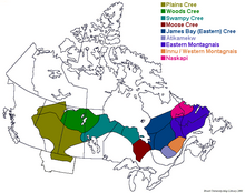


 Group of Cree people
 Merasty women and girls, Cree, The Pas, Manitoba, 1942
 Chief King of the Wind
 Chief Thundercloud
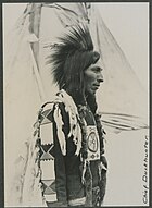 Chief Duckhunter
 Cree girl (1928)
 Illustration of a Snake woman (left) and a Cree woman (right), c. 1840–1843, Karl Bodmer


