
Size of this preview: 800 × 554 pixels. Other resolutions: 320 × 222 pixels | 640 × 443 pixels | 1,024 × 709 pixels | 1,280 × 886 pixels | 2,560 × 1,772 pixels | 5,200 × 3,600 pixels.
Original file (5,200 × 3,600 pixels, file size: 5.2 MB, MIME type: image/jpeg)
Summary
| Description |
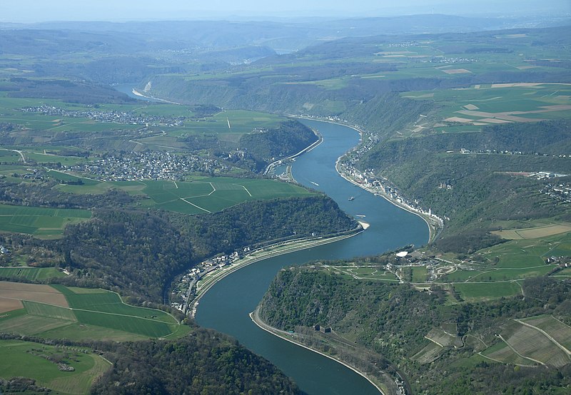
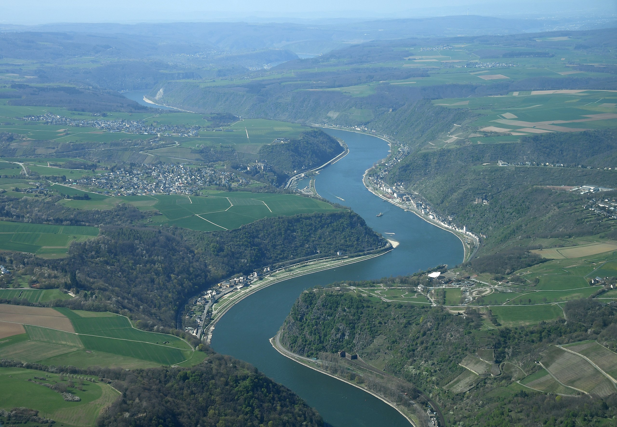
English: Aerial image of the Upper Middle Rhine Valley in the area of Sankt Goarshausen with the Lorelei at the the bottom of the image
Deutsch: Luftbild des Oberen Mittelrheintals im Gebiet von Sankt Goarshausen mit der Loreley unten im Bild |
| Date | |
| Source | Own work |
| Author | Carsten Steger |
| Camera location | | View this and other nearby images on: OpenStreetMap |
|---|
| Object location | | View this and other nearby images on: OpenStreetMap |
|---|
Licensing
I, the copyright holder of this work, hereby publish it under the following license:
This file is licensed under the Creative Commons Attribution-Share Alike 4.0 International license.
- You are free:
- to share – to copy, distribute and transmit the work
- to remix – to adapt the work
- Under the following conditions:
- attribution – You must give appropriate credit, provide a link to the license, and indicate if changes were made. You may do so in any reasonable manner, but not in any way that suggests the licensor endorses you or your use.
- share alike – If you remix, transform, or build upon the material, you must distribute your contributions under the same or compatible license as the original.
File history
Click on a date/time to view the file as it appeared at that time.
| Date/Time | Thumbnail | Dimensions | User | Comment | |
|---|---|---|---|---|---|
| current | 15:07, 2 July 2021 | | 5,200 × 3,600 (5.2 MB) | Carsten Steger | Sharpened the image slightly. |
| 10:33, 15 May 2021 |  | 5,200 × 3,600 (4.75 MB) | Carsten Steger | Uploaded own work with UploadWizard |
File usage
The following pages on the English Wikipedia use this file (pages on other projects are not listed):
Global file usage
The following other wikis use this file:
- Usage on es.wikipedia.org
- Usage on gl.wikipedia.org
- Usage on mt.wikipedia.org