
Size of this preview: 800 × 555 pixels. Other resolutions: 320 × 222 pixels | 640 × 444 pixels | 1,024 × 710 pixels | 1,280 × 887 pixels | 2,560 × 1,775 pixels | 5,184 × 3,594 pixels.
Original file (5,184 × 3,594 pixels, file size: 6.21 MB, MIME type: image/jpeg)
Summary
| Description |
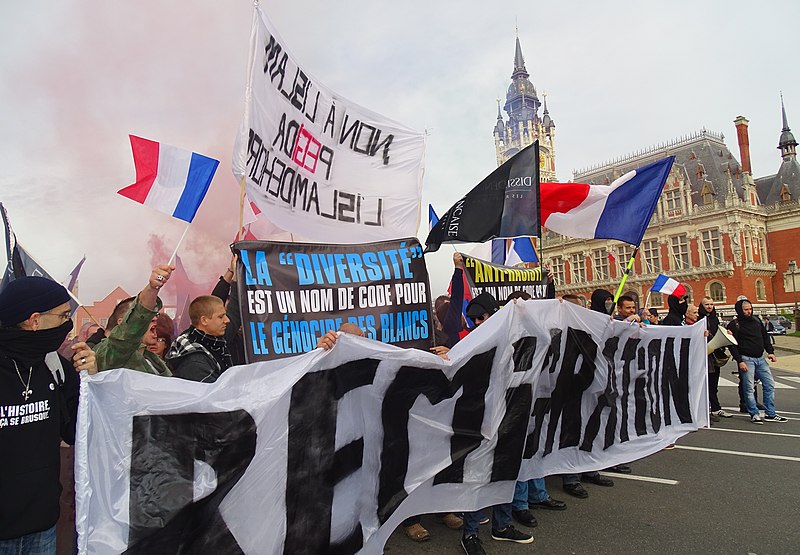
English: Demonstration against illegal immigrants, immigration-invasion and the Islamization of Europe on November 8, 2015 in Calais, Nord, Nord-Pas-de-Calais, France. A few hours later, during the night, sixteen police officers working for the security of Calaisians were injured in the Jungle, the slum of illegal immigrants. New violence took place the next day and the day after Français : Autres éléments du BMNPC Manifestation contre les clandestins, l'immigration-invasion et l'islamisation de l'Europe le 8 novembre 2015 à Calais |
|||||||||||||||||||||||
| Date | ||||||||||||||||||||||||
| Source | Own work | |||||||||||||||||||||||
| Author |
|
|||||||||||||||||||||||
| Permission (Reusing this file) |
| |||||||||||||||||||||||
| Attribution (required by the license) | Jérémy-Günther-Heinz Jähnick / Calais - Manifestation contre les clandestins, l'immigration-invasion et l'islamisation de l'Europe, 8 novembre 2015 (22) / Wikimedia Commons / | |||||||||||||||||||||||
.JPG)

.JPG)
| Camera location | | View this and other nearby images on: OpenStreetMap |
|---|
.JPG¶ms=050.951803_N_0001.853381_E_globe:Earth_type:camera__&language=en)
File history
Click on a date/time to view the file as it appeared at that time.
| Date/Time | Thumbnail | Dimensions | User | Comment | |
|---|---|---|---|---|---|
| current | 10:57, 9 November 2015 | | 5,184 × 3,594 (6.21 MB) | Jérémy-Günther-Heinz Jähnick |
File usage
The following pages on the English Wikipedia use this file (pages on other projects are not listed):
Global file usage
The following other wikis use this file:
- Usage on ar.wikipedia.org
- Usage on es.wikipedia.org
- Usage on fa.wikipedia.org
- Usage on fr.wikipedia.org
- Usage on he.wikipedia.org
- Usage on hy.wikipedia.org
- Usage on id.wikipedia.org
- Usage on it.wikipedia.org
- Usage on it.wikiquote.org
- Usage on ko.wikipedia.org
- Usage on ms.wikipedia.org
- Usage on nl.wikipedia.org
- Usage on pt.wikipedia.org
- Usage on ro.wikipedia.org
- Usage on ru.wikipedia.org
- Usage on sr.wikipedia.org
- Usage on sv.wikipedia.org
- Usage on zh.wikipedia.org
.JPG)