| Tidewater Provincial Park | |
|---|---|
 | |
| Location | Northeastern Ontario |
| Nearest city | Moosonee, Ontario |
| Coordinates | 51°15′45″N 80°37′30″W / 51.26250°N 80.62500°W |
| Area | 980 ha (2,400 acres)[1] |
| Established | 1964 |
| Governing body | Ontario Parks (operated by the Town of Moosonee) |
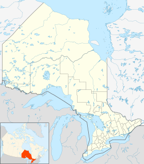
Tidewater Provincial Park is a provincial park located on five islands[2] in the Moose River estuary between Moosonee and Moose Factory, Ontario, Canada:
- Charles Island
- South Charles Island
- Butler Island
- Hayes Island
- Bushy Island
The park was created in 1964 and is operated by the Town of Moosonee rather than the Ministry of Natural Resources.[2] Access to the park is by boat only, including water taxis from Moosonee.[2]
Camping[edit]
Overnight camping was eliminated due to cuts in 2012 and park is no longer listed on the Ontario Parks website.[3]
As of 2015 Tidewater is again listed on the Ontario Parks website and pamphlets are displayed at Provincial Parks promoting Tidewater as a destination. Though the park is operational, it only consists of 20 tent sites that are available on a first-come-first-served basis.
References[edit]
- ^ Tidewater Provincial Park - Official Site
- ^ a b c "Tidewater Provincial Park". Ontario-Canada-Travel.com. Archived from the original on June 27, 2016.
- ^ "Nine Northern provincial parks to close for camping". 19 October 2012.
External links[edit]

