Kisoro Airport | |||||||||||
|---|---|---|---|---|---|---|---|---|---|---|---|
| Summary | |||||||||||
| Airport type | Public | ||||||||||
| Owner | Civil Aviation Authority of Uganda | ||||||||||
| Serves | Kisoro, Uganda | ||||||||||
| Elevation AMSL | 6,200 ft / 1,890 m | ||||||||||
| Coordinates | 1°17′00″S 29°43′10″E / 1.28333°S 29.71944°E | ||||||||||
| Map | |||||||||||
| Runways | |||||||||||
| |||||||||||
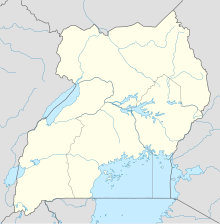
Kisoro Airport (ICAO: HUKI) is an airport serving the town of Kisoro in Uganda and nearby Bwindi Impenetrable National Park and Mgahinga Gorilla National Park. It is in extreme southwestern Uganda, 6 kilometres (4 mi) north of the Rwanda border, and approximately 343 kilometres (213 mi) by air southwest of Entebbe International Airport, the country's largest civilian and military airport.[4] It is one of twelve upcountry airports administered by the Civil Aviation Authority of Uganda.
The airport is mainly used by small planes flying tourists on a daily basis to Mgahinga Gorilla National Park, the southern side of Bwindi Impenetrable National Park, as well as connecting onto Queen Elizabeth National Park.[5] As of 2017, the airport does not accommodate international flights. The Civil Aviation Authority of Uganda has hinted on plans of upgrading the Kisoro Airport.[6]
The Kisoro non-directional beacon (Ident: KS) is located on the field.[7]
Airlines and destinations[edit]
| Airlines | Destinations |
|---|---|
| Aerolink Uganda | Entebbe[8] |
| BAR Aviation Uganda | Kajjansi |
See also[edit]
References[edit]
- ^ Kisoro Airfield, Uganda Civil Aviation Authority, 25 February 2014, accessed 15 November 2015
- ^ Google Maps - Kisoro
- ^ SkyVector - Kisoro National
- ^ "Distance between Entebbe Airport () and Kisoro (Kisoro) (Uganda)". distancecalculator.globefeed.com. Retrieved 2018-08-29.
- ^ "Kisoro Airstrip Flight Schedule". Savannah Wings. Retrieved 2022-05-31.
- ^ CAA unveils master plan to create four new international airports
- ^ "SkyVector: Flight Planning / Aeronautical Charts". skyvector.com. Retrieved 2018-08-29.
- ^ Aerolink Uganda (2019). "Aerolink Uganda Destinations". Entebbe: Aerolink Uganda. Retrieved 17 July 2019.

