
Size of this preview: 800 × 533 pixels. Other resolutions: 320 × 213 pixels | 640 × 427 pixels | 1,024 × 683 pixels | 1,280 × 853 pixels | 2,560 × 1,707 pixels | 3,522 × 2,348 pixels.
Original file (3,522 × 2,348 pixels, file size: 1.52 MB, MIME type: image/jpeg)
Summary
| Camera location | | View this and other nearby images on: OpenStreetMap |
|---|
| Description |
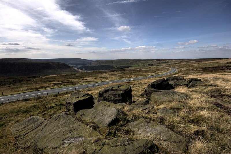
English: A view of Saddleworth Moor, in Greater Manchester, from Hollin Brown Knoll. The A635 road cuts through the moor, and in the distance Yeoman Hey reservoir, and Dove Stones reservoir, are visible. |
| Date | |
| Source | Own work |
| Author | Parrot of Doom |
Licensing
I, the copyright holder of this work, hereby publish it under the following licenses:
This file is licensed under the Creative Commons Attribution-Share Alike 3.0 Unported license.
- You are free:
- to share – to copy, distribute and transmit the work
- to remix – to adapt the work
- Under the following conditions:
- attribution – You must give appropriate credit, provide a link to the license, and indicate if changes were made. You may do so in any reasonable manner, but not in any way that suggests the licensor endorses you or your use.
- share alike – If you remix, transform, or build upon the material, you must distribute your contributions under the same or compatible license as the original.

|
Permission is granted to copy, distribute and/or modify this document under the terms of the GNU Free Documentation License, Version 1.2 or any later version published by the Free Software Foundation; with no Invariant Sections, no Front-Cover Texts, and no Back-Cover Texts. A copy of the license is included in the section entitled GNU Free Documentation License. |
You may select the license of your choice.
File history
Click on a date/time to view the file as it appeared at that time.
| Date/Time | Thumbnail | Dimensions | User | Comment | |
|---|---|---|---|---|---|
| current | 20:41, 30 September 2009 | | 3,522 × 2,348 (1.52 MB) | Parrot of Doom | {{Information |Description={{en|1=A view of Saddleworth Moor, from Hollin Brown Knoll. The A635 road cuts through the moor, and in the distance Yeoman Hey reservoir, and Dove Stones reservoir, are visible.}} |Source={{own}} |Author=[[User:Parrot of Doom| |
File usage
The following pages on the English Wikipedia use this file (pages on other projects are not listed):
- List of places in Greater Manchester
- Moors murders
- Saddleworth Moor
- Wikipedia:Today's featured article/Most viewed
- Wikipedia:Today's featured article/September 2010
- Wikipedia:Today's featured article/September 27, 2010
- Wikipedia:Top 25 Report/May 14 to 20, 2017
- Portal:United Kingdom/Featured article
- Portal:United Kingdom/Featured article/96
Global file usage
The following other wikis use this file:
- Usage on ast.wikipedia.org
- Usage on da.wikipedia.org
- Usage on de.wikipedia.org
- Usage on en.wiktionary.org
- Usage on fi.wikipedia.org
- Usage on fr.wikipedia.org
- Usage on it.wikipedia.org
- Usage on no.wikipedia.org
- Usage on pl.wikipedia.org
- Usage on ru.wikipedia.org
- Usage on www.wikidata.org