No higher resolution available.
Rag_and_hassock_outcrop_(geograph_2560799).jpg (640 × 480 pixels, file size: 161 KB, MIME type: image/jpeg)
Summary
| Description |
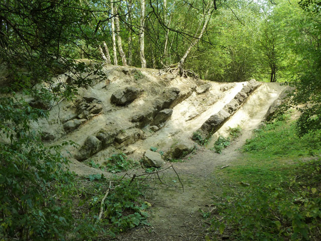
English: Rag and hassock outcrop: Alternating soft and hard beds in the Lower Greensand. The rag is the hard stone. In Dryhill local nature reserve, which is also an SSSI because of these geological exposures. |
| Date | |
| Source | From geograph.org.uk |
| Author | Robin Webster |
| Permission (Reusing this file) |
Creative Commons Attribution Share-alike license 2.0 |
| Attribution (required by the license) | Robin Webster / Rag and hassock outcrop / |
| Camera location | | View this and other nearby images on: OpenStreetMap |
|---|
.jpg¶ms=051.275941_N_0000.149393_E_globe:Earth_type:camera_source:geograph-osgb36(TQ5001955171)_heading:90.00&language=en)
| Object location | | View this and other nearby images on: OpenStreetMap |
|---|
.jpg¶ms=051.275930_N_0000.149690_E_globe:Earth_class:object_type:object_source:geograph-osgb36(TQ50045517)_heading:90.00&language=en)
Licensing

|
This image was taken from the Geograph project collection. See this photograph's page on the Geograph website for the photographer's contact details. The copyright on this image is owned by Robin Webster and is licensed for reuse under the Creative Commons Attribution-ShareAlike 2.0 license.
|
This file is licensed under the Creative Commons Attribution-Share Alike 2.0 Generic license.
Attribution: Robin Webster
- You are free:
- to share – to copy, distribute and transmit the work
- to remix – to adapt the work
- Under the following conditions:
- attribution – You must give appropriate credit, provide a link to the license, and indicate if changes were made. You may do so in any reasonable manner, but not in any way that suggests the licensor endorses you or your use.
- share alike – If you remix, transform, or build upon the material, you must distribute your contributions under the same or compatible license as the original.
File history
Click on a date/time to view the file as it appeared at that time.
| Date/Time | Thumbnail | Dimensions | User | Comment | |
|---|---|---|---|---|---|
| current | 01:13, 8 January 2020 | | 640 × 480 (161 KB) | Hemiauchenia | Transferred from geograph.co.uk using [https://tools.wmflabs.org/geograph2commons/ geograph2commons] |
File usage
The following pages on the English Wikipedia use this file (pages on other projects are not listed):
Global file usage
The following other wikis use this file:
- Usage on www.wikidata.org
.jpg)