Size of this preview: 800 × 544 pixels. Other resolutions: 320 × 217 pixels | 640 × 435 pixels | 974 × 662 pixels.
Original file (974 × 662 pixels, file size: 640 KB, MIME type: image/jpeg)
Summary
| Description |
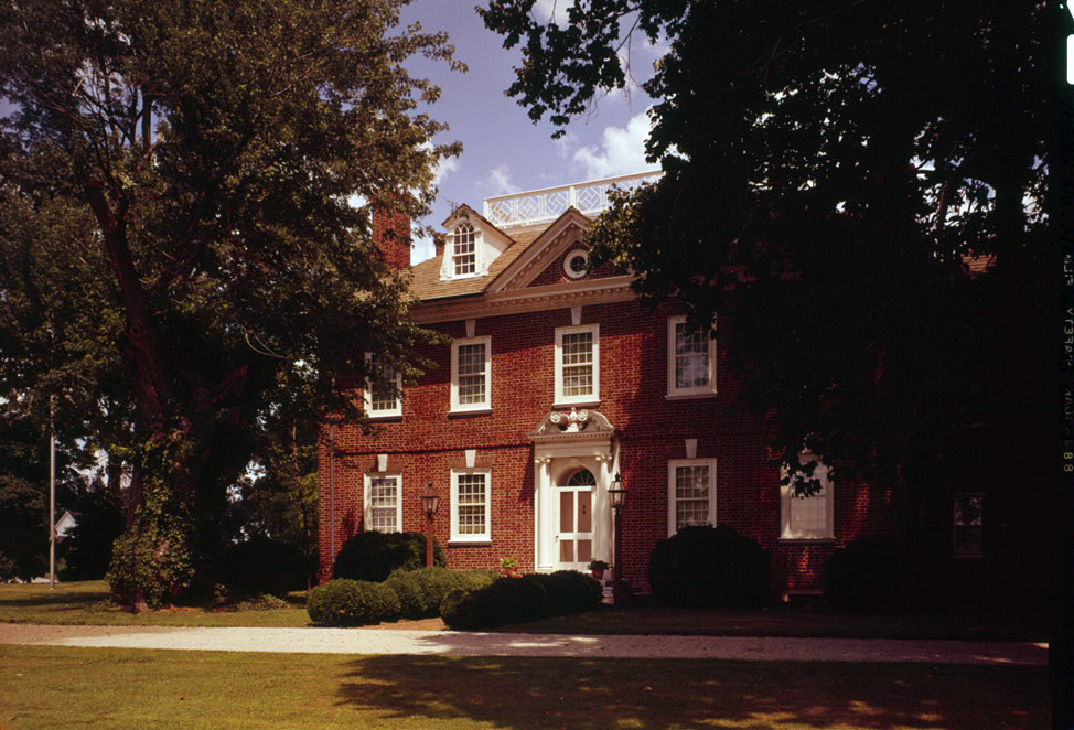
English: Mt. Harmon Plantation at World's End, near Earleville, Maryland.
Français : Mt. Harmon plantation a World's End, près de Earleville, Maryland, Etats-Unis |
|||||||||||||||||||||||||
| Date | ||||||||||||||||||||||||||
| Source | http://memory.loc.gov/pnp/habshaer/md/md0600/md0674/color/571565cv.jpg | |||||||||||||||||||||||||
| Author |
|
|||||||||||||||||||||||||
| Object location | | View this and other nearby images on: OpenStreetMap |
|---|
|
This is an image of a place or building that is listed on the National Register of Historic Places in the United States of America. Its reference number is 74000945. |
Licensing

|
This file comes from the Historic American Buildings Survey (HABS), Historic American Engineering Record (HAER) or Historic American Landscapes Survey (HALS). These are programs of the National Park Service established for the purpose of documenting historic places. Records consist of measured drawings, archival photographs, and written reports.
This tag does not indicate the copyright status of the attached work. A normal copyright tag is still required. See Commons:Licensing. |
| This image or media file contains material based on a work of a National Park Service employee, created as part of that person's official duties. As a work of the U.S. federal government, such work is in the public domain in the United States. See the NPS website and NPS copyright policy for more information. |
File history
Click on a date/time to view the file as it appeared at that time.
| Date/Time | Thumbnail | Dimensions | User | Comment | |
|---|---|---|---|---|---|
| current | 01:53, 22 June 2012 | | 974 × 662 (640 KB) | Acroterion | {{Information |Description ={{en|1=Mt. Harmon Plantation at World's End, near Earleville, Maryland, USA. Cropped and color-corrected photograph.}} |Source =http://memory.loc.gov/pnp/habshaer/md/md0600/md0674/color/571565cv.jpg |Author ... |
File usage
The following pages on the English Wikipedia use this file (pages on other projects are not listed):
Global file usage
The following other wikis use this file:
- Usage on www.wikidata.org