
Size of this PNG preview of this SVG file: 465 × 600 pixels. Other resolutions: 186 × 240 pixels | 372 × 480 pixels | 595 × 768 pixels | 793 × 1,024 pixels | 1,587 × 2,048 pixels | 1,550 × 2,000 pixels.
Original file (SVG file, nominally 1,550 × 2,000 pixels, file size: 381 KB)
Summary
| Description |
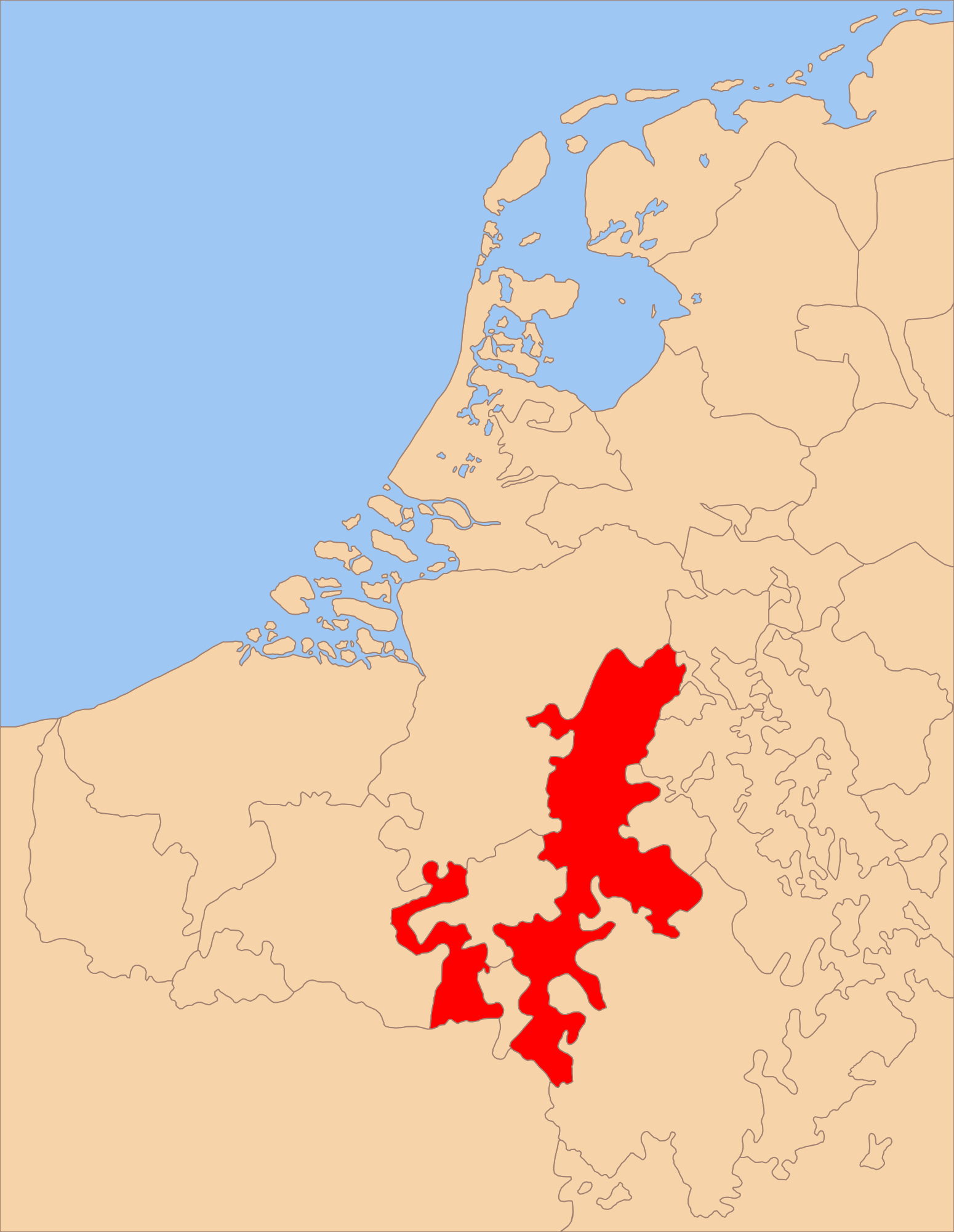
English: Locator map of the Prince-Bischopric of Liege around 1350.
Nederlands: Locatiekaart van het Prinsbisdom Luik rond 1350 |
| Date | |
| Source | Own work |
| Author | Sir Iain |
Licensing
I, the copyright holder of this work, hereby publish it under the following licenses:
This file is licensed under the Creative Commons Attribution-Share Alike 3.0 Unported license.
- You are free:
- to share – to copy, distribute and transmit the work
- to remix – to adapt the work
- Under the following conditions:
- attribution – You must give appropriate credit, provide a link to the license, and indicate if changes were made. You may do so in any reasonable manner, but not in any way that suggests the licensor endorses you or your use.
- share alike – If you remix, transform, or build upon the material, you must distribute your contributions under the same or compatible license as the original.

|
Permission is granted to copy, distribute and/or modify this document under the terms of the GNU Free Documentation License, Version 1.2 or any later version published by the Free Software Foundation; with no Invariant Sections, no Front-Cover Texts, and no Back-Cover Texts. A copy of the license is included in the section entitled GNU Free Documentation License. |
You may select the license of your choice.
File history
Click on a date/time to view the file as it appeared at that time.
| Date/Time | Thumbnail | Dimensions | User | Comment | |
|---|---|---|---|---|---|
| current | 10:07, 6 May 2008 | | 1,550 × 2,000 (381 KB) | Sir Iain | {{Information |Description='''English:''' Locator map of the Prince-Bischopric of Liege around 1350.<br>'''Nederlands:''' Locatiekaart van het Prinsbisdom Luik rond 1350 |Source=Self-made |Date=05/05/2008 |Author= Sir Iain |Permission= | |
File usage
The following pages on the English Wikipedia use this file (pages on other projects are not listed):
Global file usage
The following other wikis use this file:
- Usage on ar.wikipedia.org
- Usage on ca.wikipedia.org
- Usage on da.wikipedia.org
- Usage on eo.wikipedia.org
- Usage on es.wikipedia.org
- Usage on et.wikipedia.org
- Usage on fr.wikipedia.org
- Usage on he.wikipedia.org
- Usage on id.wikipedia.org
- Usage on it.wikipedia.org
- Usage on ja.wikipedia.org
- Usage on lmo.wikipedia.org
- Usage on lt.wikipedia.org
- Usage on nn.wikipedia.org
- Usage on pt.wikipedia.org
- Usage on ro.wikipedia.org
- Usage on sh.wikipedia.org
- Usage on simple.wikipedia.org
- Usage on sk.wikipedia.org
- Usage on uk.wikipedia.org
- Usage on vi.wikipedia.org
- Usage on vls.wikipedia.org
- Usage on wa.wikipedia.org
- Usage on www.wikidata.org
- Usage on zh.wikipedia.org