Size of this preview: 670 × 600 pixels. Other resolutions: 268 × 240 pixels | 536 × 480 pixels | 858 × 768 pixels | 1,144 × 1,024 pixels | 1,756 × 1,572 pixels.
Original file (1,756 × 1,572 pixels, file size: 702 KB, MIME type: image/jpeg)
Summary
| Description |
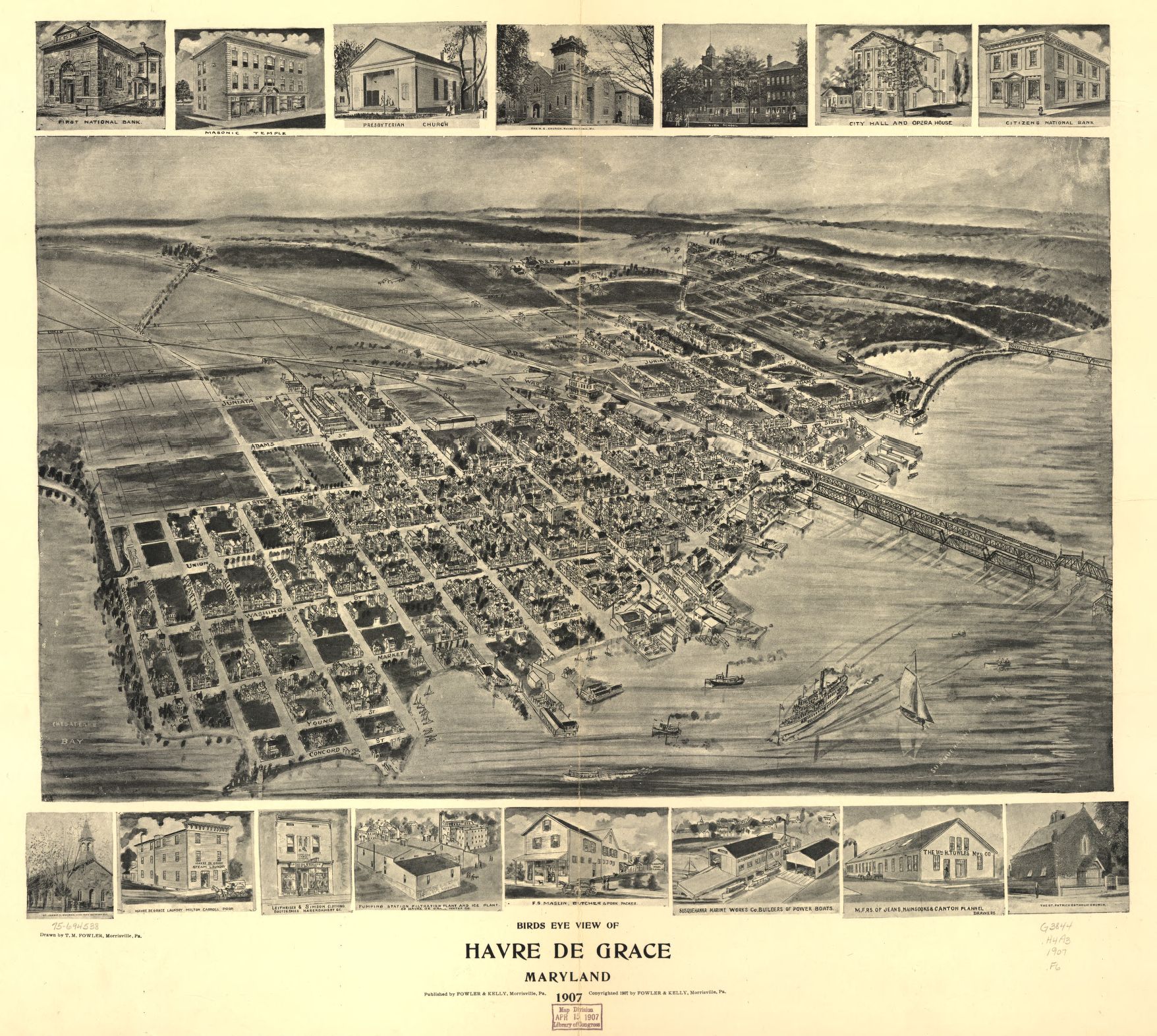
English: An old map of Havre de Grace, Maryland, United States. The Pennsylvania Railroad bridge (now called the Amtrak Susquehanna River Bridge) and the B&O Railroad Bridge (now called the CSX Susquehanna River Bridge) are seen on the right. |
||||
| Date | |||||
| Source |
|
||||
| Author | Thaddeus Mortimer Fowler | ||||
| Permission (Reusing this file) |
|
||||

File history
Click on a date/time to view the file as it appeared at that time.
| Date/Time | Thumbnail | Dimensions | User | Comment | |
|---|---|---|---|---|---|
| current | 05:57, 10 July 2013 | | 1,756 × 1,572 (702 KB) | ALH | higher resolution |
| 06:10, 8 January 2010 |  | 1,024 × 916 (654 KB) | Yassie | {{Information |Description= An old map of Havre de Grace, Maryland, United States. |Source= http://www.flickr.com/photos/28496558@N02/2664887513/ |Date= 1907 |Author= [http://www.flickr.com/people/28496558@N02 Olde Yankee Map and Photo] |Permission= |oth |
File usage
The following pages on the English Wikipedia use this file (pages on other projects are not listed):
Global file usage
The following other wikis use this file:
- Usage on ja.wikipedia.org