Size of this preview: 800 × 600 pixels. Other resolutions: 320 × 240 pixels | 640 × 480 pixels | 1,024 × 768 pixels | 1,280 × 960 pixels | 2,560 × 1,920 pixels | 4,032 × 3,024 pixels.
Original file (4,032 × 3,024 pixels, file size: 2.86 MB, MIME type: image/jpeg)
Summary
| Description |
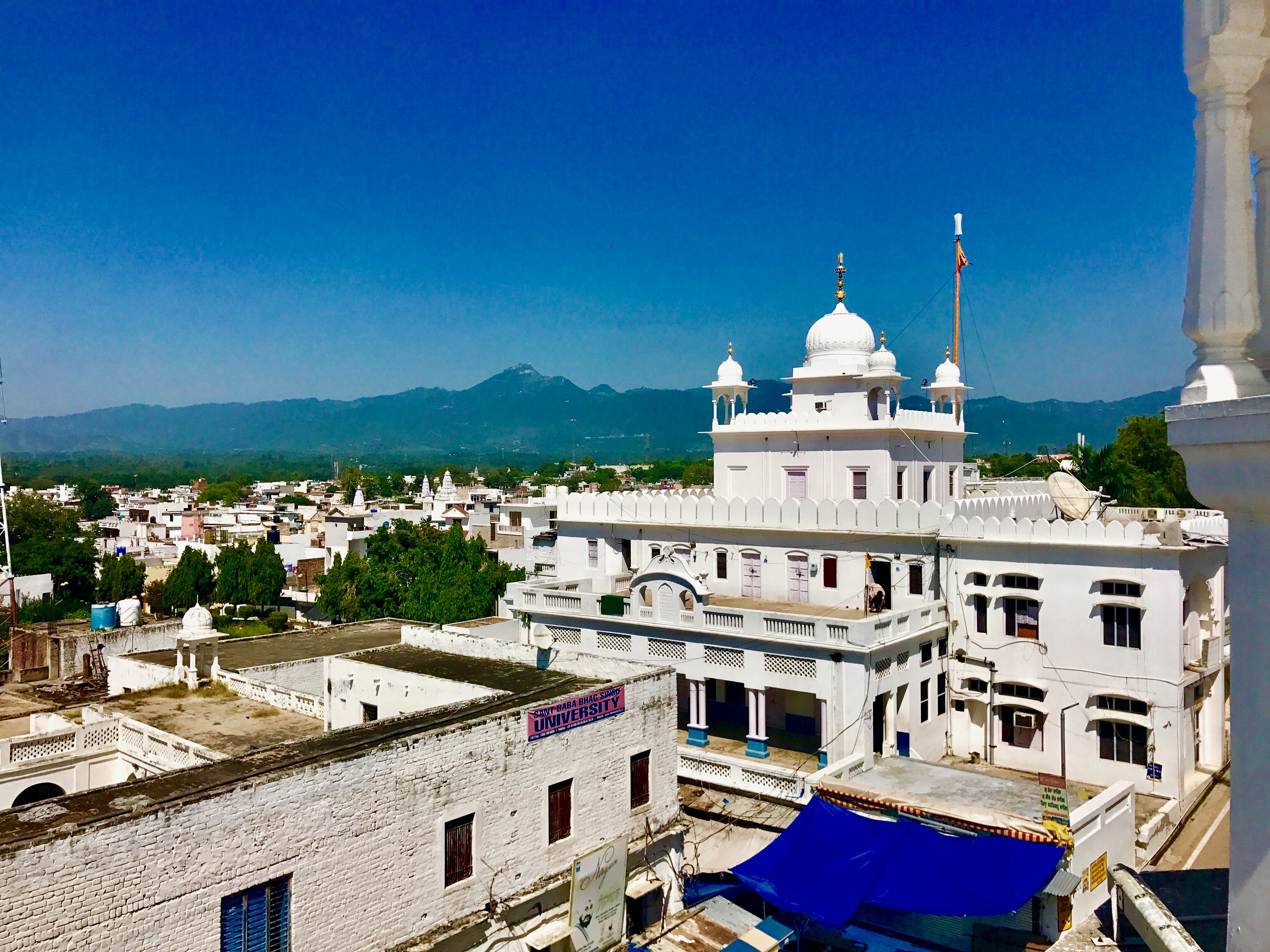
English: Takht Sri Keshgarh Sahib also known as Anandpur Sahib is the historic site in Sikhism where Khalsa was founded by Guru Gobind Singh.
It is located near Himalayan foothills near the river Satluj. The site is second only to Amritsar, the city of Golden Temple in the Sikh tradition. Anandpur Sahib was founded in the year 1665 by the ninth Sikh Guru, Tegh Bahadur. A small town is the site of major annual gathering of Sikhs for Hola Mohalla festival every year in spring when other parts of India are celebrating Holi. It is a festive gathering with a display of martial arts, fairs and gaiety. |
| Date | |
| Source | Own work |
| Author | Ms Sarah Welch |
| Camera location | | View this and other nearby images on: OpenStreetMap |
|---|
Licensing
I, the copyright holder of this work, hereby publish it under the following license:
This file is licensed under the Creative Commons Attribution-Share Alike 4.0 International license.
- You are free:
- to share – to copy, distribute and transmit the work
- to remix – to adapt the work
- Under the following conditions:
- attribution – You must give appropriate credit, provide a link to the license, and indicate if changes were made. You may do so in any reasonable manner, but not in any way that suggests the licensor endorses you or your use.
- share alike – If you remix, transform, or build upon the material, you must distribute your contributions under the same or compatible license as the original.
File history
Click on a date/time to view the file as it appeared at that time.
| Date/Time | Thumbnail | Dimensions | User | Comment | |
|---|---|---|---|---|---|
| current | 19:04, 24 September 2017 | | 4,032 × 3,024 (2.86 MB) | Ms Sarah Welch | User created page with UploadWizard |
File usage
The following pages on the English Wikipedia use this file (pages on other projects are not listed):
Global file usage
The following other wikis use this file:
- Usage on bh.wikipedia.org
- Usage on hi.wikipedia.org
- Usage on kn.wikipedia.org
- Usage on th.wikipedia.org