
Size of this preview: 800 × 600 pixels. Other resolutions: 320 × 240 pixels | 640 × 480 pixels | 1,024 × 768 pixels | 1,280 × 960 pixels | 2,560 × 1,920 pixels | 4,608 × 3,456 pixels.
Original file (4,608 × 3,456 pixels, file size: 6.99 MB, MIME type: image/jpeg)
Summary
| Description |
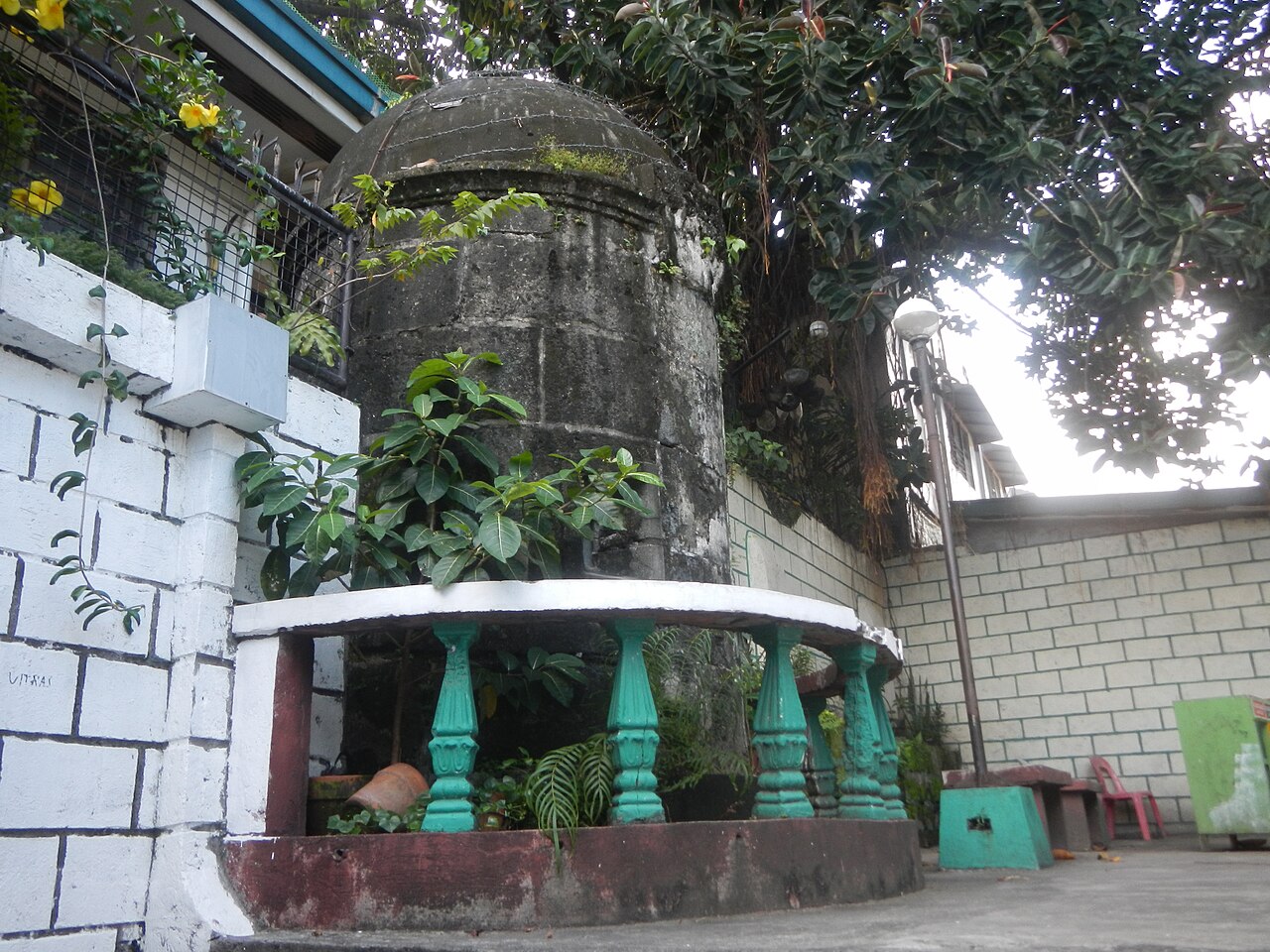
English: San Juan Plaza Mayor Agora Parking Plaza "Tanghalan ng Masa" 14°36'19"N 121°1'21"E Almacen de Polvora gunpowder depot San Juan (Region NCR) Military Structure Storehouse for explosives With Marker Marker Date 1988 San Juan Elementary School Compound 14°36'23"N 121°1'21"E San Juan City Metro Manila NCR Built in 1781 by Engineer Jose Belesta by Order of Governor-General Basco Y Vargas by Royal Decree of 1779 for 138 to 184 Polvora or gun powder attacked by Katipuneros under Andres Bonifacio in August 30, 1896 Puregold Agora Agora Public Market (San Juan) 14°36'18"N 121°1'24"E N. Domingo Street 14°36'39"N 121°2'0"E F. Blumentritt Street 14°35'55"N 121°1'45"E Major roads in Metro Manila in the List of barangays of Metro Manila, Legislative district of San Juan-Mandaluyong Legislative district of San Juan, Metro Manila Barangays Progreso 4°36'11"N 121°1'14"E Rivera 14°36'18"N 121°1'17"E Batis 14°35'58"N 121°1'28"E Pedro Cruz 14°36'19"N 121°1'34"E Tibagan 14°36'4"N 121°1'43"E San Perfecto 14°36'11"N 121°1'23"E Kabayanan 14°35'50"N 121°1'46"E San Juan, Metro Manila (Note: Judge Florentino Floro, the owner, to repeat, Donor Florentino Floro of all these photos hereby donate gratuitously, freely and unconditionally all these photos to and for Wikimedia Commons, exclusively, for public use of the public domain, and again without any condition whatsoever). |
| Date | |
| Source | Own work |
| Author | Judgefloro |
| Camera location | | View this and other nearby images on: OpenStreetMap |
|---|
Licensing
| I, the copyright holder of this work, release this work into the public domain. This applies worldwide. In some countries this may not be legally possible; if so: I grant anyone the right to use this work for any purpose, without any conditions, unless such conditions are required by law. |
File history
Click on a date/time to view the file as it appeared at that time.
| Date/Time | Thumbnail | Dimensions | User | Comment | |
|---|---|---|---|---|---|
| current | 18:37, 22 October 2016 | | 4,608 × 3,456 (6.99 MB) | Judgefloro | User created page with UploadWizard |
File usage
The following pages on the English Wikipedia use this file (pages on other projects are not listed):