Saint-Jean | |
|---|---|
 The church in Saint-Jean | |
 Coat of arms | |
Location of Saint-Jean  | |
 Saint-Jean  Saint-Jean | |
| Coordinates: 43°39′59″N 1°30′21″E / 43.6664°N 1.5058°E | |
| Country | France |
| Region | Occitania |
| Department | Haute-Garonne |
| Arrondissement | Toulouse |
| Canton | Toulouse-9 |
| Intercommunality | Toulouse Métropole |
| Government | |
| • Mayor (2020–2026) | Bruno Espic[1] |
| Area 1 | 5.94 km2 (2.29 sq mi) |
| Population (2021)[2] | 11,243 |
| • Density | 1,900/km2 (4,900/sq mi) |
| Time zone | UTC+01:00 (CET) |
| • Summer (DST) | UTC+02:00 (CEST) |
| INSEE/Postal code | 31488 /31240 |
| Elevation | 145–211 m (476–692 ft) (avg. 205 m or 673 ft) |
| 1 French Land Register data, which excludes lakes, ponds, glaciers > 1 km2 (0.386 sq mi or 247 acres) and river estuaries. | |
Saint-Jean (French pronunciation: [sɛ̃ ʒɑ̃] ⓘ; Languedocien: Sent Joan le Vièlh) is a commune in the Haute-Garonne department in southwestern France.
It is located northeast of Toulouse on the N88 or road of Albi (exit 14 on the peripheral).
Population[edit]
The inhabitants of the commune are known as Saint-Jeannais.
| Year | Pop. | ±% p.a. |
|---|---|---|
| 1968 | 1,887 | — |
| 1975 | 4,787 | +14.22% |
| 1982 | 6,512 | +4.49% |
| 1990 | 7,168 | +1.21% |
| 1999 | 8,362 | +1.73% |
| 2007 | 9,667 | +1.83% |
| 2012 | 10,319 | +1.31% |
| 2017 | 10,694 | +0.72% |
| Source: INSEE[3] | ||
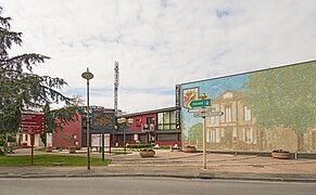
Sights[edit]
One of the commune's main points of interest is its historic church.
Notable People[edit]
- Camille Razat - born and raised in Saint-Jean.
Monument[edit]
-
 The town hall.
 -
 Church "Saint Jean-Baptiste", bell gable.
 -
 Church "Saint Jean-Baptiste"


International relations[edit]
Saint-Jean is twinned with:
See also[edit]
References[edit]
- ^ "Répertoire national des élus: les maires" (in French). data.gouv.fr, Plateforme ouverte des données publiques françaises. 13 September 2022.
- ^ "Populations légales 2021". The National Institute of Statistics and Economic Studies. 28 December 2023.
- ^ Population en historique depuis 1968, INSEE
External links[edit]
| National | |
|---|---|
| Geographic | |