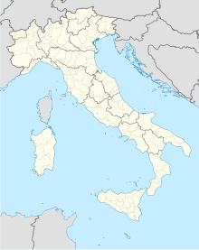
Siena–Ampugnano Airport Aeroporto di Siena-Ampugnano | |||||||||||
|---|---|---|---|---|---|---|---|---|---|---|---|
 | |||||||||||
| Summary | |||||||||||
| Airport type | Military / Public | ||||||||||
| Serves | Siena, Tuscany, Italy | ||||||||||
| Elevation AMSL | 634 ft / 193 m | ||||||||||
| Coordinates | 43°15′23″N 011°15′18″E / 43.25639°N 11.25500°E | ||||||||||
| Website | https://www.skyservices.it/article/welcome-to-siena-airport | ||||||||||
| Map | |||||||||||
| Runways | |||||||||||
| |||||||||||
| Statistics (2012) | |||||||||||
| |||||||||||
Siena–Ampugnano Airport (Italian: Aeroporto di Siena-Ampugnano) (IATA: SAY, ICAO: LIQS)[3] was a small military airfield in Ampugnano, near Siena, in Tuscany, Italy. All employment has been terminated in 2014.[4]
2008 the site has been proposed for a new international airport capable of handling 4 million passengers a year by 2020. Since 2003 the project has met widespread local opposition.[5][6] Upon request about current status and future of the airport in November 2016 the Siena Comune confirmed by eMail: ″the airport of Siena is not operating″[citation needed]. As of January 2017, the field is mentioned as being operated by Sky Services.[7] There are however indications of rather high rates, opposed to limited levels of service.[8]
History[edit]
During World War II, the facility was known as Malignano Airfield. It was a major United States Air Force Twelfth Air Force base of operations during the Italian Campaign.[9]
Facilities[edit]
The airport resides at an elevation of 634 feet (193 m) above mean sea level. It has one runway designated 18/36 with an asphalt surface measuring 1,393 by 30 metres (4,570 ft × 98 ft).
References[edit]
- ^ EAD Basic
- ^ Associazione Italiana Gestori Aeroportuali
- ^ "LIQS/Siena-Ampugnano General Airport Information". acukwik.com. Retrieved 2022-03-09.
- ^ All employments terminated. Information by the Siena Comune
- ^ Peter Popham (19 January 2008). "Plans for a new airport bringing cheap flights to Tuscany provoke furious opposition". The Independent.
- ^ Committee against Expansion of Ampugnano Airport-Siena
- ^ "Siena". Archived from the original on 2017-02-02. Retrieved 2017-01-22.
- ^ "Trips & Airports - Siena / Sienna LIQS any recent experiences ?".
- ^ Maurer, Maurer. Air Force Combat Units of World War II. Maxwell AFB, Alabama: Office of Air Force History, 1983. ISBN 0-89201-092-4, and Air Force Historical Research Agency
External links[edit]
- Official website: English, Italian
- Accident history for SAY at Aviation Safety Network
