
Size of this preview: 794 × 600 pixels. Other resolutions: 318 × 240 pixels | 636 × 480 pixels | 1,017 × 768 pixels | 1,280 × 967 pixels | 2,560 × 1,934 pixels | 5,000 × 3,777 pixels.
Original file (5,000 × 3,777 pixels, file size: 7.13 MB, MIME type: image/jpeg)
Summary
| Description | |
| Date | |
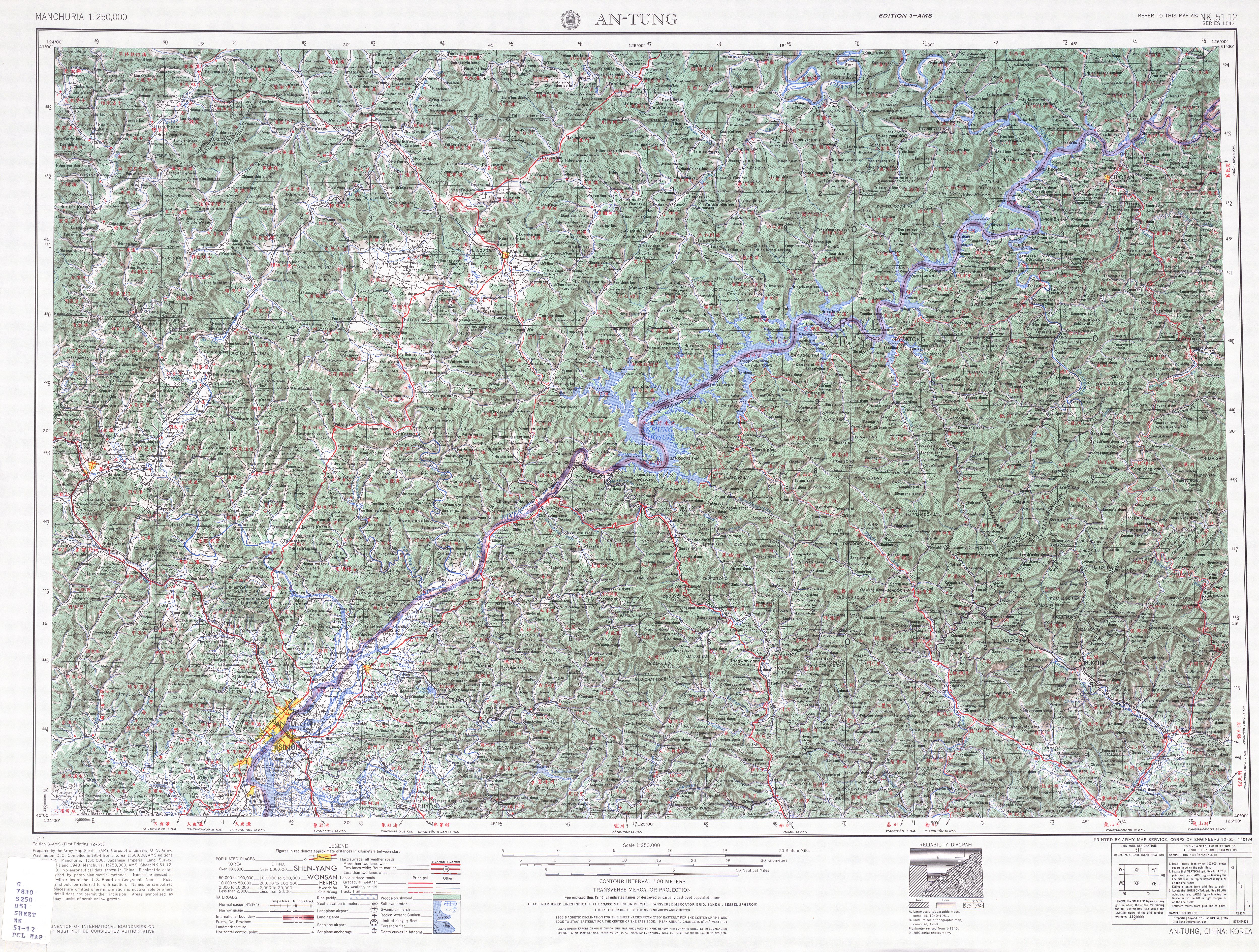
| Source | http://legacy.lib.utexas.edu/maps/ams/manchuria/txu-oclc-6614368-nk51-12.jpg |
| Author | Army Map Serivce (AM), Corps of Engineers 1954 |
-
 Index Map

Licensing
This image or file is a work of a U.S. Army Corps of Engineers soldier or employee, taken or made as part of that person's official duties. As a work of the U.S. federal government, the image is in the public domain.
|
File history
Click on a date/time to view the file as it appeared at that time.
| Date/Time | Thumbnail | Dimensions | User | Comment | |
|---|---|---|---|---|---|
| current | 14:49, 10 September 2019 | | 5,000 × 3,777 (7.13 MB) | Geographyinitiative | User created page with UploadWizard |
File usage
The following pages on the English Wikipedia use this file (pages on other projects are not listed):