
Size of this preview: 797 × 599 pixels. Other resolutions: 319 × 240 pixels | 638 × 480 pixels | 1,021 × 768 pixels | 1,280 × 963 pixels | 2,560 × 1,925 pixels | 3,032 × 2,280 pixels.
Original file (3,032 × 2,280 pixels, file size: 1.93 MB, MIME type: image/jpeg)
Summary
| Description |
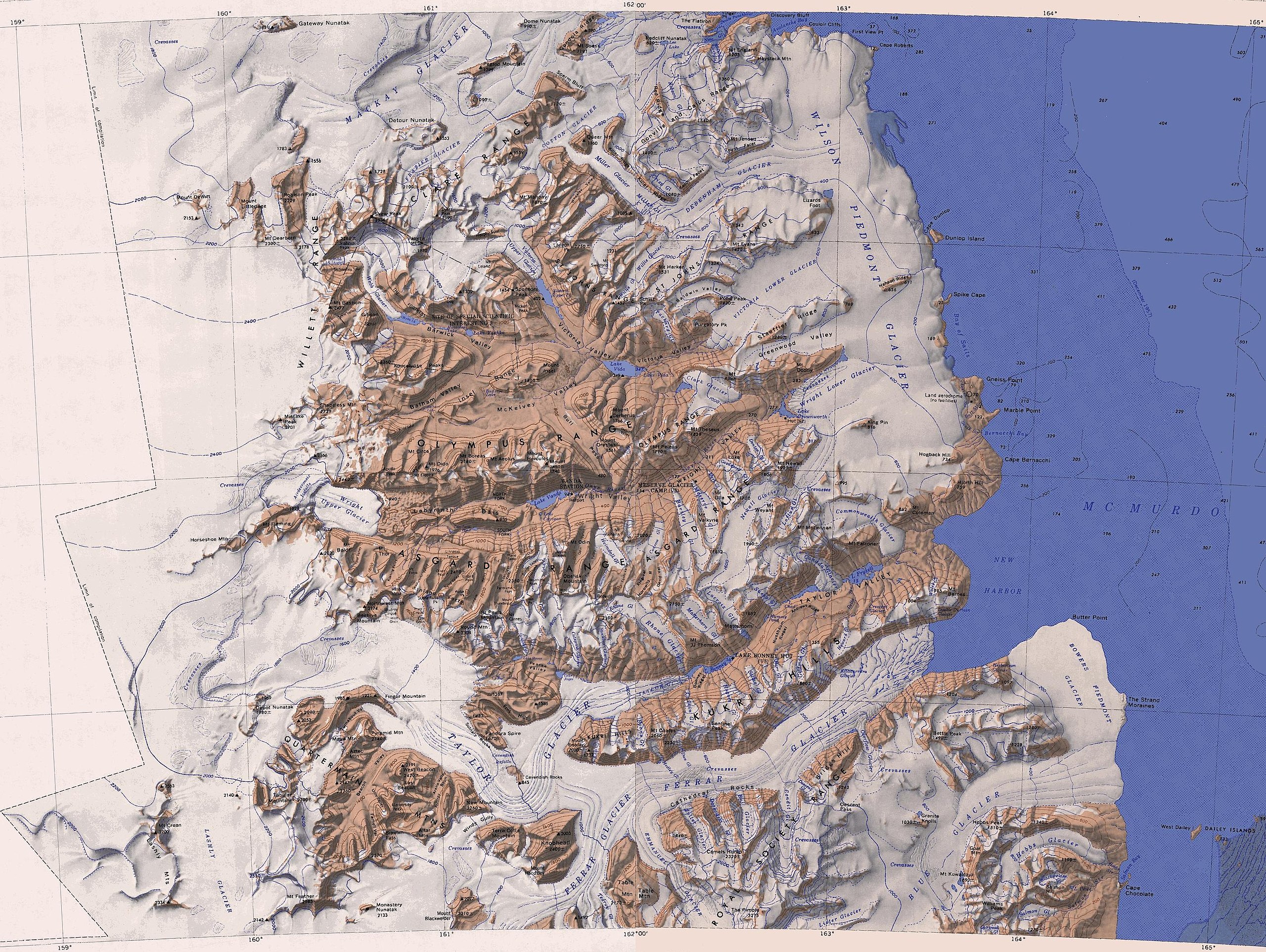
English: Map of the McMurdo Dry Valleys merged from two 1:250,000-scale topographic reconnaissance maps published by the U.S. Geological Survey in cooperation with the National Science Foundation, both compiled in 1962 (the western half revised in 1988, the eastern half in 1970). It comprises the area from 77° to 78° South and approximately 158° to 165° East |
| Date | (revised in 1988 and 1970) |
| Source |
This file was derived from: |
| Author | Olaf Studt |
Licensing
This image is in the public domain in the United States because it only contains materials that originally came from the United States Geological Survey, an agency of the United States Department of the Interior. For more information, see the official USGS copyright policy.
|
File history
Click on a date/time to view the file as it appeared at that time.
| Date/Time | Thumbnail | Dimensions | User | Comment | |
|---|---|---|---|---|---|
| current | 13:37, 8 November 2017 | | 3,032 × 2,280 (1.93 MB) | Olaf Studt | {{Information |Description ={{en|1=Map of the McMurdo Dry Valleys merged from two 1:250,000-scale topographic reconnaissance maps published by the U.S. Geological Survey in cooperation with the [[:en:National Science... |
File usage
The following pages on the English Wikipedia use this file (pages on other projects are not listed):
Global file usage
The following other wikis use this file:
- Usage on bg.wikipedia.org
- Usage on de.wikipedia.org
- Usage on nds.wikipedia.org
- Usage on www.wikidata.org
.jpg)