No higher resolution available.
LongIslandSoundDrainageBasinsUSEPA.jpg (509 × 427 pixels, file size: 70 KB, MIME type: image/jpeg)
Summary[edit]
| Description |
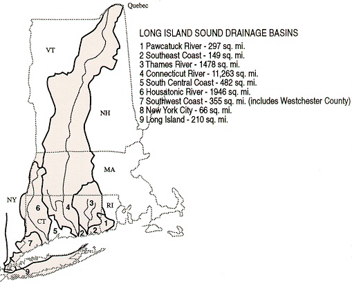
Map of Watershed of Long Island Sound In this map, the section labeled "9" (Long Island) is miscolored. The part of Long Island that drains into the Sound is to the north of the line, not to the south, and amounts to a small fraction of the entire area of Long Island. |
|---|---|
| Source |
Source: Website of the U.S. Environmental Protection Agency http://www.epa.gov/region01/eco/lis/assets/images/abasin.jpg |
| Date | |
| Author | |
| Permission (Reusing this file) |
See below.
|
Licensing[edit]
File history
Click on a date/time to view the file as it appeared at that time.
| Date/Time | Thumbnail | Dimensions | User | Comment | |
|---|---|---|---|---|---|
| current | 01:37, 12 May 2007 | | 509 × 427 (70 KB) | Noroton (talk | contribs) | Map of Watershed of Long Island Sound Source: Website of the U.S. Environmental Protection Agency http://www.epa.gov/region01/eco/lis/assets/images/abasin.jpg |
You cannot overwrite this file.
File usage
The following pages on the English Wikipedia use this file (pages on other projects are not listed):