
Size of this PNG preview of this SVG file: 568 × 599 pixels. Other resolutions: 228 × 240 pixels | 455 × 480 pixels | 728 × 768 pixels | 971 × 1,024 pixels | 1,942 × 2,048 pixels | 990 × 1,044 pixels.
Original file (SVG file, nominally 990 × 1,044 pixels, file size: 31 KB)
| Description |
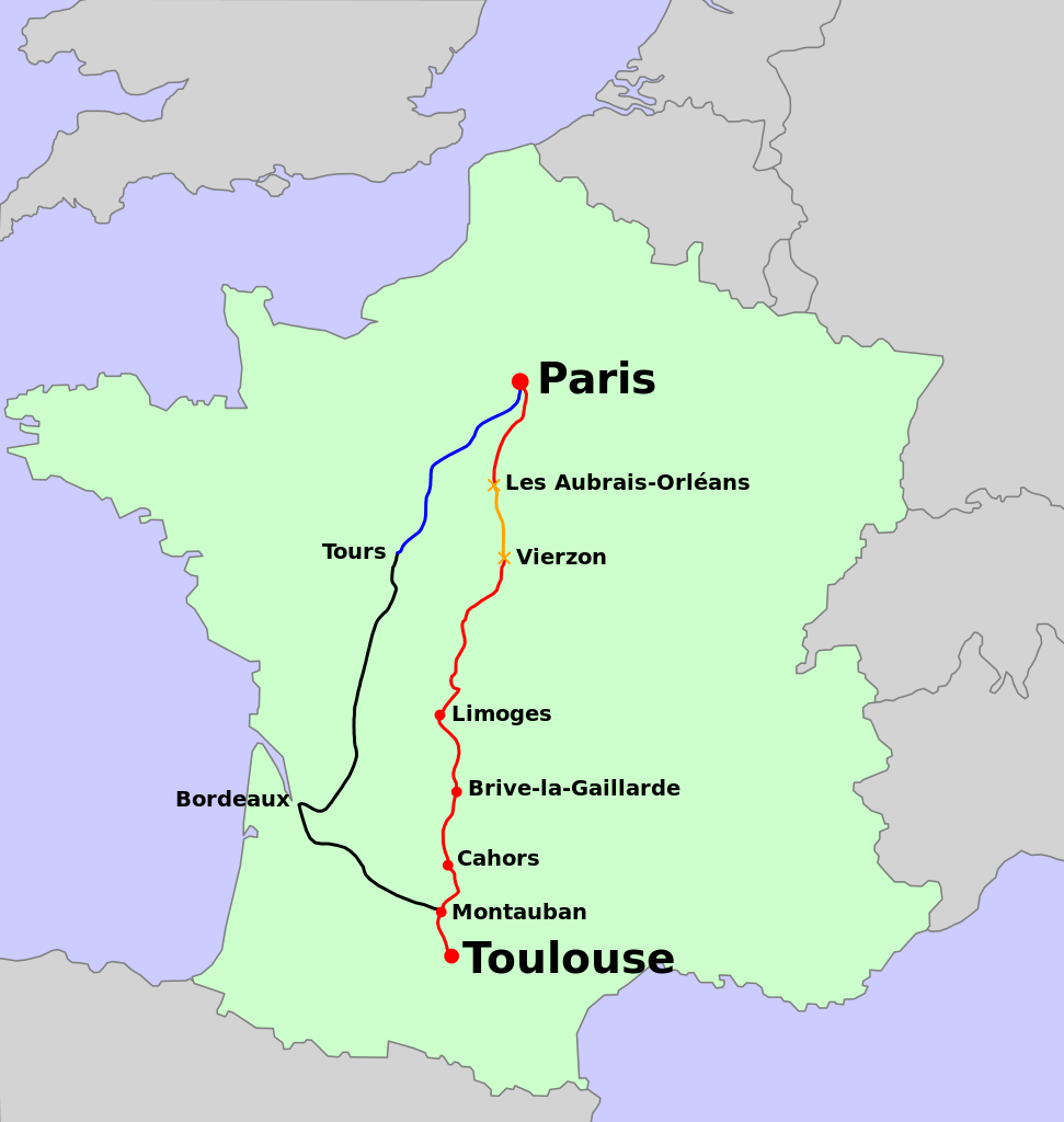
route of "le Capitole"
|
| Date | (UTC) |
| Source | |
| Author |
|
I, the copyright holder of this work, hereby publish it under the following licenses:
| This file is licensed under the Creative Commons Attribution-Share Alike 3.0 Unported license. | ||
| ||
| This licensing tag was added to this file as part of the GFDL licensing update. |

|
Permission is granted to copy, distribute and/or modify this document under the terms of the GNU Free Documentation License, Version 1.2 or any later version published by the Free Software Foundation; with no Invariant Sections, no Front-Cover Texts, and no Back-Cover Texts. A copy of the license is included in the section entitled GNU Free Documentation License. |
You may select the license of your choice.
Original upload log
This image is a derivative work of the following images:
- File:Carte_TGV.svg licensed with Cc-by-sa-3.0-migrated, GFDL
- 2009-09-03T19:09:08Z Benjism89 1000x1056 (1078415 Bytes) + liège - aix-la-chapelle, bourg - bellegarde
- 2009-08-31T08:39:23Z Benjism89 1000x1056 (1077763 Bytes) + le havre - strasbourg, - lausanne - berne - zurich
- 2009-07-03T14:46:49Z Benjism89 1000x1056 (1082864 Bytes) ajout cherbourg - dijon, paris - les sables d'olonne
- 2008-03-24T22:13:53Z Madcap 1000x1056 (1013443 Bytes) Maybe this time it will work...
- 2008-03-24T00:46:24Z Madcap 1000x1056 (1013443 Bytes) Reverted to version as of 00:40, 24 March 2008
- 2008-03-24T00:45:56Z Madcap 1000x1056 (1013443 Bytes) Old version mistakenly uploaded
- 2008-03-24T00:40:22Z Madcap 1000x1056 (1013443 Bytes) (pl) Liczne poprawki mapki: * Zmiana kolorow * Linia High Speed 1 (Wielka Wrytania): ** drugi odcinek linii otwarty, ** dodano dwa dworce: Stratford International (jescze nie obslugiwany, zaznaczony jako "w budowie") oraz Ebb
- 2007-06-19T07:48:45Z Andrew pmk 1000x1056 (1000219 Bytes) update map to show that LGV Est is now open; correct spelling error
- 2007-06-09T23:11:45Z PemFR 1000x1056 (1028078 Bytes) {{French TGV network map |Description= |Source= |Date= |Author= |Permission= |other_versions= }}
- 2007-06-09T22:37:23Z PemFR 1000x1056 (1028083 Bytes) {{Information |Description=French TGV network map |Source= |Date= |Author= |Permission= |other_versions= }}
- 2006-09-17T12:57:08Z Steff 1000x1056 (1028165 Bytes) == Summary == (en) The map of French railways (SNCF) passengers service, including internationnal TGV high-speed trains. (fr) La carte du réseau voyageurs de la SNCF, les TGV internationaux inclus. (pl) Mapa sieci połącze�
- 2006-03-24T05:53:35Z Madcap 1000x1056 (1058435 Bytes) (en) The map of French railways (SNCF) passengers service, including internationnal TGV high-speed trains. (fr) La carte du réseau voyageurs de la SNCF, les TGV internationaux inclus. (pl) Mapa sieci połączeń pasażerskic
Uploaded with derivativeFX
File history
Click on a date/time to view the file as it appeared at that time.
| Date/Time | Thumbnail | Dimensions | User | Comment | |
|---|---|---|---|---|---|
| current | 10:46, 11 September 2009 | | 990 × 1,044 (31 KB) | Matsukaze | {{Information |Description=route of "le Capitole" * red + orange : le Capitole * orange : 200km/h from 1967 * blue + black : TGV Paris - Toulouse from 1990 |Source=*File:Carte_TGV.svg |Date=2009-09-11 10:45 (UTC) |Author=*File:Carte_TGV.svg: [ |
File usage
The following pages on the English Wikipedia use this file (pages on other projects are not listed):
Global file usage
The following other wikis use this file:
- Usage on de.wikipedia.org
- Usage on fr.wikipedia.org
- Usage on hu.wikipedia.org
- Usage on it.wikipedia.org
- Usage on ja.wikipedia.org
- Usage on nl.wikipedia.org
- Usage on oc.wikipedia.org
- Usage on www.wikidata.org
- Usage on zh.wikipedia.org