No higher resolution available.
Hotel,_beach,_and_shipwreck_south_of_R257_at_Bunbeg_-_geograph.org.uk_-_1159653.jpg (570 × 380 pixels, file size: 214 KB, MIME type: image/jpeg)
Summary
| Description |
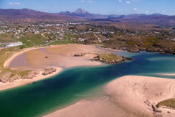
English: Ostan Gweedore Hotel, beach, & shipwreck south of R257 at Gweedore Seen is an inlet to the Atlantic Ocean south of Bunbeg Harbour. This area is east of the Donegal Carrickfin Airport. |
| Date | |
| Source | From geograph.org.uk |
| Author | Sue Mischyshyn |
| Camera location | | View this and other nearby images on: OpenStreetMap |
|---|
_heading:112.00&language=en)
| Object location | | View this and other nearby images on: OpenStreetMap |
|---|
_heading:112.00&language=en)
Licensing

|
This image was taken from the Geograph project collection. See this photograph's page on the Geograph website for the photographer's contact details. The copyright on this image is owned by Sue Mischyshyn and is licensed for reuse under the Creative Commons Attribution-ShareAlike 2.0 license.
|
This file is licensed under the Creative Commons Attribution-Share Alike 2.0 Generic license.
Attribution: Sue Mischyshyn
- You are free:
- to share – to copy, distribute and transmit the work
- to remix – to adapt the work
- Under the following conditions:
- attribution – You must give appropriate credit, provide a link to the license, and indicate if changes were made. You may do so in any reasonable manner, but not in any way that suggests the licensor endorses you or your use.
- share alike – If you remix, transform, or build upon the material, you must distribute your contributions under the same or compatible license as the original.
File history
Click on a date/time to view the file as it appeared at that time.
| Date/Time | Thumbnail | Dimensions | User | Comment | |
|---|---|---|---|---|---|
| current | 10:31, 25 February 2011 | | 570 × 380 (214 KB) | GeographBot | == {{int:filedesc}} == {{Information |description={{en|1=Hotel, beach, & shipwreck south of R257 at Bunbeg Seen is an inlet to the Atlantic Ocean south of Bunbeg Harbour. This area is east of the Donegal Carrickfin Airport.}} |date=2008-05-04 |source=From |
File usage
The following pages on the English Wikipedia use this file (pages on other projects are not listed):
Global file usage
The following other wikis use this file:
- Usage on bg.wikipedia.org
- Usage on ca.wikipedia.org
- Usage on ceb.wikipedia.org
- Usage on cy.wikipedia.org
- Usage on en.wikivoyage.org
- Usage on eo.wikipedia.org
- Usage on es.wikipedia.org
- Usage on eu.wikipedia.org
- Usage on fa.wikipedia.org
- Usage on fi.wikipedia.org
- Usage on fo.wikipedia.org
- Usage on fr.wikivoyage.org
- Usage on ga.wikipedia.org
- Usage on gd.wikipedia.org
- Usage on gl.wikipedia.org
- Usage on gv.wikipedia.org
- Usage on he.wikipedia.org
- Usage on hr.wikipedia.org
- Usage on ig.wikipedia.org
- Usage on it.wikipedia.org
- Usage on ja.wikipedia.org
- Usage on kab.wikipedia.org
- Usage on no.wikipedia.org
- Usage on pt.wikipedia.org
- Usage on ru.wikipedia.org
- Usage on uk.wikipedia.org
- Usage on vls.wikipedia.org
- Usage on www.wikidata.org
- Usage on zh.wikipedia.org