
Size of this preview: 401 × 599 pixels. Other resolutions: 161 × 240 pixels | 321 × 480 pixels | 514 × 768 pixels | 685 × 1,024 pixels | 2,074 × 3,098 pixels.
Original file (2,074 × 3,098 pixels, file size: 3.68 MB, MIME type: image/jpeg)
Summary
| Camera location | | View this and other nearby images on: OpenStreetMap |
|---|
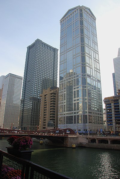
| Description |
English: Chicago river, showing buildings on West Wacker Drive. On the foreground, the building by Ricard Bofill Arquitectura, 1990-92- |
| Date | |
| Source | Own work |
| Author | Alvesgaspar |
| Other versions |
 |
Licensing
I, the copyright holder of this work, hereby publish it under the following licenses:

|
Permission is granted to copy, distribute and/or modify this document under the terms of the GNU Free Documentation License, Version 1.2 or any later version published by the Free Software Foundation; with no Invariant Sections, no Front-Cover Texts, and no Back-Cover Texts. A copy of the license is included in the section entitled GNU Free Documentation License. |
| This file is licensed under the Creative Commons Attribution-Share Alike 3.0 Unported license. | ||
| ||
| This licensing tag was added to this file as part of the GFDL licensing update. |
You may select the license of your choice.

|
This image has been assessed under the valued image criteria and is considered the most valued image on Commons within the scope: 77 West Wacker, Chicago. You can see its nomination here. |
File history
Click on a date/time to view the file as it appeared at that time.
| Date/Time | Thumbnail | Dimensions | User | Comment | |
|---|---|---|---|---|---|
| current | 00:50, 16 November 2007 | | 2,074 × 3,098 (3.68 MB) | Alvesgaspar | {{Information |Description=Chicago river, showing buildings on West Wacker Drive |Source=self-made |Date=November 2007 |Author= Alvesgaspar |Permission= |other_versions=80px }} [[Category:Phptos by Alvesga |
| 00:49, 16 November 2007 |  | 2,074 × 3,098 (3.68 MB) | Alvesgaspar | {{Information |Description=Chicago river, showing buildings on West Wacket Drive |Source=self-made |Date=November 2007 |Author= Alvesgaspar |Permission= |other_versions=80px }} [[Category:Phptos by Alvesga | |
| 00:47, 16 November 2007 |  | 2,074 × 3,098 (3.68 MB) | Alvesgaspar | {{Information |Description=Chicago river, showing buildings on West Wacket St. |Source=self-made |Date=November 2007 |Author= Alvesgaspar |Permission= |other_versions=80px }} [[Category:Phptos by Alvesgasp |
File usage
The following pages on the English Wikipedia use this file (pages on other projects are not listed):
Global file usage
The following other wikis use this file:
- Usage on ca.wikipedia.org
- Usage on de.wikipedia.org
- Usage on el.wikipedia.org
- Usage on es.wikipedia.org
- Usage on fa.wikipedia.org
- Usage on hy.wikipedia.org
- Usage on pt.wikipedia.org
- Usage on uk.wikipedia.org