
Size of this preview: 478 × 600 pixels. Other resolutions: 191 × 240 pixels | 382 × 480 pixels | 974 × 1,222 pixels.
Original file (974 × 1,222 pixels, file size: 253 KB, MIME type: image/jpeg)
Summary
| Description |
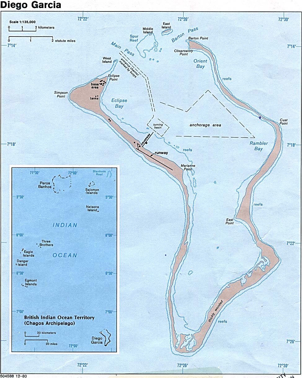
English: Map of Diego Garcia. |
| Date | |
| Source | Diego Garcia (British Indian Ocean Territory) (Political) 1980 from Perry-Castañeda Library Map Collection: Indian Ocean Maps |
| Author | U.S. Central Intelligence Agency |
| Permission (Reusing this file) |
Public domain |
Licensing
| This image is a work of a Central Intelligence Agency employee, taken or made as part of that person's official duties. As a Work of the United States Government, this image or media is in the public domain in the United States.
|

|
File history
Click on a date/time to view the file as it appeared at that time.
| Date/Time | Thumbnail | Dimensions | User | Comment | |
|---|---|---|---|---|---|
| current | 07:32, 22 January 2005 | | 974 × 1,222 (253 KB) | Hoshie | CIA map of Diego Garcia. |
File usage
The following pages on the English Wikipedia use this file (pages on other projects are not listed):
Global file usage
The following other wikis use this file:
- Usage on ar.wikipedia.org
- Usage on el.wikipedia.org
- Usage on es.wikipedia.org
- Usage on fi.wikipedia.org
- Usage on gl.wikipedia.org
- Usage on hi.wikipedia.org
- Usage on hr.wikipedia.org
- Usage on hy.wikipedia.org
- Usage on id.wikipedia.org
- Usage on is.wikipedia.org
- Usage on it.wikipedia.org
- Usage on ja.wikipedia.org
- Usage on mk.wikipedia.org
- Usage on ml.wikipedia.org
- Usage on ne.wikipedia.org
- Usage on nl.wikipedia.org
- Usage on pnb.wikipedia.org
- Usage on ru.wikipedia.org
- Usage on uk.wikipedia.org
- Usage on ur.wikipedia.org
- Usage on www.wikidata.org