
Size of this preview: 800 × 450 pixels. Other resolutions: 320 × 180 pixels | 640 × 360 pixels | 1,024 × 576 pixels | 1,280 × 720 pixels | 2,816 × 1,584 pixels.
Original file (2,816 × 1,584 pixels, file size: 1.68 MB, MIME type: image/jpeg)
|
This is an image of a place or building that is listed on the National Register of Historic Places in the United States of America. Its reference number is 73001629. |
| Camera location | | View this and other nearby images on: OpenStreetMap |
|---|
| Description |
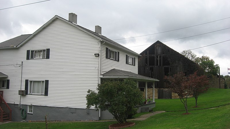
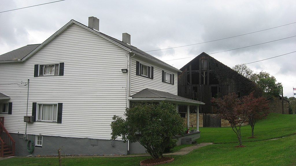
English: Buildings on the southern side of U.S. Route 40 at Brier Hill in Redstone Township, Fayette County, Pennsylvania, United States. What remains of the community is a historic district that is listed on the National Register of Historic Places. Moreover, the dilapidated wooden barn (built in 1848) is individually listed on the Register with its associated tavern in the background on the far right; they are known as the Peter Colley Tavern and Barn. |
||
| Date | Taken on 30 September 2011 | ||
| Source | Own work | ||
| Author | Nyttend | ||
| Permission (Reusing this file) |
|
File history
Click on a date/time to view the file as it appeared at that time.
| Date/Time | Thumbnail | Dimensions | User | Comment | |
|---|---|---|---|---|---|
| current | 13:47, 13 November 2011 | | 2,816 × 1,584 (1.68 MB) | Nyttend | {{Location|39|58|48|N|79|49|51|W}} {{Information |Description={{en|Buildings on the southern side of {{w|U.S. Route 40}} at {{w|Brier Hill, Pennsylvania|Brier Hill}} in {{w|Redstone Township, Fayette County, Pennsylvania|Redstone Township}}, {{w|Fayette C |
File usage
The following pages on the English Wikipedia use this file (pages on other projects are not listed):
Global file usage
The following other wikis use this file:
- Usage on www.wikidata.org